


- Brief description
-
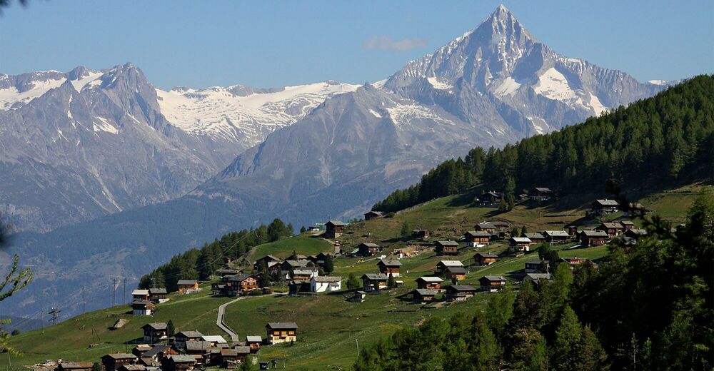
This high trail leads along the treeline from Visperterminen to Gspon, past ancient pine forests and among a wealth of alpine flora. The 11-kilometre hike offers breathtaking views of the Vispertal valley.
- Difficulty
-
easy
- Rating
-
- Starting point
-
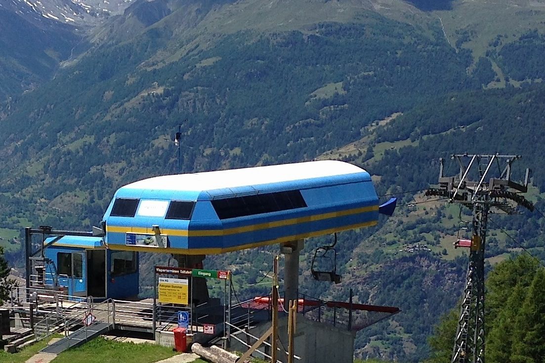
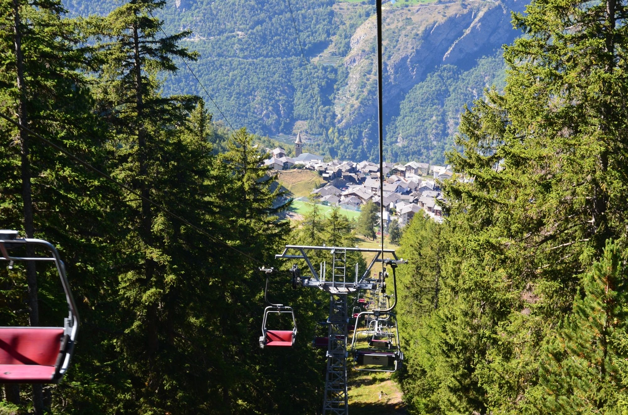
Giw, summit station of the chairlift
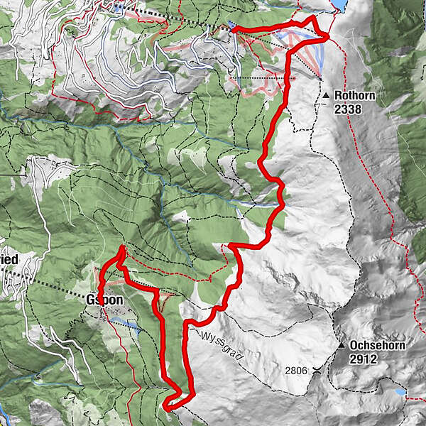
- Route
-
GiwBergrestaurant Giw0.0 kmSädolti5.1 kmGspon11.5 kmAlpenblick11.6 kmZe Hischinu11.6 kmGspon (1,899 m)11.6 km
- Best season
-
JanFebMarAprMayJunJulAugSepOctNovDec
- Description
-
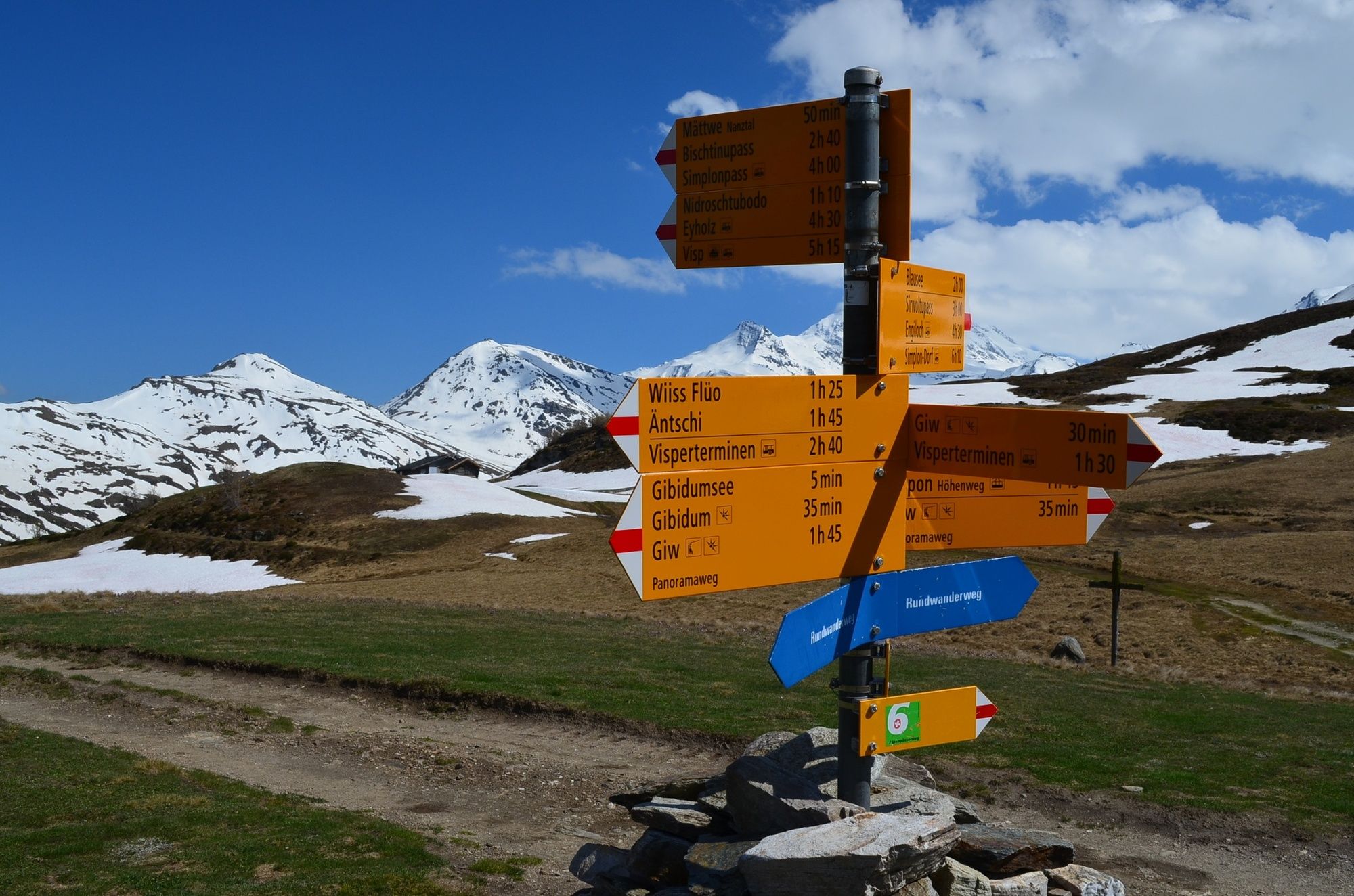
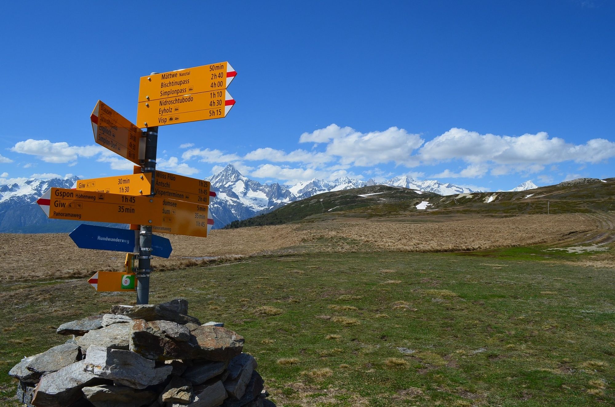
The high trail from Giw to Gspon forms part of the Great Walser Trail from Zermatt to the Kleinwalsertal. One thousand years ago, descendants of a Germanic people settled in the upper Valais. The Walsers were used to life in the high mountains and keen to migrate further and create new settlements in previously uninhabited mountain regions. The Great Walser Trail does not follow the migration routes of people from Valais, but instead connects the various sites linked with traditional Walser culture.
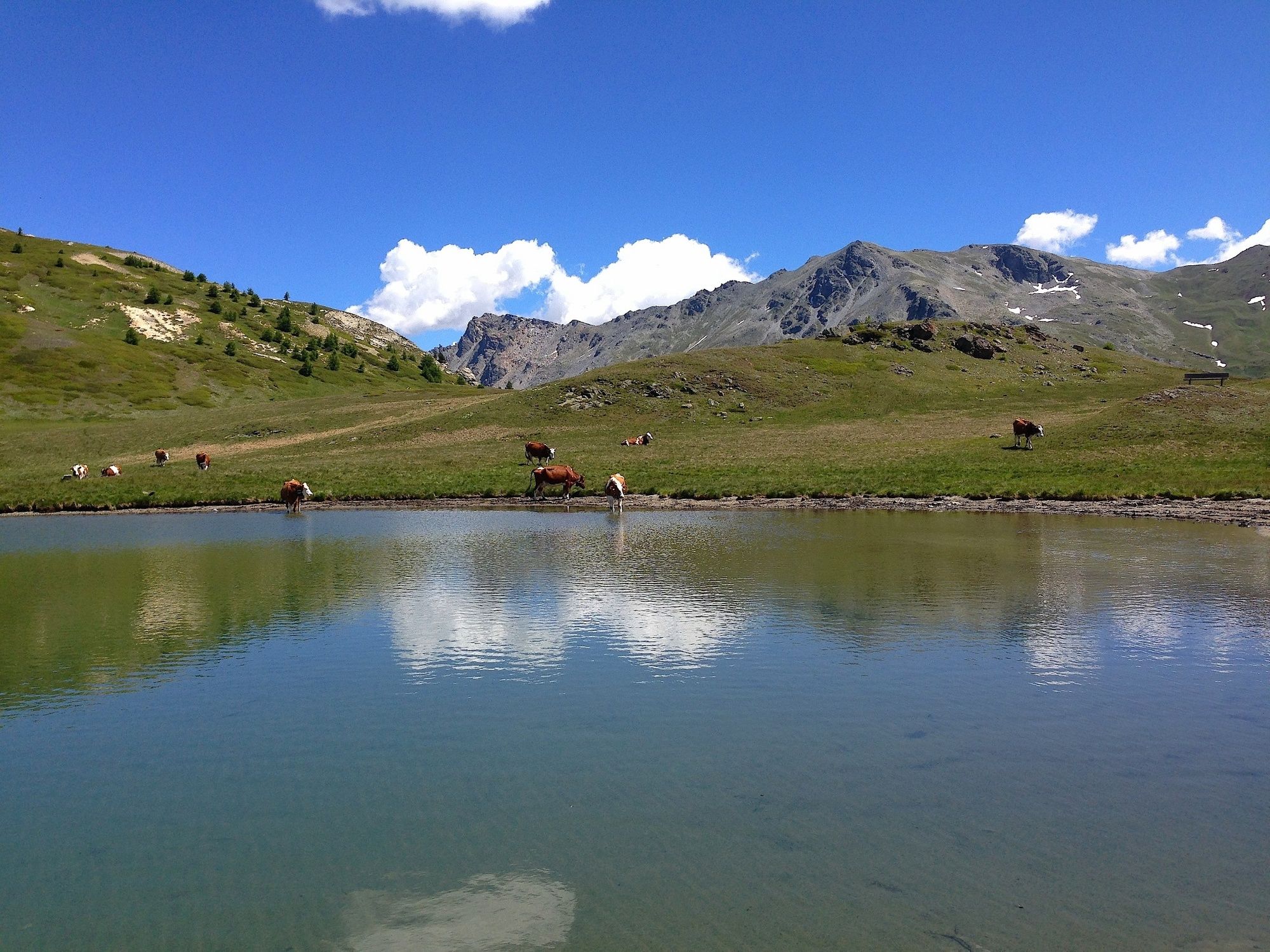
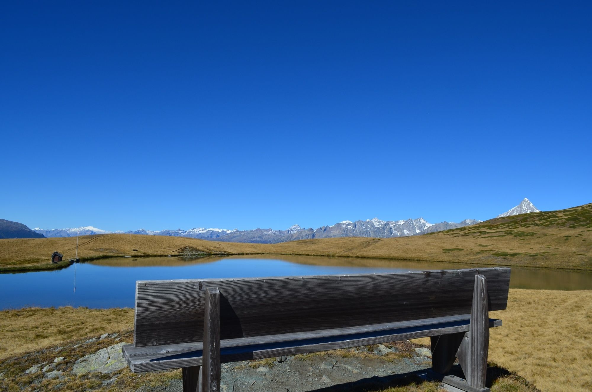
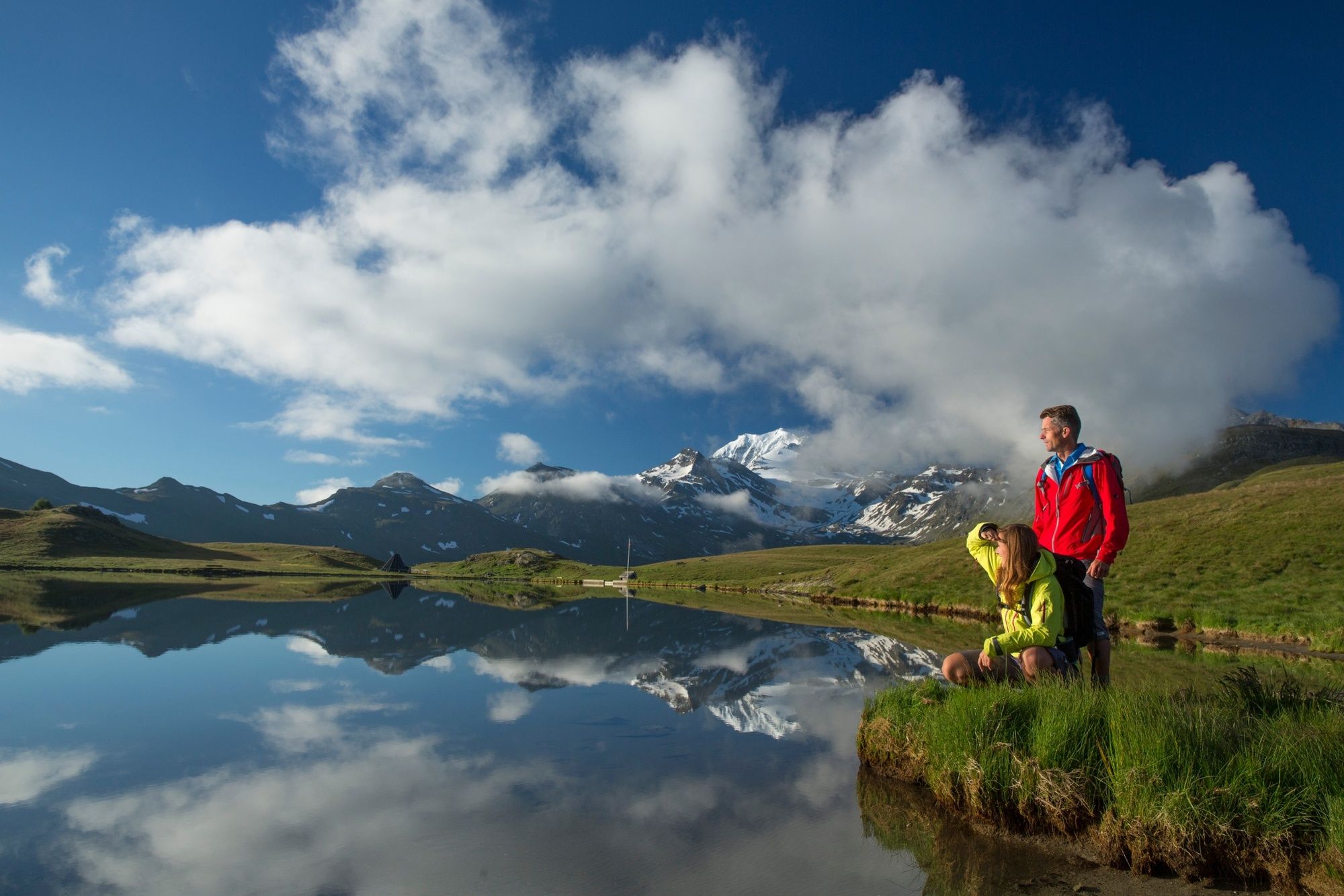
Starting point for the hike is the summit station of the chairlift from Visperterminen to Giw. A steep ascent through forest and then across open terrain leads to the Gibidum Pass. It is well worth making the detour via the Gibidumsee lake, fed by the Heido, one of the historical “Suonen” (irrigation channels) of Valais. The shallow lake (2 m) quickly warms up in summer: perfect for a refreshing dip!
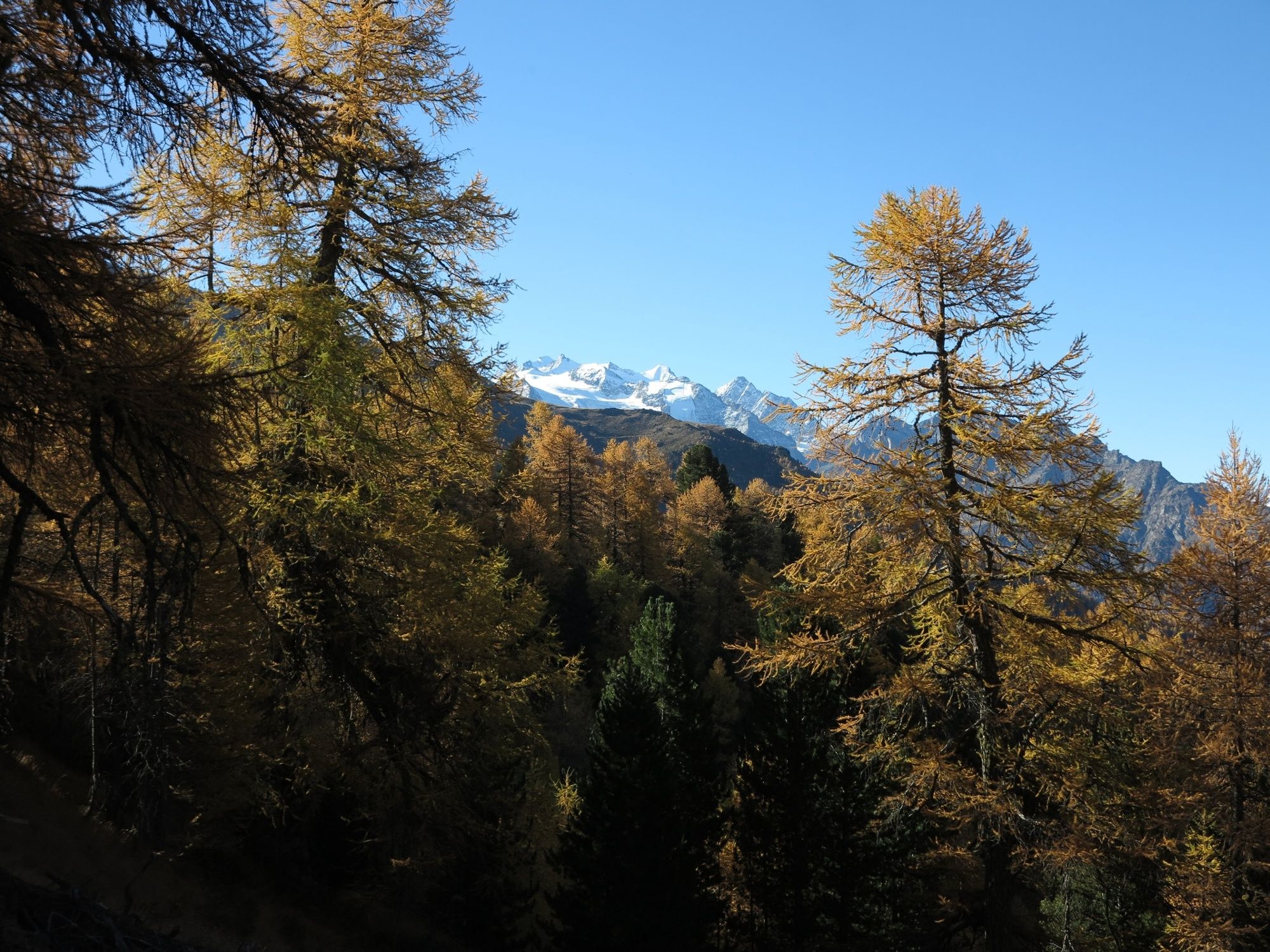
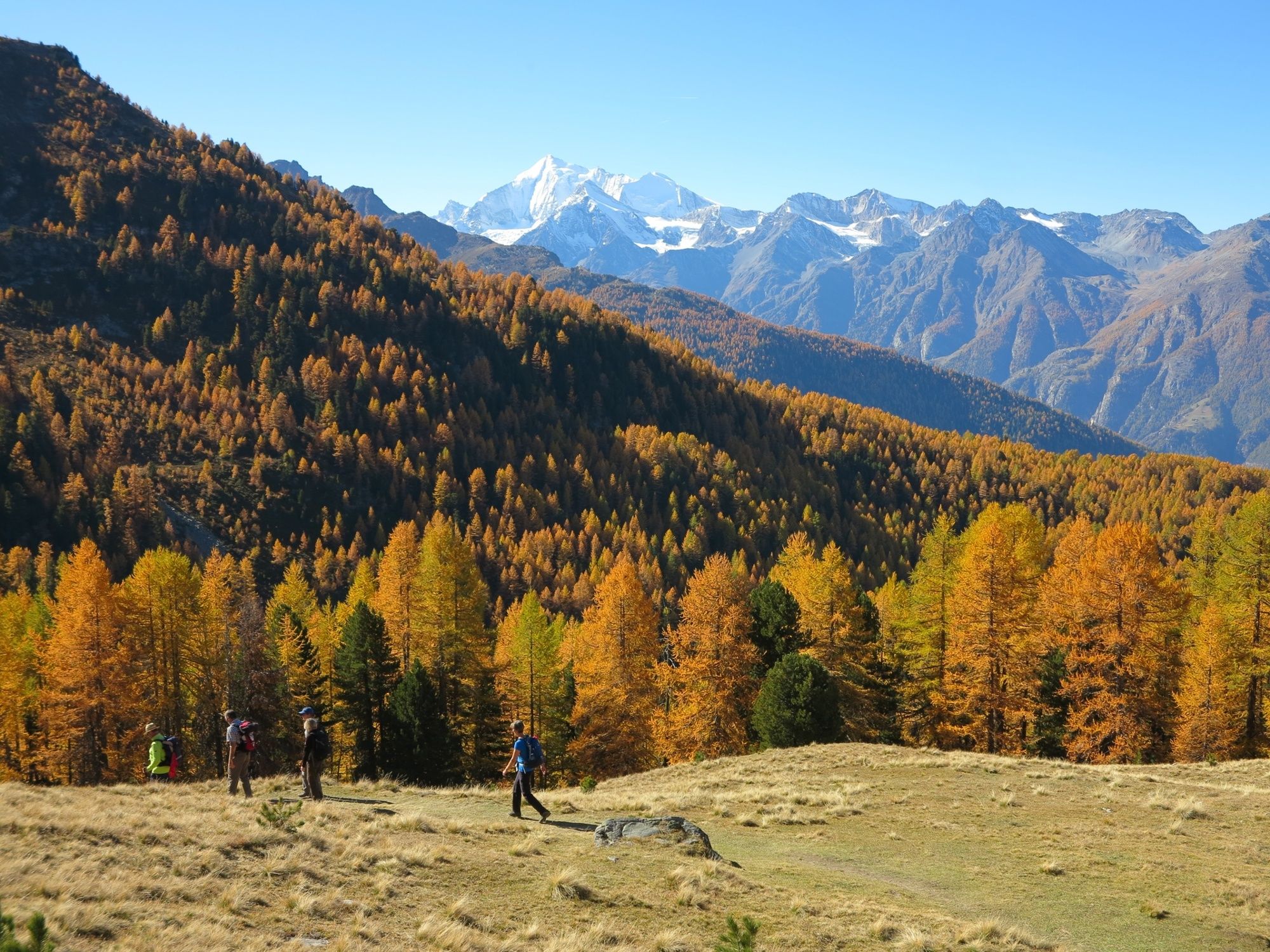
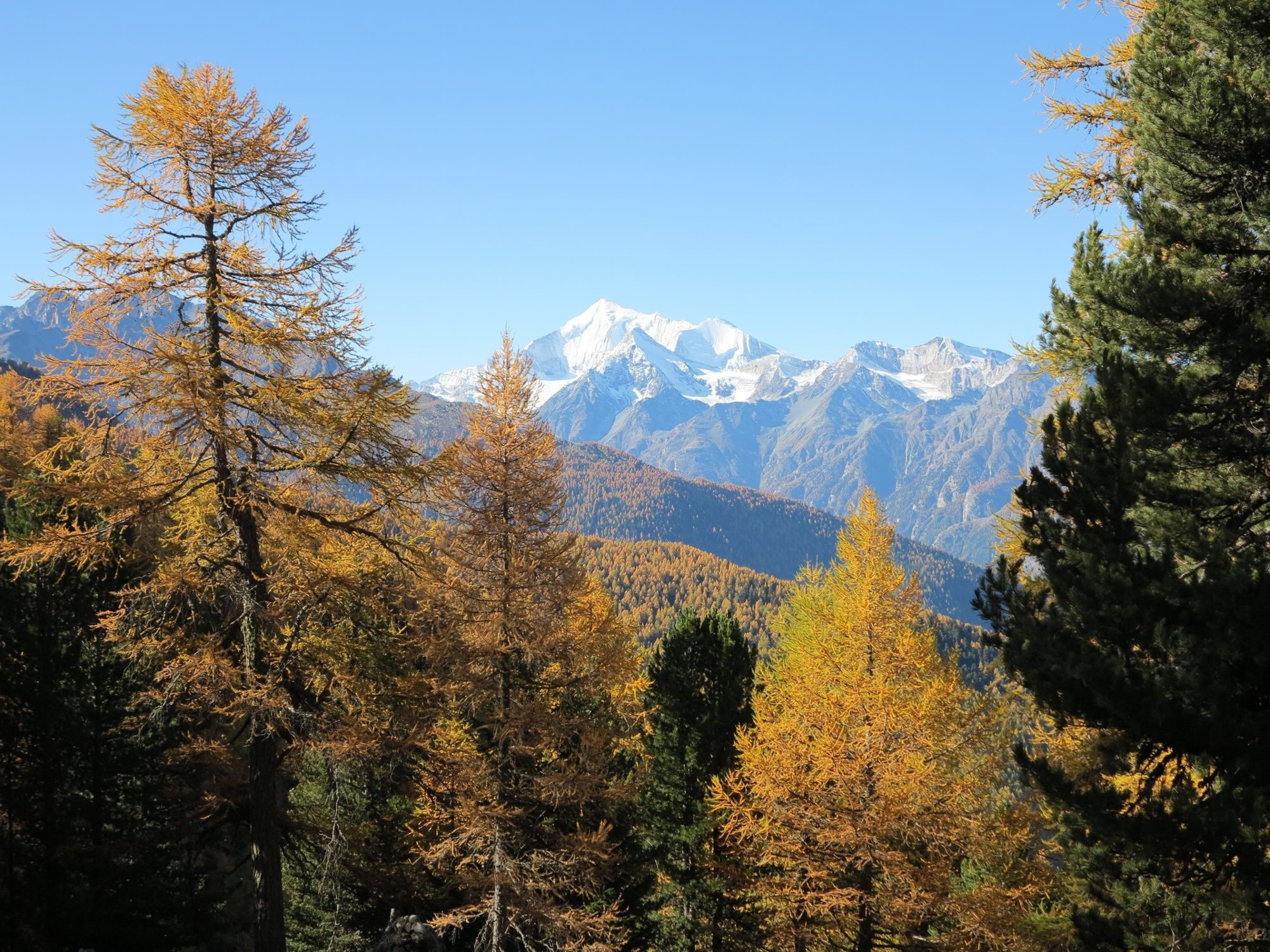
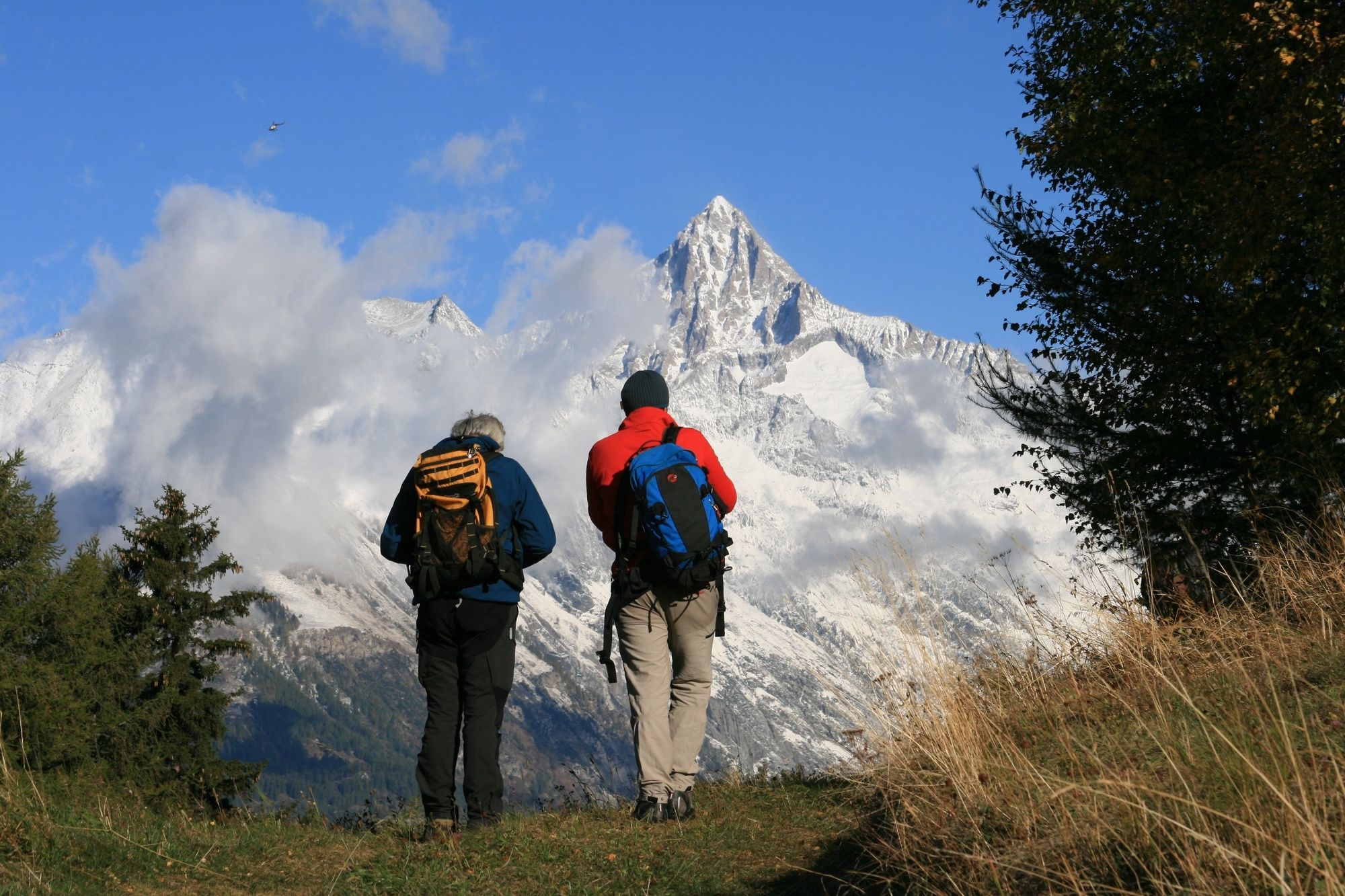
All along the trail, you enjoy glorious views of the Vispertal valley as well as dramatic peaks from the Bietschhorn and Balfrin to the Weisshorn (4,506 m). The path leads mostly along the treeline but also passes through sections of the Lochwald and Riedjiwald forests. Here, in autumn, hikers often hear the belling of stags in rut. However, to actually see one of these fine creatures in the thick forest requires rather more luck.
At Sädolti, the trail starts its descent to Gspon, a car-free mountain village that has carefully preserved its original charm. Gspon is also known as home to Europe’s highest football pitch, the «Ottmar Hitzfeld Gspon Arena».
Highlights:
Village of Visperterminen, home to Europe’s highest vineyards, with many options for tasting local wines direct in the cellars Gibidumsee lake, suitable for a dip Easy high-altitude trail above the treeline, panoramic views - Directions
-
The easiest way to access the starting point of the walk at Giw is to take the chairlift up from Visperterminen, but you could alternatively hike up. A steep climb then leads via Stafel to the Gibidum Pass. From here, you walk above the treeline across the alpine pastures of Sänntum and Sitestafel. After a short climb you reach Sädolti, an ideal spot for a break to enjoy the fine views. The hike finishes with the descent to the car-free village of Gspon.
You can easily extend the hike in a number of ways – for example, by following one of the many paths back to Visperterminen, or by walking from Gspon down to Stalden instead of taking the cable car. You could also follow the entire high trail as far as Saas-Grund – for which you should allow about 7 hours’ hiking time.
- Highest point
- 2,368 m
- Endpoint
-
Gspon
- Height profile
-
 © outdooractive.com
 - Equipment
-
We recommend:
good footwear clothing suitable for the weather: always carry a waterproof jacket hat or cap sunscreen bottle for water picnic camera binoculars (optional) hiking poles (optional) printout of this hike (click «Print» icon, to download)For certain walks:
Swimwear - Safety instructions
-
Use of the trails and the information on this website is at hikers’ own risk. Local conditions may entail changes to routes. Valais/Wallis Promotion accepts no liability for the accuracy and completeness of information on this website.
For all hikes:
Bring a map. Download full description of this route including large-scale map by clicking on «Print» icon, top right of this page. Use marked trails only, and observe all signposting – for your own safety, to safeguard grazing animals and to avoid disturbing wildlife. Close gates after passing through. Please be considerate to other trail users, and to the plants and animals. Do not leave any waste in nature.For mountain hikes:
Take extra care protecting yourself from the sun at altitude. UV radiation can be exceptionally strong, even in cloudy weather. Plan hike carefully: take into consideration fitness level of each participant, weather forecast and season. Weather conditions can change quickly in the mountains, without warning. Appropriate clothing is therefore essential, along with adequate supplies of food and water. In uncertain weather, turn back in good time.For high-altitude hikes:
Inform others of the route you plan to take. Whenever possible, avoid going alone. Do not venture onto glaciers without a mountain guide. Take note of the warning signs that point out the constant danger in river beds and along watercourses below dams and reservoirs: water levels may rise rapidly without warning. - Tips
-
Discover the Heida, the typical local wine of Visperterminen’s vineyards, Europe’s highest, on a tasting visit to one of the cellars.
- Additional information
- Directions
-
A9 motorway and cantonal road 9 to Visp. Follow the signs for Visperterminen, taking the Terbinerstrasse road via Unterstalden and Oberstalden to Visperterminen.
At the Giw chairlift, hikers can buy a round ticket that includes the chairlift up to Giw, the cable car from Gspon down to Stalden and the PostBus from Stalden back to Visperterminen.
- Public transportation
-
Train to Visp, then postal bus to Visperterminen. Find full timetable information at sbb.ch.
At the Giw chairlift, hikers can buy a round ticket that includes the chairlift up to Giw, the cable car from Gspon down to Stalden and the PostBus from Stalden back to Visperterminen.
- Parking
-
Parking at the base station of the Giw chairlift in Visperterminen. Follow the local parking instructions.


-

-
AuthorThe tour Gibidumpass is used by outdooractive.com provided.


General info
-
Oberwallis
1872
-
Rund um Visp
849
-
Staldenried - Gspon
162


