
- Brief description
-
Find your Source of Happiness on the almost three thousand metre high summit of the Torrenthorn.
- Difficulty
-
medium
- Rating
-
- Starting point
-
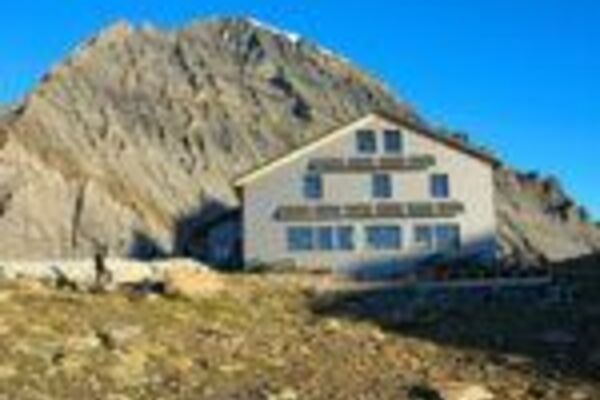
Rinderhütte, cable car summit station
- Route
-
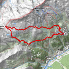
Torrenthorn (2,997 m)3.3 km
- Best season
-
JanFebMarAprMayJunJulAugSepOctNovDec
- Description
-
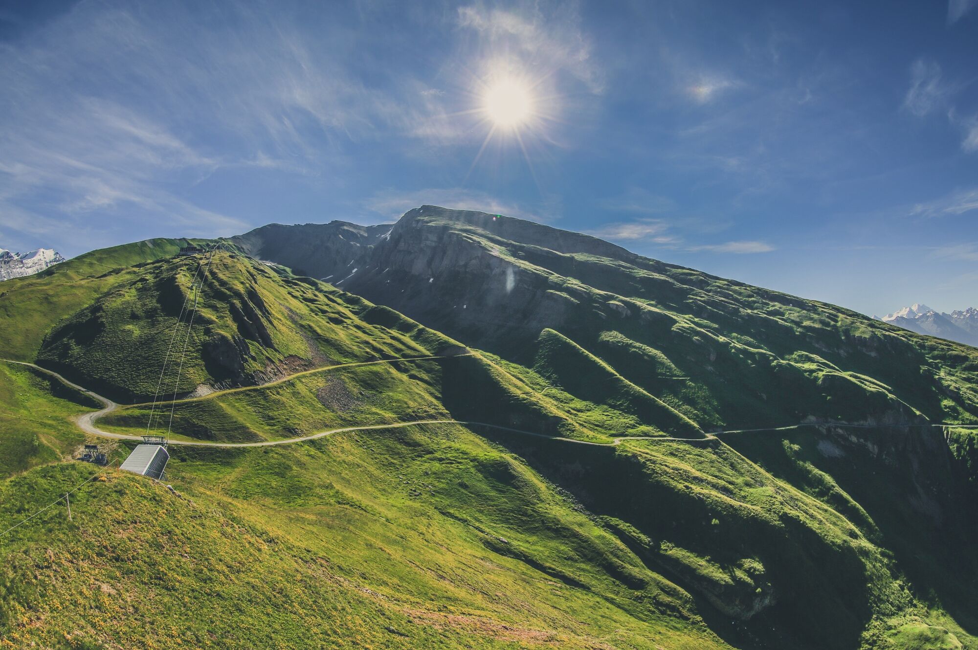
Starting point for the hike is Rinderhütte, the summit station of the cable car from Leukerbad. The climb leads across the alpine pastures of Torrent, where many cows, sheep and goats spend the summer.
The path leads steadily towards the western ridge of the Torrenthorn via the Rinderhalte pastures, where hikers will frequently hear the whistling of marmots.
At an altitude of around 2,700 m, the grassy alpine meadows give way to rocky terrain. Up on the ridge you enjoy a magnificent view of the Majingalp pastures and the dramatic Montanji cliffs: best known for the precipitous Gemmiwand rock face above Leukerbad, they extend eastwards all the way to the summit of the Balmhorn on the border between Valais and the Bernese Oberland.
After about another kilometre you reach the summit of the Torrenthorn, also known as the “Rigi of Valais”. From the summit you have a complete 360° panoramic view, and on a clear day you can see peaks including the Jungfrau, Bietschhorn, Monte Leone, Weissmies, the Mischabel massif, Monte Rosa, Matterhorn, Grand Combin and even Mont Blanc.
For the return leg, the most direct route is along the ridge and via the historical Hotel Torrenthorn back to Rinderhütte. However, it is also possible to extend the hike via alternative descents. For example, you can follow the ridge south towards the Schafberg and climb another peak before following the alpine route (marked white-blue-white) down to Rinderhütte. Another alternative is to turn north at Rinderhalte to descend to the Majingalp pastures, and then walk along the Dala river back down to Leukerbad.
Highlights:
Summit of the Torrenthorn, with superb panoramic views of the Valais and Bernese Alps – and on a clear day, the French Alps. Many options for extending the hike via a variety of alternative descent routes. - Directions
-
Take the cable car up to the summit station of Rinderhütte, and then climb the path across the alpine meadows to Rinderhalte. The route then leads along the western ridge up to the summit of the Torrenthorn. The descent as described leads initially along the ridge but branches left just before Rinderhalte to descend across meadows. The trail leads past the former Hotel Torrenthorn and continues descending to Rinderhütte.
- Highest point
- 2,985 m
- Endpoint
-
Rinderhütte, cable car summit station
- Height profile
-
 © outdooractive.com
 - Equipment
-
Day hiking bag (approx. 20 litres) with rain cover, sturdy and comfortable footwear, multi-layered clothing suitable for the weather and hard-wearing, telescopic poles, sun and rain protection, provisions and drinking water, first aid kit, pocket knife, mobile phone, maps.
- Safety instructions
-
Bring a map. Download full description of this route including large-scale map by clicking on "Print" icon, top right of this page.
Use marked trails only, and observe all signposting – for your own safety, to safeguard grazing animals and to avoid disturbing wildlife.
Close gates after passing through.
Please be considerate to other trail users, and to the plants and animals.
Take extra care protecting yourself from the sun at altitude. UV radiation can be exceptionally strong, even in cloudy weather.
Plan hike carefully: take into consideration fitness level of each participant, weather forecast and season.
Weather conditions can change quickly in the mountains, without warning. Appropriate clothing is therefore essential, along with adequate supplies of food and water. In uncertain weather, turn back in good time.
- Tips
-
Relax after the hike in the soothing thermal spring water at one of Leukerbad’s spas.
- Additional information
-
The tourist office in Leukerbad has got brochures and information material about hiking in the region and will give you detailled information about this hike.
- Directions
-
From Basel and Zurich: A1 motorway to Bern; A6 to Spiez; direction Kandersteg; Kandersteg - Goppenstein car transport; direction Gampel; Leuk - Leukerbad.
From Geneva: Motorway A1 to Lausanne; direction Sion/Sierre; Leuk - Leukerbad.
From Milan: Motorway A8/A26 direction Simplon; car transport Iselle-Brig; direction Leuk - Leukerbad.
- Public transportation
-
Leuk can be reached by train (SBB), then by bus (LLB - Leuk Leukerbad Bus Reisen) to the starting point in Leukerbad. Find full timetable information at sbb.ch.
- Parking
-
Various parking options in the village of Leukerbad. Follow the local parking guidance system.
Car parks in Leukerbad: Sportarena parking, Rathaus parking, Torrent parking, Leukerbad Therme parking, Alpentherme parking.


- Author
-
The tour Ascent of the Torrenthorn is used by outdooractive.com provided.


General info
-
Oberwallis
1872
-
Leuk/Leukerbad
1028
-
Leukerbad
309