
- Brief description
-
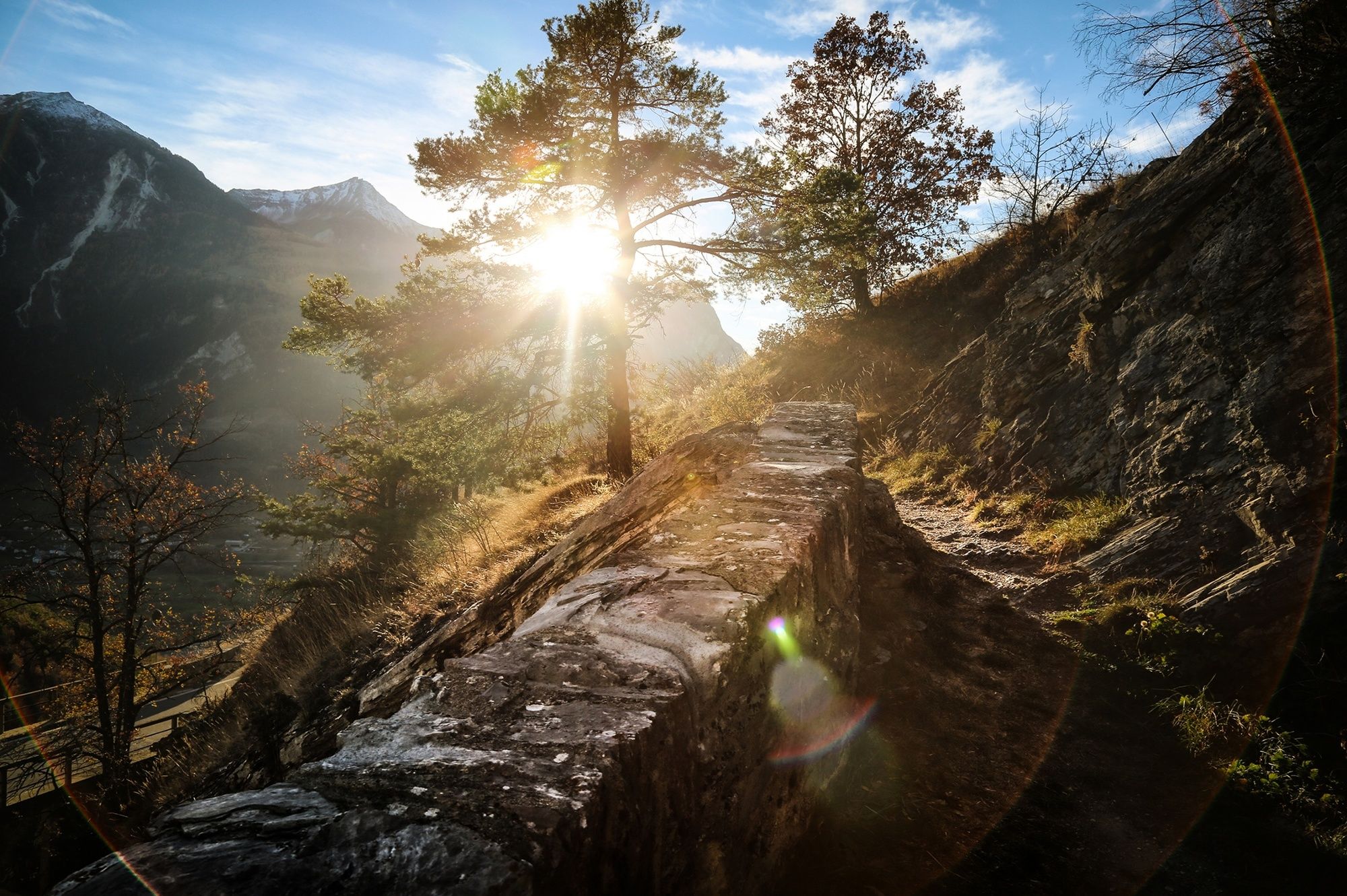
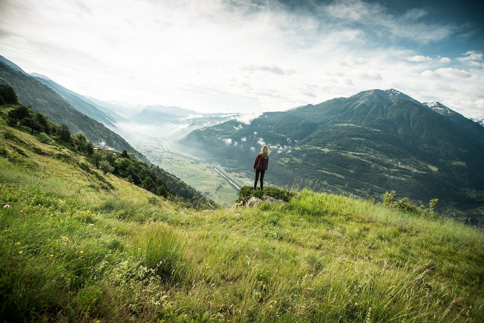
Panoramic hike through the Pfyn-Finges Nature Park, from the mountain village of Jeizinen along the sunny south-facing slopes of the Rhône valley to Leuk. Discover the village of Erschmatt with its rye centre, and the satellite ground station above Leuk.
- Difficulty
-
easy
- Rating
-
- Starting point
-
Jeizinen, cable car summit station
- Route
-
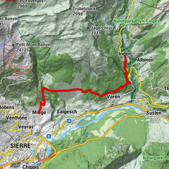
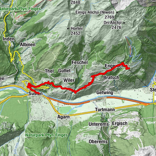
BrumattenJeizinen (1,525 m)BiältiRestaurant Bielti (1,490 m)0.0 kmKirche Geburt Mariens0.1 kmHengert0.1 kmHohflüä0.2 kmTrogachra0.5 kmEngersch1.5 kmErschmatt (1,228 m)3.5 kmRoggen Stube3.6 kmOber Rotafen6.3 kmBrunnen6.5 kmWiler6.7 kmLeuk Stadt (731 m)9.8 kmKirche10.0 kmSusten (630 m)11.3 kmLeuk (623 m)11.4 km
- Best season
-
JanFebMarAprMayJunJulAugSepOctNovDec
- Description
-
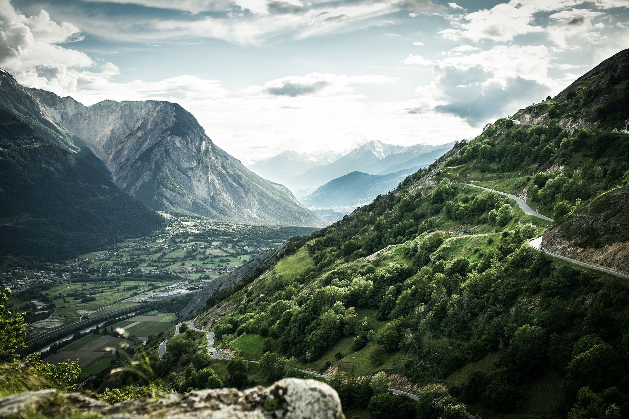
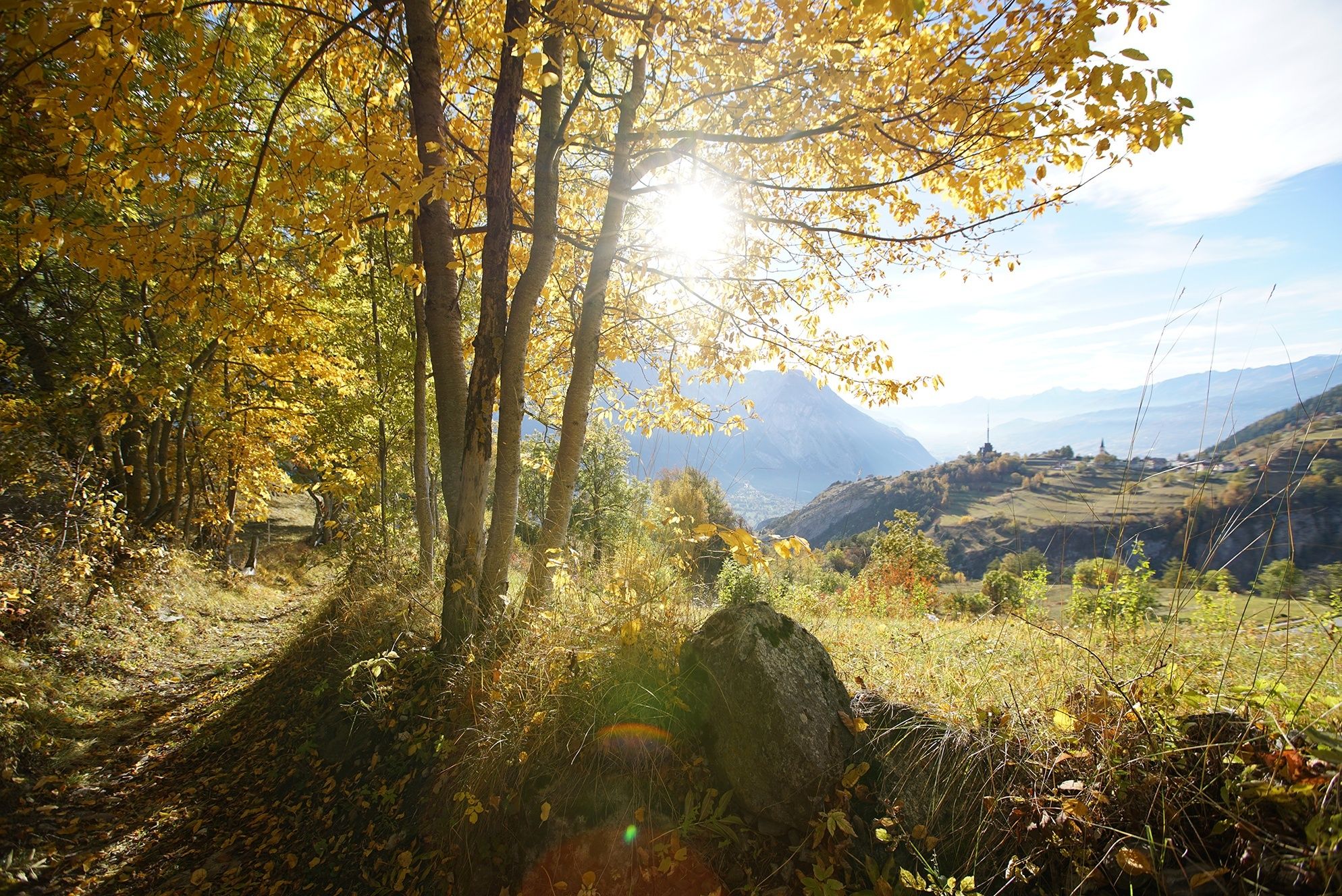
The hike begins in the mountain village of Jeizinen at an altitude of 1,500 m, accessible from Gampel by cable car. After about 20 minutes’ walk, you reach the historical hamlet of Engersch with its narrow main alley lined with charming wooden chalets.
From here, the path descends steeply to Erschmatt. In the Undri Zälg area, you pass the gardens of the Erschmatt rye centre, where ancient varieties of cultivated plants and in particular rye are grown.
Rye was once the main cereal cultivated in the mountain villages of Valais. Because it can withstand very cold temperatures, rye could be cultivated up to altitudes of 2,000 m in Valais. The rye was used to make Valais rye bread, which was baked in large village ovens that were lit just two or three times a year. This typical bread could be kept for several months.
Another steep descent leads to the Feschel gorge, spanned by the Hohe Brücke (“High Bridge”) about 100 vertical metres above the foaming Feschelju river. Also known as the “Devil’s Bridge”, it was built in the 16th century and is the focus of legends similar to those surrounding its famous namesake in the Schöllenen gorge near the Gotthard.
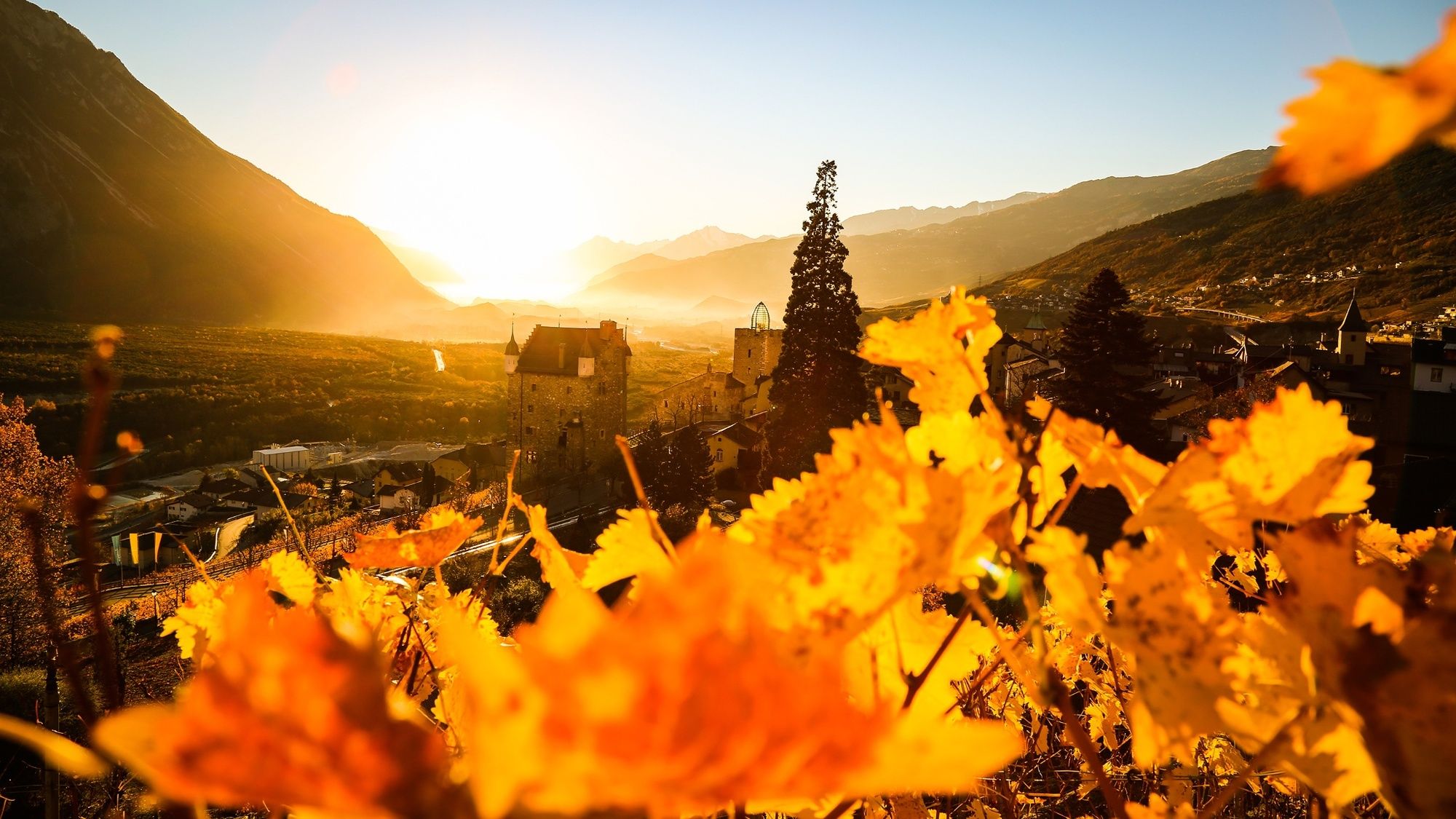
The hike continues via Obere Lichten to Brentjong, above Leuk, best known for its satellite ground station, visible from far away. In the 1970s, this station was regarded as a technological marvel. After its sale to an American company, many suspected it was used for spying. Today, alongside the current owner from Germany, the Swiss federal government also undertakes intelligence-gathering activities here.
To finish the walk, you descend past vineyards to Leuk. As well as the historical and picturesque town centre, it is worth visiting the castle, restored by the famous Swiss architect Mario Botta.
Highlights:
The village of Erschmatt and its rye centre, with many activities relating to traditional Valais rye bread. The “Devil’s Bridge” across the Feschel gorge between Erschmatt and Leuk. The historical town of Leuk and the satellite ground station above. - Directions
-
Starting from Jeizinen, the route leads via the hamlet of Engersch to Erschmatt. In the Undri Zälg area, you pass one of the cultivation gardens of the Erschmatt rye centre and then pass through the mountain village before descending to the “Devil’s Bridge” across the Feschel gorge.
You continue via Obere Lichten to reach the satellite ground station in Brentjong. At the end of the walk, you descend through steep vineyards to the town of Leuk. The hike finishes at Leuk railway station, located below the town on the banks of the Rhône.
- Highest point
- 1,518 m
- Endpoint
-
Leuk, railway station
- Height profile
-
 © outdooractive.com
 - Equipment
-
We recommend:
good footwear clothing suitable for the weather: always carry a waterproof jacket hat or cap sunscreen bottle for water picnic camera binoculars (optional) hiking poles (optional) printout of this hike (click «Print» icon, to download)For certain walks:
Swimwear - Safety instructions
-
Use of the trails and the information on this website is at hikers’ own risk. Local conditions may entail changes to routes. Valais/Wallis Promotion accepts no liability for the accuracy and completeness of information on this website.
For all hikes:
Bring a map. Download full description of this route including large-scale map by clicking on «Print» icon, top right of this page. Use marked trails only, and observe all signposting – for your own safety, to safeguard grazing animals and to avoid disturbing wildlife. Close gates after passing through. Please be considerate to other trail users, and to the plants and animals. Do not leave any waste in nature.For mountain hikes:
Take extra care protecting yourself from the sun at altitude. UV radiation can be exceptionally strong, even in cloudy weather. Plan hike carefully: take into consideration fitness level of each participant, weather forecast and season. Weather conditions can change quickly in the mountains, without warning. Appropriate clothing is therefore essential, along with adequate supplies of food and water. In uncertain weather, turn back in good time.For high-altitude hikes:
Inform others of the route you plan to take. Whenever possible, avoid going alone. Do not venture onto glaciers without a mountain guide. Take note of the warning signs that point out the constant danger in river beds and along watercourses below dams and reservoirs: water levels may rise rapidly without warning. - Tips
-
As well as the garden of traditional cultivated plants, the rye centre runs a range of rye-related activities – such as the chance to prepare and bake your own bread to take away. You can also order ancient rye varieties from Erschmatt to plant in your own garden.
- Additional information
- Directions
-
From Sion or Brig: A9 motorway or cantonal road 9 to Gampel.
From Bern: A6 motorway to Spiez, then cantonal road to Kandersteg. Take the car transporter service from Kandersteg to Goppenstein, continue on the cantonal road to Gampel.
- Public transportation
-
Regular regional trains along the Simplon line to Gampel. Continue either on foot or by bus to the base station of the Gampel–Jeizinen cable car.
- Parking
-
Parking at the base station of the Gampel–Jeizinen cable car. Follow the parking signs in Gampel.
-

-
AuthorThe tour Leuker Sonnenberge is used by outdooractive.com provided.


General info
-
Oberwallis
1873
-
Turtmanntal
949
-
Agarn
271