
- Brief description
-
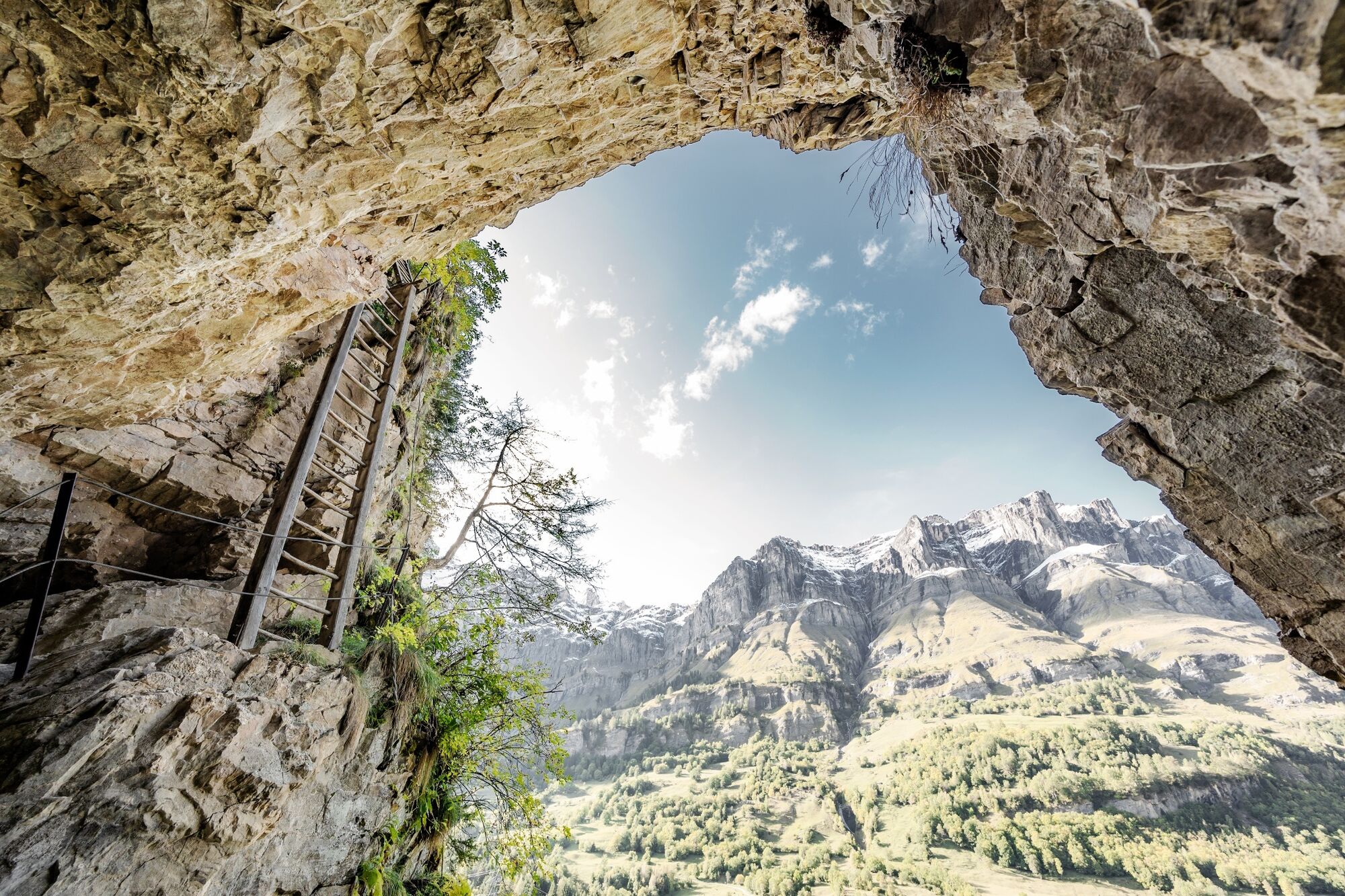
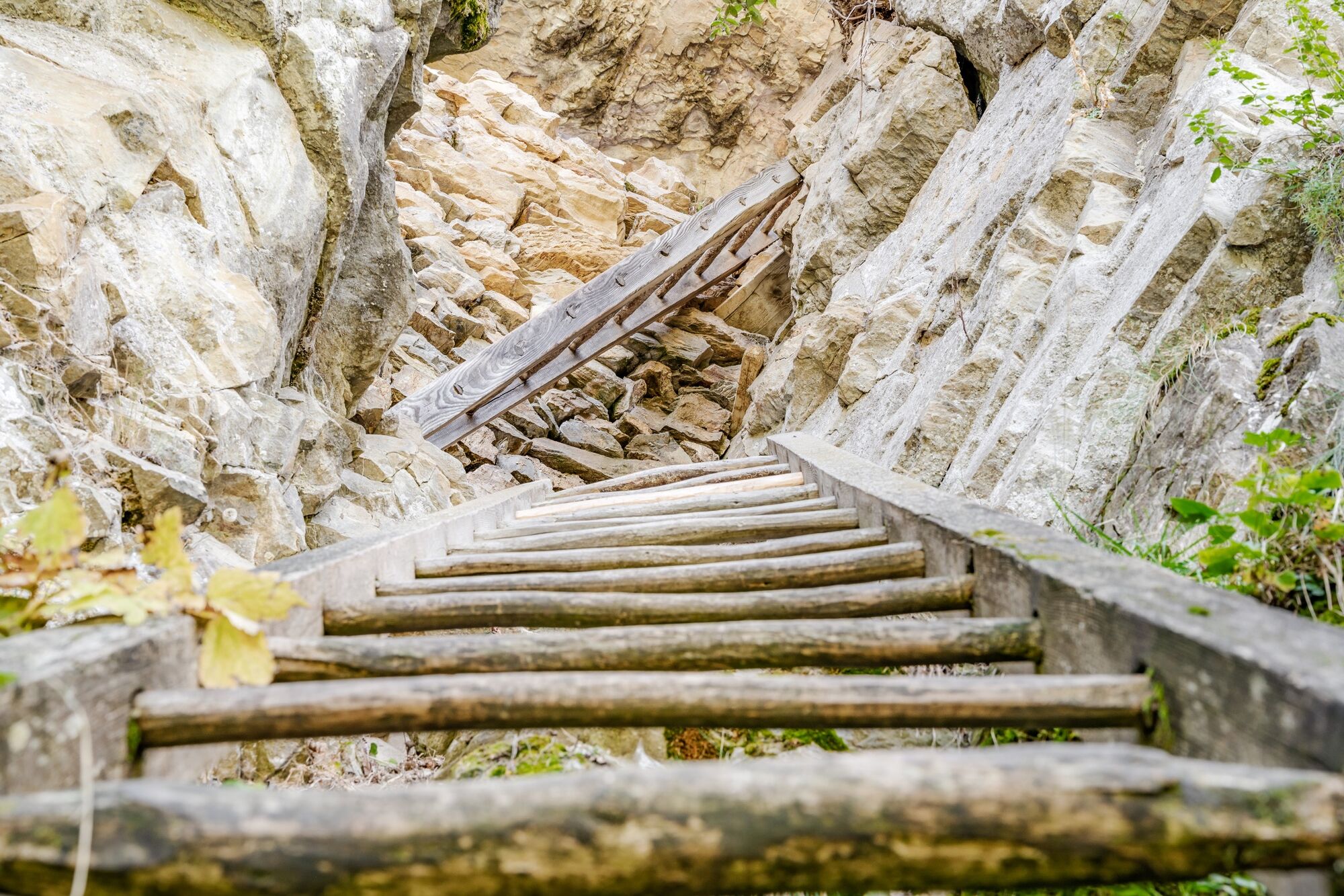
The oldest via ferrata in Switzerland - or rather in the Alps since 1781. Climb the dramatic sequence of wooden ladders on the historical trade route between the villages of Albinen and Leukerbad.
- Difficulty
-
difficult
- Rating
-
- Starting point
-
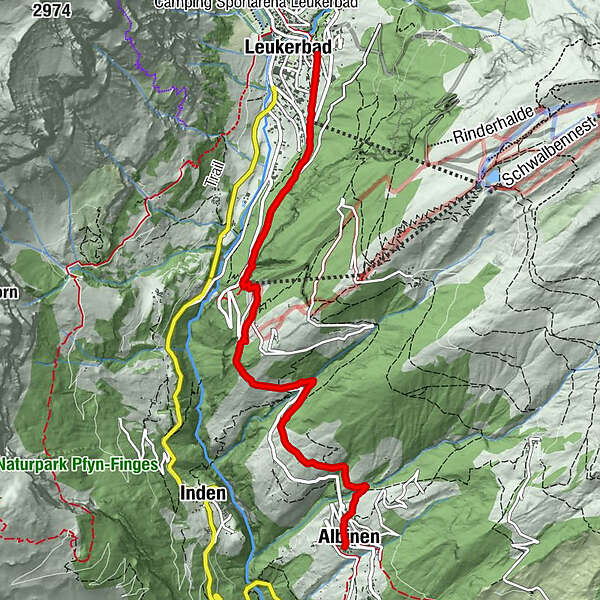
Leukerbad, main village square
- Route
-
Loèche-lès-Bains (1,402 m)Hotel Restaurant Flaschen2.5 kmFlaschen2.5 kmDorben (1,361 m)3.6 kmRastplatz Oberdietu4.9 kmAlbinen (1,300 m)6.2 kmGodswärgjistubu6.2 kmPfarrkirche Heiliger Bruder Klaus6.2 km
- Best season
-
JanFebMarAprMayJunJulAugSepOctNovDec
- Description
-
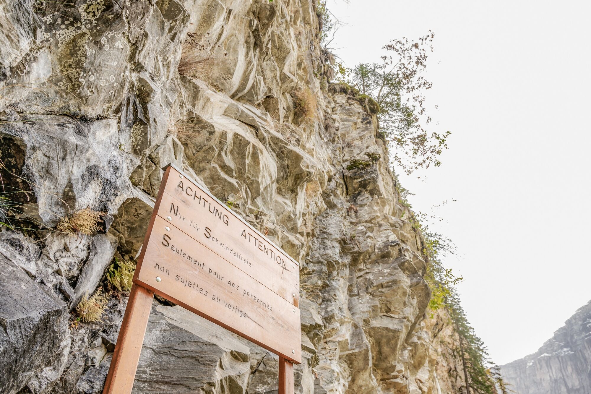
Highlight of this walk is the ascent of a sequence of eight wooden ladders, which once provided the only link between Leukerbad and Albinen. The latter is a traditional Valais village of ancient wooden chalets blackened by sunshine. The two-hour hike from Leukerbad to Albinen is only for those with a good head for heights.
Starting in the village of Leukerbad, the trail leads southwards and through the Lochwald forest to reach the beginning of the thrilling ascent of the Albinen ladders. These once provided the only link between Leukerbad and Albinen, and were primarily used for the transport of agricultural goods. It is also likely – although unproven – that the ladders formed an extension of the Gemmi Pass route linking the Kander valley with the Rhône valley.
The sequence of ladders represents a climb of about 100 vertical metres and ends by the base station of the Flaschen–Torrentalp gondola. Here, the Restaurant Flaschen offers a welcome break for refreshments.
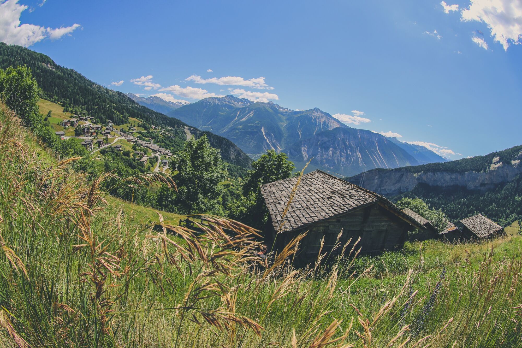
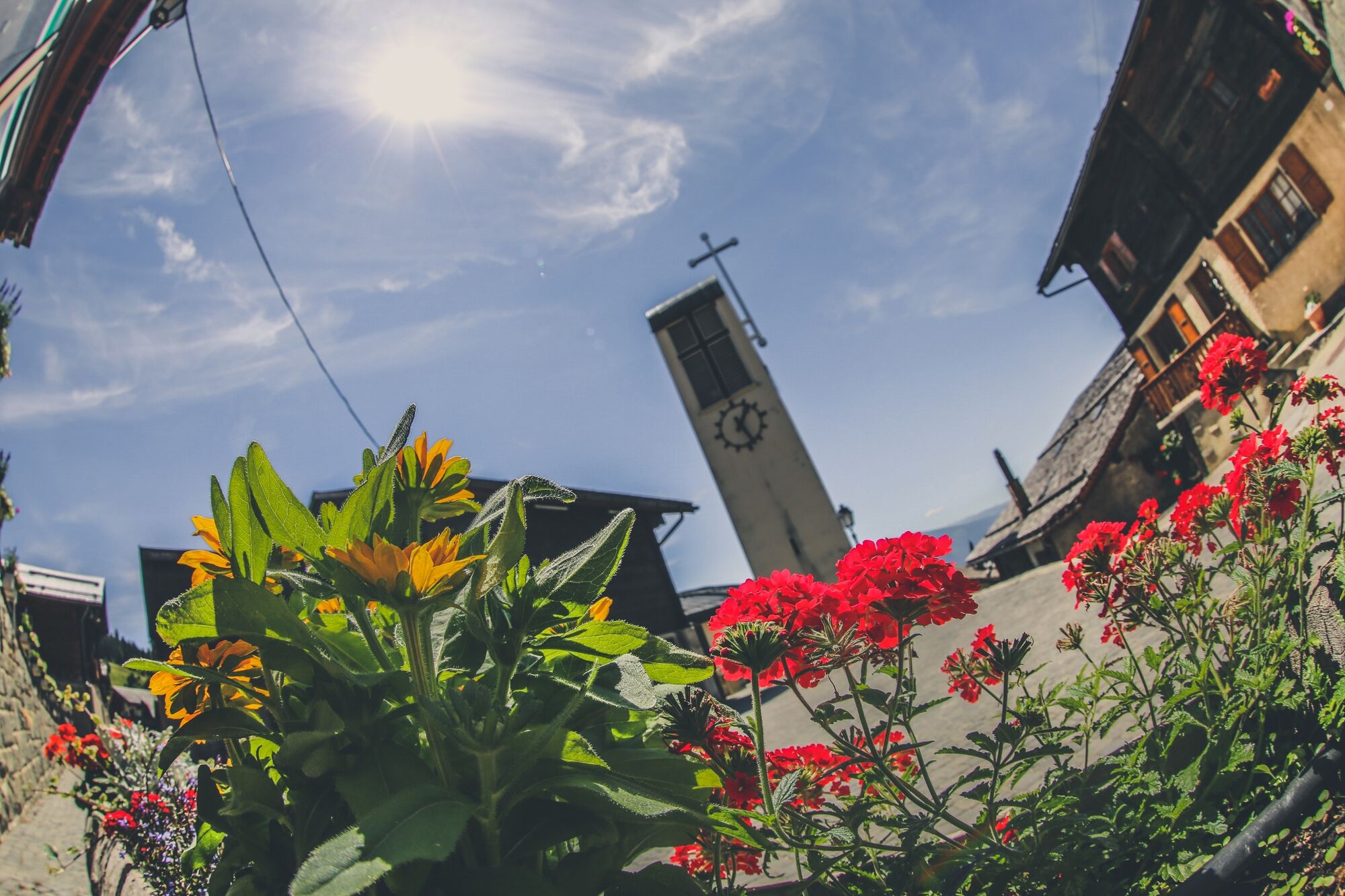
The trail continues, partly through forest, partly through fields and meadows, passing above the hamlet of Dorben before reaching Albinen. This is a typical Valais mountain village with many well-preserved houses and barns. Only the village church is built in modern style, as its predecessor was destroyed in an earthquake. The population was largely self-sufficient until the mid-20th century; the access road was built only in the 1960s.
To make the most efficient use of the land available, locals built their houses very close together. As all the gables of the houses face the same way, across the valley, the village has a remarkably uniform appearance, and is today a heritage site of national importance.
From Albinen, hikers can either continue in the direction of the mountain villages of Guttet-Feschel and Erschmatt or return to Leukerbad. In order to follow a different route back, walkers can return to Leukerbad via Torrentalp and another dramatic passage, the Wolfstritt.
Highlights:
The dramatic Albinen ladders, which once provided the only link between Leukerbad and Albinen. The unspoilt mountain village of Albinen with its well-preserved wooden houses dating from the 17th and 18th - Directions
-
The trail takes you past the base station of the Torrent cable car to reach the bottom of the eight Albinen ladders. Soon after you have climbed up, you pass the base station of the gondola for the Rinderhütte on the Torrent. The trail then leads above the asphalt road as far as Albinen, where you can enjoy some well-deserved refreshments. If you wish, and you have the energy, continue your hike either through the forest towards Guttet-Feschel and Erschmatt or return to Leukerbad via Torrentalp. Alternatively, you can take a bus back to Leukerbad or down to Leuk.
- Highest point
- 1,548 m
- Endpoint
-
Albinen
- Height profile
-
 © outdooractive.com
 - Equipment
-
Day hiking bag (approx. 20 litres) with rain cover, sturdy and comfortable footwear, multi-layered clothing suitable for the weather and hard-wearing, telescopic poles, sun and rain protection, provisions and drinking water, first aid kit, pocket knife, mobile phone, maps.
- Safety instructions
-
Bring a map. Download full description of this route including large-scale map by clicking on "Print" icon, top right of this page.
Use marked trails only, and observe all signposting – for your own safety, to safeguard grazing animals and to avoid disturbing wildlife.
Close gates after passing through.
Please be considerate to other trail users, and to the plants and animals.
- Tips
-
If you don't have a head for heights and want to avoid the ladders, you can switch from the foot of the ladders to the road and walk through the tunnel. A little further on you meet the hiking trail to Albinen.
From Albinen, you can either continue the hike in the direction of the two mountain villages of Guttet-Feschel and Erschmatt or return to Leukerbad. To avoid having to take the same way back, the tour described leads back to the spa village via Torrentalp. Another adventurous descent, the Wolfstritt, takes you back to the village of Leukerbad.
- Additional information
-
The tourist office in Leukerbad has got brochures and information material about hiking in the region and will give you detailled information about this hike.
- Directions
-
From Basel and Zurich: A1 motorway to Bern; A6 to Spiez; direction Kandersteg; Kandersteg - Goppenstein car transport; direction Gampel; Leuk - Leukerbad.
From Geneva: Motorway A1 to Lausanne; direction Sion/Sierre; Leuk - Leukerbad.
From Milan: Motorway A8/A26 direction Simplon; car transport Iselle-Brig; direction Leuk - Leukerbad.
- Public transportation
-
Leuk can be reached by train (SBB), then by bus (LLB - Leuk Leukerbad Bus Reisen) to the starting point in Leukerbad.
- Parking
-
Various parking options in the village of Leukerbad. Follow the local parking guidance system.
Car parks in Leukerbad: Sportarena parking, Rathaus parking, Torrent parking, Leukerbad Therme parking, Alpentherme parking.

- Author
-
The tour From Leukerbad to Albinen via the historical Albinen ladders is used by outdooractive.com provided.


General info
-
Oberwallis
1871
-
Leuk/Leukerbad
1027
-
Albinen
273