


- Brief description
-
High-altitude hike from the Col du Sanetsch (2,252 m) across an other-worldly landscape of sculpted rock formations below the Tsanfleuron Glacier. Refreshment stop at the Cabane de Prarochet.
- Difficulty
-
difficult
- Rating
-
- Starting point
-
Tsanfleuron
- Route
-
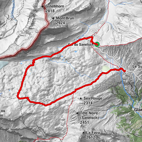
Col du Sanetsch (2,252 m)9.6 km
- Best season
-
JanFebMarAprMayJunJulAugSepOctNovDec
- Description
-
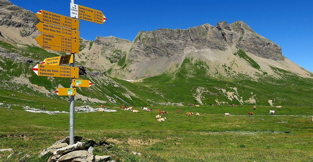
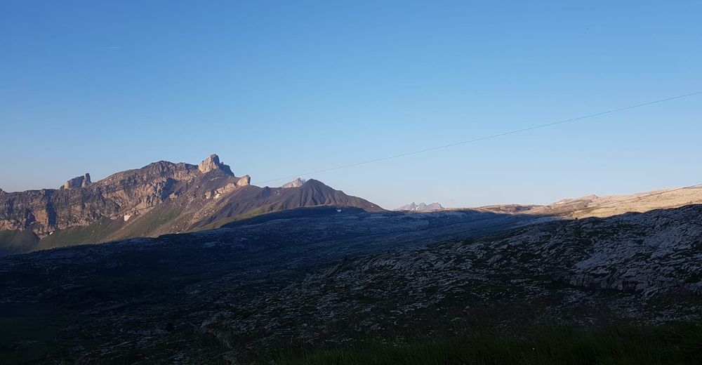
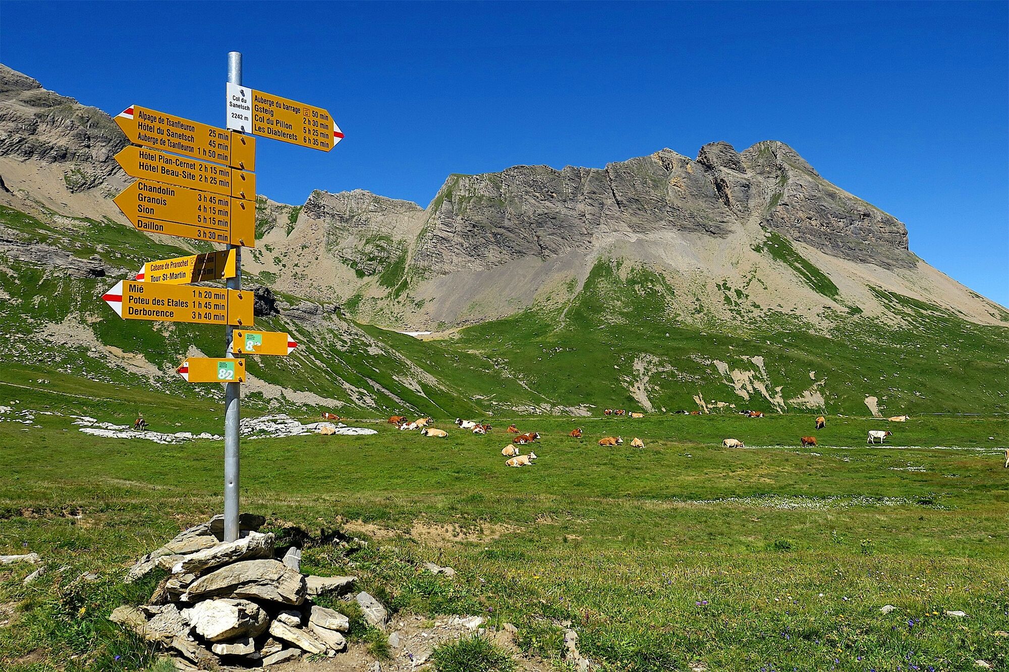
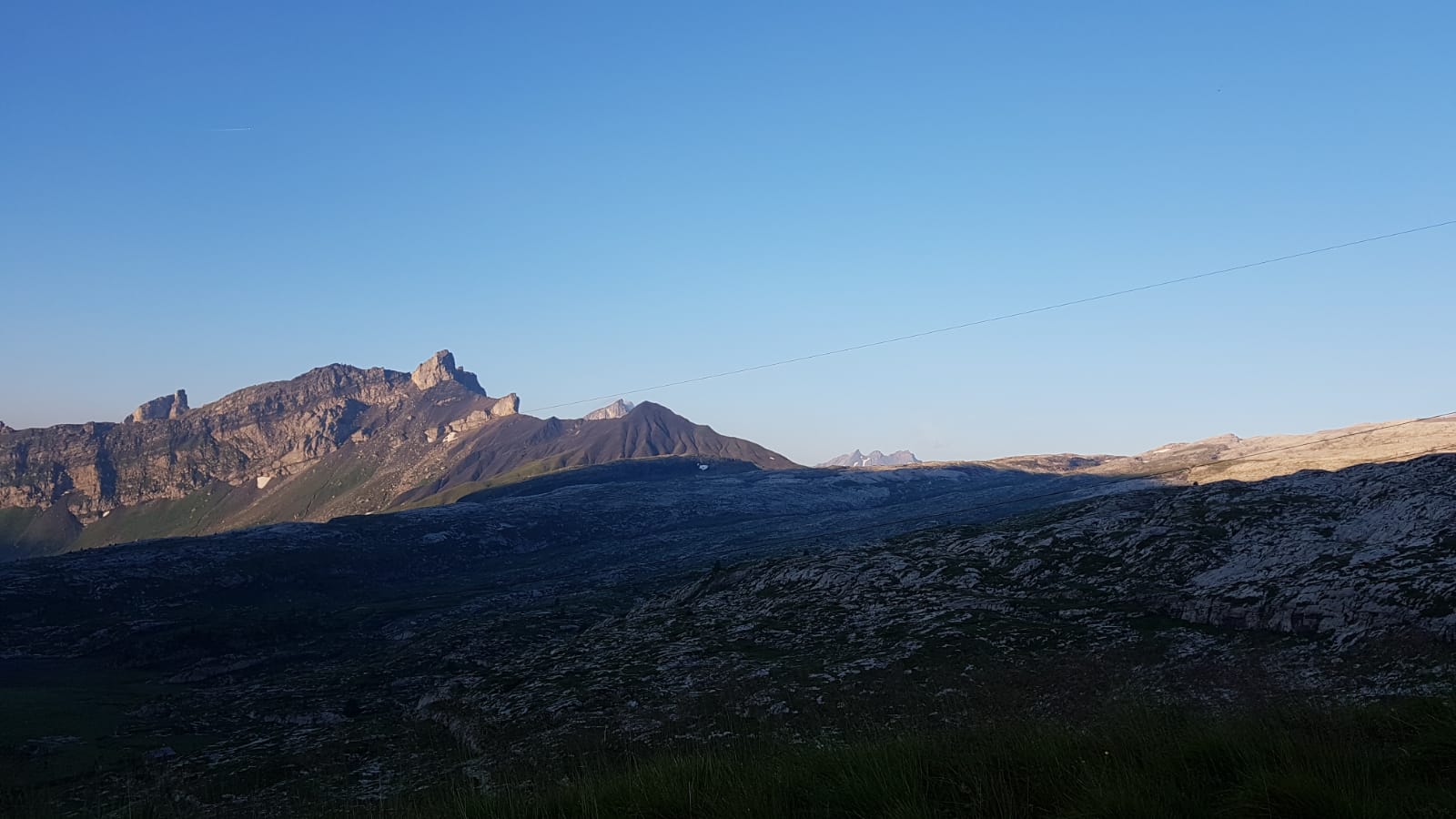
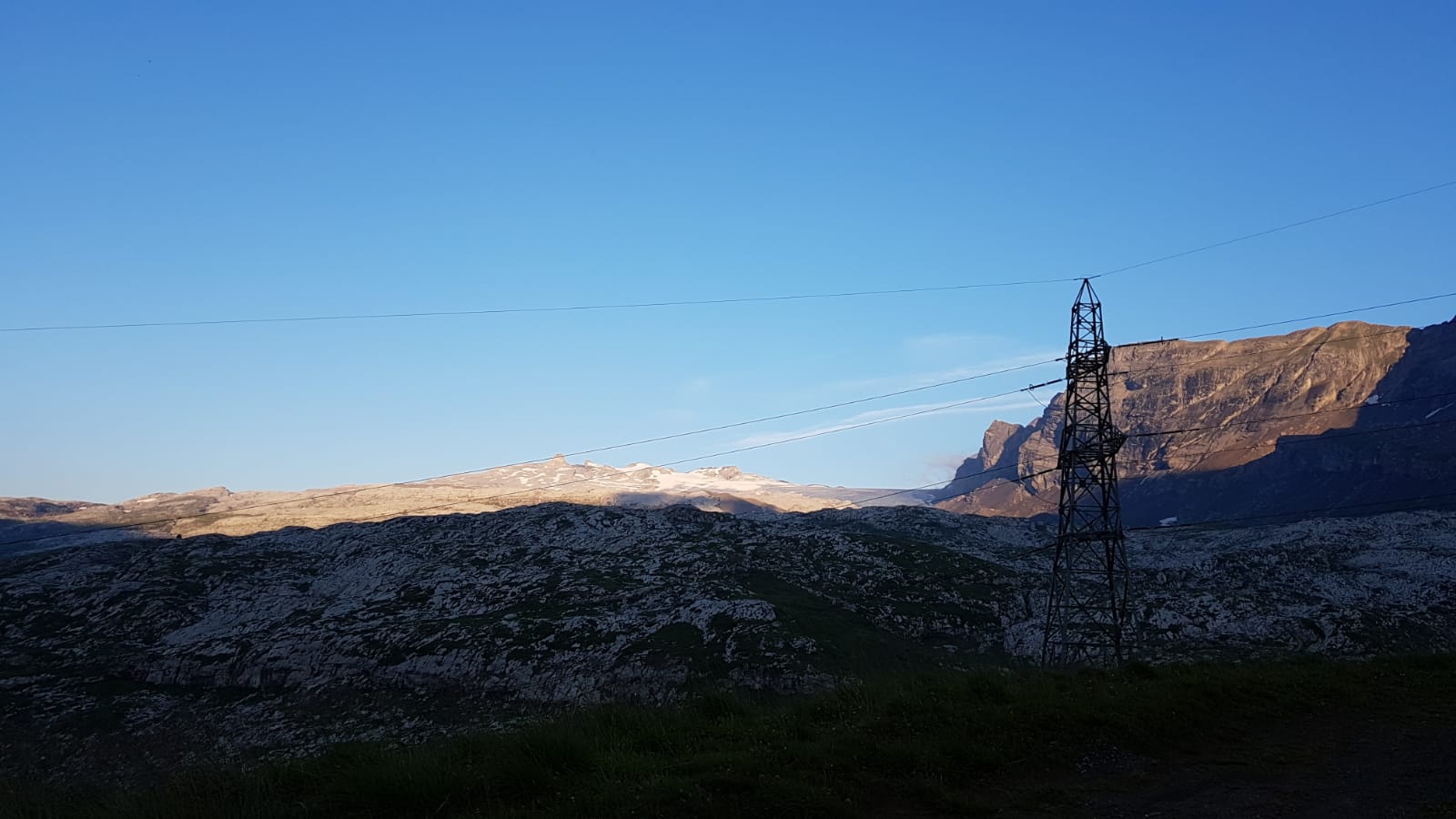
The "Tsanfleuron Lapis" is an impressive rocky area sculpted by the forces of nature, which lies below the Tsanfleuron glacier. On the upper part, until recently covered with ice, the rock is smooth and rounded, polished by the glacier. Below, the rocks released from the ice thousands of years ago provide an eroded and cracked karst landscape over time and with the flow of water. Between the two areas are the moraines that the Tsanfleuron glacier left until 1850. Today, the glacier is about 2 km from this incomparable place in Europe.
The hike makes a wide loop around this lunar landscape. The path begins in the hamlet of Tsanfleuron in the direction of the glacier, until the hut of Prarochet (2'556 m), built by the ski club of Savièse. From mid-June to mid-September, this hut is the ideal place to stop and have a refreshment. From there, you can enjoy the view of the Diablerets ski lifts, the impressive "Quille du Diable" rock formation and several 4,000 meters peaks from Valais. The path then leads along the northern side of Tsanfleuron's lapis to the Sanetsch Pass.
Highlights:
Spectacular drive up (by car or postal bus) from the Rhône valley Les Lapis de Tsanfleuron – karst landscape of sculpted limestone Cabane de Prarochet – welcoming mountain refuge near the foot of the glacier - Directions
-
From the hamlet of Tsanfleuron, follow the yellow hiking trail signs pointing to the Cabane de Prarochet. The second part of the path is then indicated by cairns or painted on the stones. From the Prarochet hut, it is easy to lose the way, so be careful of the markings on the stones to continue northeast towards the Sanetsch Pass.
- Highest point
- 2,547 m
- Endpoint
-
Col du Sanetsch
- Height profile
-
 © outdooractive.com
 - Equipment
-
We recommend:
good footwear clothing suitable for the weather: always carry a waterproof jacket hat or cap sunscreen bottle for water picnic camera binoculars (optional) hiking poles (optional) printout of this hike (click «Print» icon, to download)For certain walks:
Swimwear - Safety instructions
-
Use of the trails and the information on this website is at hikers’ own risk. Local conditions may entail changes to routes. Valais/Wallis Promotion accepts no liability for the accuracy and completeness of information on this website.
For all hikes:
Bring a map. Download full description of this route including large-scale map by clicking on «Print» icon, top right of this page. Use marked trails only, and observe all signposting – for your own safety, to safeguard grazing animals and to avoid disturbing wildlife. Close gates after passing through. Please be considerate to other trail users, and to the plants and animals. Do not leave any waste in nature.For mountain hikes:
Take extra care protecting yourself from the sun at altitude. UV radiation can be exceptionally strong, even in cloudy weather. Plan hike carefully: take into consideration fitness level of each participant, weather forecast and season. Weather conditions can change quickly in the mountains, without warning. Appropriate clothing is therefore essential, along with adequate supplies of food and water. In uncertain weather, turn back in good time.For high-altitude hikes:
Inform others of the route you plan to take. Whenever possible, avoid going alone. Do not venture onto glaciers without a mountain guide. Take note of the warning signs that point out the constant danger in river beds and along watercourses below dams and reservoirs: water levels may rise rapidly without warning. - Tips
-
Bring binoculars for a chance to observe the rare bearded vulture.
- Additional information
- Arrival
-
A9 motorway to Sion.
Driving from the west: exit junction 25 (Conthey), follow signs for Conthey and then Sion. After 2.7 km from motorway exit, at Pont-de-la-Morge, turn north up the valley of La Morge, following signs for “Col du Sanetsch”.
Driving from the east: exit junction 26 (Sion-Ouest), follow signs for Sion. After 800 m, turn left, following signs to Conthey. Follow this road for 2.6 km; at Pont-de-la-Morge, turn north up the valley of La Morge, following signs for “Col du Sanetsch”.
- Public transportation
-
Train to Sion. Postal bus to Chandolin-près-Savièse; change onto postal bus to Col du Sanetsch. One connection a day on high season, and only during weekend from mid-august. Find full timetable information at www.cff.ch.
- Parking
-
At the Col du Sanestch (free of charge)

-

-
AuthorThe tour Tour des lapiaz de Zanfleuron is used by outdooractive.com provided.


General info
-
Thyon les Collons
1426
-
Coteaux du Soleil
604
-
Gsteig bei Gstaad
170


