


- Brief description
-
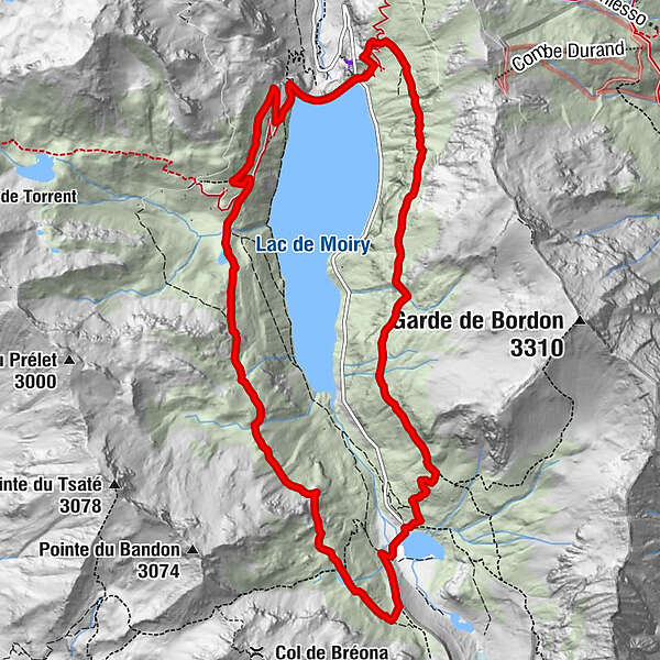
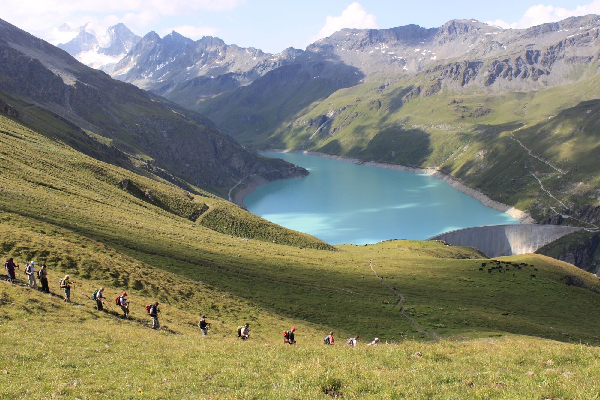
High circuit of the Lac de Moiry at the 2,500-metre level, with dramatic views of the dam, the lake, the wild Val de Moiry and its sparkling glacier.
- Difficulty
-
medium
- Rating
-
- Starting point
-
Moiry dam
- Route
-
Clems & Fabs0.0 km
- Best season
-
JanFebMarAprMayJunJulAugSepOctNovDec
- Description
-
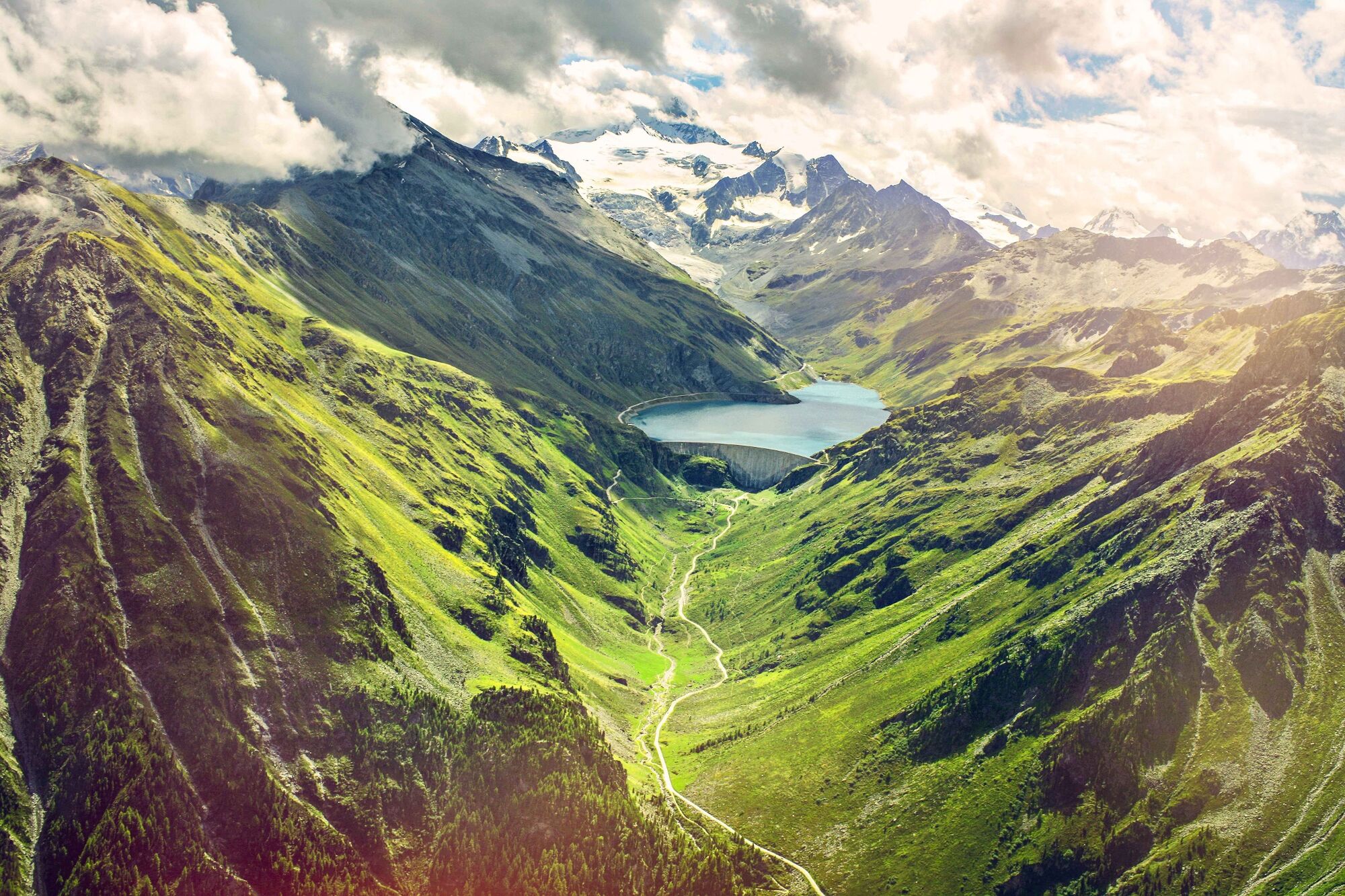
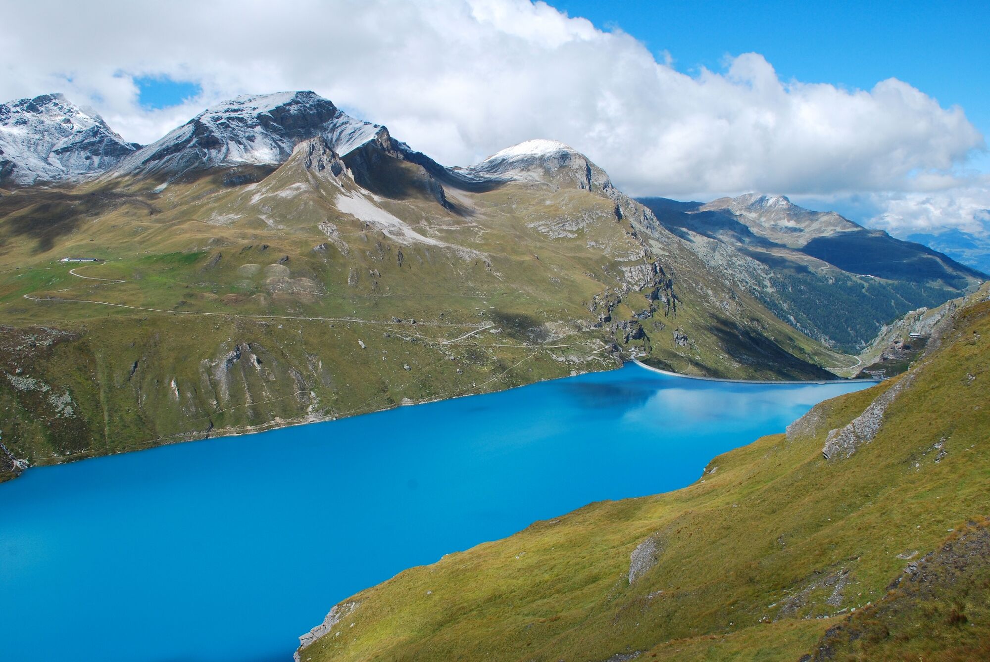
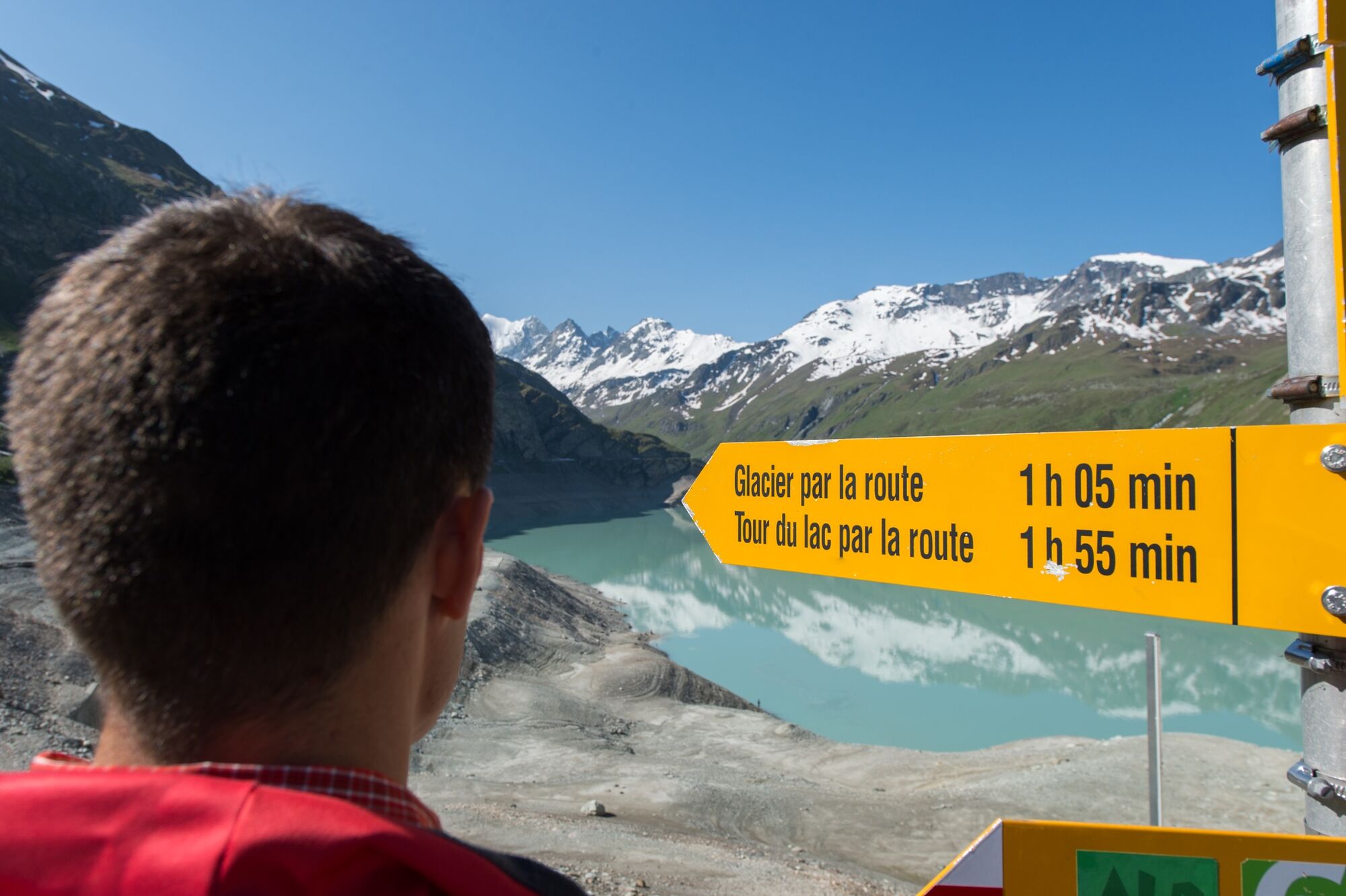
This scenic circuit loops around the turquoise waters of the Lac de Moiry – not at the level of the lake, but a couple of hundred meters higher up, at an altitude of roughly 2,500 m. Hikers may encounter various different names for the trail including «Tour du Lac de Moiry 2500», «Tour du Lac 2500», «Haut Tour du Lac» and «Chemin 2500». At the far end of the lake, the trail drops down to cross the river La Gougra, which feeds the reservoir – and which is in turn fed by the Glacier de Moiry higher up the valley. The path snakes past the glacial lake of Lac de Châteaupré before scaling an impressive glacial moraine to return to the 2,500-metre level – this time on the western side of the valley. The start and finish point of the circuit is the crest of the Moiry dam. The reservoir it has created also collects water from neighbouring valleys via a network of tunnels before channeling it down to the Rhône valley, 1,722 vertical meters below. On the way the water passes through three hydroelectric power stations, which produce enough electricity to meet the annual needs of more than 120,000 homes. Close to the crest, the dam restaurant has a large sunny terrace looking out over the lake. Climbing enthusiasts can tackle the via ferrata that scales the cliffs just below the dam, revealing dramatic views of the lower valley and the arched curtain of concrete, 148 m high.
Highlights
Panoramic high trail through a dramatic alpine landscape sculpted by glaciers Moiry dam – guided visits, restaurant with sun terrace, via ferrata - Directions
-
Start at the bus stop/car park at the crest of the dam, close to the restaurant. The hike can be walked in either direction; these instructions are for a clockwise circuit around the reservoir. From the dam crest, the trail zig-zags steeply up the west-facing slopes overlooking the reservoir to reach an altitude of about 2,370 m. The trail then leads southwards along the mountain flanks and beyond the far end of the reservoir to reach the high pastures of Fêta d’Août de Châteaupré, before dropping steeply down to the glacial waters of the Lac de Châteaupré (2,349 m). The trail crosses the river La Gougra just below the lake to scale the glacial moraine and the slopes on the opposite side of the valley. At an altitude of about 2,490 m, the trail turns north-west and begins a long traverse of the valley’s east-facing slopes. Along the way it passes two small lakes – the Lac de la Bayenna and the Lac du Louché – before dropping down to the crest of the dam to complete the circuit.
- Highest point
- 2,584 m
- Endpoint
-
Moiry dam
- Height profile
-
 © outdooractive.com
 - Equipment
-
We recommend:
good footwear clothing suitable for the weather: always carry a waterproof jacket hat or cap sunscreen bottle for water picnic camera binoculars (optional) hiking poles (optional) printout of this hike (click “Print” icon, to download)For certain walks:
Swimwear - Safety instructions
-
Use of the trails and the information on this website is at hikers’ own risk. Local conditions may entail changes to routes. Valais/Wallis Promotion accepts no liability for the accuracy and completeness of information on this website.
For all hikes:
Bring a map. Download full description of this route including large-scale map by clicking on “Print” icon, top right of this page. Use marked trails only, and observe all signposting – for your own safety, to safeguard grazing animals and to avoid disturbing wildlife. Close gates after passing through. Please be considerate to other trail users, and to the plants and animals. Do not leave any waste in nature.For mountain hikes:
Take extra care protecting yourself from the sun at altitude. UV radiation can be exceptionally strong, even in cloudy weather. Plan hike carefully: take into consideration fitness level of each participant, weather forecast and season. Weather conditions can change quickly in the mountains, without warning. Appropriate clothing is therefore essential, along with adequate supplies of food and water. In uncertain weather, turn back in good time.For high-altitude hikes:
Inform others of the route you plan to take. Whenever possible, avoid going alone. Do not venture onto glaciers without a mountain guide. Take note of the warning signs that point out the constant danger in river beds and along watercourses below dams and reservoirs: water levels may rise rapidly without warning. - Tips
-
Free guided tour inside the Moiry dam with the Pass Anniviers Liberté to learn more about its network of tunnels through the concrete and rock.
- Additional information
- Directions
-
Take the exit 29 (Sierre-Est) of the A9 highway and continue to the Val d'Anniviers. In the village of Vissoie, turn right on the «Route de Grimentz» and continue to the village of Grimentz. Cross the village and continue on the «Route de Moiry» until you arrive at the dam.
- Public transportation
-
Frequent train connections on the Simplon line to Sierre. From there, take the post bus to Val d'Anniviers. Change in Vissoie and take the bus direction Moiry dam. Find full timetable information at sbb.ch.
- Parking
-
Car park at crest of Moiry dam.

-

-
AuthorThe tour Tour du Lac de Moiry is used by outdooractive.com provided.


General info
-
Unterwallis
1192
-
Sierre Anniviers
782
-
Zinal
277
")


