

- Brief description
-
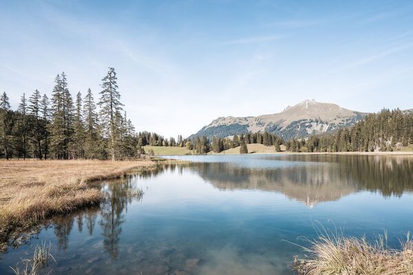
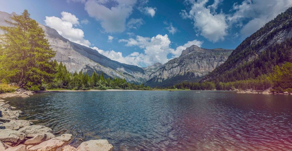
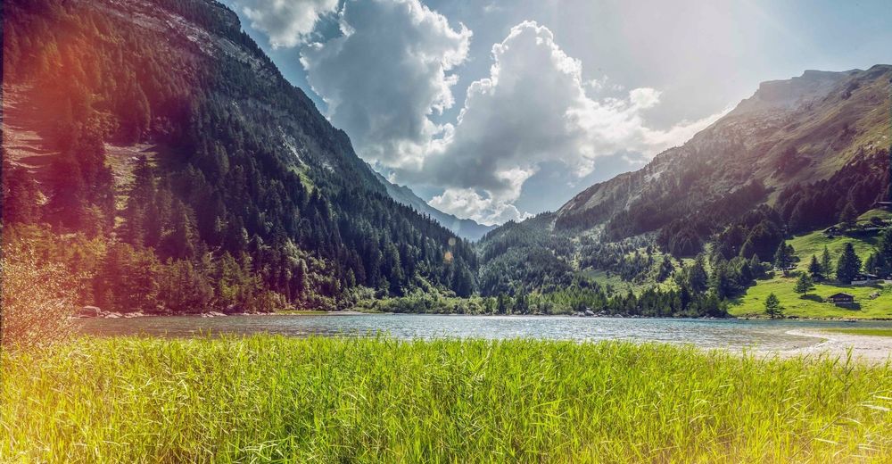
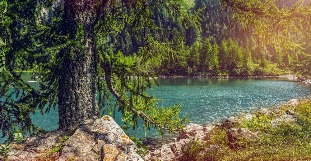
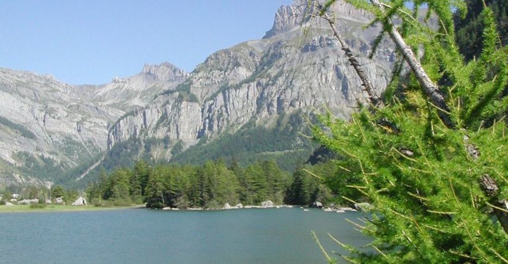
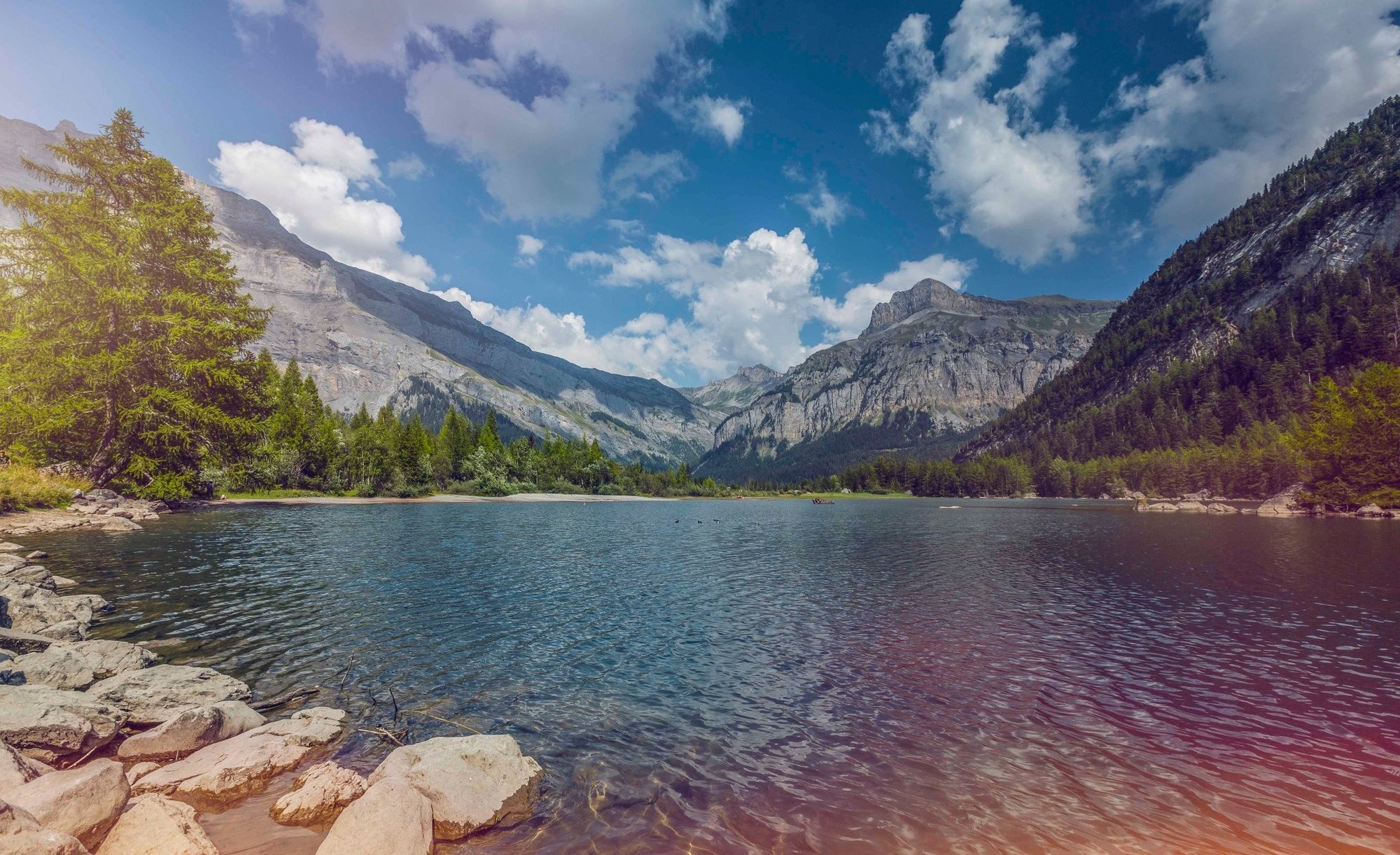
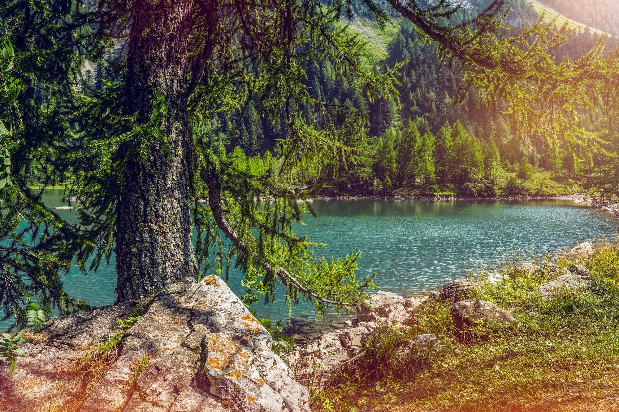
A walk around the landscape created in a remote valley by two colossal rockslides in the 18th century. A tranquil lake, pristine forest, abundant wildlife: Derborence is now a national nature reserve.
- Difficulty
-
easy
- Rating
-
- Starting point
-
Derborence (car park / bus stop)
- Route
-
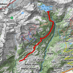
Godet3.5 kmAuberge du Godet3.5 kmDerborence6.2 kmRefuge du Lac (1,462 m)6.2 km
- Best season
-
JanFebMarAprMayJunJulAugSepOctNovDec
- Description
-
On 23 Sep 1714, a geological cataclysm devastated the pastures of Derborence: part of the mountain above collapsed, wiping out the community of animals and herders who spent the summer there. Locals believed the disaster the work of the devil; the mountain became known as Les Diablerets.
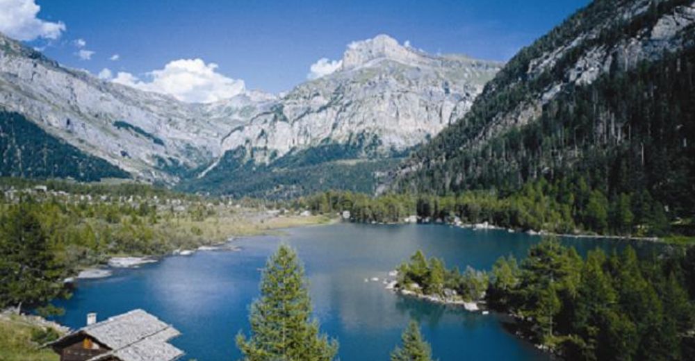
Because the “cursed” valley was largely abandoned, there were fewer casualties from an even bigger rockfall 35 years later. Giant boulders covered the valley floor, damming the river and creating Europe’s youngest natural lake. Scientists believe that about 50 million cubic metres of rock in all tumbled down from the mountain. Today, the “new” landscape – a national nature reserve – is the delight of biologists, geologists, photographers and visitors all ages.
This hike links two tours: one of the rockslide debris (“Tour de l’éboulement des Diablerets”) and one of the lake (“Tour du Lac de Derborence”). Highlights include the virgin forest west of the lake with monumental fir trees up to 450 years old and undergrowth exceptionally rich in plant species. Walkers have excellent chances of spotting wildlife: local mammals include ibex, deer, chamois, marmot and lynx; birds include golden eagle, black grouse and bearded vulture.
Families may prefer to opt for just one of the two tours that form our circuit. Each has a dedicated guide book (free download) with activities for children. A friendly mountain restaurant close to the two main lakes on the circuit offer rest and play stops.
The journey up to Derborence is an adventure in itself. The only access is via a narrow, twisting road along the gorges of the river La Lizerne.
Highlights
Thrilling road journey to access the hike along a wild canyon Impressive landscape created by the rockslides, framed by dramatic mountains Attractive family theme trails - Directions
-
The main car park and bus stop are located close to the Lac de Derborence. Our circuit and map start here, with the hike proceeding in a clockwise direction. The tour begins by crossing the main debris from the rockfall, before traversing the mountain slopes to a point above the Godey reservoir. Here the trail drops down and crosses the valley to reach the ancient forest of Ecorcha. Our hike finishes with a clockwise loop around the Lac de Derborence.
A second car park and bus stop by the Godey reservoir, with nearby mountain restaurant, offer an alternative starting point.
If walking with children, allow plenty of extra time to do the activities in the booklets!
- Highest point
- 1,514 m
- Endpoint
-
Derborence (car park / bus stop)
- Height profile
-
 © outdooractive.com
 - Equipment
-
We recommend:
good footwear clothing suitable for the weather: always carry a waterproof jacket hat or cap sunscreen bottle for water picnic camera binoculars (optional) hiking poles (optional) printout of this hike (click “Print” icon, to download)For certain walks:
Swimwear - Safety instructions
-
Use of the trails and the information on this website is at hikers’ own risk. Local conditions may entail changes to routes. Valais/Wallis Promotion accepts no liability for the accuracy and completeness of information on this website.
For all hikes:
Bring a map. Download full description of this route including large-scale map by clicking on “Print” icon, top right of this page. Use marked trails only, and observe all signposting – for your own safety, to safeguard grazing animals and to avoid disturbing wildlife. Close gates after passing through. Please be considerate to other trail users, and to the plants and animals. Do not leave any waste in nature.For mountain hikes:
Take extra care protecting yourself from the sun at altitude. UV radiation can be exceptionally strong, even in cloudy weather. Plan hike carefully: take into consideration fitness level of each participant, weather forecast and season. Weather conditions can change quickly in the mountains, without warning. Appropriate clothing is therefore essential, along with adequate supplies of food and water. In uncertain weather, turn back in good time.For high-altitude hikes:
Inform others of the route you plan to take. Whenever possible, avoid going alone. Do not venture onto glaciers without a mountain guide. Take note of the warning signs that point out the constant danger in river beds and along watercourses below dams and reservoirs: water levels may rise rapidly without warning. - Tips
-
Bring camera, binoculars and also a hand lens for plants and rocks: nature lovers are in for a treat!
- Additional information
- Directions
-
A9 motorway, exit 25 (Conthey). Follow signs for Pont-de-la-Morge, Conthey, Aven, Derborence. Note that the road to Derborence is closed from the beginning of November to the end of April.
- Public transportation
-
Train to Sion, then postal bus to Derborence. Buses run only in summer: daily from late-June to late-September, then weekends until early October. Buses stop at Le Godey en route to Derborence. Find full timetable information at sbb.ch.
- Parking
-
Parking shortly before the Lac de Derborence (also below the Lac de Godey, halfway round the loop).


-

-
AuthorThe tour Tour de l'éboulement des Diablerets is used by outdooractive.com provided.


General info
-
Thyon les Collons
1435
-
Coteaux du Soleil
608
-
Ardon
78