
- Brief description
-
Panoramic hike across alpine pastures and through fragrant forests up to the idyllic Lac de Tseuzier. Gentle climb, ideal for families, partly along the Bisse de Sion irrigation channel.
- Difficulty
-
medium
- Rating
-
- Starting point
-
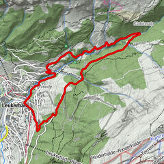
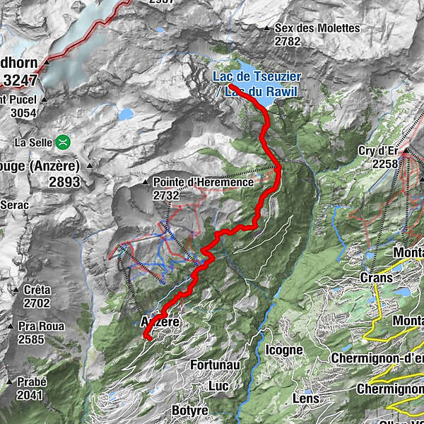
Anzère village
- Route
-
Place de la Télécabine0.1 kmLes Bochonès0.5 kmAnzère (1,500 m)0.6 kmProbon1.9 kmLes Grillesses2.7 kmLes Rousses7.1 kmLes Rousses12.3 kmLes Grillesses16.9 kmProbon17.6 kmAnzère (1,500 m)18.9 kmLes Bochonès18.9 kmPlace de la Télécabine19.5 km
- Best season
-
JanFebMarAprMayJunJulAugSepOctNovDec
- Description
-
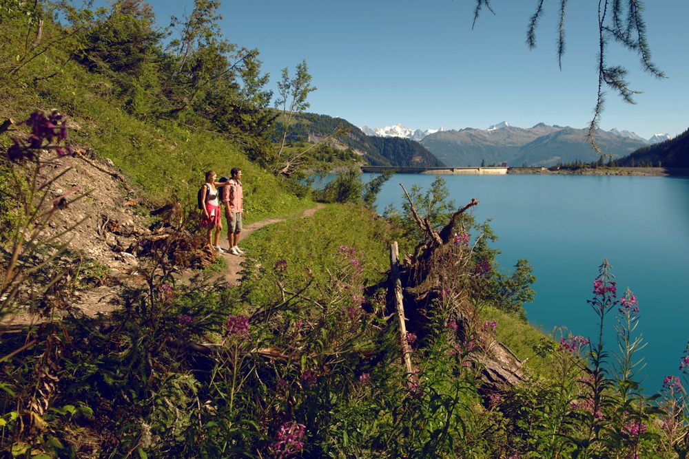
The incline of this walk is gentle, but the views evolve along the way in epic style.
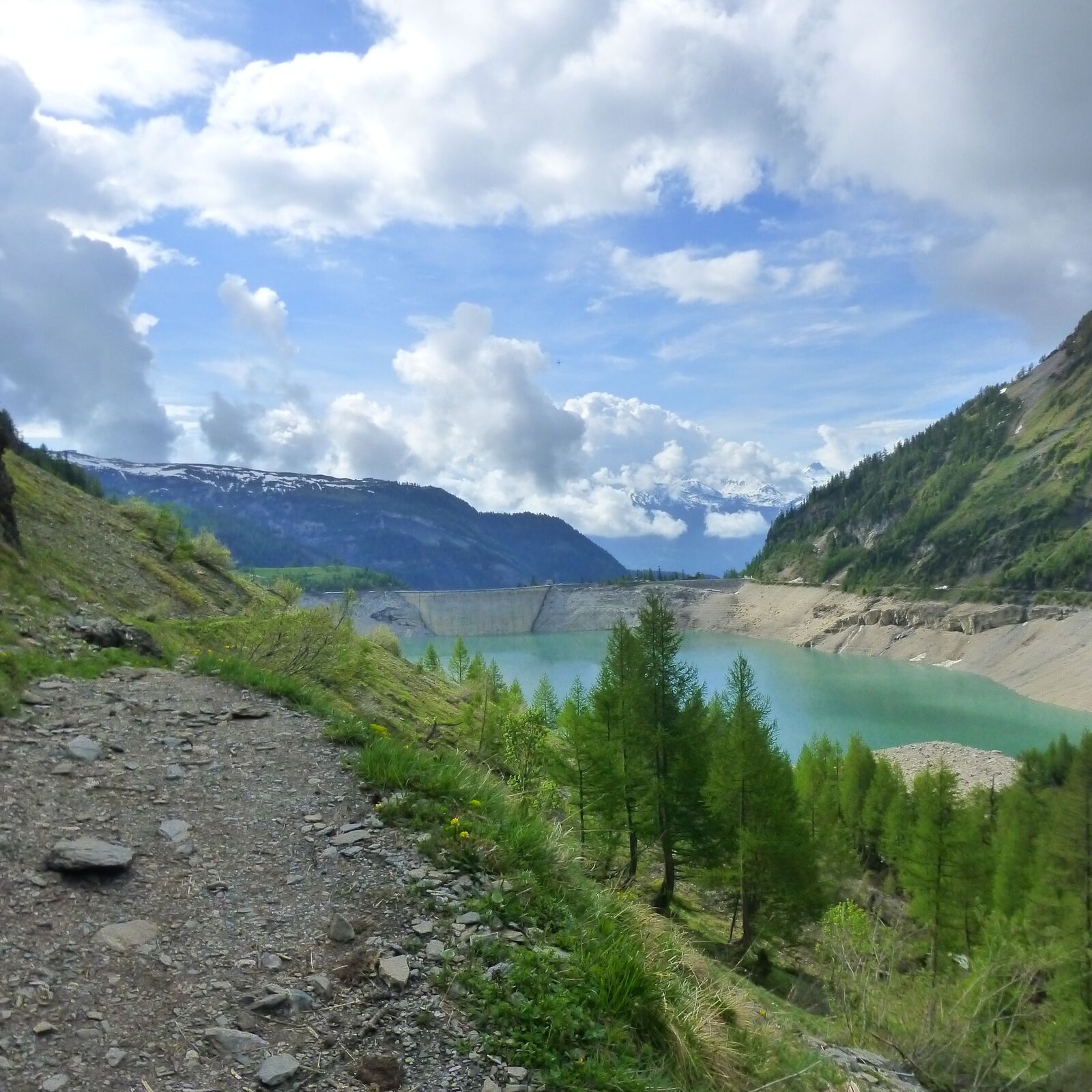
At first, as the trail leads behind and above the resort of Anzère, hikers enjoy sweeping panoramic views along the Rhône valley and to the snow-capped peaks on the far side. As it leads higher into the valley of La Liène, the path looks out over an increasingly wild, forested and rocky landscape. Finally, the trail emerges at the crest of the Tseuzier dam to reveal a peaceful lake in a magnificent mountain bowl.
The route generally follows the Bisse de Sion, an irrigation channel built from 1901 to 1903 to carry water from a point above the lake as far as the slopes overlooking Sion. Some sections of the bisse now flow through underground pipes; along these stretches, the trail follows a similar route above ground.
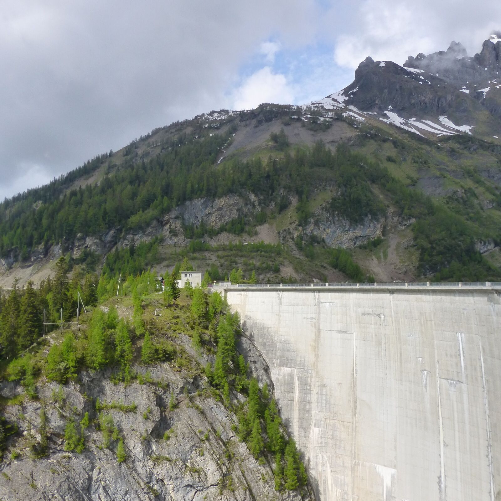
The trail ends at the Lac de Tseuzier, an artificial reservoir created by the Tseuzier (or Rawil) dam, built from 1953 to 1957. This captures the waters of the river La Lienne, which originate on the steep mountainsides beyond.
In Roman times and during the Middle Ages, this valley lay on the route of a busy alpine crossing: over the Rawyl Pass (2,425 m) into the Bernese Oberland. There is no road over the pass today, but the trail is popular with hikers.
Near the top of the dam, the Restaurant du barrage de Zeuzier (1,777 m) has a large sunny terrace, and makes a relaxing stop for refreshments.
This walk can easily be combined with the “Tour du Lac de Tseuzier”.
NB Expect to see different names and spellings for the lake (Tseuzier/Zeuzier), dam (Rawil/Rawyl) and river (Liène/Lienne).
Highlights:
Panoramic trail with sweeping views, gentle incline Bisse de Sion – historical irrigation channel Lac de Tseuzier – idyllic alpine lake, restaurant with sunny terrace - Directions
-
From the gondola station, the trail sweeps behind and above the resort, climbing gently to the north-east. For long stretches, the historical Bisse de Sion now flows through underground pipes, but close to the rocky outcrop of Sé des Samarins, the trail turns northward and follows the open-air bisse upstream all the way to Les Rousses.
The last section of the route up to the dam follows the road, which in places leads through tunnels. Hikers can either walk through these tunnels or follow the old route used by the bisse guardians – but note that this features exposed sections, with hand cables and metal ladders, which require a good head for heights. This option is unsuitable for walkers with dogs or young children.
At the end of the walk, return to Anzère by postal bus (change at St-Romain).
- Highest point
- 1,804 m
- Endpoint
-
Tseuzier dam
- Height profile
-
 © outdooractive.com
 - Equipment
-
We recommend:
good footwear clothing suitable for the weather: always carry a waterproof jacket hat or cap sunscreen bottle for water picnic camera binoculars (optional) hiking poles (optional) printout of this hike (click “Print” icon, to download)For certain walks:
Swimwear - Safety instructions
-
Use of the trails and the information on this website is at hikers’ own risk. Local conditions may entail changes to routes. Valais/Wallis Promotion accepts no liability for the accuracy and completeness of information on this website.
For all hikes:
Bring a map. Download full description of this route including large-scale map by clicking on “Print” icon, top right of this page. Use marked trails only, and observe all signposting – for your own safety, to safeguard grazing animals and to avoid disturbing wildlife. Close gates after passing through. Please be considerate to other trail users, and to the plants and animals. Do not leave any waste in nature.For mountain hikes:
Take extra care protecting yourself from the sun at altitude. UV radiation can be exceptionally strong, even in cloudy weather. Plan hike carefully: take into consideration fitness level of each participant, weather forecast and season. Weather conditions can change quickly in the mountains, without warning. Appropriate clothing is therefore essential, along with adequate supplies of food and water. In uncertain weather, turn back in good time.For high-altitude hikes:
Inform others of the route you plan to take. Whenever possible, avoid going alone. Do not venture onto glaciers without a mountain guide. Take note of the warning signs that point out the constant danger in river beds and along watercourses below dams and reservoirs: water levels may rise rapidly without warning. - Tips
-
If driving up from the Rhône valley, stop en route in Botyre for the entertaining Bisse Museum, housed in a fine 17th-century building.
- Additional information
- Directions
-
A9 motorway, exit 27 (Sion-Est). Follow signs for Anzère.
- Public transportation
-
Train to Sion, then postal bus to Anzère. Find full timetable information at sbb.ch
- Parking
-
Parking at gondola station. Follow the parking instructions in resort.

-

-
AuthorThe tour To the Lac de Tseuzier is used by outdooractive.com provided.


General info
-
Thyon les Collons
1426
-
Anzère/ Valais
889
-
Anzère
176