


- Brief description
-
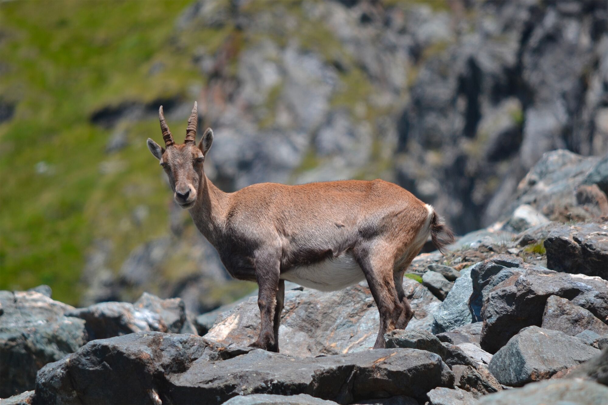
The “Path of the chamois” into the nature reserve of the Haut Val de Bagnes leads along steep slopes high above the valley floor, offering dramatic views and plenty of chances to spot local wildlife.
- Difficulty
-
difficult
- Rating
-
- Starting point
-
La Chaux (cable car)
- Route
-
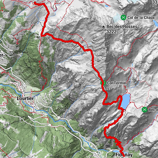
Cabane de Louvie7.8 kmFionnay (1,491 m)11.5 km
- Best season
-
JanFebMarAprMayJunJulAugSepOctNovDec
- Description
-
The chamois is the iconic animal of the Haut Val de Bagnes nature reserve, the second-largest in Switzerland at 150 sq. km. The nimble-footed mountain goats can negotiate the steepest rock faces, and are perfectly adapted to the steep terrain.
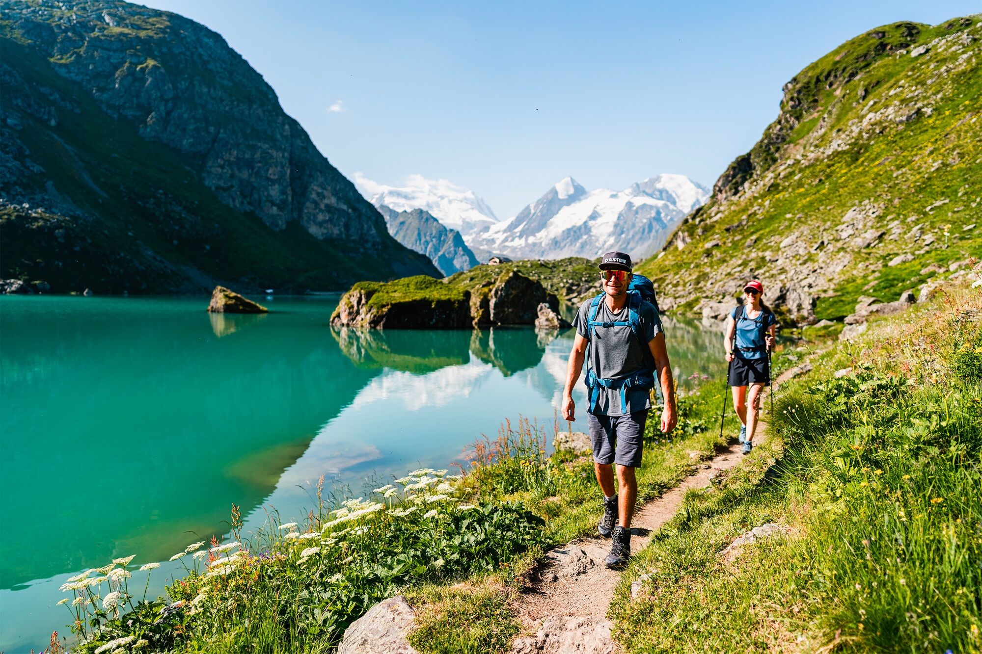
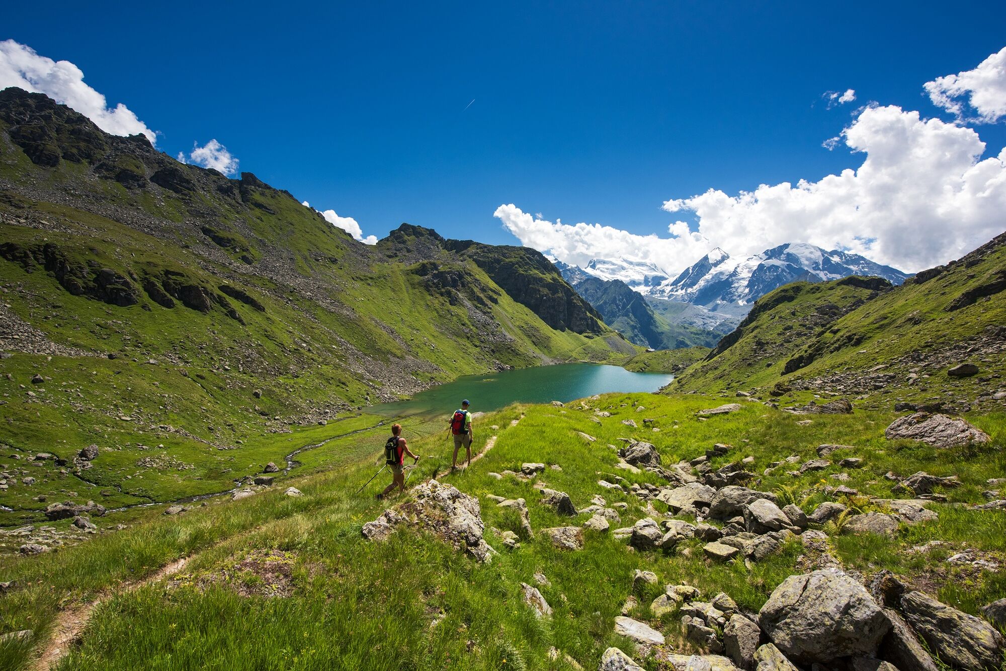
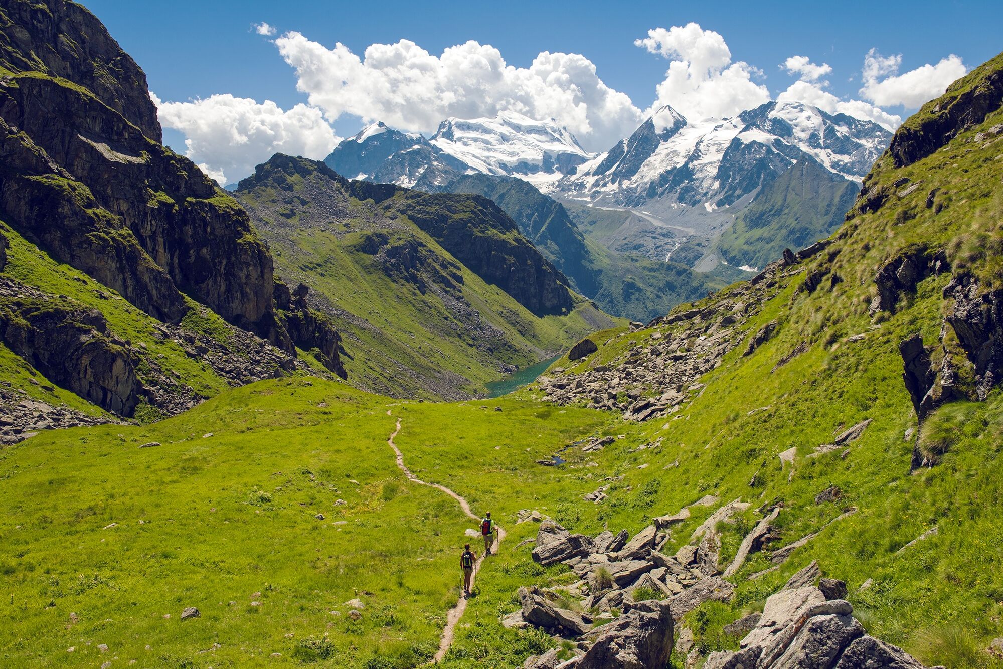
This trail offers a thrilling experience of this wild landscape: from high pastures across precipitous slopes to the idyllic Lac de Louvie, with its charming refuge, and down to the village of Fionnay on the valley floor.
The Sentier de Chamois proper begins at La Chaux, but for a contrasting prelude, start at Les Ruinettes and follow the flat trail through the Verbier 3-D Sculpture Park. The original works of art, commissioned by the 3-D Foundation, enjoy a spectacular natural setting.
At La Chaux, the “Path of the chamois” begins in lush pastures, home to the distinctive black Herens cows of Valais, before leading across rocky slopes into increasingly wild terrain. As the slopes become steeper, the views become more dramatic: a sure foot and a good head for heights are required, especially at the giddy section around the Col Termin.
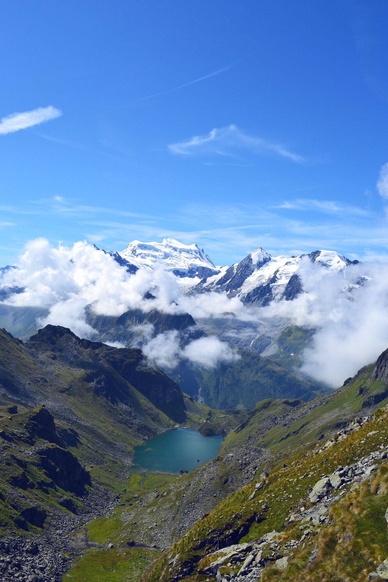
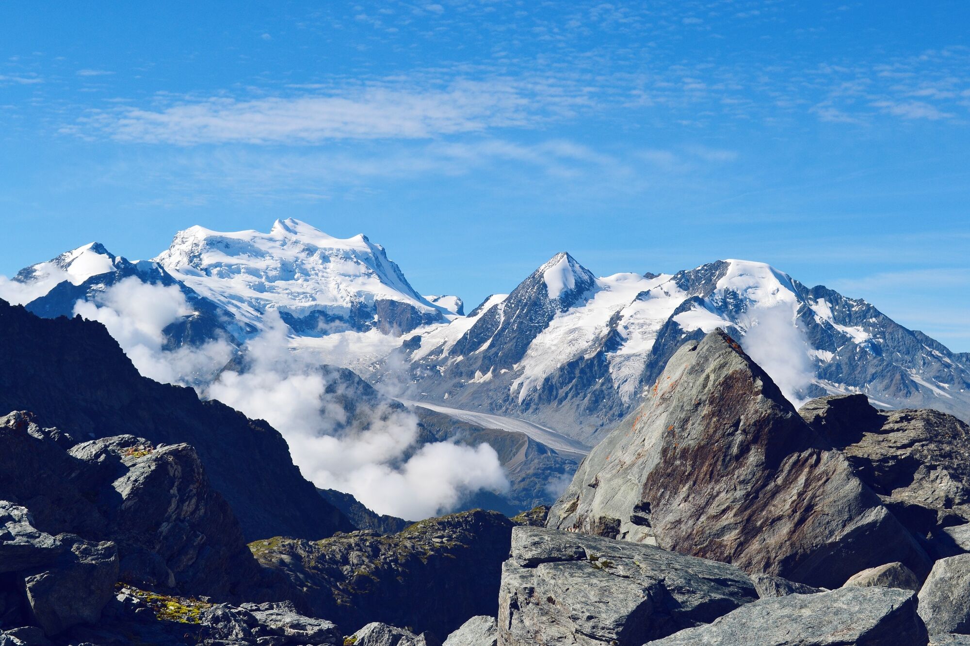
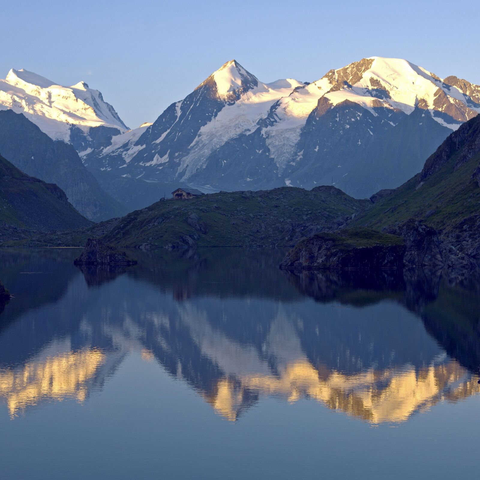
Here, the views open up towards the upper Val de Bagnes, crowned by the sparkling glaciers on the Combin massif. The trail twists down to the Lac de Louvie, with its traditional vaulted stone stables. The welcoming Cabane de Louvie (2,250 m), with its sunny terrace overlooking the lake, is ideal for a refreshment stop.
From the refuge, the path zig-zags down steep slopes to Fionnay. NB For a slightly shorter version of the walk, take the La Chaux Express gondola/chairlift from Les Ruinettes to La Chaux, and start there.
Highlights
Verbier 3-D Sculpture Park – sculpture trail in a spectacular natural setting Haut Val de Bagnes nature reserve – opportunities to spot wildlife including ibex, marmots and birds of prey Dramatic, steep terrain – thrilling views of the whole valley, from sleepy villages to glaciated peaks Cabane de Louvie – idyllic refuge by the sparkling Lac de Louvie - Directions
-
Option 1: start walk at the gondola station at Les Ruinettes, and follow the flat sculpture trail to La Chaux.
Option 2: from Les Ruinettes, take the La Chaux Express gondola/chairlift to La Chaux, and start walk there.
From La Chaux, follow the trail across the flanks of the mountain bowl towards Mintset, but at the ridge turn left to head eastwards up the valley across increasingly steep slopes. Take care, especially around the exposed Col Termin. The trail then drops sharply to the Lac de Louvie, before leading steeply down to Fionnay.
- Highest point
- 2,644 m
- Endpoint
-
Fionnay (bus stop)
- Height profile
-
 © outdooractive.com
 - Equipment
-
We recommend:
good footwear clothing suitable for the weather: always carry a waterproof jacket hat or cap sunscreen bottle for water picnic camera binoculars (optional) hiking poles (optional) printout of this hike (click “Print” icon, top right, to download)For certain walks:
Swimwear - Safety instructions
-
Use of the trails and the information on this website is at hikers’ own risk. Local conditions may entail changes to routes. Valais/Wallis Promotion accepts no liability for the accuracy and completeness of information on this website.
For all hikes:
Bring a map. Download full description of this route including large-scale map by clicking on “Print” icon, top right of this page. Use marked trails only, and observe all signposting – for your own safety, to safeguard grazing animals and to avoid disturbing wildlife. Close gates after passing through. Please be considerate to other trail users, and to the plants and animals. Do not leave any waste in nature.For mountain hikes:
Take extra care protecting yourself from the sun at altitude. UV radiation can be exceptionally strong, even in cloudy weather. Plan hike carefully: take into consideration fitness level of each participant, weather forecast and season. Weather conditions can change quickly in the mountains, without warning. Appropriate clothing is therefore essential, along with adequate supplies of food and water. In uncertain weather, turn back in good time.For high-altitude hikes:
Inform others of the route you plan to take. Whenever possible, avoid going alone. Do not venture onto glaciers without a mountain guide. Take note of the warning signs that point out the constant danger in river beds and along watercourses below dams and reservoirs: water levels may rise rapidly without warning. - Tips
-
At the Lac de Louvie, make a short detour to the northern shore to visit the traditional vaulted stone stables.
- Additional information
- Directions
-
A9 motorway, exit 22 (Gd St-Bernard). Follow signs to Verbier as far as Le Châble, for gondola up to start of walk.
- Public transportation
-
Train to Martigny, change to local train to Le Châble. Gondola to La Chaux via Verbier.
At end of hike, take a postal bus from Fionnay to Le Châble. Find full timetable information at www.sbb.ch.
- Parking
-
Free parking at Le Châble gondola/train station. Parking also available in Verbier (fee payable). Follow the local car park routeing in Le Châble or Verbier.

-

-
AuthorThe tour Sentier des Chamois is used by outdooractive.com provided.


General info
-
Unterwallis
1201
-
Verbier
341
-
Bruson
87


