

- Brief description
-
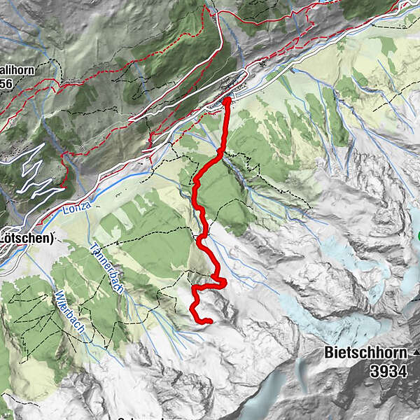
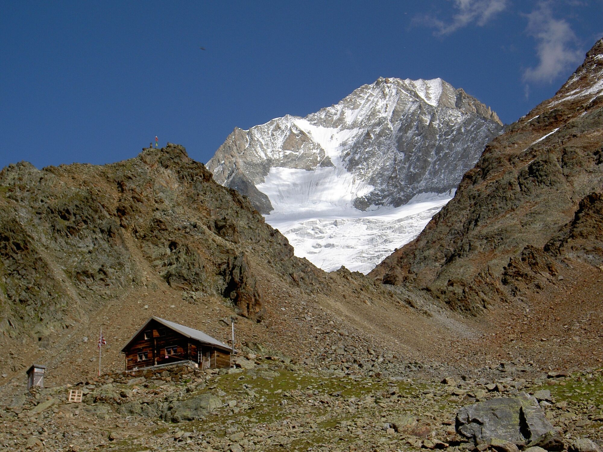
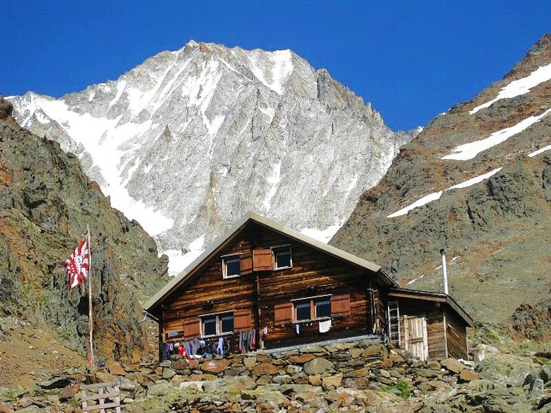
Enchanting hike from Blatten to the Bietschhorn Hut.
- Difficulty
-
difficult
- Rating
-
- Starting point
-
Blatten, Post
- Route
-
Dorfkirche0.1 kmBlatten (Lötschen)0.1 kmBietschhornhütte4.2 km
- Best season
-
JanFebMarAprMayJunJulAugSepOctNovDec
- Description
-
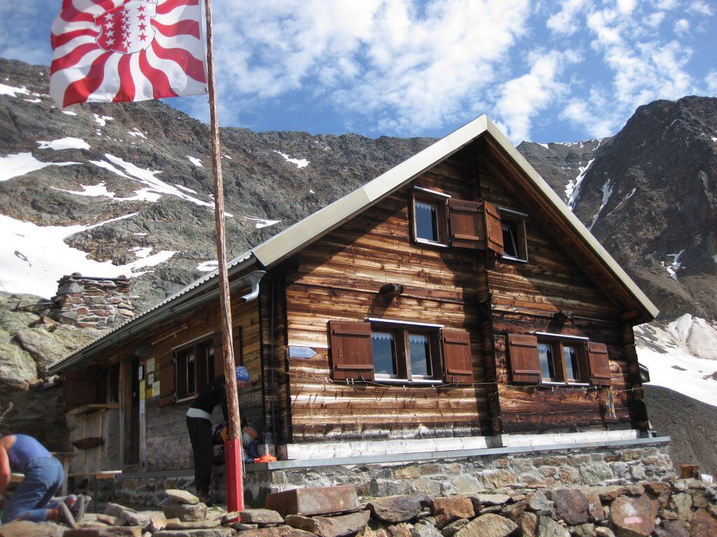
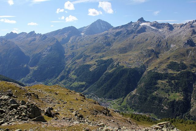
The predominantely steep ascent can be started from Blatten (3hrs 05min), Ried (3hrs 10min) or Wiler (3hrs 35min). At the hut you can enjoy outstanding views over the Lötschental and Hockenhorn ridge as far as the Balmhorn. The Bietschhorn Hut is run throughout from mid-July till the 31th August and on weekends on request from late June until mid-July and September. The Bietschhorn Hut is the starting point for Bietschhorn- and Wilerhorn-ascents and other alpine hikes.
- Directions
-
Blatten - Bietschhorn Hut
Descent options:
Bietschhorn Hut - Wiler Bietschhorn Hut - Ried Bietschhorn Hut - Blatten Bietschhorn Hut - Goppenstein (partly pathless, steep and sparely marked) - Highest point
- 2,550 m
- Endpoint
-
Bietschhorn Hut
- Height profile
-
 © outdooractive.com
 - Safety instructions
-
Plan your tour carefully
Ensure that you have a full set of appropriate equipment
Never embark on a tour alone
Inform friends, relatives, the mountain hut supervisor or the hotel porter of your proposed tour. Report back when you arrive at your destination.
Keep a constant eye on weather developments
Adhere to the principle: if in doubt, turn back! - Tips
-
The 1: 25,000 scale hiking map is your perfect companion for an unforgettable day's hiking in the Lötschental. Available from the Lötschental Tourist Information Office in Wiler or online at www.loetschental.ch/webshop
- Additional information
-
Bietschhorn Hut - One of the oldest mountain huts in the Swiss Alps offers pure unadulterated romance. The hut is not only the starting point for ascents of the Bietschhorn and Wilerhorn, but also offers attractive intersecting routes for ambitious mountain hikers. More information on: Tel. +41 (0)79 305 85 94, www.aacb.ch
- Directions
-
Drive into the Lötschental from Goppenstein, past the villages of Ferden, Kippel and Wiler to Blatten as far as the old post office.
- Public transportation
-
The postbus runs every hour from Gampel/Steg or Goppenstein to Blatten ("Blatten, Post" postbus stop).
- Parking
-
You can park your car in the car park next to the old post office in Blatten (not free).
- Author
-
The tour Bietschhorn Hut (from Blatten) is used by outdooractive.com provided.


General info
-
Oberwallis
1877
-
Lötschental
1079
-
Blatten
132