


- Brief description
-
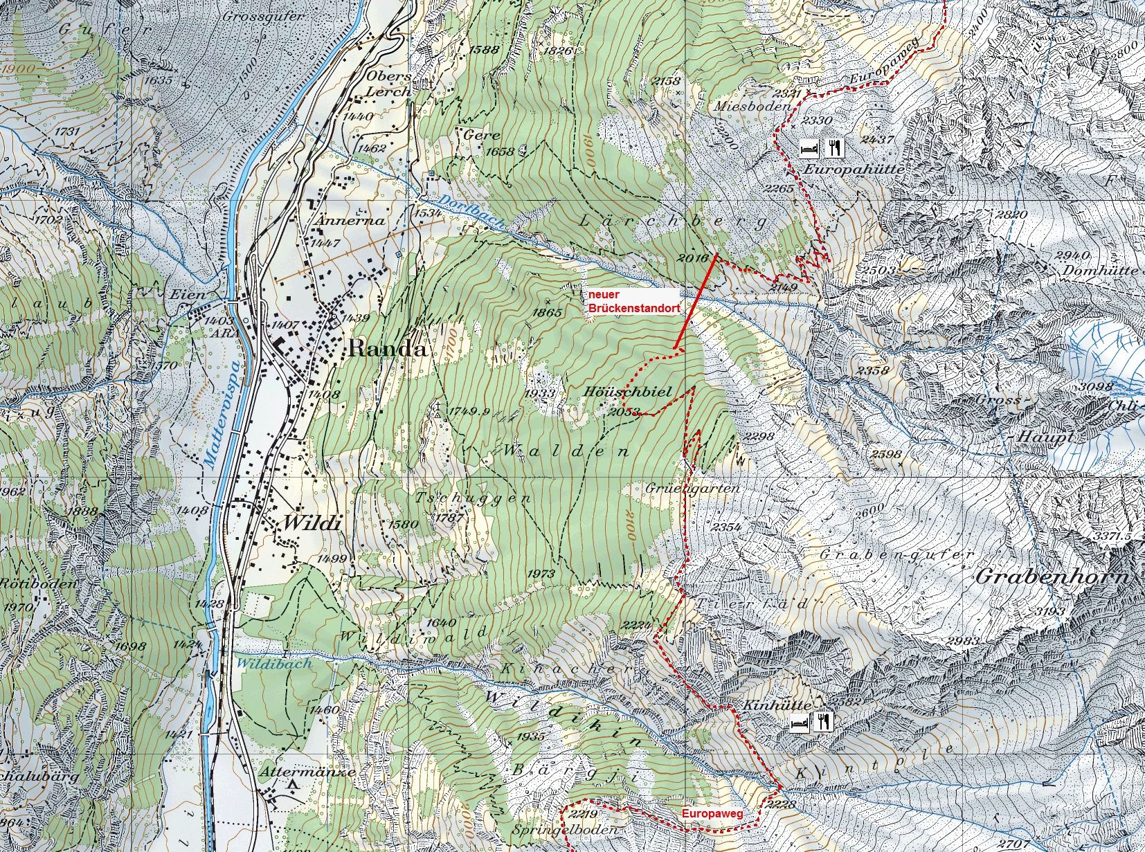
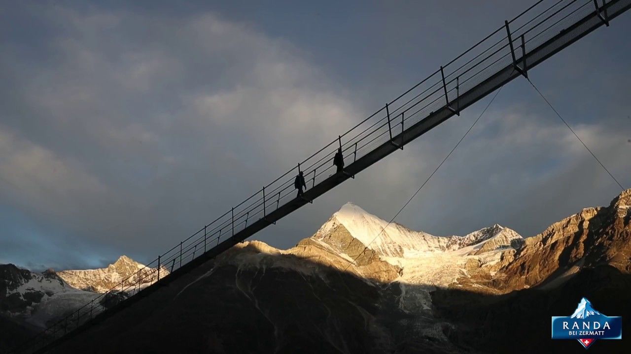
The circular hike to the Randa Suspension Bridge goes through larchwood forests and leads to an imposing record construction: the longest pedestrian suspension bridge in the Alps.
- Difficulty
-
medium
- Rating
-
- Starting point
-
Randa (1,439 m)
- Route
-
Randa (1,406 m)Treff 4940.3 kmKirche St. Sebastian0.3 kmEuropahütte4.6 kmGere7.0 kmKirche St. Sebastian8.3 kmTreff 4948.3 kmRanda (1,406 m)8.6 km
- Best season
-
JanFebMarAprMayJunJulAugSepOctNovDec
- Description
-
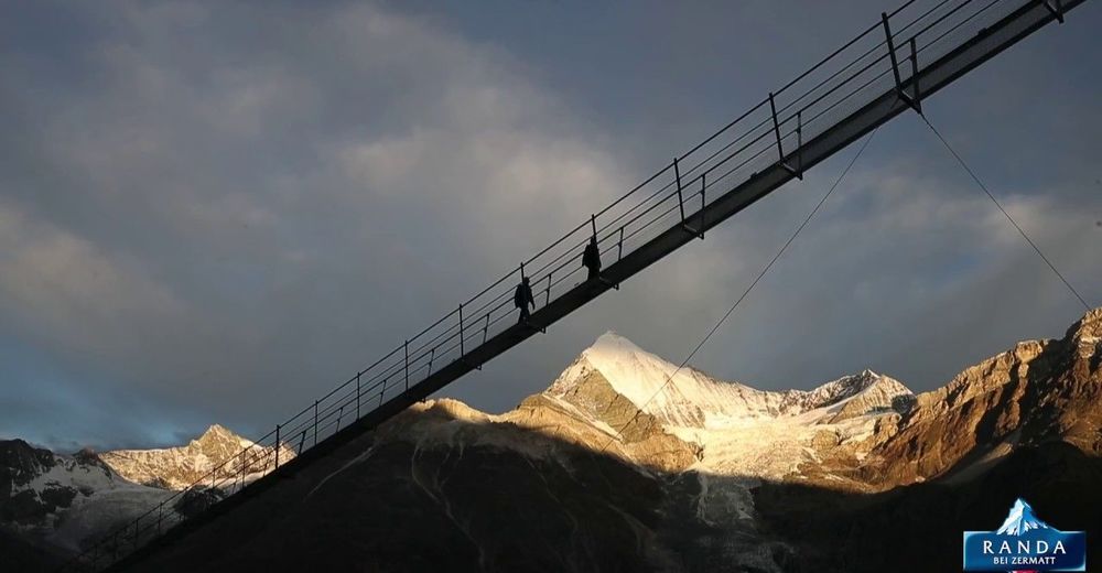
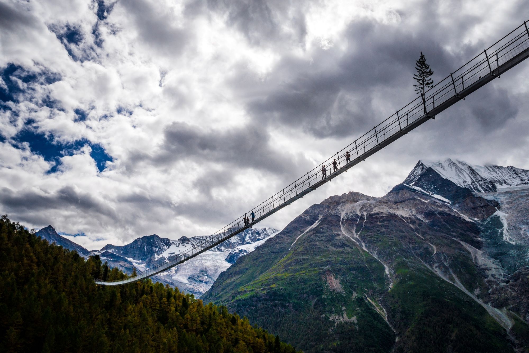
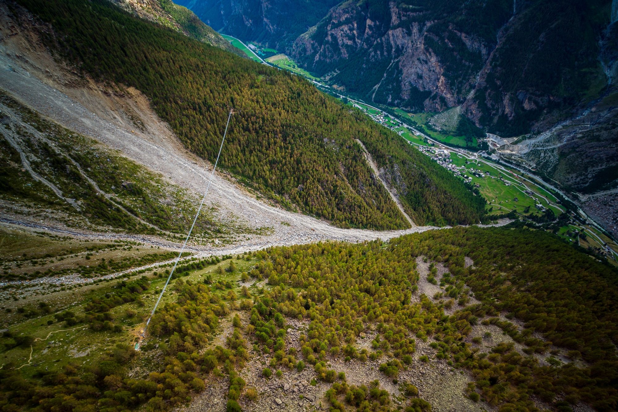
The path begins at the Randa train station, where the "Europabrücke" signs point in the correct direction. Through larchwood forests and past the "Hohtschugga" viewing point, hikers reach the "Charles Kuonen Suspension Bridge". At 494 m, it is the longest pedestrian suspension bridge in the Alps. It takes almost 10 minutes to cross it and in the middle, swaying walkers are at the highest point: 85 m above the Grabengufer. After crossing, the path continues right back to Randa. As an option, one could make a detour to the Europa hut after the bridge.
Suitable for the entire family One may not have a fear of heights The crossing of the bridge is free of charge Viewing point from "Hohtschugga" at 1,749 m The Europa hut (built 1998/1999) stands on stilts The Europa hut is on the Europa path, as the name suggests, and thus also on the Monte Rosa tour. - Directions
-
Randa (station) – Hauspil – Suspension Bridge – Europa hut– descente on the path to Gere – Randa (station)
(Hiking time in reverse direction: approx. 4h 30)
This hike is marked on the signposts as “Rundwanderung Hängebrücke Randa”.
- Highest point
- 2,263 m
- Endpoint
-
Randa (1,439 m)
- Height profile
-
 © outdooractive.com
 - Equipment
-
We recommend:
Good, sturdy footwear Water and provisions Hiking poles (optional) Clothing suitable for the weather (always carry a waterproof) - Safety instructions
-
Avoid the bridge during storms (thunder and lightning) Not having a fear of heights is an advantage. Find out whether children and or dogs would cross the bridge (grated walkway); see the “Tip from the author” section. Plan every mountain tour carefully and adapt to participants’ fitness level as well as the weather and season. Weather conditions can change quickly in the mountains. Appropriate clothing is therefore essential, along with adequate supplies of food and water. In uncertain weather, turn back in good time. Inform others of planned route, and whenever possible avoid going alone. Do not leave the marked routes; do not venture onto glaciers without a mountain guide. Please be considerate to other walkers and to plants and animals. Take note of the warning signs drawing attention to the constant danger in river beds and along watercourses below dams and reservoirs.
If the bridge is open or not can be seen online: www.europaweg.ch
- Tips
-
For a practice tour, the shorter suspension bridge above Zermatt at Furi is just right. At 100 m long, it crosses the Gorner Gorge and is 90 m high at its highest point.
- Additional information
- Directions
-
The drive from Visp to Randa takes about 30–40 min. The road leads through the wild and beautiful Mattertal valley.
- Public transportation
-
By train to Randa: less than 3½ hours from Zürich airport or 4 hours from Geneva airport. Change at Visp onto the Matterhorn Gotthard Bahn (Matterhorn Gotthard Railway). From Visp, the railway leads through the Mattertal valley past idyllic small villages to Randa.
- Parking


- Author
-
The tour Circular Hike to the Suspension Bridge in Randa (Nr. 69) is used by outdooractive.com provided.


General info
-
Oberwallis
1877
-
Mattertal
555
-
Täsch
195


")


