
- Brief description
-
This panoramic trail is the best way to explore the Moosalp. A unique panoramic view of the Upper Valais and twelve 4000-metre peaks await you on from the upper plateau.
- Difficulty
-
easy
- Rating
-
- Starting point
-
Moosalp, Chalte Brunne
- Route
-
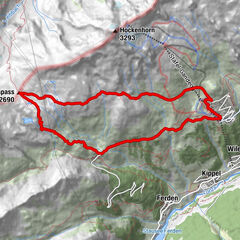
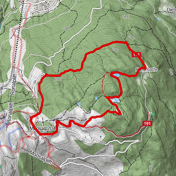
DorbiaMoosalp (2,048 m)0.0 kmStand1.5 kmPanorama5.3 kmDorbia6.2 km
- Best season
-
JanFebMarAprMayJunJulAugSepOctNovDec
- Description
-
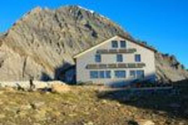
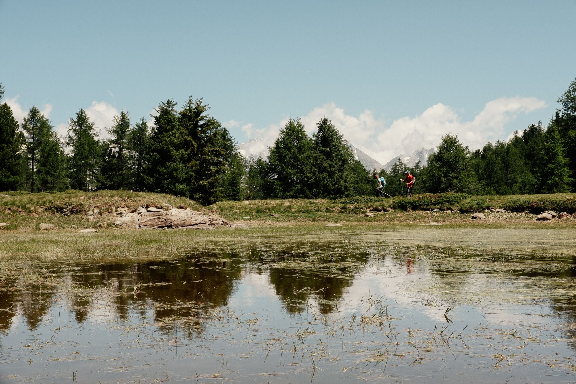
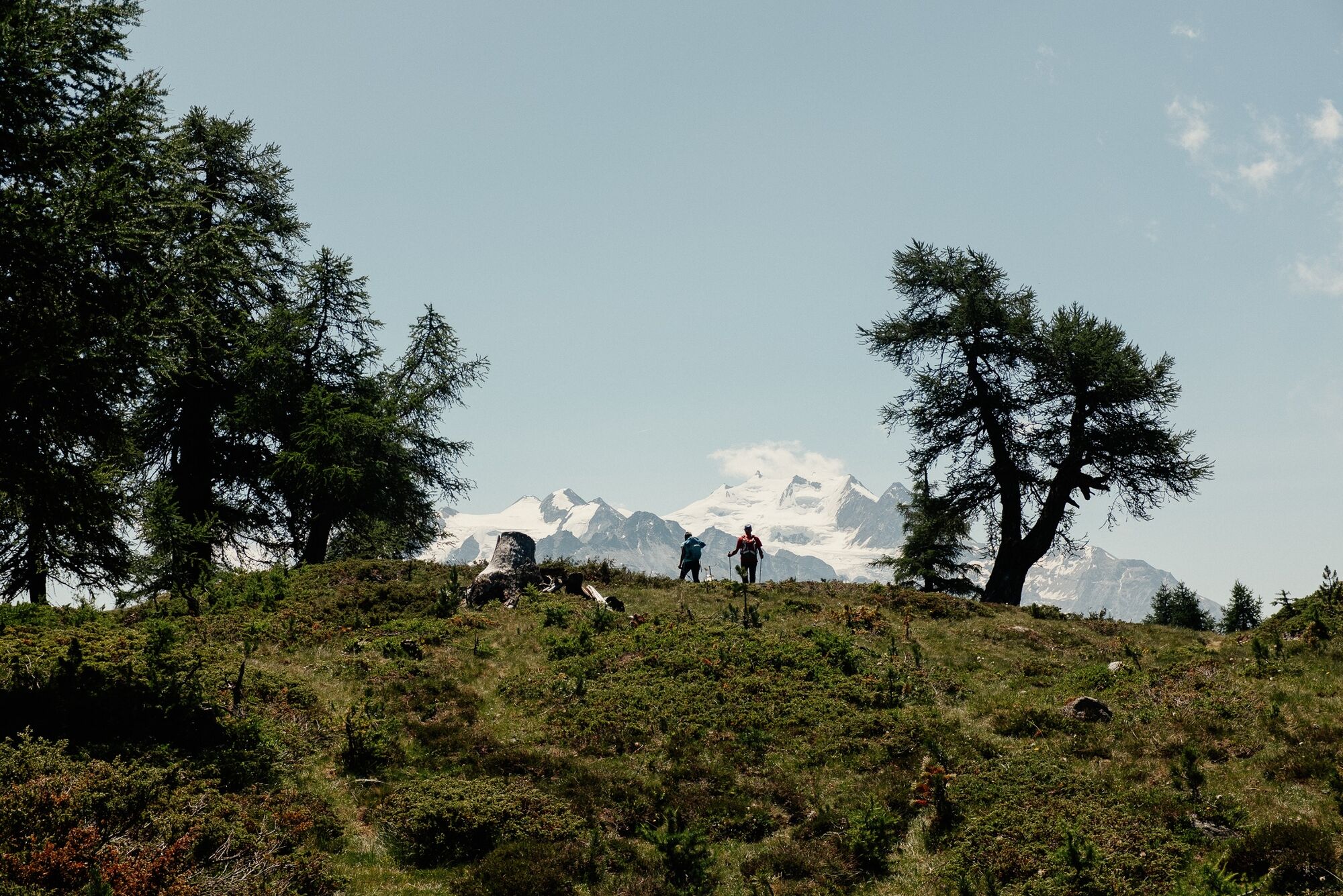
This excursion takes you high above the Rhone Valley to Moosalp. Surrounded by numerous mountain giants such as the Bietschhorn, the Weisshorn and the Mischabel group with the Nadelhorn, Dom and Täschhorn, the region is perfect for hikes and excursions. Take a bus from Visp to the upper plateau where this panoramic circular trail starts. Make the Bürchneralp your first stop and enjoy a little raclette and other Valais specialities at the Panorama restaurant which lives up to its name with a magnificent terrace. Take another break at the small but beautifully landscaped Breitmattu Lake and capture the breathtaking scenery on camera. The highlight of the circular trip follows at the "Stand" viewpoint. This can be reached via various narrow paths and is one of the most popular places on Moosalp from which you can enjoy a view of the Bernese and Valais Alps and 4000-metre peaks.
- Directions
-
Moosalp is the start and end point for this circular hike. The upper plateau can be reached by bus from Visp via Bürchen or Stalden via Törbel. The trail initially leads past an Alpine stable and then out into the region’s unique landscapes. Once you reach Bürchneralp, the trail initially ascends gently before descending to the hamlet of Ledi. This is where the ascent to Beitmatte, a large clearing, begins. After the large stone house, turn off onto the path to Breitmattusee and continue to Boningersee (although the latter is more of a bog). The highlight of the hike follows in the form of the "Stand" viewing platform with its unique panoramic view, before tackling the last section back to Moosalp.
- Highest point
- 2,117 m
- Endpoint
-
Moosalp, Chalte Brunne
- Height profile
-
 © outdooractive.com
 - Equipment
-
We recommend:
good footwear clothing suitable for the weather: always carry a waterproof jacket hat or cap sunscreen bottle for water picnic camera binoculars (optional) hiking poles (optional) printout of this hike (click «Print» icon, to download)For certain walks:
Swimwear - Safety instructions
-
Use of the trails and the information on this website is at hikers’ own risk. Local conditions may entail changes to routes. Valais/Wallis Promotion accepts no liability for the accuracy and completeness of information on this website.
For all hikes:
Bring a map. Download full description of this route including large-scale map by clicking on «Print» icon, top right of this page. Use marked trails only, and observe all signposting – for your own safety, to safeguard grazing animals and to avoid disturbing wildlife. Close gates after passing through. Please be considerate to other trail users, and to the plants and animals. Do not leave any waste in nature.For mountain hikes:
Take extra care protecting yourself from the sun at altitude. UV radiation can be exceptionally strong, even in cloudy weather. Plan hike carefully: take into consideration fitness level of each participant, weather forecast and season. Weather conditions can change quickly in the mountains, without warning. Appropriate clothing is therefore essential, along with adequate supplies of food and water. In uncertain weather, turn back in good time.For high-altitude hikes:
Inform others of the route you plan to take. Whenever possible, avoid going alone. Do not venture onto glaciers without a mountain guide. Take note of the warning signs that point out the constant danger in river beds and along watercourses below dams and reservoirs: water levels may rise rapidly without warning. - Tips
-
End this exciting day with a delicious cream cake at the Moosalp restaurant at the top of the pass.
- Additional information
- Directions
-
Via Visp – Bürchen or Stalden – Törbel. It is worth changing to public transport in Visp or Stalden (see public transport details).
- Public transportation
-
Take the postal bus from Visp train station up to Moosalp, the starting point of the hike. After the hike, the postal bus offers a comfortable trip back to Visp.
- Parking
-
We recommend parking your car in Visp at the parking garage near the train station and taking the bus to Moosalp.

- Author
-
The tour Moosalp Panoramaweg is used by outdooractive.com provided.


General info
-
Oberwallis
1877
-
Unterbäch
937
-
Törbel
150