- Brief description
-
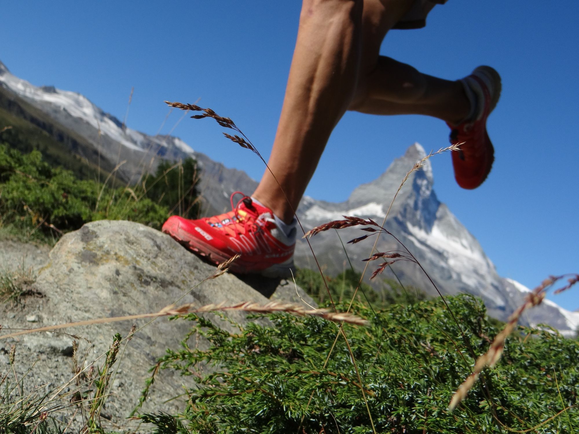
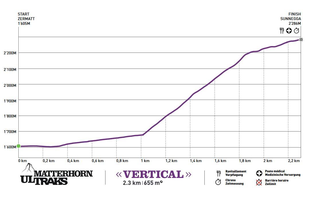
This course represents a thrilling challenge for super-fit runners: 2.3 km long, 655 vertical metres and some tricky terrain. A race for hardened athletes who nonetheless prefer to take care of their joints.
- Difficulty
-
difficult
- Rating
-
- Starting point
-
Zermatt (1,620 m)
- Route
-
Zermatt (1,608 m)0.1 km
- Best season
-
JanFebMarAprMayJunJulAugSepOctNovDec
- Description
-
The Matterhorn Ultraks Trail races have taken place every August since 2012. The routes are devised so that non-runners also enjoy an impressive spectacle and can cheer on the competitors.
For spectators: exciting viewpoint at Sunnegga For spectators: the cable card leading to the finish line at the summit Option to help as a volunteer
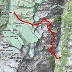
The Vertical course leads from Zermatt up Sunnegga. Whoever reaches the summit is guaranteed a loud cheer! - Directions
-
Zermatt - Sunnegga
Distance: 2.3 km
D+ 655 and D- 0 - Highest point
- 2,260 m
- Endpoint
-
Sunnegga (2,288 m)
- Height profile
-
 © outdooractive.com
 - Equipment
-
No compulsory equipment specifications are set by the organising committee.
Recommended:
Suitable footwear Hiking poles (optional) Clothing suitable for the weather (always carry a waterproof and long-sleeved shirt) Mobile phone Survival blanketRefreshment stations are located along the route.
- Safety instructions
- Additional information
- Directions
-
Zermatt is car-free. Private vehicles are permitted only as far as Täsch (5 km before Zermatt). The Täsch–Zermatt road is closed to the public.
Onward travel to Zermatt is either by private taxi or shuttle train. Trains depart every 20 minutes; the journey takes about 12 minutes, and ends at the Bahnhofplatz in Zermatt. - Public transportation
-
By train to the Matterhorn village: 3½ hours from Zürich airport or 4 hours from Geneva airport. Change at Visp onto the Matterhorn Gotthard Bahn (Matterhorn Gotthard Railway). From Visp, the railway leads through the Mattertal valley past idyllic small villages to Zermatt.
Zermatt is also the start and finish point for the world-famous Glacier Express panoramic train journey (Zermatt to St. Moritz or Davos). - Parking
-
Täsch has car parks with both covered and open-air parking – e.g. at the Matterhorn Terminal or privately operated facilities.
Onward travel: see “Getting there”.

- Author
-
The tour Matterhorn Ultraks Trail "Vertical" is used by outdooractive.com provided.
GPS Downloads


General info
Refreshment stop
Flora
Fauna
A lot of view
Other tours in the regions
-
Oberwallis
121
-
Mattertal
34
-
Zermatt
14