

- Brief description
-
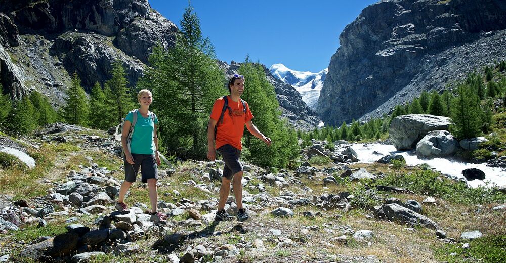
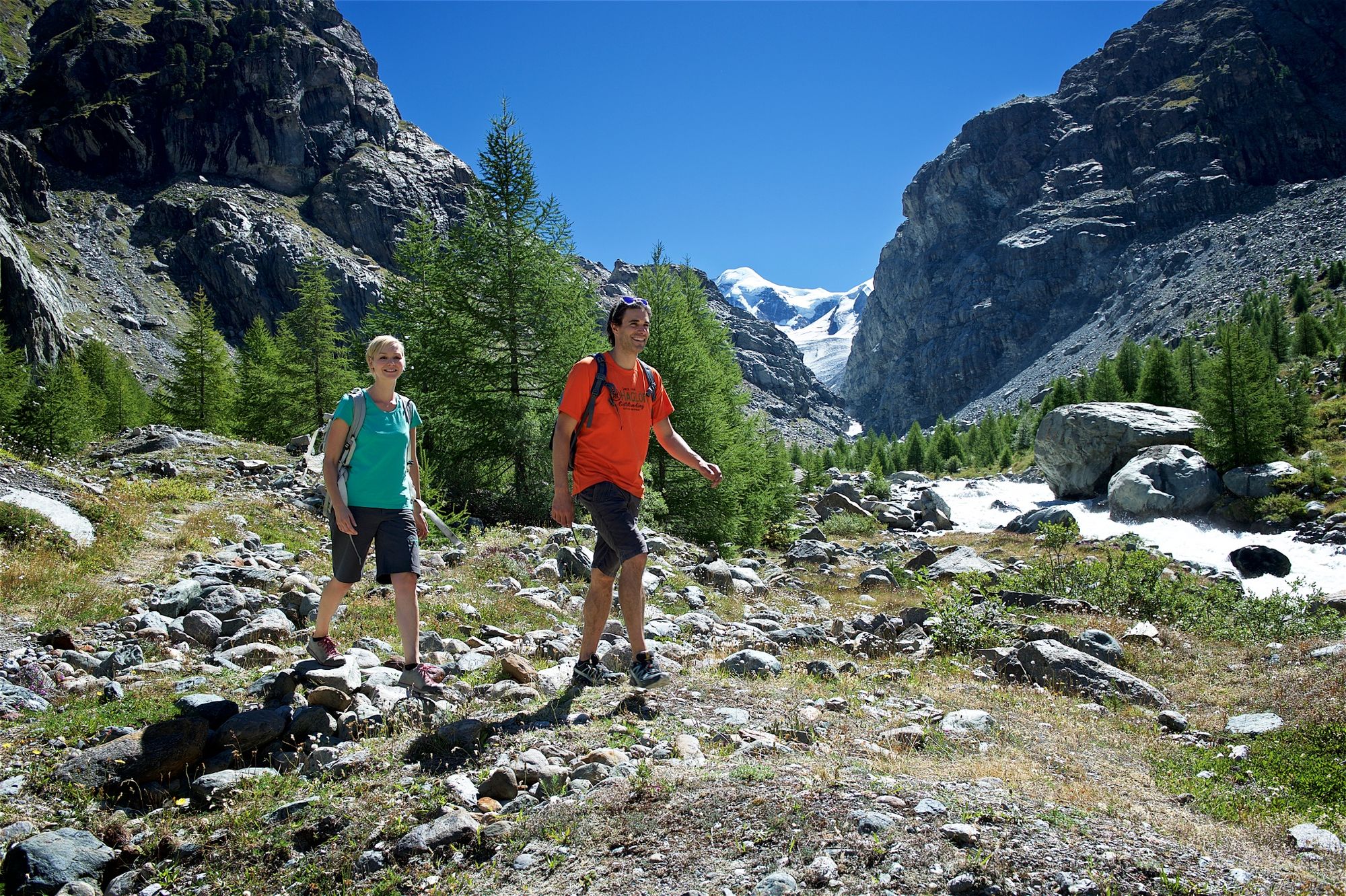
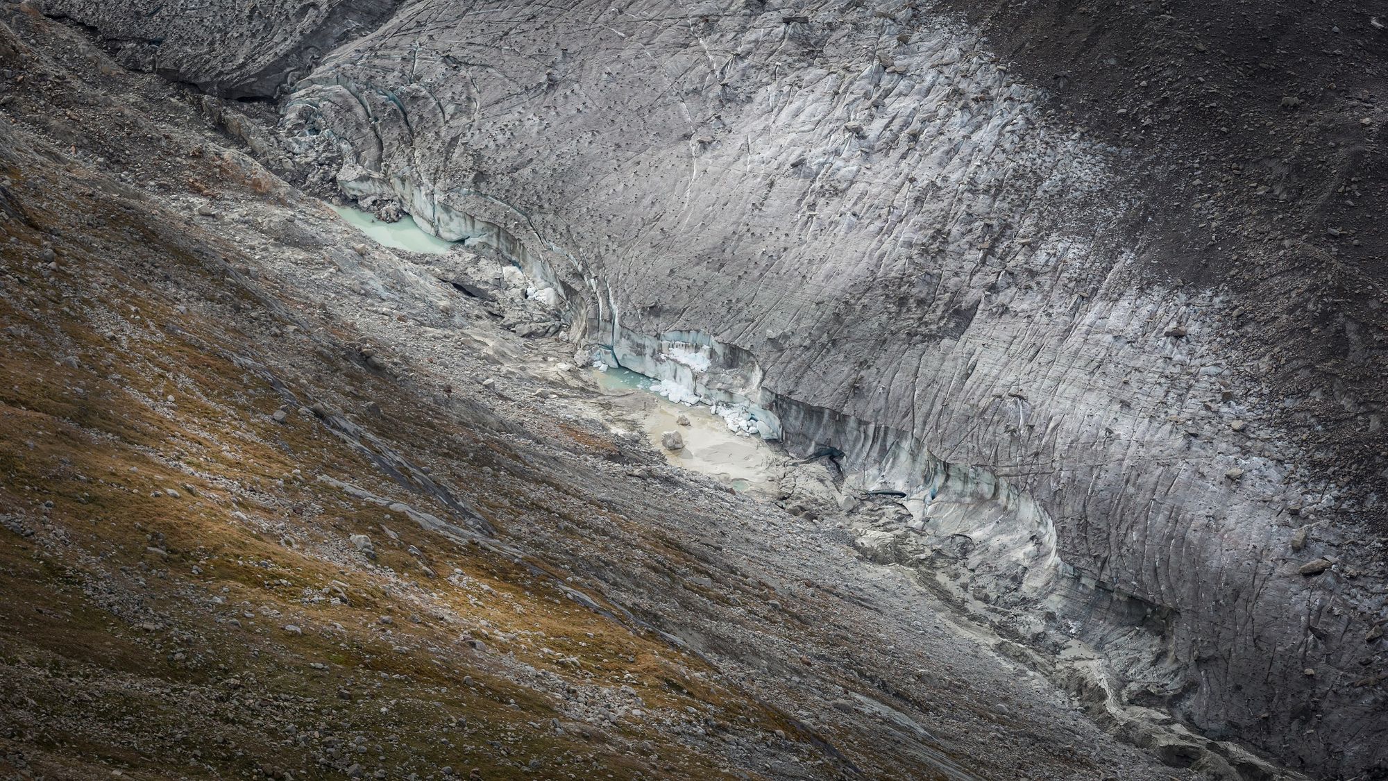
This hike leads to the dramatic rugged terrain of the lower Gorner glacier. During the last 150 years, it has retreated by over 3,000 m. Anyone interested in climate change can witness the process of a major glacier melting every step of the way.
- Difficulty
-
medium
- Rating
-
- Starting point
-
Furi (1,867 m)
- Route
-
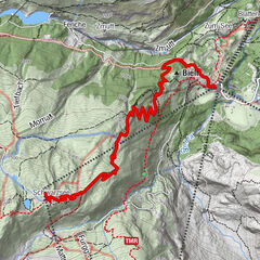
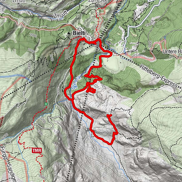
Furi0.2 kmFuri (1,864 m)7.1 kmFuri7.3 km
- Best season
-
JanFebMarAprMayJunJulAugSepOctNovDec
- Description
-
The hike begins in a leisurely way. You walk over green mountain meadows and pass through sparse larch and Alpine pine forests. After the “Im Boden” area, you leave the hanging bridge on the left and arrive at the intersection of the two streams, the Furggbach and the Gornera; the latter is the outflow from the Gorner glacier. You cross the streams on small bridges, under which the streams murmur or change to thunderous grey behemoths depending on the time of year, weather, and the melt-off from the glacier. Then the path continues upwards along the left side of the Gornera. The landscape here is no longer “charming”; this is “pathfinder territory” where debris fields pile up the rubble while pioneer larch trees have already put down roots. In the valley below is the steep climb to the vantage point at Blattenten.
Glaciers grow and shrink – over the centuries and the millennia. The Gorner glacier reached its maximum length between 1859 and 1865, then also in 1667, and in 1385. In between those milestones, the glacier retreated by about 1,000 m. There was hardly any glacial mass that could be called the Gorner glacier – in other words, it did not exist in the year 1,000 and during the century when Christ was born. The information boards along the signed theme way explain the phenomenon of glacier existence.
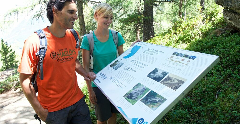
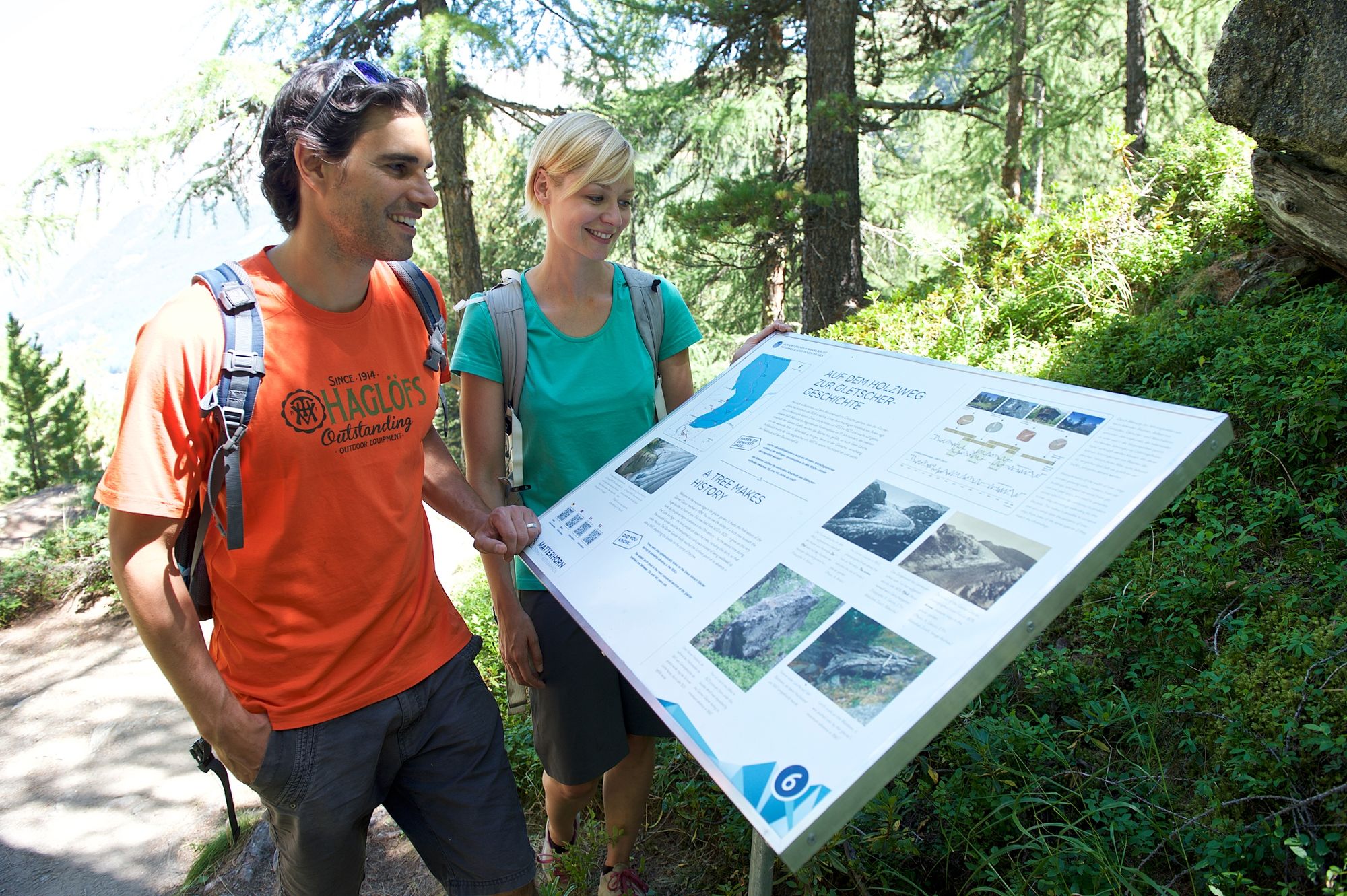
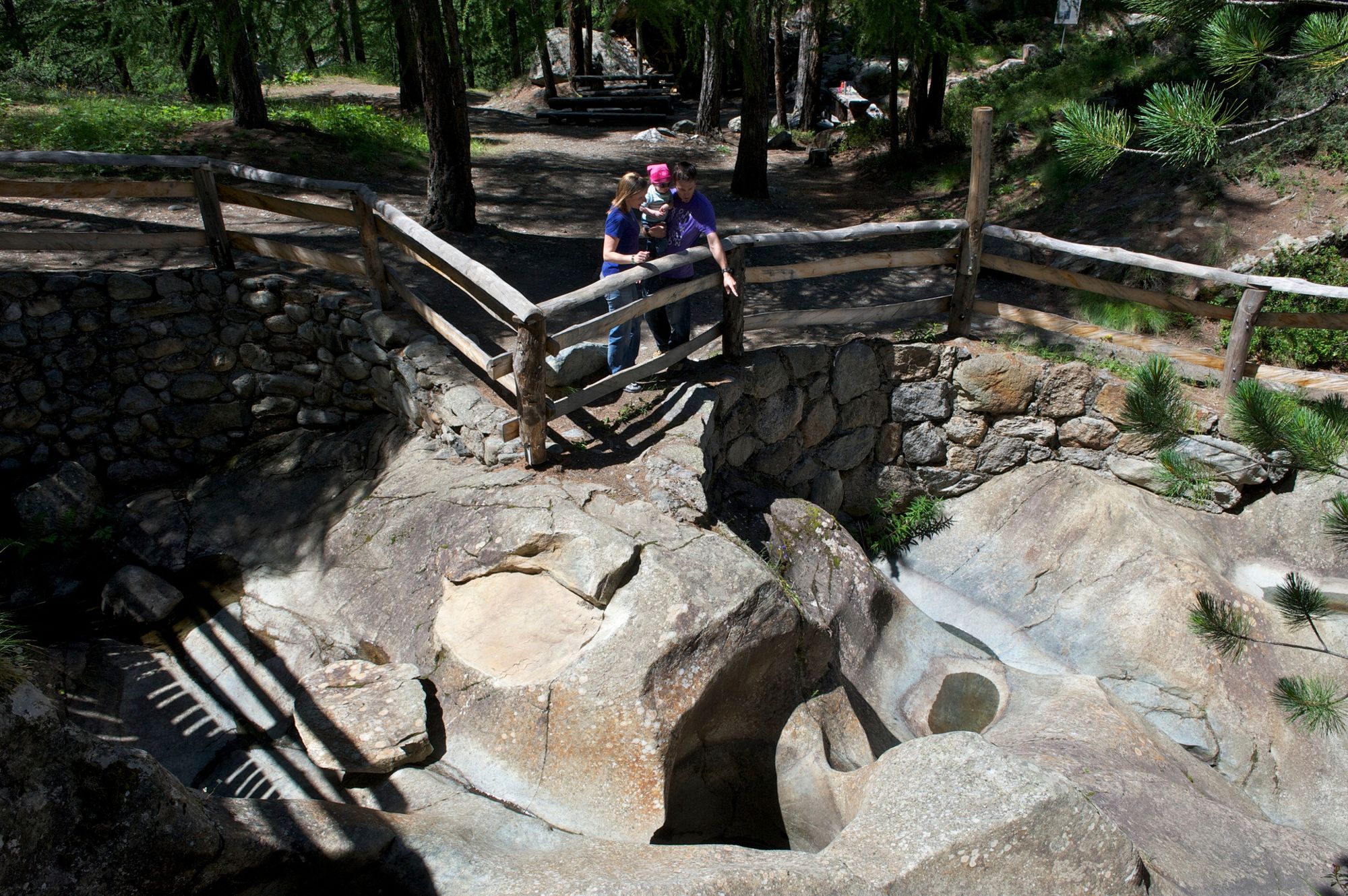
On the return path, the Dossen glacier garden can also be visited. There are ten boards along the path in German and English explaining the glacier world. The history of the “Im Boden” alp, which was buried under the advancing ice mass in the 19th century, is exciting. As is also the fact that the local people undertook a tree-clearing process to steal the valuable wood away from the greedy gullet of the advancing glacier. - Directions
-
Furi - crossing the brigde over the Furgg stream - along the Gornera stream - till Blatteten - back to the glacier garden Dossen - Schweigmatten - Furi
(Hiking time in reverse direction: approx. 2 h 45)
This hike is marked on the signposts as “Der Gornergletscher im Wandel der Zeit”.
- Highest point
- 2,141 m
- Endpoint
-
Furi (1,867 m)
- Height profile
-
 © outdooractive.com
 - Equipment
-
We recommend:
Good footwear Hiking poles (optional) Clothing suitable for the weather (always carry a waterproof) Smartphone: QR codes on the information boards provide additional information; in French and Italian as well. - Safety instructions
-
Plan every mountain tour carefully and adapt to participants’ fitness level as well as the weather and season. Weather conditions can change quickly in the mountains. Appropriate clothing is therefore essential, along with adequate supplies of food and water. In uncertain weather, turn back in good time. Inform others of planned route, and whenever possible avoid going alone. Do not leave the marked routes; do not venture onto glaciers without a mountain guide. Please be considerate to other walkers and to plants and animals. Take note of the warning signs drawing attention to the constant danger in river beds and along watercourses below dams and reservoirs.
Caution: We strongly advise that you do not go to the tongue of the glacier on your own. There are many dangers to be found in the area around the end of a glacier: rushing water, glacier sheering, invisible glacier ice under the rubble that could break, etc. If you would like to go near the glacier, you must go with a mountain guide (Zermatters).
- Tips
-
Take along a picnic. There is a barbecue area and a playground at the Dossen glacier garden along the return route towards Furi.
The Matterhorn Museum - Zermatlantis shows mountain reliefs where the glaciers in the area around Zermatt are clearly visible.
- Directions
-
Zermatt is car-free. Private vehicles are permitted only as far as Täsch (5 km before Zermatt). The Täsch–Zermatt road is closed to the public.
Onward travel to Zermatt is either by private taxi or shuttle train. Trains depart every 20 minutes; the journey takes about 12 minutes, and ends at the Bahnhofplatz in Zermatt.
- Public transportation
-
By train to the Matterhorn village: 3½ hours from Zürich airport or 4 hours from Geneva airport. Change at Visp onto the Matterhorn Gotthard Bahn (Matterhorn Gotthard Railway). From Visp, the railway leads through the Mattertal valley past idyllic small villages to Zermatt.
Zermatt is also the start and finish point for the world-famous Glacier Express panoramic train journey (Zermatt to St. Moritz or Davos).
- Parking
-
Täsch has car parks with both covered and open-air parking – e.g. at the Matterhorn Terminal or privately operated facilities.
Onward travel: see “Getting there”.
- Author
-
The tour The Gornergletscher over the Course of Time (Nr. 17b) is used by outdooractive.com provided.


General info
-
Unterwallis
1196
-
Mattertal
555
-
Zermatt
154