
- Brief description
-
Do you know the difference between a granary and a barn? What does "büüchä" mean and where does the term Grafschaft, which is used for the three mountain villages of Selkingen, Biel and Ritzingen, actually come from?
- Difficulty
-
easy
- Rating
-
- Starting point
-
Selkingen, Selkingerstrasse
- Route
-
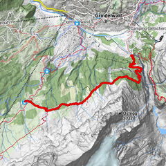
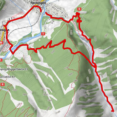
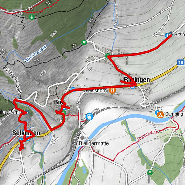
Selkingen (1,318 m)0.2 kmBiel (1,312 m)1.4 kmWeisshorn1.9 kmSt. Annakapelle2.1 kmRitzingen (1,318 m)2.1 kmRitzinger Feldkapelle3.0 km
- Best season
-
JanFebMarAprMayJunJulAugSepOctNovDec
- Description
-
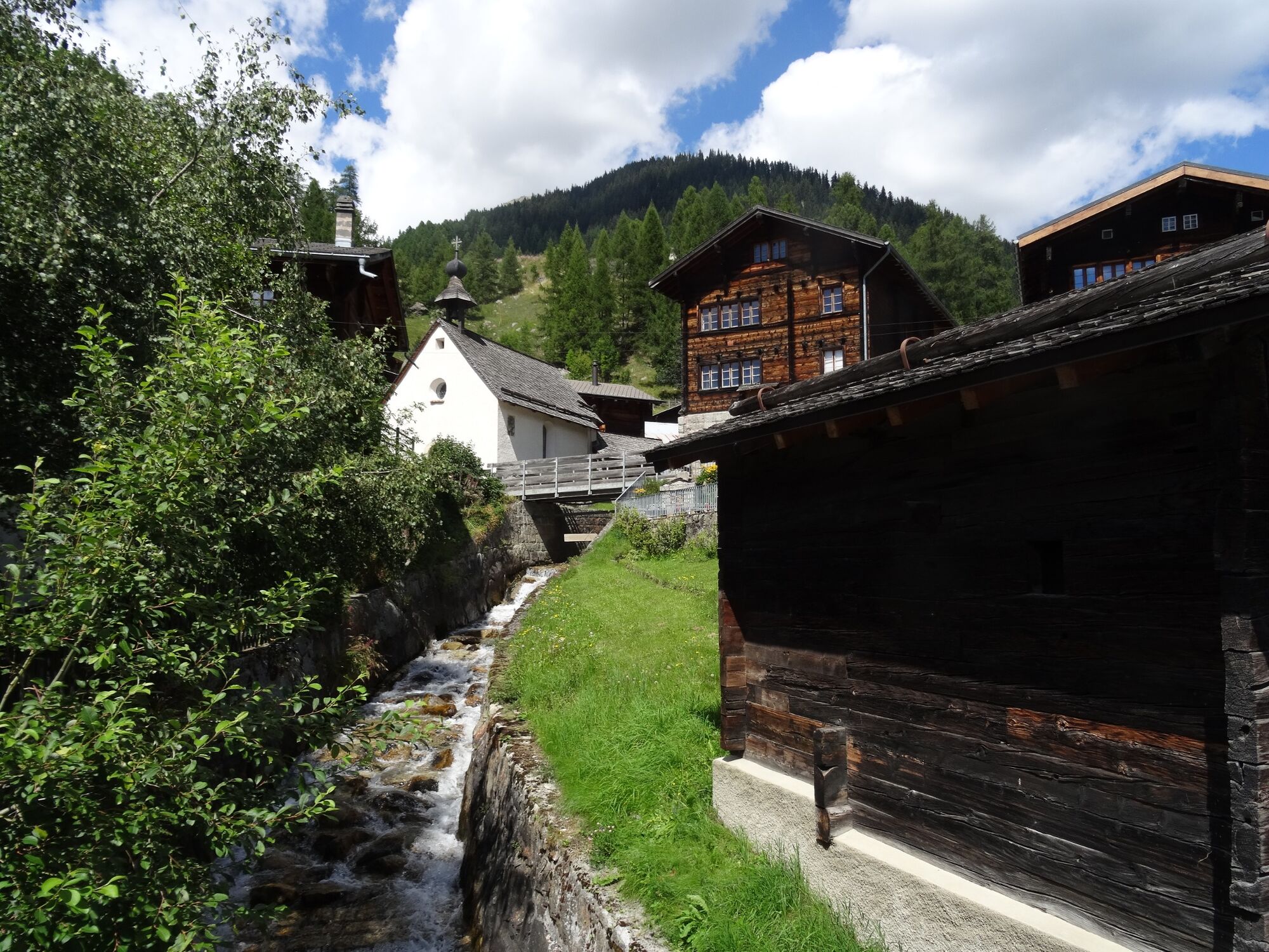
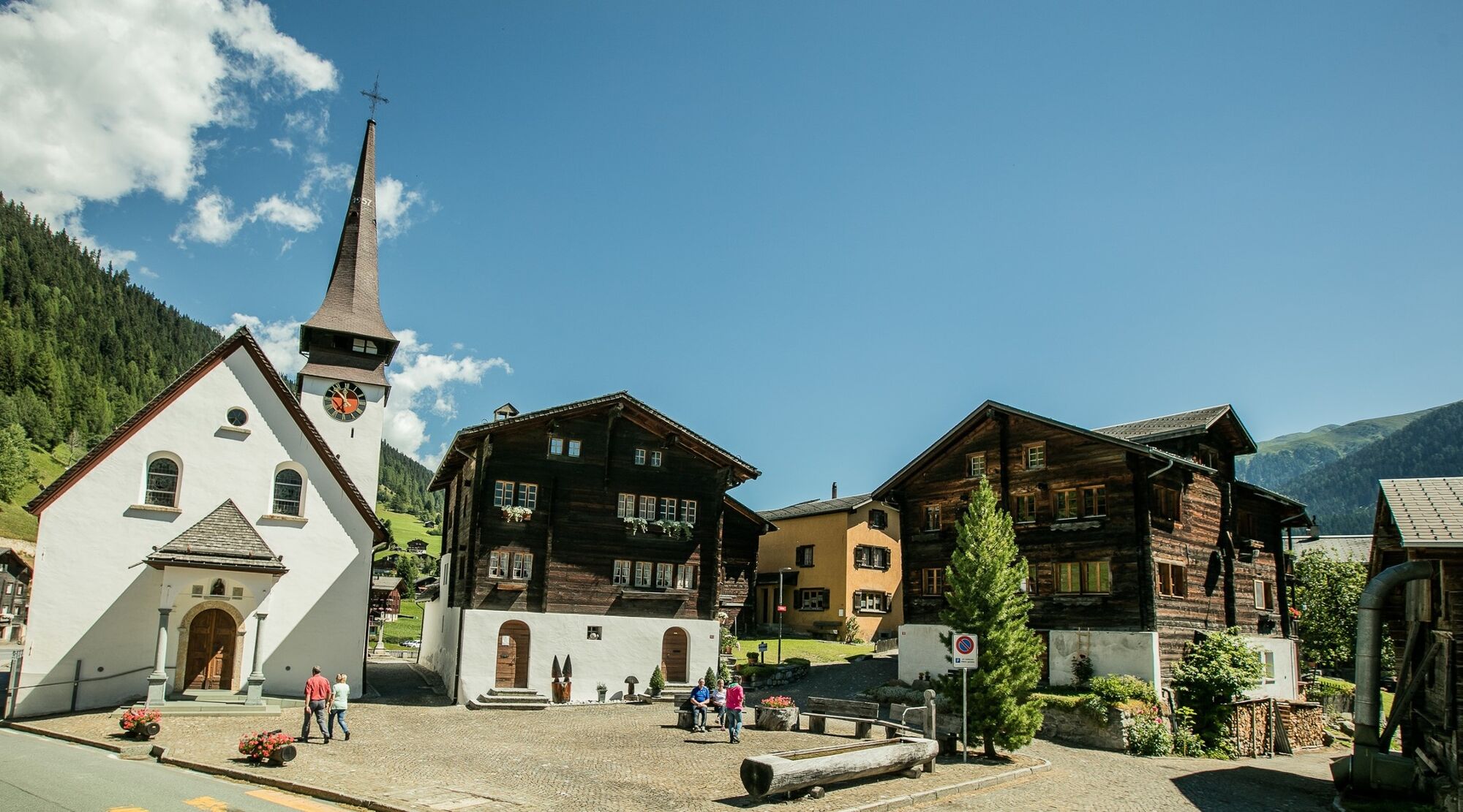
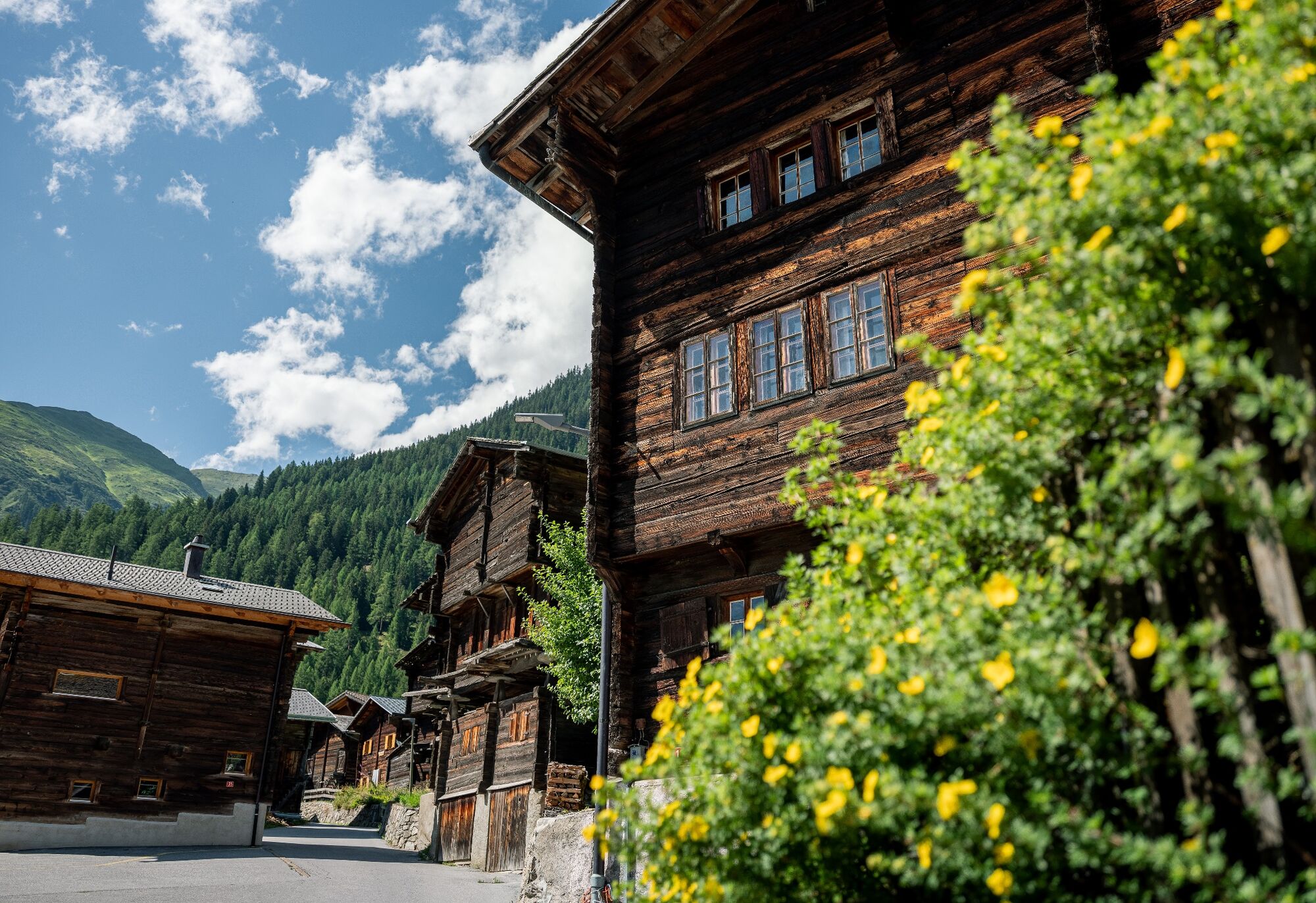
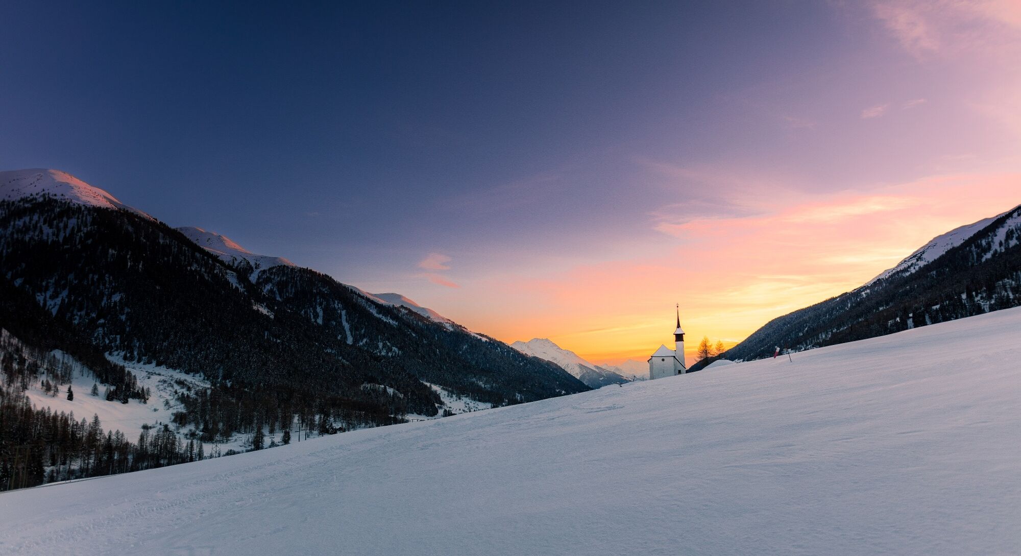
The objective of the cultural history trail is to bring the local people and guests closer to their homeland or holiday resort in an inviting way. Starting in Selkingen, the trail first leads through the alleys to Biel and finally to Ritzingen. The final point of the autodidactic tour is "in the heart of the world", as this location of the chapel Ritzingenfeld is affectionately called in the vernacular.
The free brochure on the culture trail contains explanations of the villages and their utilitarian and sacred buildings, but also takes up topics such as population and their customs. It also contains a list of further literature for all those who would like to delve deeper into the culture and history of the Goms valley. The little booklet is available at the tourist information offices in Reckingen, Münster and Oberwald.
- Directions
-
Starting point Selkingen, Selkingerstrasse - SELKINGEN - Prefäktehüs (1) - Vorschutz Haus (2) - Haus mit Andreaskreuz (3) - Ursprüngliches Heidehüs (4) - Hochbarockhaus (5) - Renaissancehaus (6) - Fennerhüs (7) - Pfisterhüs (8) - Stockmühle (9) - Markuskapelle (11) - Ritzhaus (12) - Antoniuskapelle (13) - BIEL - Stadelgruppe (19) - Heidehüs (20) - Heustadelgruppe (18) - Vorschutzhaus ( 23) - Posthüs (23) - Grafehüs (21) - Pfarrhaus (16) - Schlosshubel (17) - Pfarrkirche (14) - Friedhofskapelle (15) - Lawinendenkmal (24) - RITZINGEN - Nothelferkapelle (25) - Annakapelle (26) - Rundbogentor (27) - Doppelhaus (28) - Stadel (29.1) - Speicher (29.2) - Stallscheune (29.3) - Feldkapelle (30)
- Highest point
- 1,381 m
- Endpoint
-
Ritzingen, Feldkapelle
- Height profile
-
 © outdooractive.com
 - Equipment
-
We recommend:
Waterproof footwear and walking sticks
Hat and warm protective outdoor clothing
Sun protection
Detailed map or information material - Safety instructions
-
The use of the snow shoeing trails is at your own risk. Oberg
The use of the theme trails is at your own risk. Obergoms Tourismus AG disclaims all liability and assumes no responsibility for the accuracy and completeness of the information on this website.
Local conditions may entail changes to routes.Take a map with you or download the complete description of the route with a large-scale map.
Carry additional sun protection with you. UV rays at high altitudes can be very strong, especially in winter, even when the sky is overcast.
oms Tourismus AG disclaims all liability and assumes no responsibility for the accuracy and completeness of the information on this website.
Local conditions may entail changes to routes.Take a map with you or download the complete description of the route with a large-scale map. Use only signposted paths and observe all markings and signs - for your own safety, for the protection of the landscape and in respect for wildlife. Be considerate of other users. Take your rubbish and that of others with you.
Weather conditions in the mountains can change very quickly and without warning. Adequate clothing and provisions (food and drink) are very important. If the weather is unstable, it is better to turn around early. Carry additional sun protection with you. UV rays at high altitudes can be very strong, especially in winter, even when the sky is overcast.
Plan your tour carefully and in detail. Inform yourself in advance about the current conditions (avalanche danger, cross-country ski runs, winter hiking trails, snow trails and road conditions) and weather conditions. The winter sports report provides you with valuable information from the region.
- Tips
-
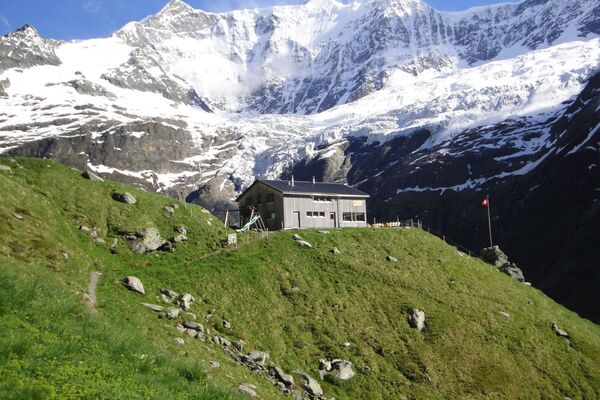
The churches and chapels of the Goms valley invite you to pause, draw strength, say a prayer or just enjoy their beauty. Come in!
- Additional information
- Arrival
- Public transportation
- Parking
-
Public parking spaces are available in the vicinity of the railway station Biel (VS) or in the villages of Selkingen, Biel (VS) or Ritzingen. Follow the local parking guidance system.


- Author
-
The tour Cultural history trail Grafschaft is used by outdooractive.com provided.


General info
-
Aletsch Arena
1485
-
Goms
528
-
Bellwald
89