
- Brief description
-
A wonderful ski tour through a beautiful landscape up to the massive firn ridge on the Petersgrat, with a variety of enjoyable descents to Fafleralp.
- Difficulty
-
medium
- Rating
-
- Starting point
-
Mountain station "Gandegg"
- Route
-
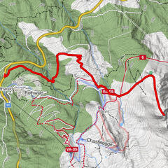
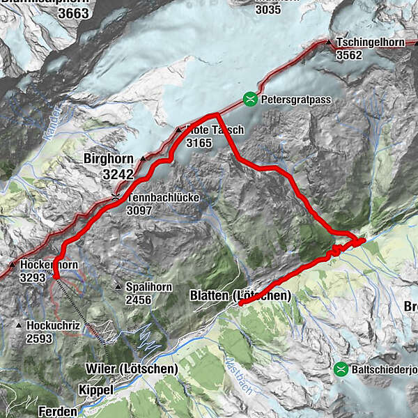
Tennbachlücke (3,097 m)2.6 kmPetersgrat (3,202 m)5.9 kmFafleralp11.5 kmKapelle Mariä Heimsuchung13.6 kmKühmad13.7 kmBlatten (Lötschen)15.5 km
- Best season
-
AugSepOctNovDecJanFebMarAprMayJunJul
- Description
-
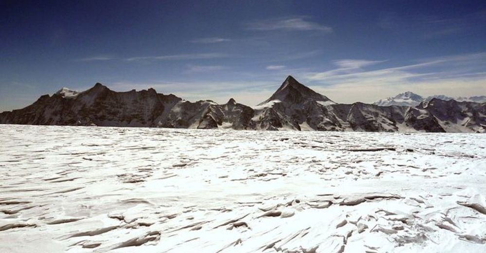
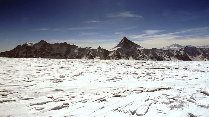
Start your tour at the Gandegg mountain station with a short descent towards Gender. Attach your pelts here and continue the tour towards the glacier "Tennbachgletscher". Ski along level ground in a north-easterly direction directly below the Sackhorn, Elwertätsch and Birghorn. In no time at all, you will have reached your destination - the Petersgrat - a massive plateau, the highest point of which is almost impossible to see.
The descent through the Uisterstal (Outer Valley) between the Tellispitza and Chrindelspitza is a real pleasure. From the Fafleralp, continue down the cross-country ski trail at a leisurely pace to Blatten (caution: cross-country skiers and winter hikers have priority on the track).Alternatively, continue your tour from the highest point of 3,202 metres above sea level over the firn ridge in an easterly direction to the western boundary rocks of the Tschingelhorn and descend from there in a wide loop to Fafleralp across the glacier "Üsser Talgletscher" via the Inners Tal (Inner Valley).
- Directions
-
Hockenhorngrat - Gender - Tennbachgletscher - Tellingletscher - Petersgrat - Üsser Talgletscher - Uisters Tal - Fafleralp - Kühmatt - Blatten
- Highest point
- 3,191 m
- Endpoint
-
Petersgrat
- Exposition
- Height profile
-
 © outdooractive.com
 - Equipment
-
A full set of glacier equipment is essential.
- Safety instructions
-
We recommend that a state-certified mountain guide accompanies you on this ski tour
Plan your tour carefully
Ensure that you have a full set of appropriate equipment
Never embark on a tour alone
Inform friends, relatives, the mountain hut supervisor or the hotel porter of your proposed tour. Report back when you arrive at your destination.
Keep a constant eye on weather developments
Adhere to the principle: if in doubt, turn back! - Tips
-
Skitourenkarte Jungfrau 264S (The Jungfrau Region Ski-Touring Map 264S) - This 1:50,000 scale topographical map includes the ski tours in the Lötschental Valley, which are described in more detail in the SAC Tour Guide available from the Lötschental Tourist Information Office in Wiler or online at www.loetschental.ch/webshop
- Additional information
- Directions
-
Drive into the Lötschental from Goppenstein, past the villages of Ferden and Kippel as far as Wiler to the valley cable car station. Take the cable car up to the Lauchernalp, then continue on a 2-seater or 3-seater chairlift to the mountain station "Gandegg".
- Public transportation
-
The postbus runs every hour from Gampel/Steg or Goppenstein to Wiler ("Wiler, Seilbahn" postbus stop). Take the cable car up to the Lauchernalp, then continue on a 2-seater or 3-seater chairlift to the mountain station "Gandegg".
- Parking
-
You can park your car in the outdoor car park or in the indoor car park beside the cable car valley station (not free).
- Author
-
The tour Petersgrat is used by outdooractive.com provided.


General info
-
Oberwallis
118
-
Lötschental
62
-
Blatten
9