- Brief description
-
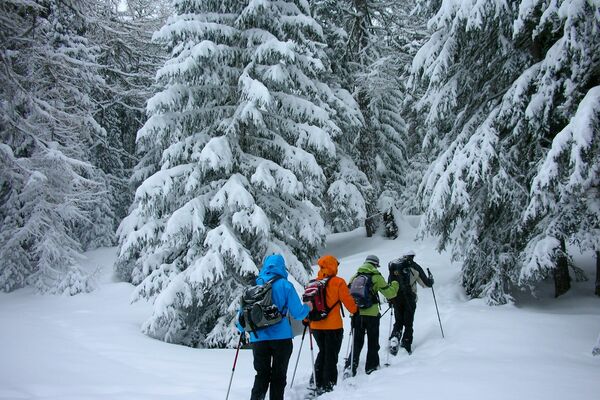
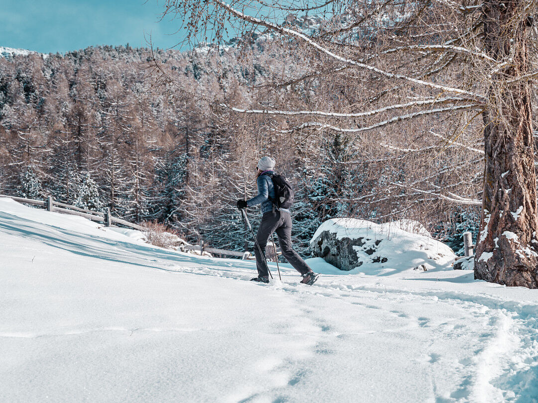
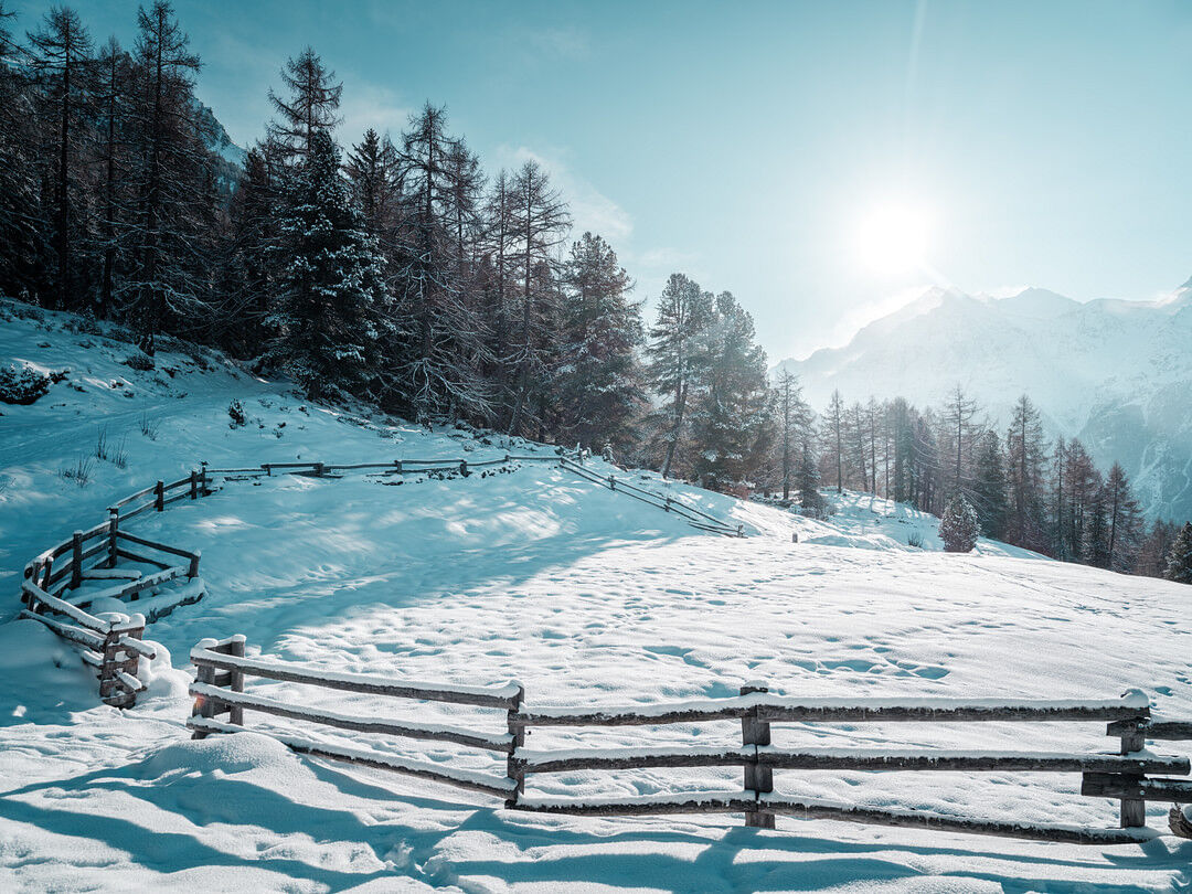
Attractive snowshoe trail up to Hannigalp
- Difficulty
-
medium
- Rating
-
- Starting point
-
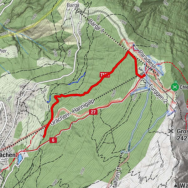
Alpe Äbnet
- Best season
-
AugSepOctNovDecJanFebMarAprMayJunJul
- Description
-
Enjoy the view from Alpe Äbnet of the Grächen winter landscape and the opposite mountain massif with the 4505 m high Weisshorn.
- Directions
-
You can reach Alp Äpnet from Grächen on foot in about 30 Auf dieser attraktiven Bergwanderung werden eure Muskeln gut warmlaufen. Diese Tour startet auf der Alpe Äbnet inmitten der beeindruckenden Bergkulisse. Nach der Liftunterquerung führt euch der Schneeschuhtrail durch den idyllischen Winterwald hinauf durch die schneeglitzernde Berglandschaft und bietet immer wieder einzigartige Panoramaaussichten. Folgt immer den Wegweisern zur Hannigalp.
- Highest point
- 2,115 m
- Endpoint
-
Hannigalp
- Height profile
-
 © outdooractive.com
 - Equipment
-
We recommend:
good footwear clothing suitable for the weather: always carry a waterproof jacket hat or cap sunscreen bottle for water picnic camera binoculars (optional) hiking poles (optional) printout of this hike (click «Print» icon, to download) - Safety instructions
-
L’utilisation des itinéraires et des informations de ce site web en va de la responsabilité de chaque randonneur. Les conditions sur place peuvent entrainer des modifications de parcours. Grächen Tourismus décline toute responsabilité quant à l’exactitude et à l’intégralité des informations du site web.
Pour toutes les randonnées :
Emportez une carte. Téléchargez la description complète de l’itinéraire avec une carte à grande échelle en cliquant sur l’icône « imprimer », au sommet à droite de la page. Empruntez uniquement les chemins balisés et observez tous les panneaux de signalisation – pour votre sécurité, pour la protection du bétail et pour ne pas perturber les animaux sauvages. Refermez les barrières après votre passage. Soyez respectueux des autres usagers, ainsi que des plantes et animaux.Pour les randonnées en montagne :
Faites particulièrement attention à bien vous protéger du soleil en altitude. Les rayons UV peuvent être très puissants, même par ciel couvert. Planifiez votre randonnée attentivement : prenez en considération le niveau physique de chaque participant, les prévisions météo et la saison. Les conditions météo peuvent changer rapidement et inopinément en montagne. Il est essentiel d’avoir des vêtements adaptés, ainsi que des réserves suffisantes de nourriture et d’eau. En cas de météo incertaine, faites marche arrière à temps.Pour les randonnées en haute-montagne :
Informez d’autres personnes au sujet de votre itinéraire. Si possible, évitez de partir seul. Ne vous aventurez pas sur des glaciers sans un guide de montagne. Prenez connaissance des panneaux de mise en garde du danger constant dans le lit des rivières, le long des cours d’eau en-dessous de barrages ou de réservoirs : le niveau de l’eau peut monter rapidement et inopinément. - Tips
-
You can walk to Alp Äpnet on foot. Alternatively, you can take the snowshoes from the left-hand bend of the corridor road through the forest to the alp.
- Additional information
- Directions
-
- Rhône Valley: Via Martigny - Visp to Grächen / St. Niklaus
- Car transport Lötschberg: Via Kandersteg - Goppenstein - Visp to Grächen / St. Niklaus (bls.ch/e/autoverlad/)
- Car transport Furka: Via Andermatt - Realp - Oberwald - Brig - Visp to Grächen / St. Niklaus (Car transport Furka)
- Tessin/Simplon: Via Lugano - Centovalli - Domodossola - Brig - Visp to Grächen / St. Niklaus (Car transport Simplon)
- Public transportation
-
From Visp you take the train to St. Niklaus. There you change to the bus, which gets you to Grächen every half hour. On weekends a direct bus operates from Visp to Grächen.
- Parking
-
Parking spaces in Grächen: The car park Millegga is located by the village entrace in Grächen. Price per day (for covered parking space): CHF 15.00
Private Parking space provider:
Amstutz Trudy
Tel. +41 (0)27 956 13 35
Jeiziner Leon
Tel. +41 (0)27 956 16 31
- Author
-
The tour Snowshoe trail: Äpnet - Hannig is used by outdooractive.com provided.


General info
-
Oberwallis
198
-
Moosalpregion
116
-
Grächen - St. Niklaus
36