
- Brief description
-
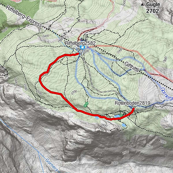
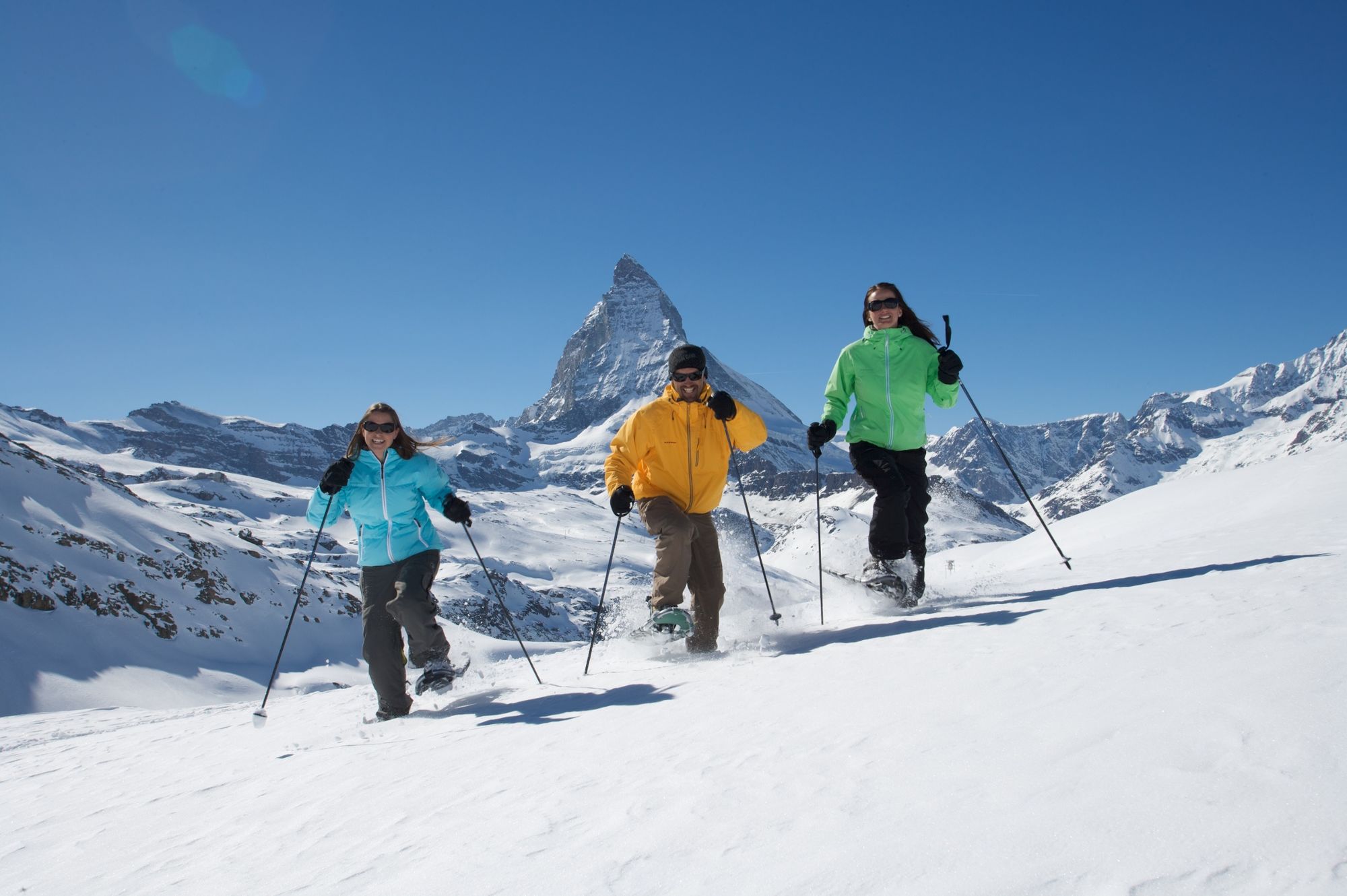
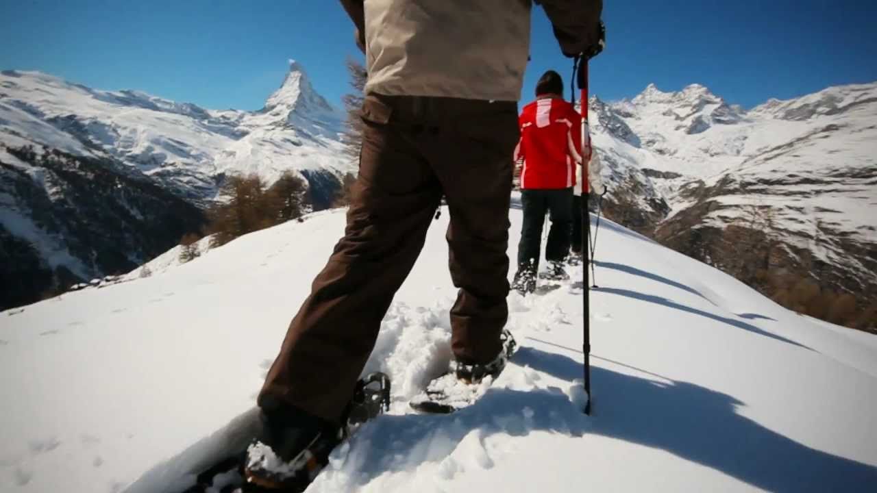
This snowshoe trail leads to some magically beautiful spots between Rotenboden and Riffelberg. Along the way it passes the frozen Riffelsee, hibernating under a thick blanket of snow.
- Difficulty
-
medium
- Rating
-
- Starting point
-
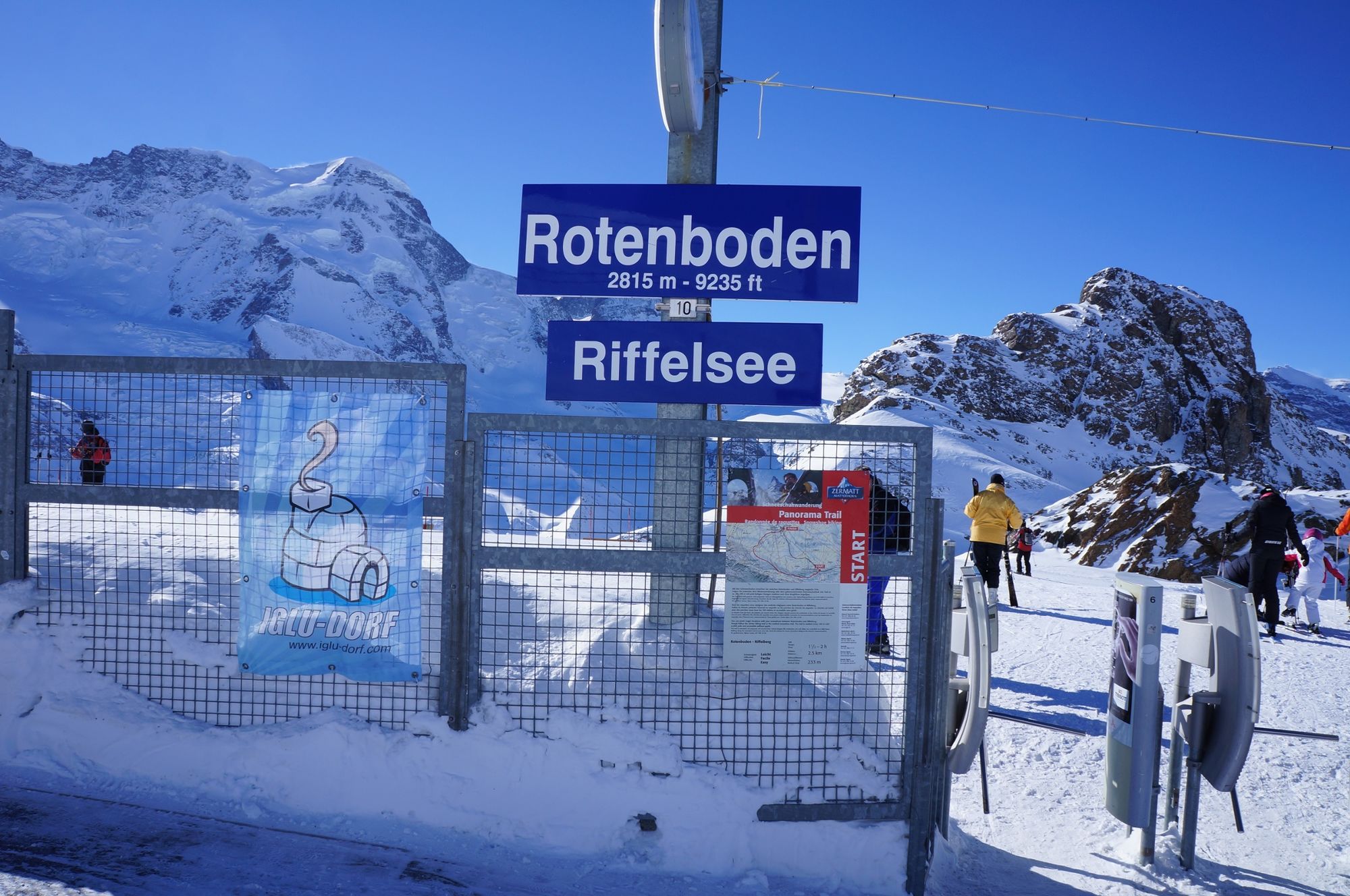
Rotenboden (2'815 m)
- Route
-
Rotenboden (2,819 m)Kapelle Riffelberg Bruder Klaus2.3 km
- Best season
-
AugSepOctNovDecJanFebMarAprMayJunJul
- Description
-
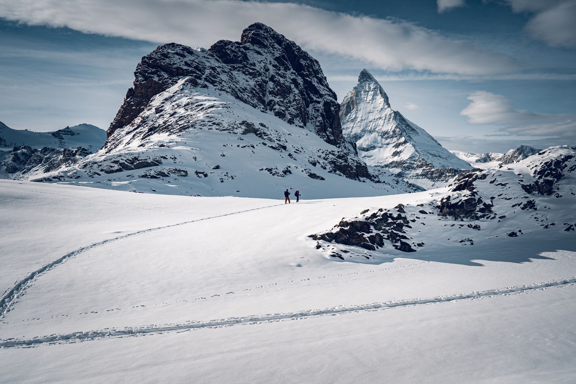
When the Riffelhorn casts its dark shadow across the Riffelsee, evening is still a long way off. But this is a magical moment in winter, known as the blue hour. A calmness descends on the mountain; the ski pistes are far off. Take a deep breath and continue walking: soon the magnificent panorama reveals itself once again, with the Matterhorn, Obergabelhorn and Weisshorn. A winter’s day of fairy-tale beauty, sure to linger long in the memory.
Marked approx. every 100 m with pink poles Guided tours bookable through the Zermatters - Directions
-
Rotenboden - Riffelberg
(Hiking time in reverse direction: approx. 1h 30 - 2h)
- Highest point
- 2,799 m
- Endpoint
-
Riffelberg (2,582 m)
- Height profile
-
 © outdooractive.com
 - Equipment
-
We recommend:
Good, waterproof footwear Snowshoes Hiking poles Warm winter clothing appropriate for the weather - Safety instructions
-
Plan every mountain tour carefully and adapt to participants’ fitness level as well as the weather and season. Weather conditions can change quickly in the mountains. Appropriate clothing is therefore essential, along with adequate supplies of food and water. In uncertain weather, turn back in good time. Inform others of planned route, and whenever possible avoid going alone. Do not leave the marked routes. It is forbidden to walk on the ski pistes. Please be considerate to other walkers and to plants and animals.
The snowshoe trails can be tackled without a mountain guide. Beware: they are not prepared in any way and are not controlled daily; nor are they secured from natural hazards such as avalanches or rockfalls. For safety, check the weather forecast and current avalanche bulletin.
All snowshoeing is at one’s own risk.
Tip: “Be searchable”. Equip yourself with an additional RECCO rescue reflector*. Whether summer or winter. Available in our Online-Shop or our information desk.
*The additional reflector does not replace an avalanche beacon. - Tips
-
As the name already indicates, this trail offers one of the finest panoramas with a cast including the Matterhorn, Obergabelhorn, Zinalrothorn, Weisshorn and many more. So be sure to take along your camera.
- Additional information
- Directions
-
Zermatt is car-free. Private vehicles are permitted only as far as Täsch (5 km before Zermatt). The Täsch–Zermatt road is closed to the public.
Onward travel to Zermatt is either by private taxi or shuttle train. Trains depart every 20 minutes; the journey takes about 12 minutes, and ends at the Bahnhofplatz in Zermatt. - Public transportation
-
By train to the Matterhorn village: 3½ hours from Zürich airport or 4 hours from Geneva airport. Change at Visp onto the Matterhorn Gotthard Bahn (Matterhorn Gotthard Railway). From Visp, the railway leads through the Mattertal valley past idyllic small villages to Zermatt.
Zermatt is also the start and finish point for the world-famous Glacier Express panoramic train journey (Zermatt to St. Moritz or Davos). - Parking
-
Täsch has car parks with both covered and open-air parking – e.g. at the Matterhorn Terminal or privately operated facilities.
Onward travel: see “Getting there”.
- Author
-
The tour Panorama Trail (Nr. 142) is used by outdooractive.com provided.


General info
-
Unterwallis
86
-
Mattertal
53
-
Zermatt
13