
- Brief description
-
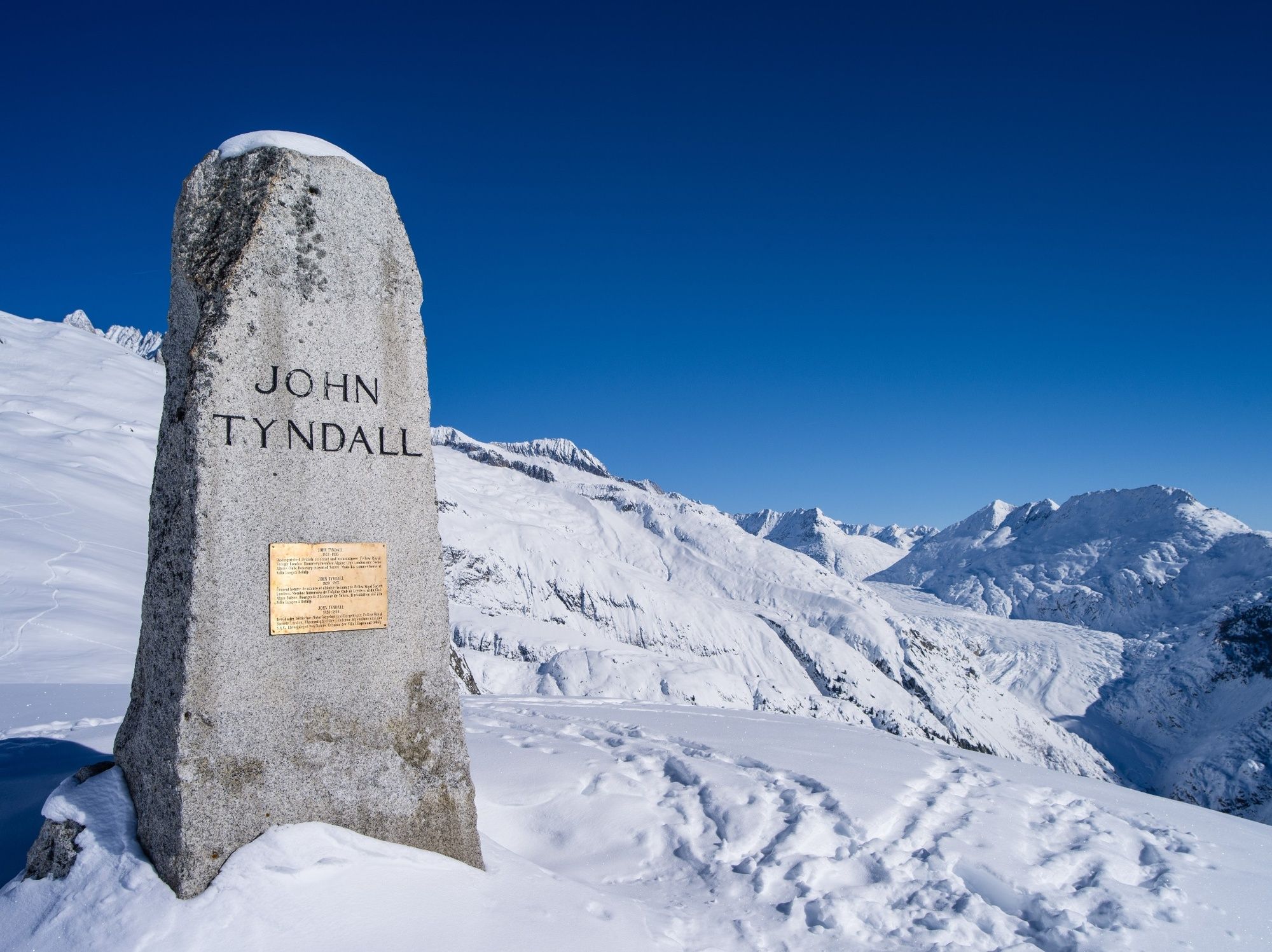
The Tyndall Trail is dedicated to the Irish scientist and alpinist John Tyndall, which is why you’ll encounter a memorial to him during this snowshoe hike. The route is generally easy to tackle, although the final section is a little more demanding.
- Difficulty
-
medium
- Rating
-
- Starting point
-
Belalp Mountain Station
- Route
-
Belalp (2,094 m)Restaurant Bergstation0.0 kmHotel Belalp1.8 kmHäxebar4.8 km
- Best season
-
AugSepOctNovDecJanFebMarAprMayJunJul
- Description
-
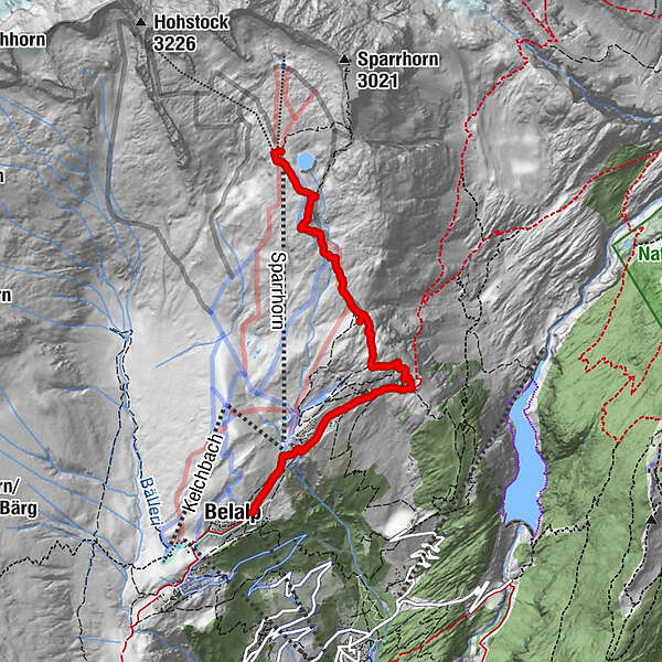
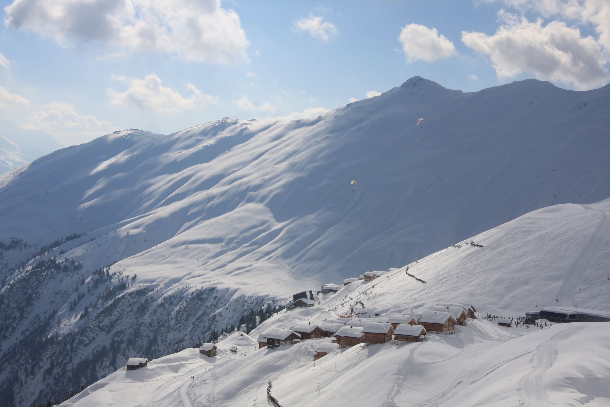
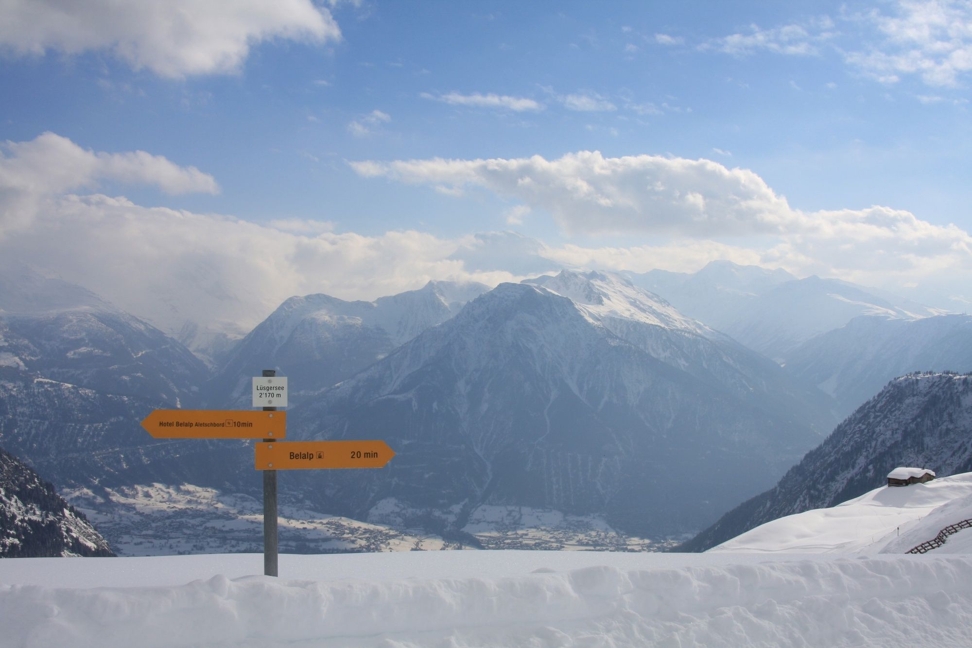
Belalp is a mountain pasture and holiday destination located on a terrace on the southern flank of the Unterbächhorn and the Sparrhorn. The Tyndall Trail begins at the Belalp cable car mountain station and initially leads via a well-maintained path to Aletschbord. Since 1858, Aletschbord has been home to the historic Hotel Belalp, which hosted the Victorian alpine pioneer John Tyndall for 44 summers. The Irishman was a passionate alpinist and scientist who took a keen interest in glacier movement and climate change. Hotel Belalp was renovated in 2015 and still maintains the historic “Tyndall Room” with original 19th-century furnishings in his honour. During the snowshoe tour you can replenish your energy levels at the hotel’s restaurant while enjoying the enchanting view of the Great Aletsch Glacier and the surrounding four-thousand-metre peaks. You then head off to Hohbiel; this is the most demanding stretch of the trail, but the view of the 17 four-thousand-metre peaks makes it worth the effort. Along the way you’ll pass the memorial to John Tyndall, which his wife had built in 1911, eight years after his death.
- Directions
-
The eight-kilometre Tyndall Trail is classified as medium difficulty and covers 580 metres in altitude difference. The departure point of the roughly three-hour snowshoe hike is the Belalp cable car mountain station. The route follows the connecting path towards Aletschbord, then continues uphill on a slightly more demanding path up to Hohbiel and its reservoir lake. The return journey follows the same route.
- Highest point
- 2,672 m
- Endpoint
-
Tyndall Memorial
- Height profile
-
 © outdooractive.com
 - Equipment
-
We recommend:
Good, waterproof footwear Snowshoes hiking poles clothing suitable for the weather: always carry a waterproof jacket hat or cap sunscreen bottle for water, picnic camera printout of this hike (click “Print” icon, top right, to download) - Safety instructions
-
Use of the snowshoe trails and the information on this website is at hikers’ own risk. Local conditions may entail changes to routes. Valais/Wallis Promotion accepts no liability for the accuracy and completeness of information on this website.
Bring a map. Download full description of this route including large-scale map by clicking on “Print” icon, top right of this page. Use marked trails only, and observe all signposting – for your own safety, to safeguard grazing animals and to avoid disturbing wildlife. Please be considerate to other trail users, and to the plants and animals. Do not leave any waste in nature. Take extra care protecting yourself from the sun at altitude. UV radiation can be exceptionally strong, even in cloudy weather. Plan hike carefully: take into consideration fitness level of each participant, weather forecast and season. Inform others of planned route, and whenever possible, avoid going alone. Weather conditions can change quickly in the mountains, without warning. Appropriate clothing is therefore essential, along with adequate supplies of food and water. In uncertain weather, turn back in good time. Do not venture onto glaciers without a mountain guide. Take note of the warning signs that point out the constant danger, especially the danger of avalanches. - Tips
-
Replenish your energy levels at the historic Hotel Belalp and enjoy an amazing view of the Great Aletsch Glacier and the four-thousand-metre peaks.
- Additional information
- Directions
-
Motorway A9 direction Brig. Continue direction Naters until Blatten.
- Public transportation
-
Accessible by train and bus. From Brig station, take the PostBus to Blatten (Belalp).
- Parking
-
Short-stay car park
For durations of less than one day, the best option is the short-stay car park (fee payable).
Indoor / outdoor car parksGuests who stay for longer than 2 days in Blatten-Belalp can park in the outdoor or indoor car parks. Payment can be made at the ticket machines or at the information and ticket counters in Blatten.
The car parks cost CHF 12.00 a day in winter and CHF 9.00 in summer.
Guests who have paid the tourist tax or who are members of Pro Blatten enjoy a discount of 15%.
Rischinu car parkDuring the winter season, the car park in Rischinu may be used free of charge. A regular shuttle bus carries guests to the base station of the cable car and gondola in comfort.
-

-
AuthorThe tour Tyndall trail is used by outdooractive.com provided.


General info
-
Aletsch Arena
131
-
Brig Simplon
71
-
Blatten-Belalp
27