


- Brief description
-
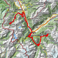
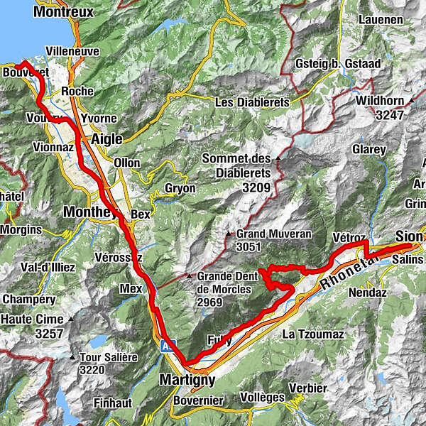
From the lakeside town of Le Bouveret to the capital of Valais, this stage runs along the banks of the Rhône River and through vineyards before climbing towards the spa resort of Ovronnaz.
- Difficulty
-
medium
- Rating
-
- Starting point
-
Le Bouveret, Rte du Lac
- Route
-
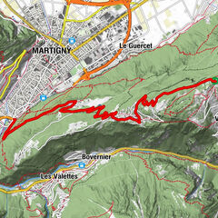
Le Bouveret (374 m)0.0 kmChessel (379 m)6.7 kmIllarsaz (384 m)12.6 kmMassongex (408 m)22.0 kméglise St-Jean-Baptiste22.2 kmBasilique Saint Maurice25.4 kmSaint-Maurice (414 m)25.5 kmLes Terreaux25.7 kmLa Rôtisserie du Bois-Noir28.9 kmEvionnaz31.0 kmCollonges (452 m)32.3 kmLe Relais Fleuri34.7 kmDorénaz (450 m)35.0 kmBranson41.4 kmFully (461 m)43.4 kmChâtaignier44.5 kmSaxé45.4 kmMazembroz46.1 kmSaillon50.8 kmancienne église et clocher53.0 kmLeytron53.2 kmProduit (Leytron)55.5 kmMontagnon56.4 kmCafé des Mayens56.5 kmDugny58.8 kmChez Eugénie61.0 kmLe Vieux Valais61.0 kmOvronnaz61.9 kmÉglise d'Ovronnaz62.0 kmLa Pension d'Ovronnaz63.7 kmLa Promenade64.3 kmChapelle des Mayens65.4 kmRelais des Mayens66.3 kmLe Temps de Vivre66.4 kmSaint-André le bistrot71.8 kmCaveau de Chamoson71.8 kmChamoson71.9 kmSaint-André71.9 kmGru73.0 kmArdon (503 m)74.8 kmLe Relais du Petit Bourg74.9 kmBalavaud75.4 kmBollaire75.4 kmMagnot75.8 kmLe Raisin76.1 kmLa Cambuse76.2 kmVétroz (483 m)77.5 kmPlan-Conthey (511 m)79.7 kmChâteauneuf80.8 kmChâteauneuf-Conthey (510 m)80.8 kmCafé restaurant de l'Aviation82.3 kmSitten (515 m)85.6 km
- Best season
-
JanFebMarAprMayJunJulAugSepOctNovDec
- Description
-
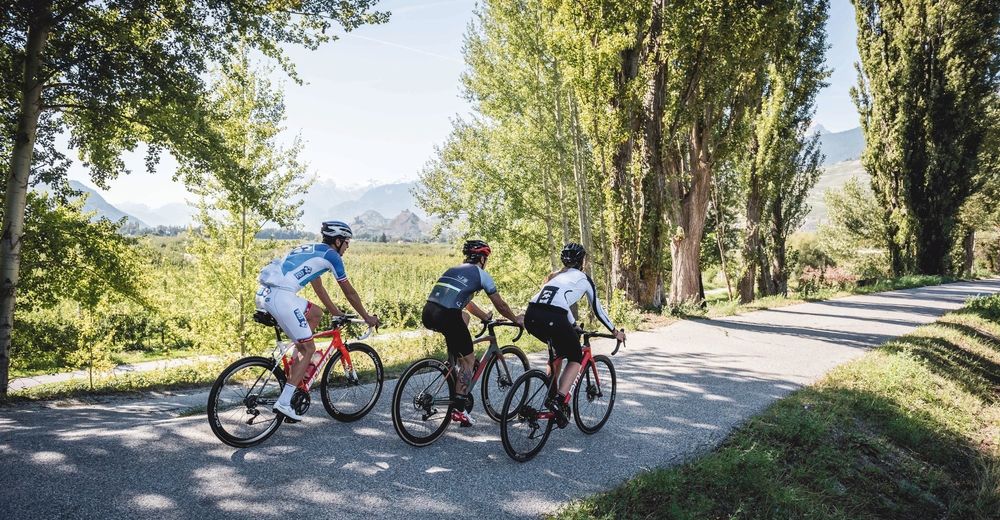
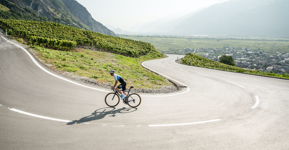
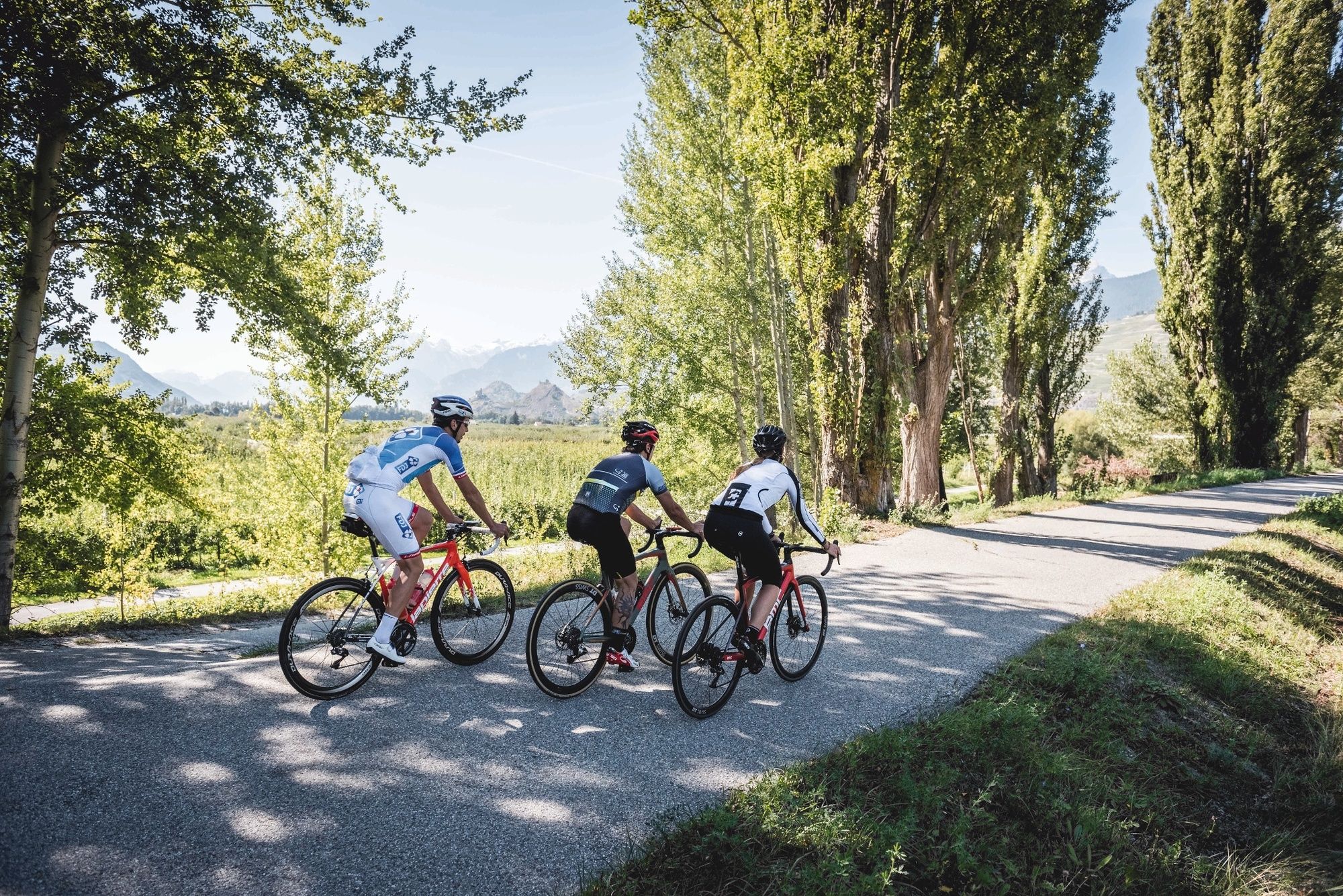
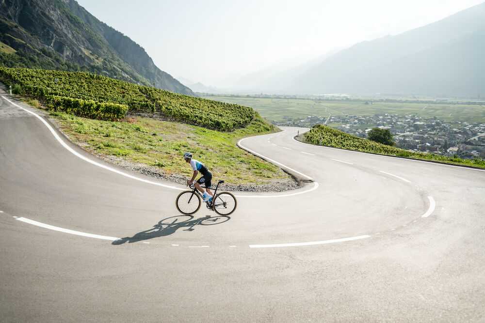
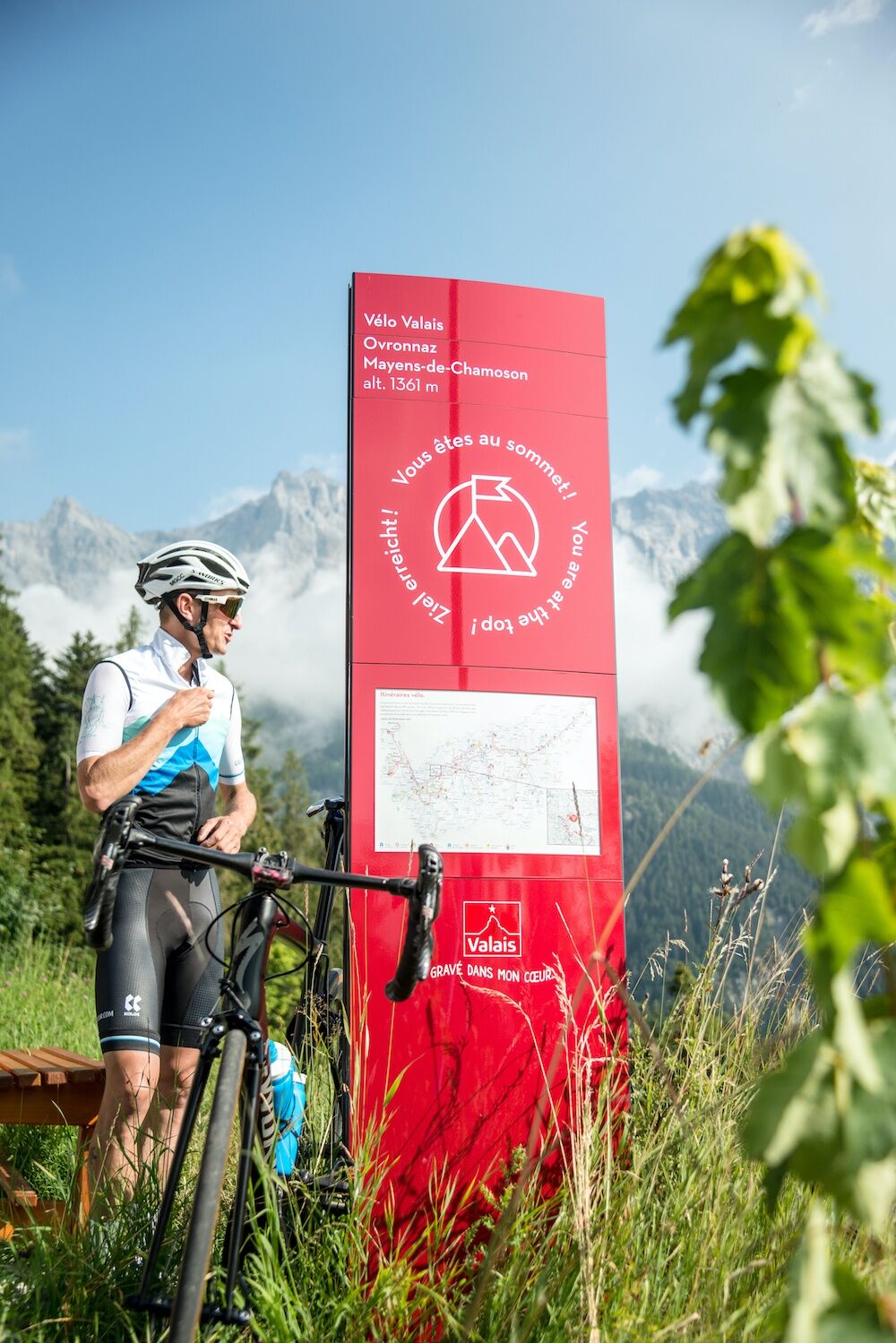
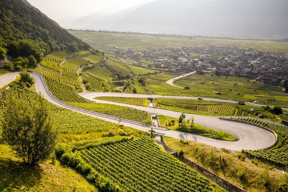
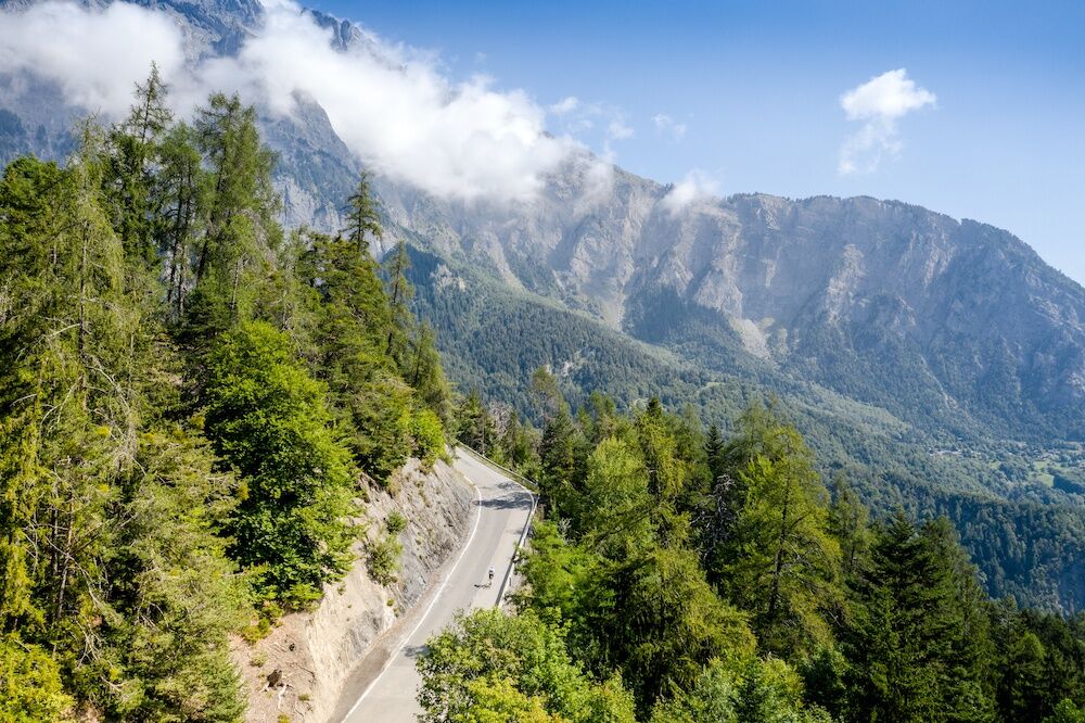
Valais is more than just a mountainous region, as the canton extends all the way to the shores of Lake Geneva, one of the largest lakes in Europe. The start of the route takes you along the Rhône, the iconic river that runs through the entire canton. This stage allows you to discover the beautiful vineyards of Valais, which are known for being the most extensive in Switzerland. The ascent to Ovronnaz resort is the highlight of the route and is marked out using Valais cycle signs. You can enjoy a magnificent panoramic view as you make your way downhill to the winemaking municipality of Chamoson. The final section of the route continues towards Ardon and Conthey before finally reaching Sion. Enjoy the charming terraces in the city centre while you're there!
- Directions
-
The beginning of the route is flat and rises slowly along the shady banks of the Rhône River. After passing close to St-Maurice and its ancient abbey, the route changes direction near Martigny and the elbow of the Rhône. You then enter the heart of Valais as you ride through Fully and its orchards. The stage continues through the vineyards before climbing towards Ovronnaz resort. A magnificent panoramic view awaits you during your descent into the winemaking village of Chamoson. The route continues in the direction of Ardon and then Conthey before reaching the city of Sion. Enjoy the charming terraces in the city centre while you're there!
- Highest point
- 1,360 m
- Endpoint
-
Sion, Rue de l'Industrie, 1950 Sion
- Height profile
-
 © outdooractive.com
 - Equipment
-
We recommend: bike in excellent working order, helmet, gloves and bell, clothing suitable for the weather (always carry a waterproof), food and drink.
- Safety instructions
-
Strictly respect the Swiss traffic rules. Please note that you are running the tour at your own risk and all liability is refused. Please be considerate to plants and animals. For your own safety, wear an helmet every time you ride a bike. Emergency numbers: 144 Ambulance / 117 Police / 1414 Helicopter Rescue (Rega).
- Tips
-
Once you're at Illarsaz, cross the bridge over the Rhône to reach the velodrome at the World Cycling Centre in Aigle. Take a refreshing break at the centre's café-restaurant!
- Additional information
- Directions
-
From the A9 motorway, take the Villeneuve exit and follow the H144 road. After crossing the Rhône, take a right on road number 21 towards France until Le Bouveret.
- Public transportation
-
SBB train from St-Maurice/Monthey. Bus services also available.
- Parking
-
This tour takes place over several stages and the starting and finishing points are at different locations. Therefore, we advise that you travel to the starting point by public transport. To do so, we recommend you use the car park at Aquaparc or the Swiss Vapeur Parc. Please follow the parking instructions.
- Author
-
The tour Valais Cycling Tour: Le Bouveret - Sion (stage 10) is used by outdooractive.com provided.