
- Brief description
-
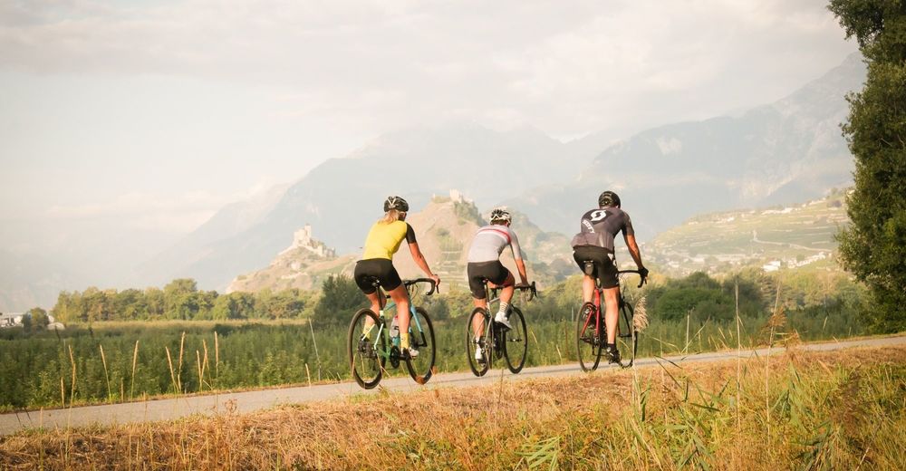
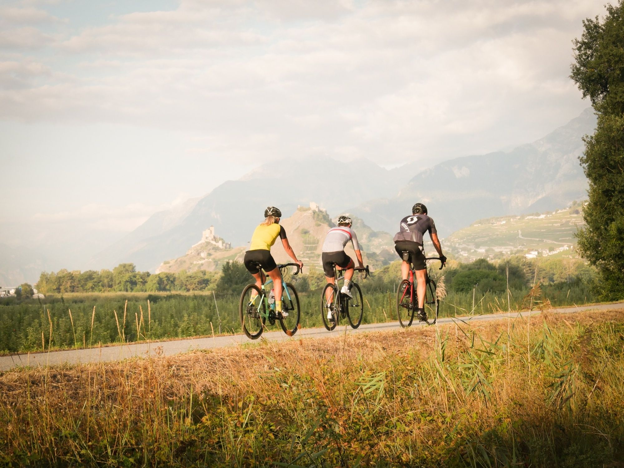
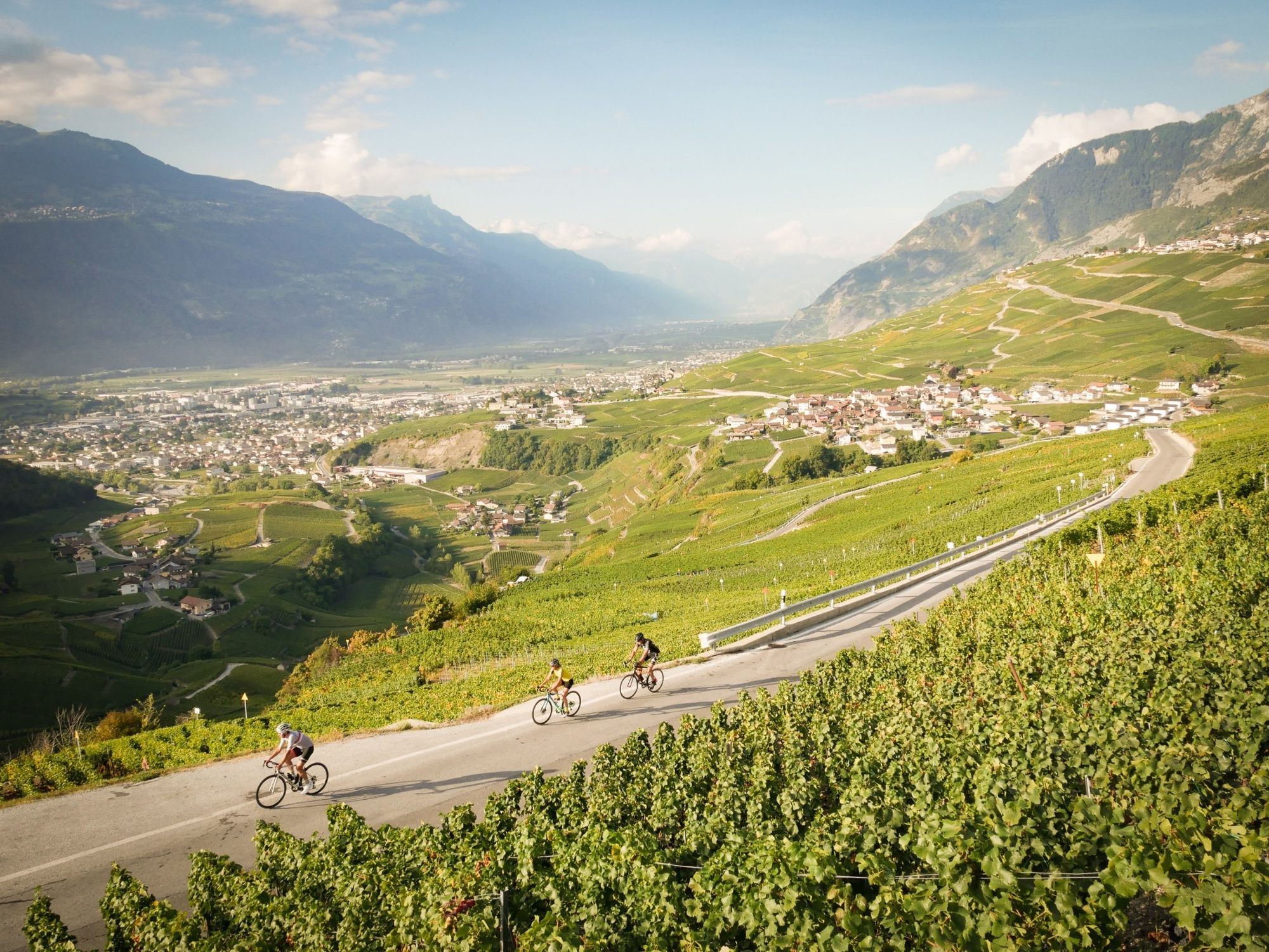
The Sion Castles Tour is a demanding route with a great variety of backdrops and scenery: terraced vineyards, orchards, forests, alpine panoramas, villages and castles.
- Difficulty
-
easy
- Rating
-
- Starting point
-
Sion
- Route
-
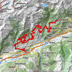
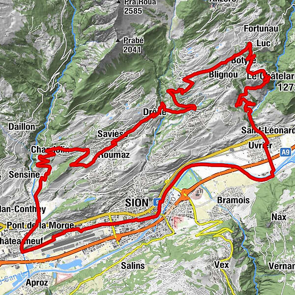
Sitten (515 m)Eglise évangélique0.0 kmCafé restaurant de l'Aviation2.3 kmChâteauneuf5.0 kmPont de la Morge6.1 kmVuisse7.5 kmChandolin10.9 kmLa Grande Maison11.0 kmCafé du Château de la Soie12.6 kmGranois12.7 kmSitten (515 m)14.5 kmRoumaz15.2 kmSaint-Germain15.5 kmCafé Restaurant de l’Union15.5 kmCafé Restaurant La Channe15.5 kmSavièse15.8 kmLa Soie16.2 kmDrône17.4 kmGrimseln (882 m)19.8 kmArbaz (1,146 m)23.3 kmBlignou (Ayent)24.2 kmBotyre (Ayent)24.6 kmSaxonne (Ayent)25.2 kmSt-Romain (Ayent)25.9 kmFortunau (Ayent)25.9 kmLuc (Ayent)26.0 kmLa Place (Ayent)27.7 kmLe château (997 m)27.9 kmLormey31.6 kmSaint-Léonard (498 m)33.7 kmUvrier34.1 kmSitten (515 m)41.3 km
- Best season
-
JanFebMarAprMayJunJulAugSepOctNovDec
- Description
-
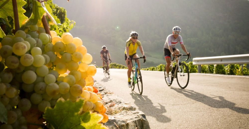
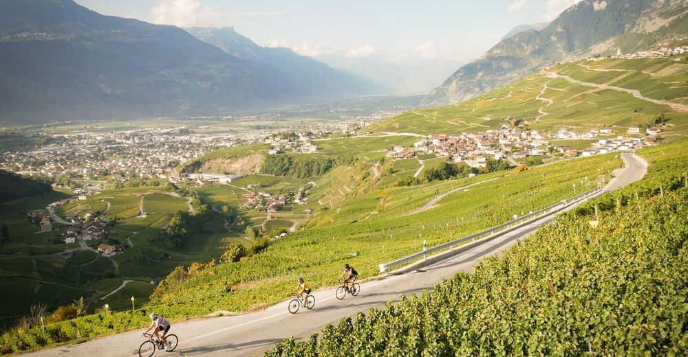
The Sion Castles Tour takes cyclists on a delightful journey of discovery through the Sion region. The itinerary passes through the municipalities of Savièse, Grimisuat, Arbaz, Ayent and St-Léonard. The route is full of variety, with ever-changing scenery. You ride in forest, across terraced vineyards and through villages, with glorious views of the Valais mountains and the two castles that dominate the city of Sion: Valère and Tourbillon. Arbaz, at an altitude of 1,140 metres, is the highest point of this fairly demanding ride, best suited to keen cyclists in good physical shape.
- Directions
-
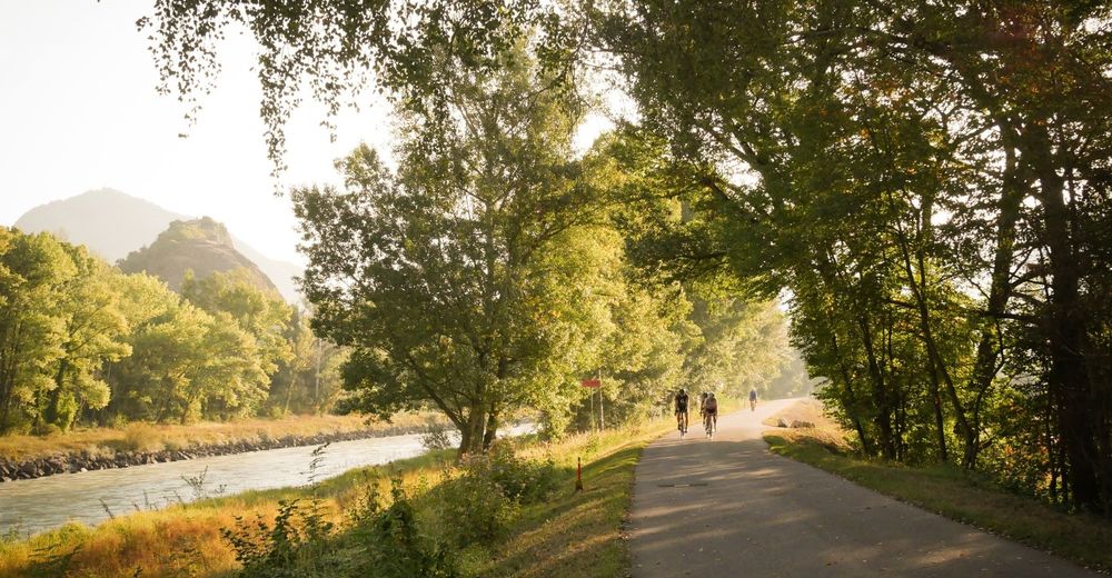
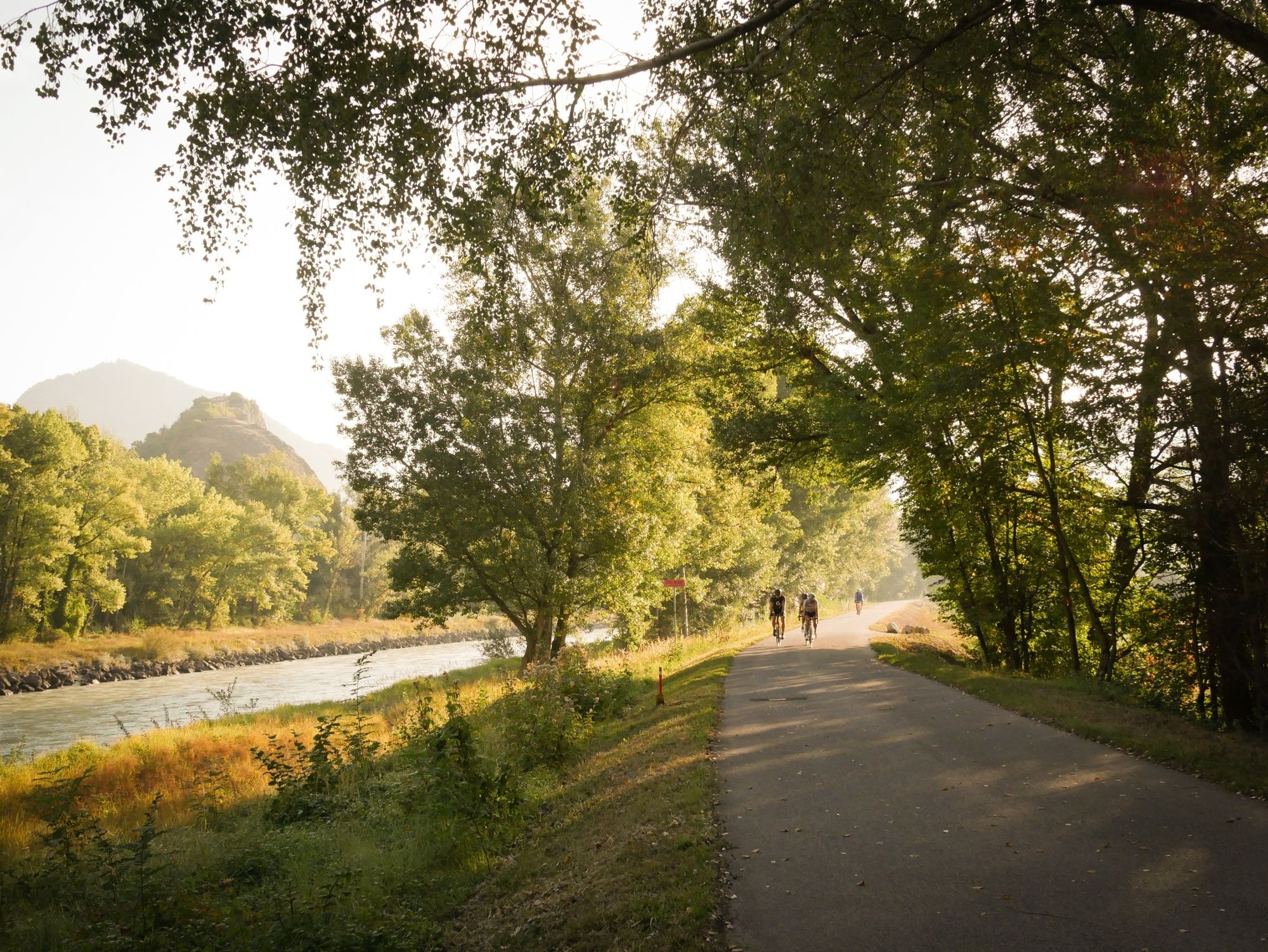
The route starts with a flat section to Châteauneuf before leading upstream along the river Morge, whose source is the Sanetsch Glacier. Soon after you reach the vineyards, you embark on the first climb up towards Savièse. You then head across to Grimisuat through a variety of scenery: villages, orchards, forests and vineyards. Pause to enjoy the glorious panoramic views: across the Rhône valley you can admire the finest summits of the Valais Alps, including the magnificent Dent Blanche. The route continues climbing as far as Arbaz, highest point of this itinerary. Proceed to the village of St-Romain, part of the municipality of Ayent, and then begin the descent towards St-Léonard, largely along a narrow lane through the vineyards. The route leads along the river Lienne as far as its confluence with the Rhône, where you begin your ride back to Sion – guided by the castles of Valère and Tourbillon, which tower majestically over the capital of Valais.
- Highest point
- 1,147 m
- Endpoint
-
Sion
- Height profile
-
 © outdooractive.com
 - Equipment
-
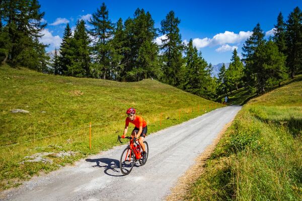
We recommend: bike in excellent working order, helmet, gloves and bell, clothing suitable for the weather (always carry a waterproof), food and drink.
- Safety instructions
-
Strictly respect the Swiss traffic rules. Please note that you are running the tour at your own risk and all liability is refused. Please be considerate to plants and animals. For your own safety, wear an helmet every time you ride a bike. Emergency numbers: 144 Ambulance / 117 Police / 1414 Helicopter Rescue (Rega).
- Tips
-
We recommend a walk around Sion’s Old Town at the foot of the castles. Also well worth a visit in the region: Derborence, Lake Tseuzier and the Val d’Hérens.
- Additional information
- Directions
-
To reach Sion by car, follow the A9 motorway through Valais. If travelling from the west, take exit 26 (Sion-Ouest), and if driving from the east, take exit 27 (Sion-Est). Follow the signs for Sion railway station.
- Public transportation
-
To reach Sion by public transport, take the train or travel on one of the many PostBus routes that serve Sion railway station.
- Parking
-
Use the free car parks by the Rue des Échutes and on the Place des Potences.

- Author
-
The tour Castles of Sion and surroundings is used by outdooractive.com provided.


General info
-
Thyon les Collons
118
-
Sion / Sitten
74
-
Grimisuat
29