
- Brief description
-
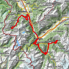
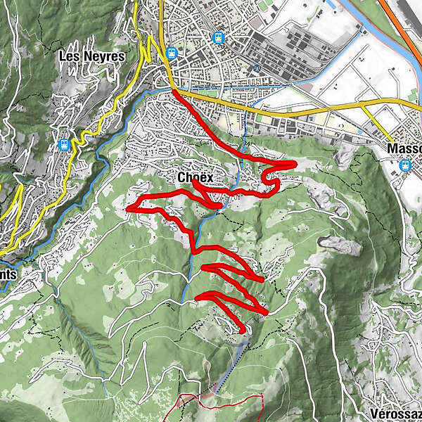
This route takes you from Monthey to Les Cerniers, at the foot of the Dents du Midi, with a panoramic view of Lake Geneva and the Rhône Valley at an altitude of 1,289 metres.
- Difficulty
-
medium
- Rating
-
- Starting point
-
Monthey, Vieux Pont
- Route
-
Monthey (430 m)Café-Berra3.7 kmChoëx3.8 kmLes Giettes9.6 kmRestaurant les Cerniers11.3 km
- Best season
-
JanFebMarAprMayJunJulAugSepOctNovDec
- Description
-
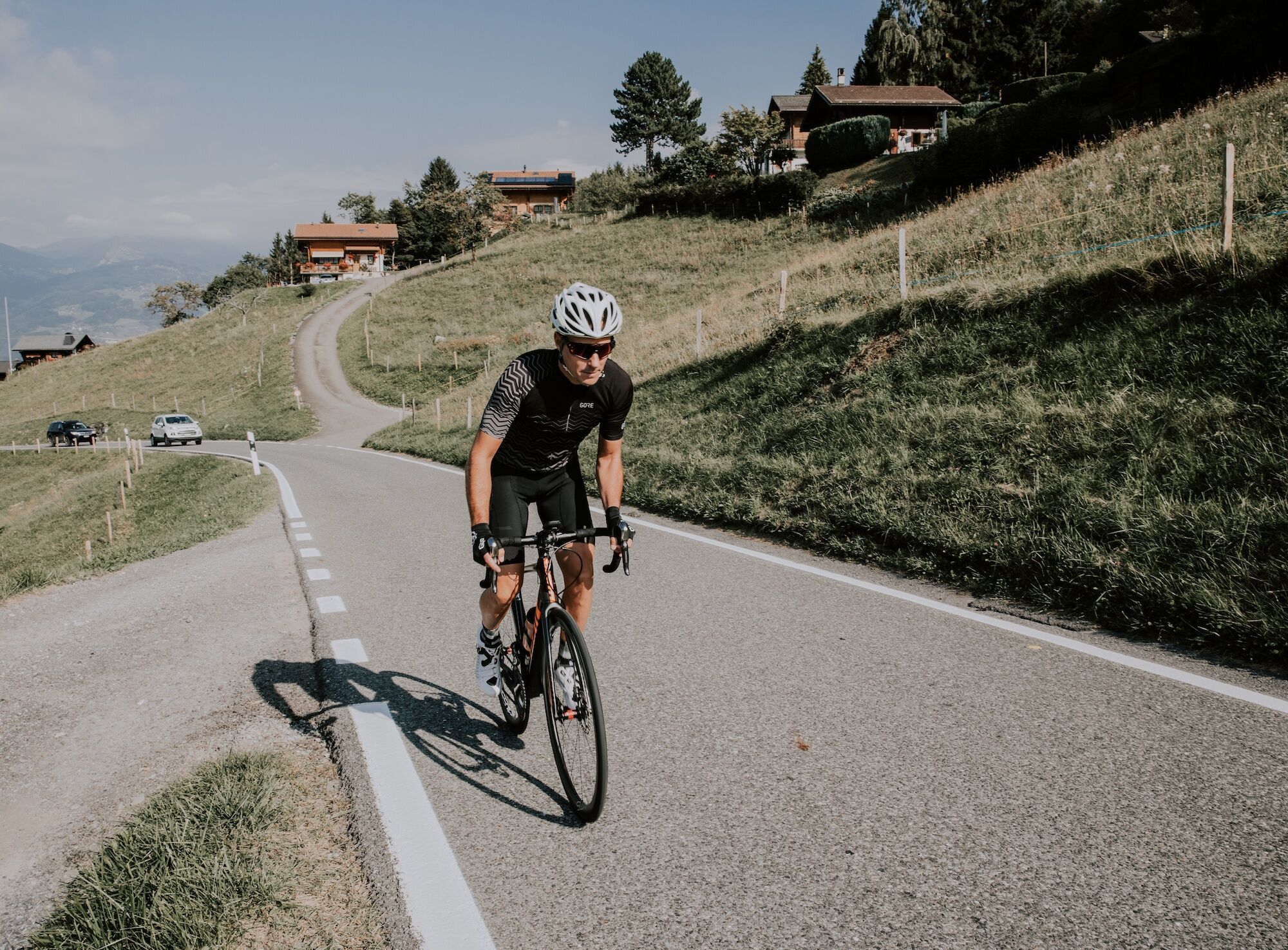
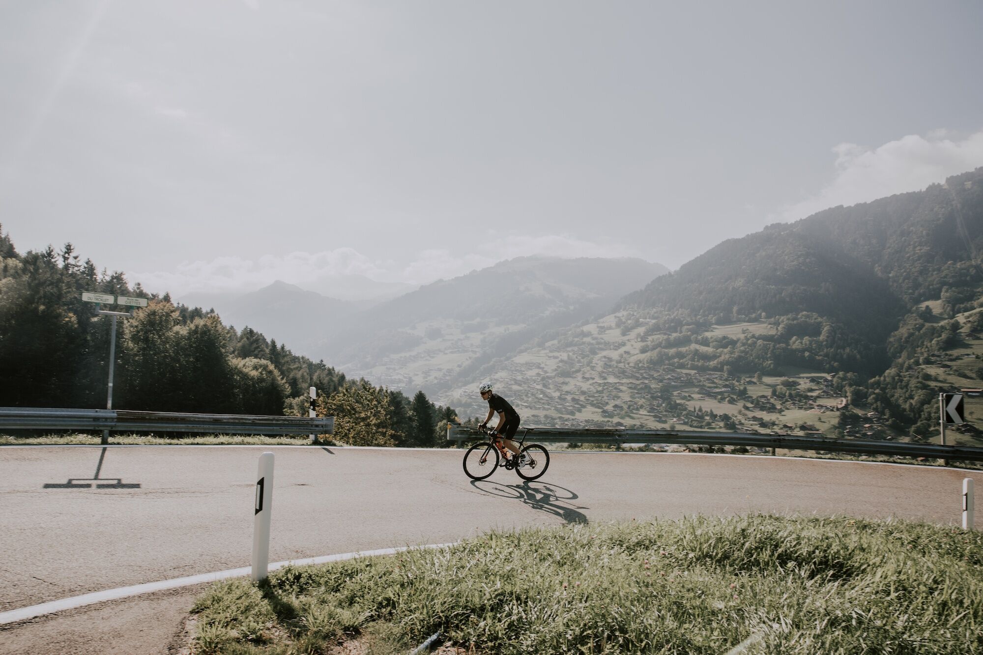
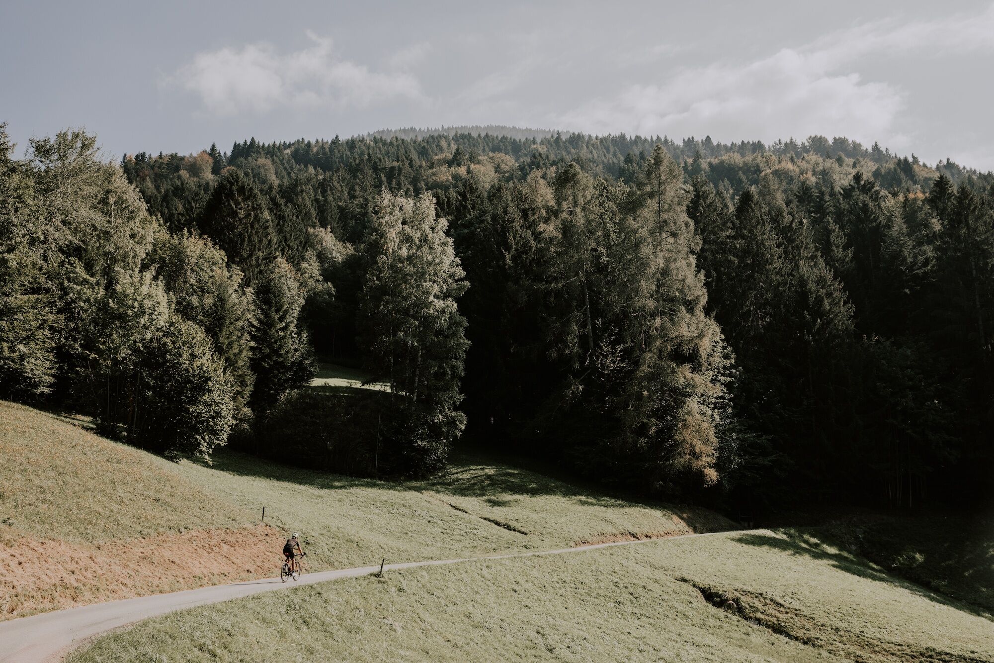
Set off on a striking climb full of contrasts. This route starts close to Monthey town centre, beside the old, wooden-covered bridge built in 1809. Begin your climb up the hillside, gradually leaving the urban environment behind you, to reach the village of Choëx where the road winds through forests and clearings. At Les Giettes, you will need to turn off to the right and follow the signs for Les Cerniers where your arrival will be accompanied by a spectacular view of the mountains and Lake Geneva.
- Directions
-
From the covered bridge in Monthey, head for the hills on a gentle climb along a wide road. After a few hundred metres, two signposts give you the choice of two routes. Continue straight ahead and follow the signs for Les Cerniers. Four similar signs will guide you throughout your climb and inform you of your progress. Keep climbing until you reach the village of Les Giettes, less than two kilometres from the summit. Turn off to the right to tackle the final few metres of the ascent to be rewarded with a stunning vantage point. Nestled between the lake, mountains and a larch forest, you will find a fantastical village of white domes housing luxurious accommodation in the heart of nature.
- Highest point
- 1,286 m
- Endpoint
-
Les Cerniers
- Height profile
-
 © outdooractive.com
 - Equipment
-
We recommend: bike in excellent working order, helmet, gloves and bell, clothing suitable for the weather (always carry a waterproof), food and drink.
- Safety instructions
-
Strictly respect the Swiss traffic rules. Please note that you are running the tour at your own risk and all liability is refused. Please be considerate to plants and animals. For your own safety, wear an helmet every time you ride a bike.
Emergency numbers: 144 Ambulance / 117 Police / 1414 Helicopter Rescue (Rega).
- Tips
-
If you have some energy left, you can explore Val d’Illiez or the Chindonne mountain pasture or relax on the beautiful terraces of the Restaurant Les Cerniers.
- Additional information
- Directions
-
From the A9 motorway, take exit 19 towards Bex, Monthey Sud and follow the signs to reach the town of Monthey.
- Public transportation
-
Take the train (SBB) to Monthey railway station, then change for a bus which will take you to the start of the route. From the station, you can also decide to cycle to the starting point.
- Parking
-
Several parking spots are available either beside the Philippe-Pottier Stadium or the tennis courts, just a few metres from the route’s starting point.

- Author
-
The tour Les Cerniers – Scenic & side valleys is used by outdooractive.com provided.


General info
-
Portes du Soleil
75
-
Région Dents du Midi
47
-
Monthey
25