
- Brief description
-
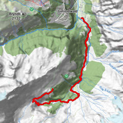
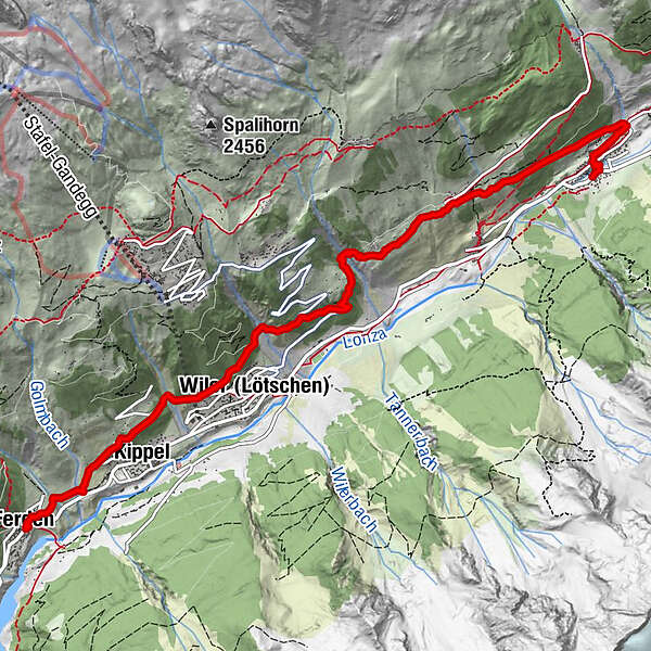
A contemplative route from Ferden to Blatten.
- Difficulty
-
medium
- Rating
-
- Starting point
-
Ferden, village
- Route
-
Kirche Ferden0.0 kmAmbord0.0 kmFerden (1,375 m)0.1 kmSt. Barbara Kapelle0.1 kmKippel (1,376 m)1.3 kmWiler (Lötschen) (1,419 m)2.5 kmWeissenried5.6 kmEisten7.1 kmBlatten (Lötschen)7.5 kmDorfkirche7.6 km
- Best season
-
JanFebMarAprMayJunJulAugSepOctNovDec
- Description
-
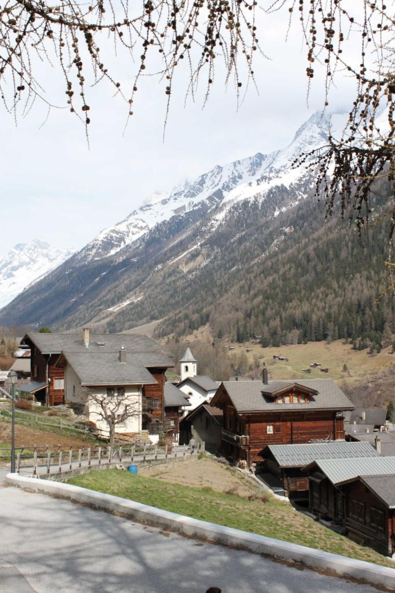
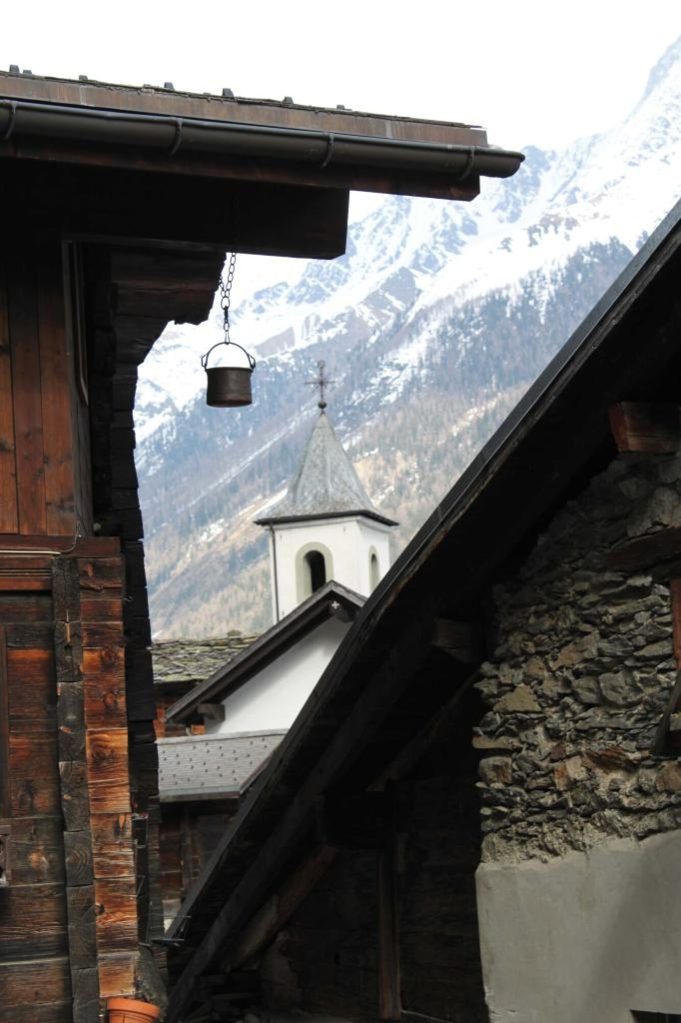
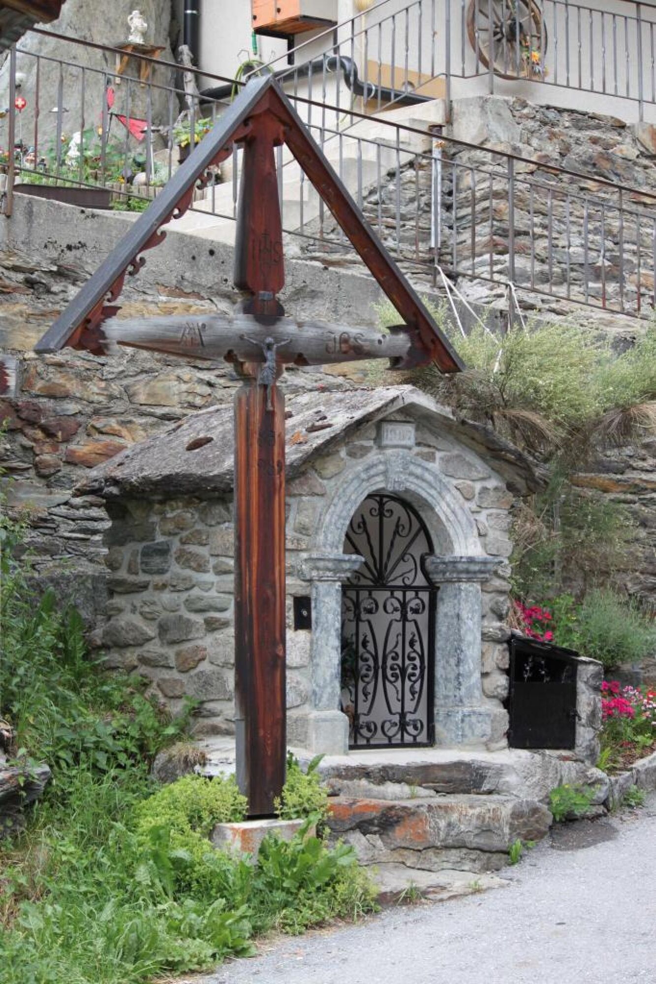
The route begins in the village of Ferden adjacent to the Barbara Chapel and leads to the parish church of Blatten. The Chapel to Saint Barbara was built in 1675 in the same era as the adjacent houses on the old village square in Ferden. The chapel was presented with a tabernacle in 1931, thereby establishing the duty to celebrate Mass once a week. The chapel lost its raison d'être when the new parish church was built. The Chapel of Saint Barbara was renovated by the Men's Association in 1976 and today is used as a chapel for laying-out the deceased.
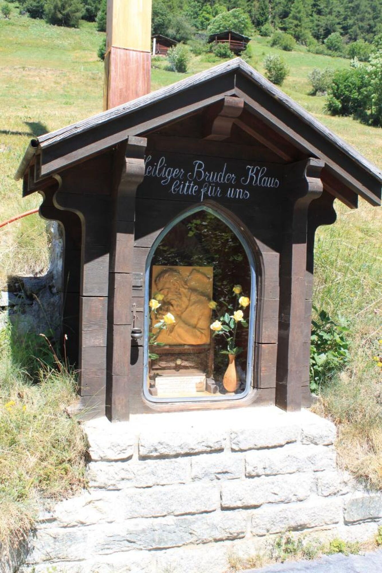
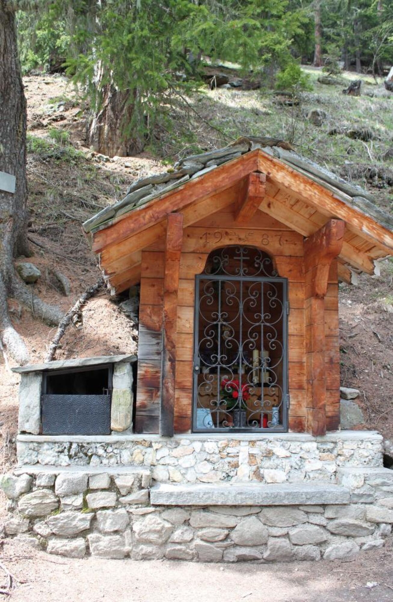
Now follow the old valley road and head for Kippel, turning left at the "Treibgasse" and follow the signs for the "Tärruweg". When you reach the "Hockenstrasse", continue along it and, shortly after the "Zubenbach" stream, the shrine to the Holy Brother Klaus comes into view. This shrine was built in 1947 on the occasion of the canonisation of Brother Klaus. The cross erected by the Youth Association is particularly striking: it is 13.5 m high and illuminated at night.
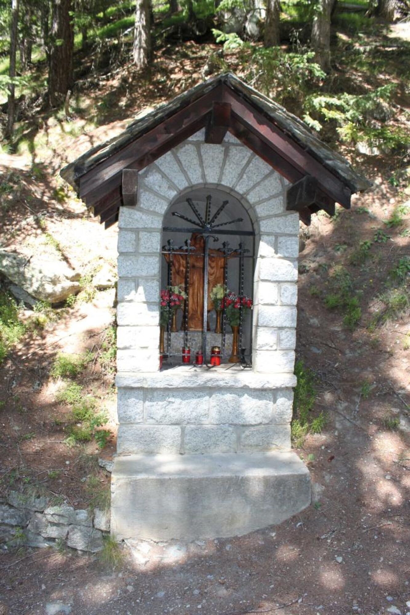
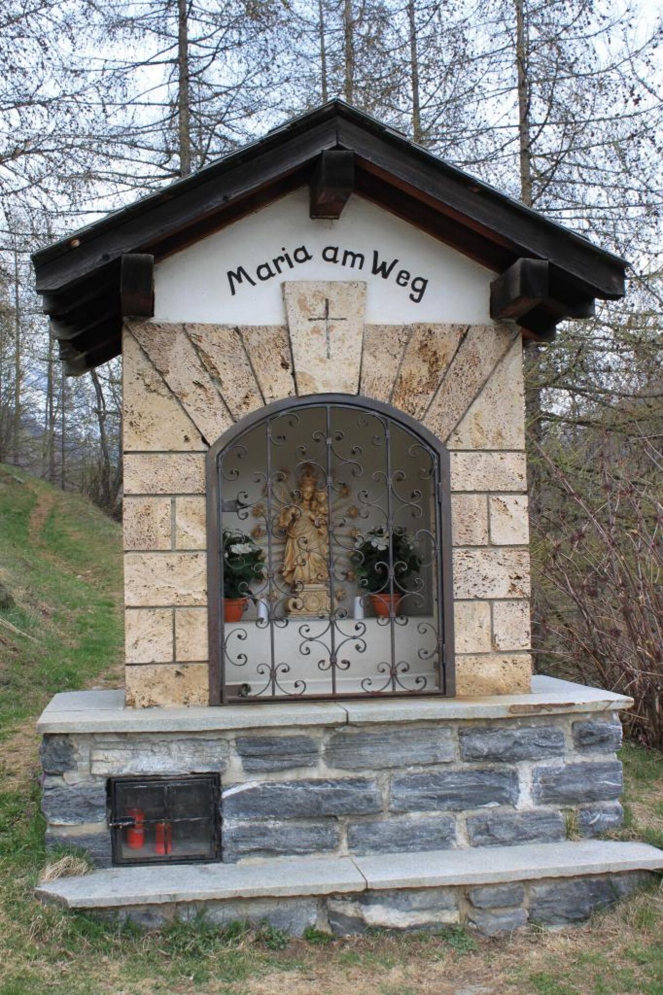
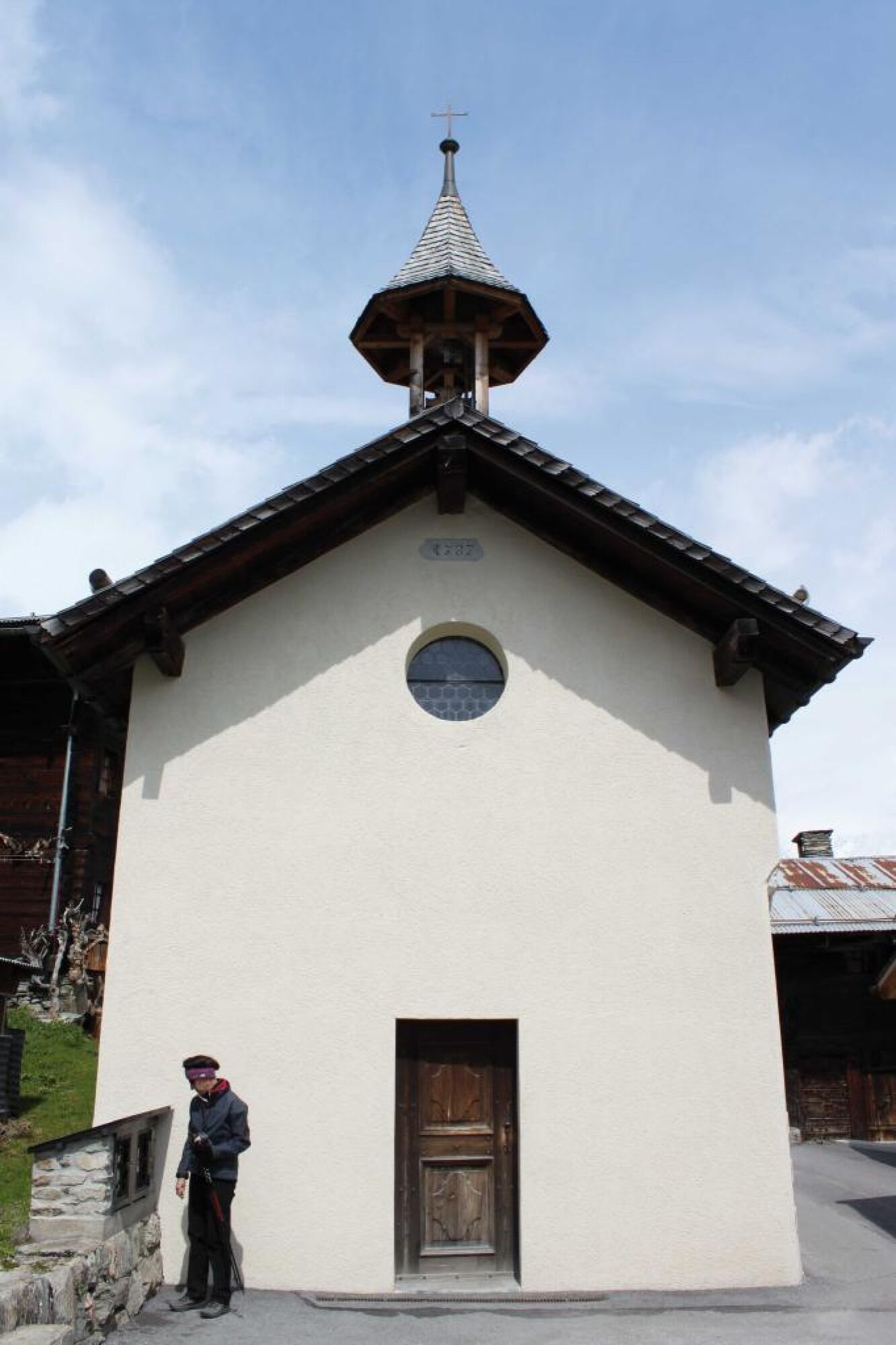
Continue along the "Hockenstrasse" to the next bend where you then take the forest trail and follow the signs on the "Mittelberg" for Wiler. Above the village you come across the shrine dedicated to the Sacred Heart of Jesus, who protectively opens his arms around the village of Wiler. We follow the gently inclined path to the fork to the "Milibach". When the path flattens out, you reach the road that leads to the Laucheralp. Follow the "Lauchernalpstrasse" down to the right to the "Loibegga" by the shrine "Maria am Weg" (Our Lady of the Path). The signpost for Tärra, Weissenried and Blatten is situated on the bend. A gentle descent brings you back to the path leading to Tärra. Follow the signposts and cross the "Tännerstäg", past the hamlet of Tärra and arrive at the hamlet of Weissenried. The Chapel of St. George is sited here. There was talk of a prayer house as early as 1687, but the chapel was not built until 1787. The last renovation took place in 1993. What is striking about this chapel is the altarpiece of St. George, the dragon-slayer, surrounded by statues of the apostles Peter and Paul. The route continues towards Blatten. The "Im Brand" Shrine is situated on the left, halfway along the path between Weissenried and Blatten. This timber shrine is dedicated to Saint Anthony of Padua. The path continues on to Blatten. Cross the "Gisentella" stream and immediately turn right into the Contemplation Trail. Continue walking to the eastern edge of the village where you meet the wayside cross and, beside it, the "Zr Sagu" shrine with the crucified Saviour standing on the right of the path close to the first houses and opposite the old mill. The path continues straight on to the old heart of the village, then down to the left to the village square and back to the church. - Directions
-
Ferden - Maria am Weg - Tärra - Weissenried - Blatten
- Highest point
- 1,706 m
- Endpoint
-
Blatten, Post
- Height profile
-
 © outdooractive.com
 - Safety instructions
-
Plan your tour carefully
Ensure that you have a full set of appropriate equipment
Never embark on a tour alone
Inform friends, relatives, the mountain hut supervisor or the hotel porter of your proposed tour. Report back when you arrive at your destination.
Keep a constant eye on weather developments
Adhere to the principle: if in doubt, turn back! - Tips
-
Order a free copy of the "Walking and Pilgrimages" brochure from the Lötschental Tourist Information Office or online at www.loetschental.ch/prospekte
- Additional information
- Directions
-
Drive into the Lötschental from Goppenstein as far as the village of Ferden.
- Public transportation
-
The postbus runs every hour from Gampel/Steg or Goppenstein to Ferden ("Ferden, Dorf" postbus stop).
- Parking
-
You can park your car in the car park by the "Ferden, Dorf" postbus stop or in the car park (not free).
- Author
-
The tour Mittelberg Trail is used by outdooractive.com provided.


General info
-
Oberwallis
1872
-
Lötschental
1075
-
Wiler
183