
- Brief description
-
This sunny round is not only interesting from the sporting side. Sunny hamlets, sacred buildings and rustic mountain villages are part of the programme.
- Difficulty
-
medium
- Rating
-
- Starting point
-
Susten/Leuk
- Route
-
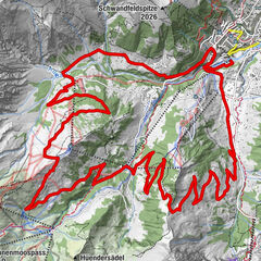
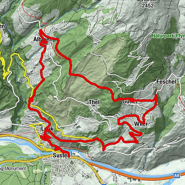
Leuk (623 m)0.1 kmSusten (630 m)0.3 kmLeuk Stadt (731 m)1.9 kmKirche1.9 kmBrunnen6.1 kmGrächmatten7.2 kmWiler8.0 kmFeschel9.1 kmGuttet10.1 kmThel11.4 kmSunnublick14.7 kmGodswärgjistubu15.0 kmPfarrkirche Heiliger Bruder Klaus15.0 kmAlbinen (1,300 m)15.0 kmKirche19.0 kmLeuk Stadt (731 m)19.1 kmSusten (630 m)20.7 kmLeuk (623 m)20.8 km
- Best season
-
JanFebMarAprMayJunJulAugSepOctNovDec
- Description
-
Thanks to the sun-exposed location, this easy route is rideable in spring and late into autumn. The route leads through the historic town of Leuk high into the "Sonnenberge" mountains to the secluded hamlets of "Lichten" and "Brunnen" to Guttet. The Valais high trail takes you to the rustic mountain village of Albinen. After an extensive break, you will have earned yourself a "rushing dessert". A descent over racy natural paths and playful trails through forest and vines brings you back to Leuk with a broad smile.
- Directions
-
You start your tour at the train station in Susten and pedal up an asphalt side road to the historic town of Leuk. After a short stretch on the main road, the route branches off and climbs up to the village of Guttet via a traffic-free side road and the deserted hamlets of "Lichten" and "Brunnen". The view over the wide Rhone valley and the renaturalised course of the river is indescribably beautiful. From Guttet, the terrain changes from asphalt to gravel. You reach the exposed mountain village of Albinen via the "Walliser Höhenweg" and have mastered the ascent. From here the route leads back down into the valley. Initially on asphalt, later on a forest road and finally on a playful trail, you reach St. Barbara. You zigzag across the main road and let it whiz again through the vines to the old town of Leuk - a great place for photo shoots and a cool beer. From here you can let it roll comfortably down to Susten station.
- Highest point
- 1,462 m
- Endpoint
-
Susten/Leuk
- Height profile
-
 © outdooractive.com
 - Equipment
-
We recommend: bike in excellent working order, helmet, gloves and bell, clothing suitable for the weather (always carry a waterproof), food and drink.
- Safety instructions
-
Use marked bike trails and routes only, and observe all signposting. Please close gates after passing through. Please be considerate to walkers and to plants and animals. As a rule, walkers have priority. When planning, take into account participants’ fitness level and ability. All riding is at one’s own risk.
- Tips
-
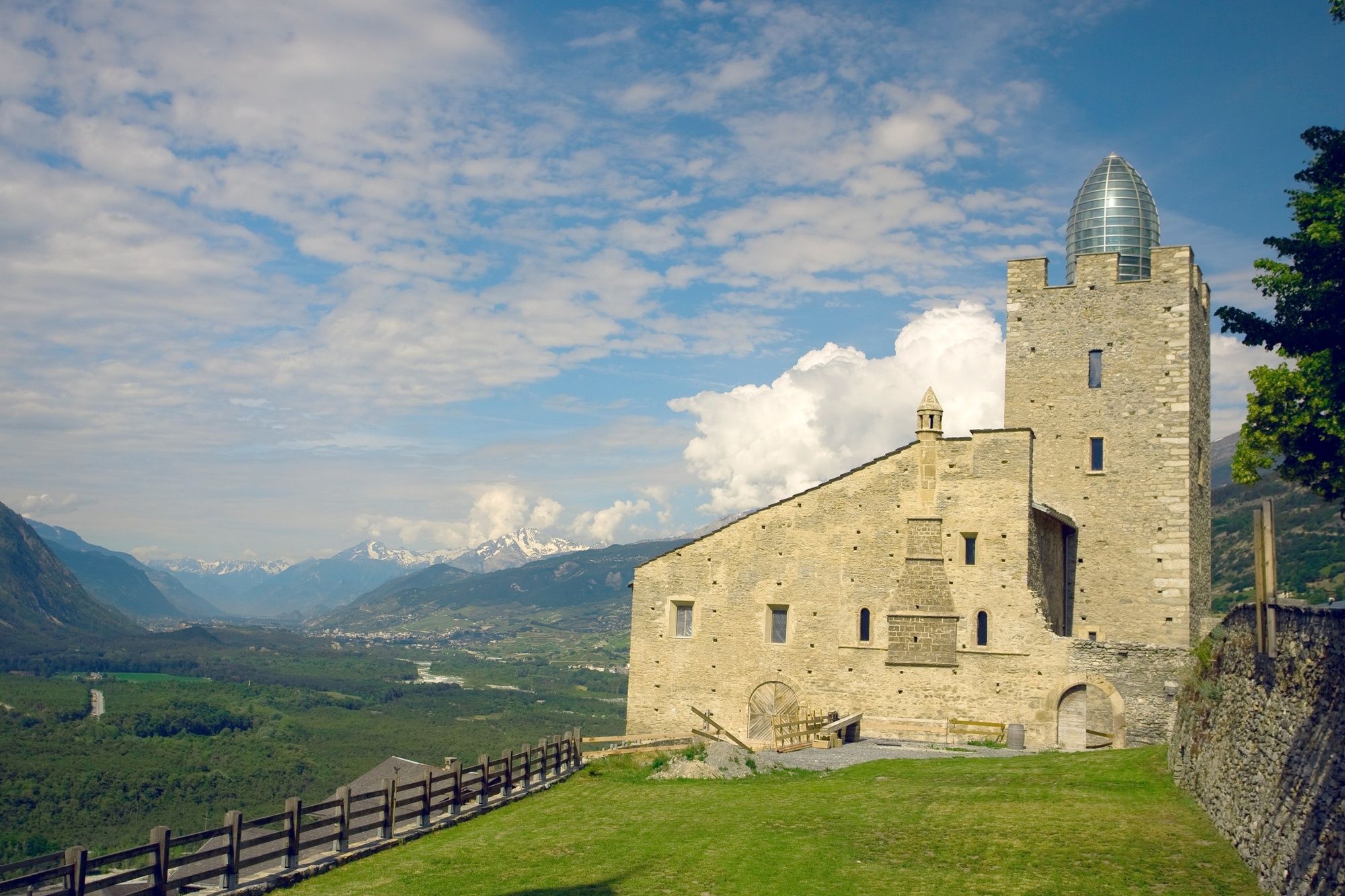
Albinen is one of the most beautiful and original mountain villages in the whole canton of Valais. Discover the narrow streets and tanned houses and attics. Pay a visit to Leuk Castle, restored by Mario Botta, and enjoy the breathtaking view of the Rhone Valley from the castle tower.
- Additional information
-
The tourist office in Leukerbad will be happy to provide information material and can give detailed information about the route.
- Directions
-
From Basel/Zurich: A1 motorway until Bern, A6 until Spiez, in the direction of Kandersteg; Car transport Kandersteg-Goppenstein; in the direction of Gampel; Leuk.
From Geneva: A1 motorway until Lausanne; in the direction of Sion/Sierre; Leuk.
From Milan: Motorway A8/A26 in the direction of Simplon; car transport Iselle-Brig; in the direction of Leuk.
- Public transportation
-
Arrive in Leuk/Susten by train (SBB).
- Parking
-
Parking at Leuk/Susten railway station.


- Author
-
The tour Sunnubärga Loop is used by outdooractive.com provided.


General info
-
Oberwallis
210
-
Leuk/Leukerbad
122
-
Agarn
37