- Brief description
-
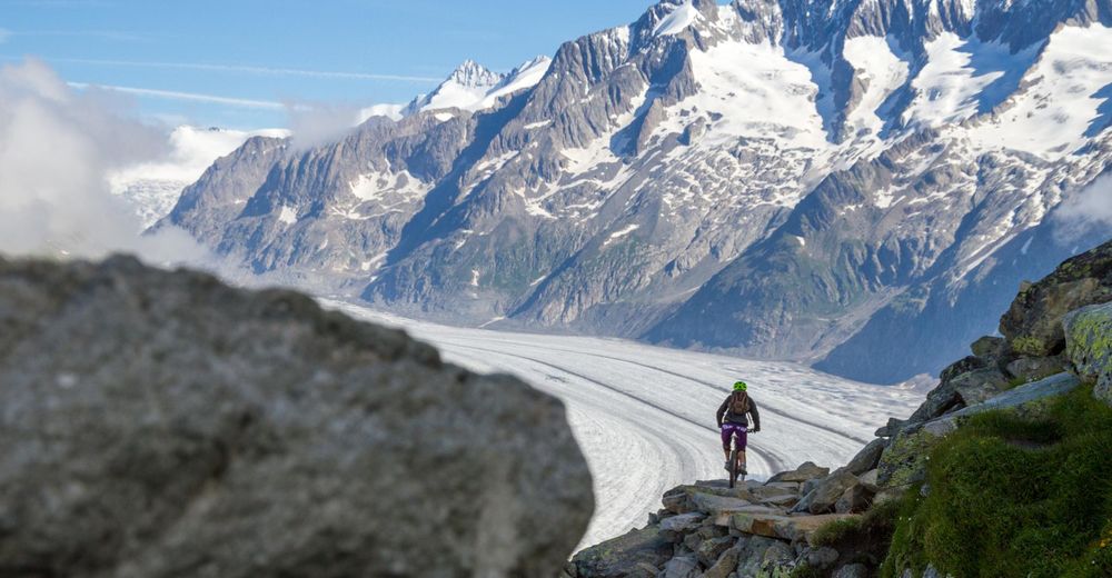
Probably one of the most stunning mountain bike rides you will ever do.
- Difficulty
-
difficult
- Rating
-
- Starting point
-
Bettmerhorn Top Station
- Route
-
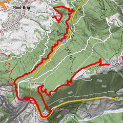
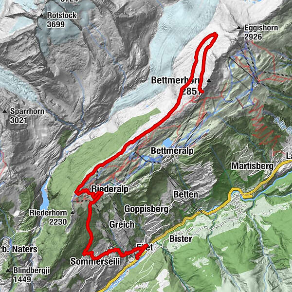
Bergrestaurant Bettmerhorn0.0 kmFotopunkt Bettmerhorn (Skiline)0.1 kmHohfluh (2,229 m)9.7 kmRiederfurka11.0 kmRiederalp-West (1,914 m)12.2 kmKapelle Riederalp12.4 kmRiederalp (1,925 m)12.6 kmSommerseili16.0 kmRied-Mörel16.6 kmBreiten18.4 kmMassholter18.6 kmFilet (757 m)18.9 kmFurka19.4 kmMörel (746 m)19.4 km
- Best season
-
JanFebMarAprMayJunJulAugSepOctNovDec
- Description
-
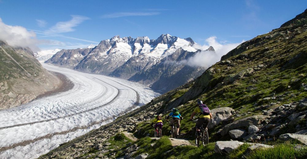
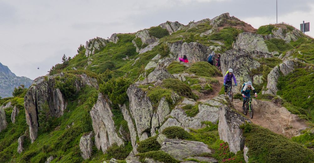
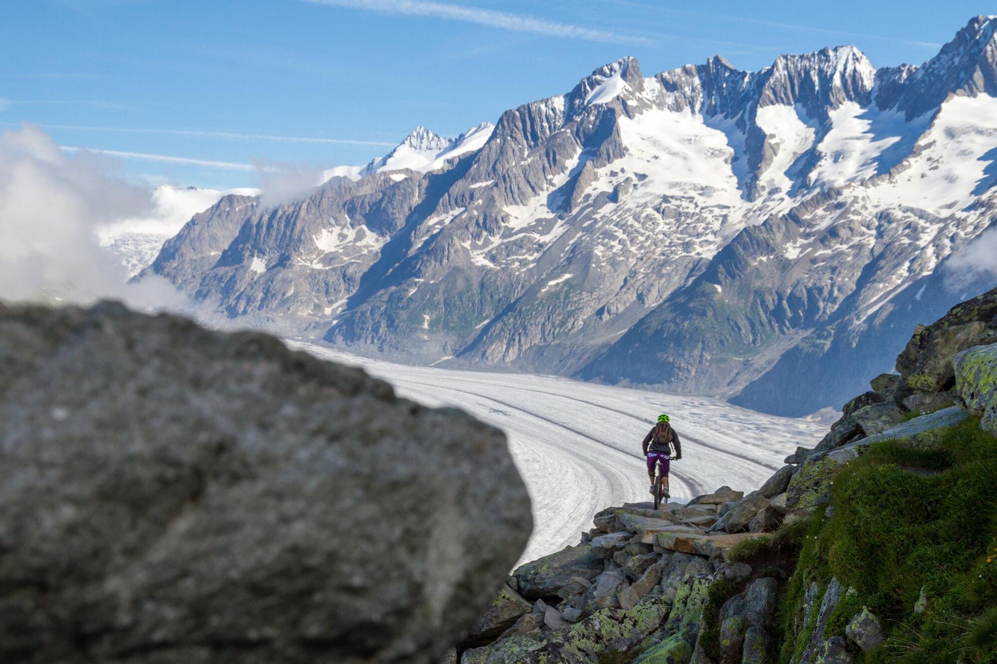
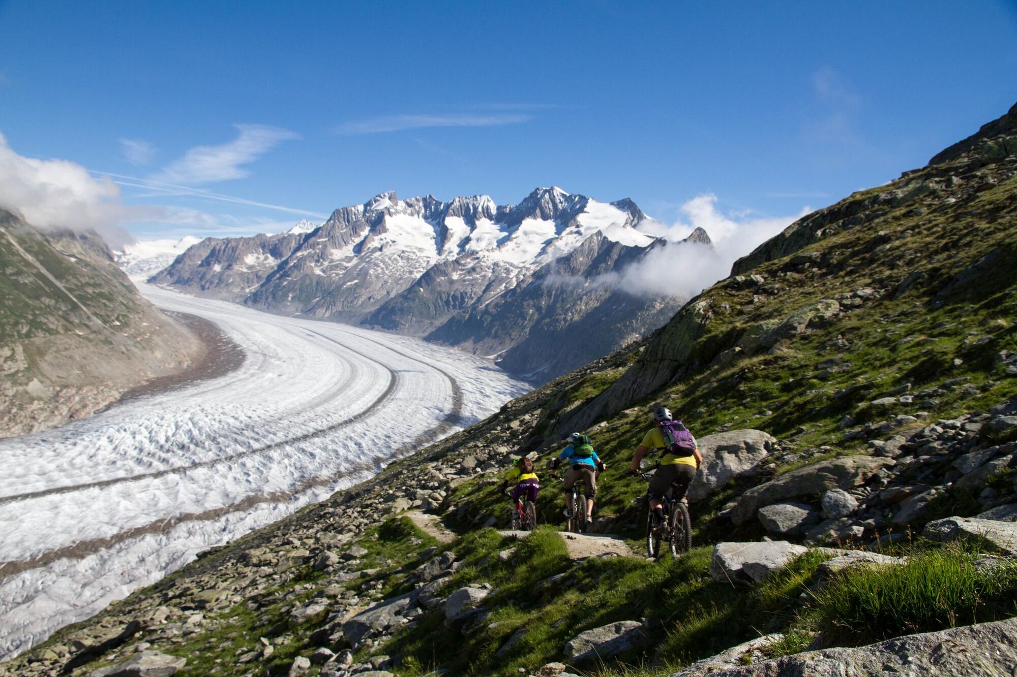
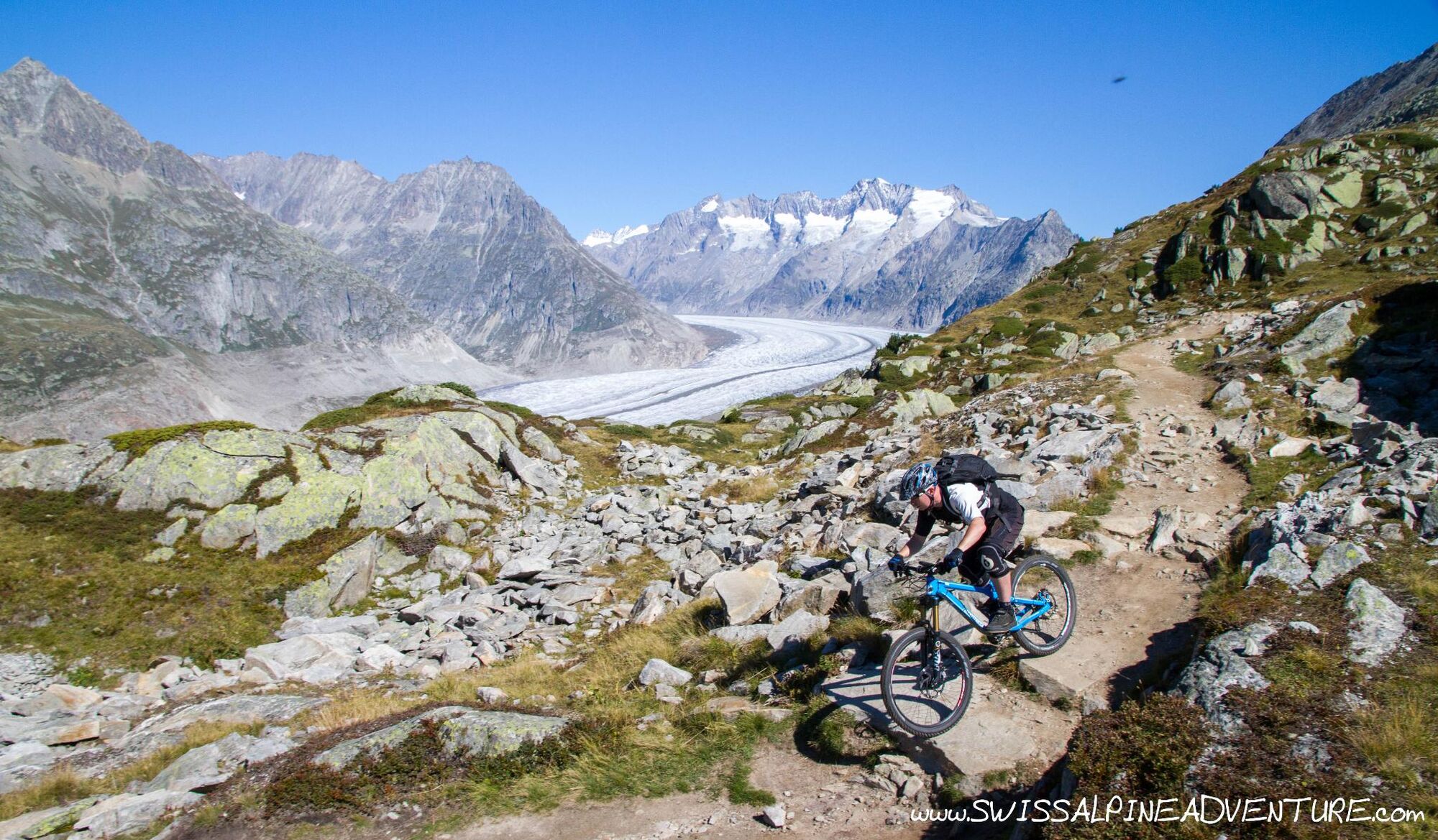
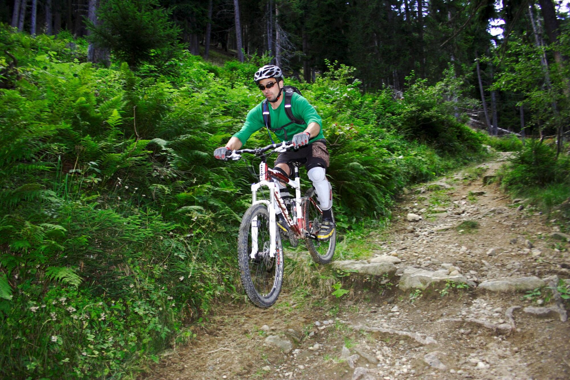
The Aletsch glacier is the longest glacier in Europe and the network of trails above the villages of Bettmeralp and Riederalp provide a unique possibility to ride your bike with one of the most spectacular backdrops imaginable. This tour is only suitable for technically good mountain bikers who are used to riding in a high alpine environment.
- Directions
-
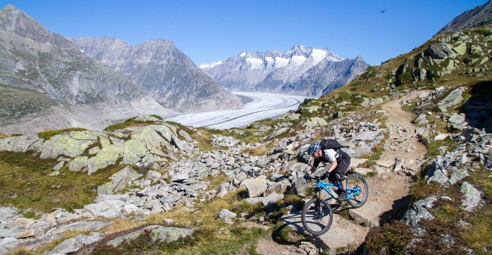
Take the cable car from Bettmeralp up to Bettmerhorn. At Bettmerhorn follow the wooden boardwalk to the glacier viewing area. Take the rocky hiking trail heading towards Fiescheralp and Marjelsee. The trail starts off with big rock slaps but soon turns into a slightly easier dirt trail with some interesting rock features.
The whole way along this trail the views of the glacier are breathtaking. After about 1.5km you will come to a rockslide where the bikes need to be carried for a while. Once you are past the rockslide keep going until you get to the junction at Roti Chumma. From here you can continue towards Fiesch or turn left and ride back towards Riederfurka.
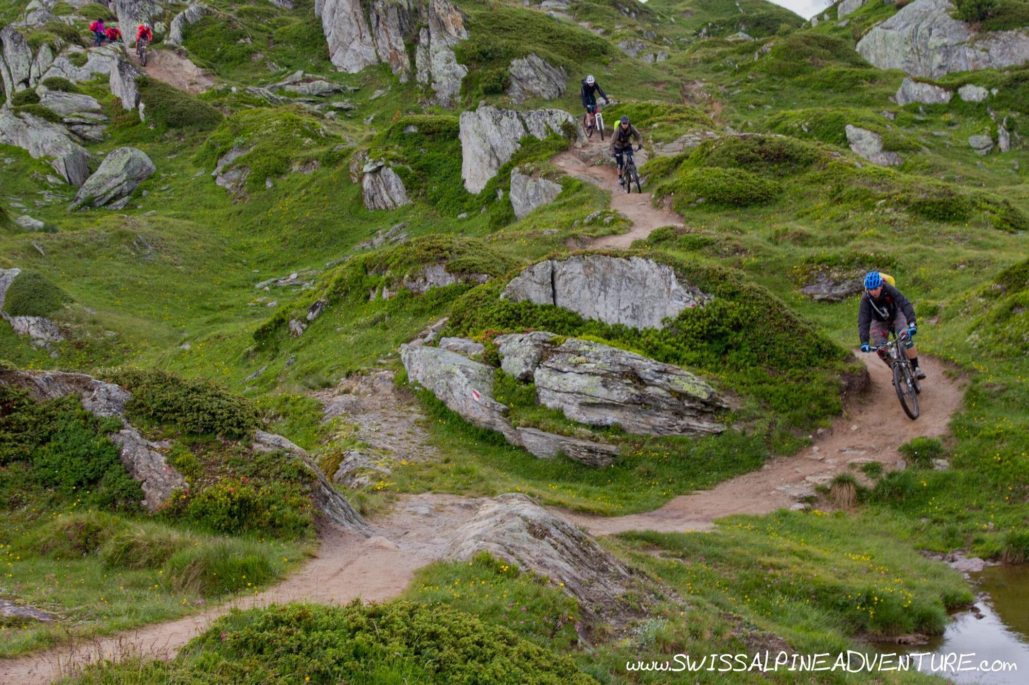
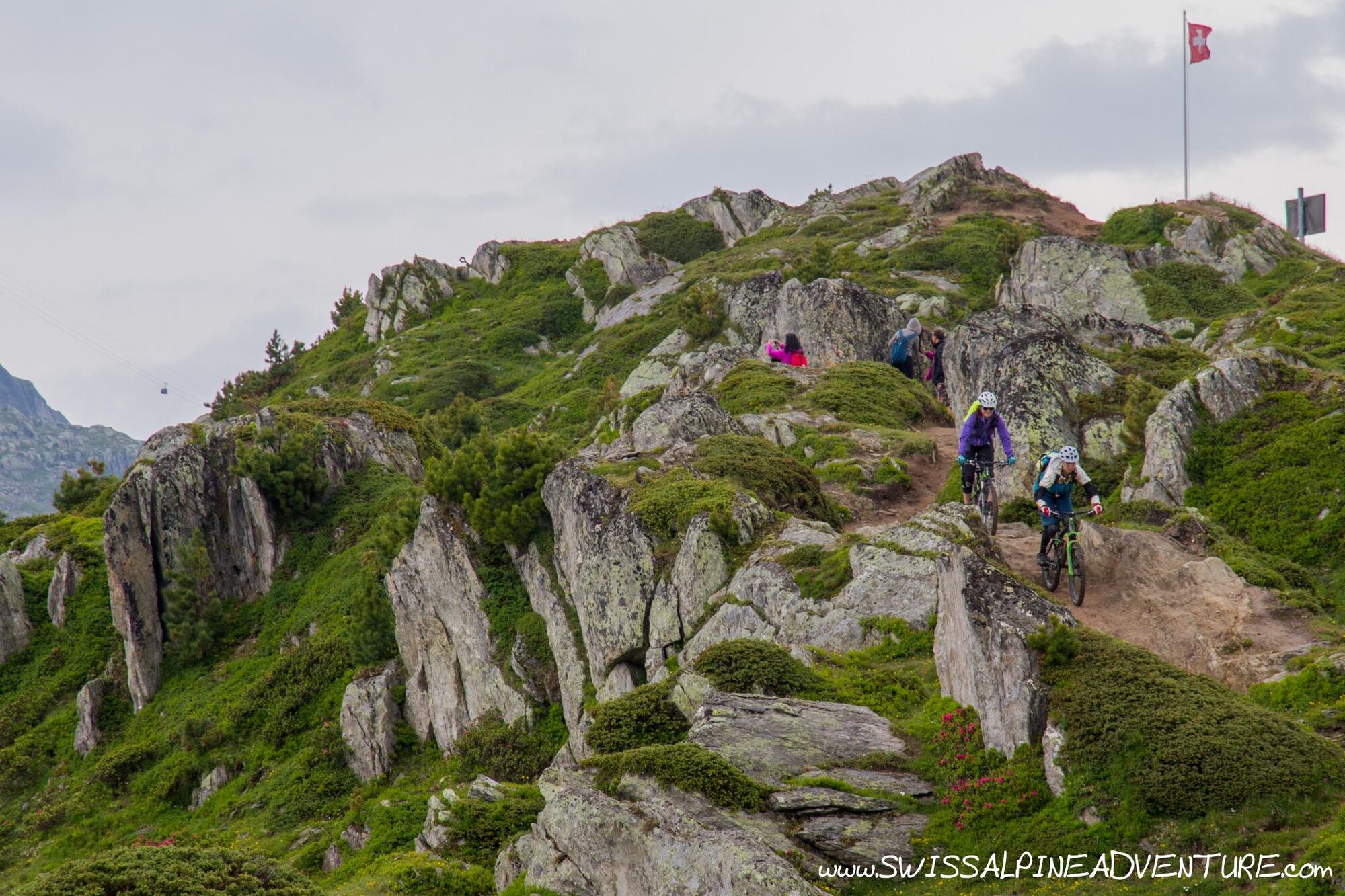
The trail to Riederfurka is undulating but all the time offering stunning views of the glacier. Stay high on the ridge towards Biel and then take the Gratweg trail to Riederfurka.
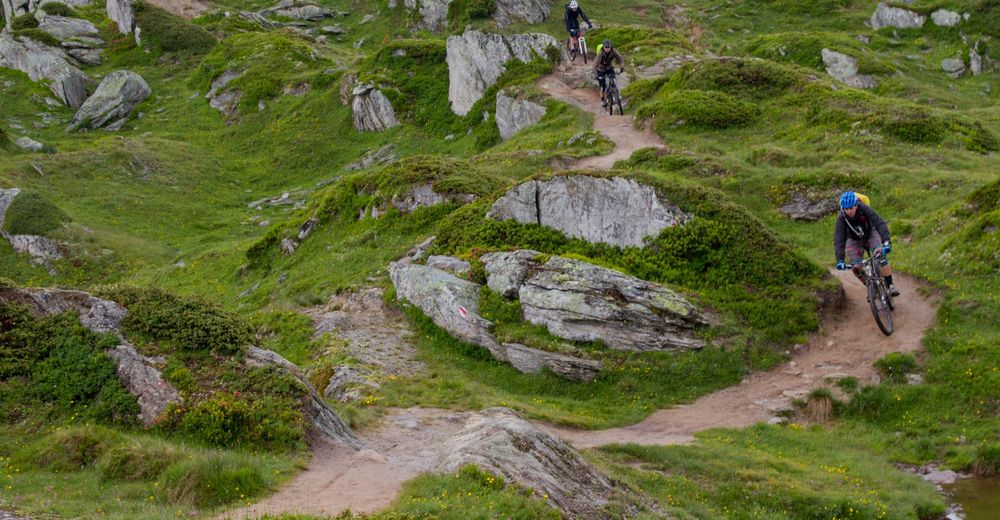
From Riederfurka head towards Riederalp and shortly after Riederalp take the hiking trail to the right towards Ried-Morel. The first section of the hiking trail follows a fire road which turns left into a field after a few hundred metres. After crossing the field turn right and descend on another fireroad for a few hundred metres until you come to a left hand switchback where a singletrail keeps going at the apex of the turn. Take this singletrail following signs for Morel the whole way.At Ried-Morel ride towards the lift station, just before the lift station take a sharp right which leads you down some steps into the village. Just after the steps take the first left down a steep concrete double track which will lead you onto more singletrail to take you down to Morel.
- Highest point
- 2,650 m
- Endpoint
-
Mörel
- Height profile
-
 © outdooractive.com
 - Equipment
-
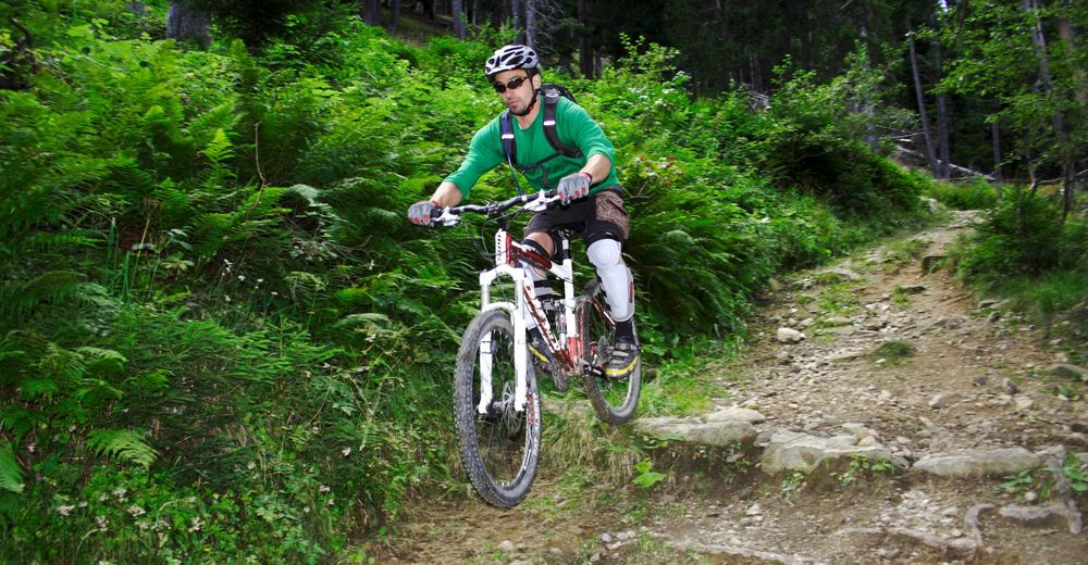
An "All Mountain" or "Enduro" bike is recommended for this trail. Unless you are a technically very capable rider I would not recommend attempting to ride this route on an XC style bike.
- Safety instructions
-
The first section of this trail is exposed and rocky. A fall could lead to serious injury. This route is only for advanced mountain bikers.
- Tips
-
There are a number of options for tours in the Aletsch area. This one gives a taste of a lot of what's on offer.
- Additional information
- Directions
-
In summer when Furkapass is open take the A4/A2 as far as Göschenen then leave the Autobahn and drive past Andermatt and over the Furkapass. Drive down the Rhone Valley as far as the Betten valley station. (Cablecar to Bettmeralp). Take the Cablecar to Bettmeralp then ride 5 minutes up through the village to the Bettmerhorn Gondola.
- Public transportation
-
There is a regular train service from Zurich to Brig every hour (2 minutes past the hour). In Brig you can take the Matterhorn Gotthard Bahn to Betten Valley Station. Take the Cablecar to Bettmeralp then ride 5 minutes up through the village to the Bettmerhorn Gondola.
- Parking
-
Parking is available in Mörel and in Betten at the valley stations of the Gondolas to Riederalp and Bettmeralp respectively.
-

-
AuthorThe tour Aletsch Glacier is used by outdooractive.com provided.

Surfaces
General info
-
Aletsch Arena
129
-
Brig Simplon
52
-
Bettmeralp
14