

- Brief description
-
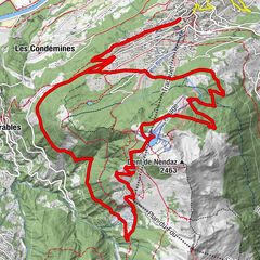
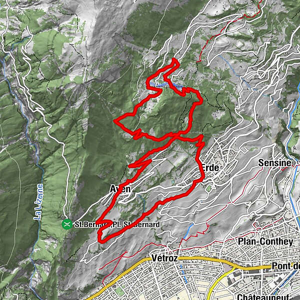
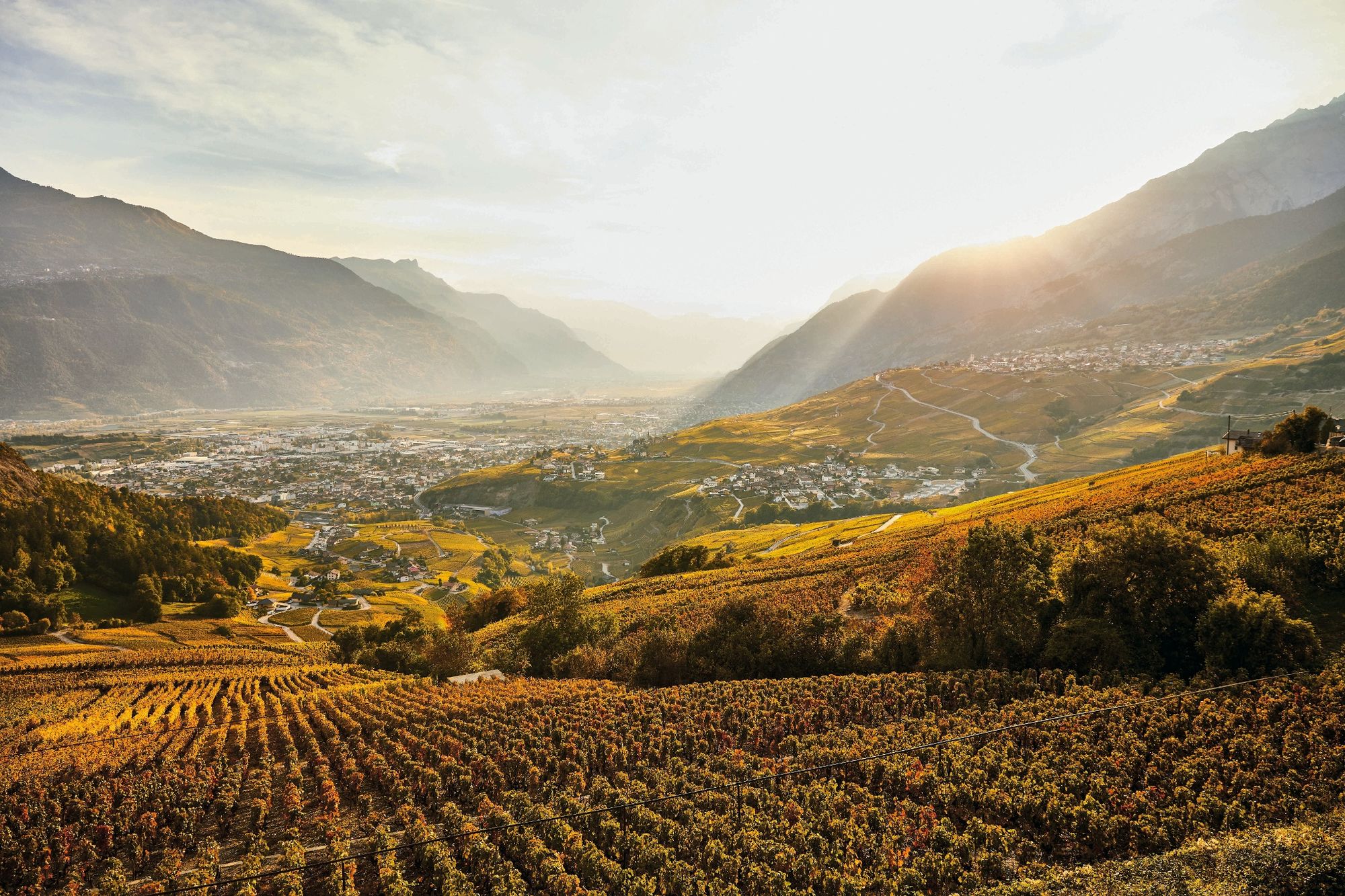
Tour in the region of the Mayens de Conthey, consisting of a rather demanding climb and a scenic descent.
- Difficulty
-
medium
- Rating
-
- Starting point
-
Erde
- Route
-
Aven0.0 kmLes Sapins0.0 kmLe Prâly1.7 kmPremploz9.6 kmErde10.2 kmAven14.1 kmLes Sapins14.1 km
- Best season
-
JanFebMarAprMayJunJulAugSepOctNovDec
- Description
-
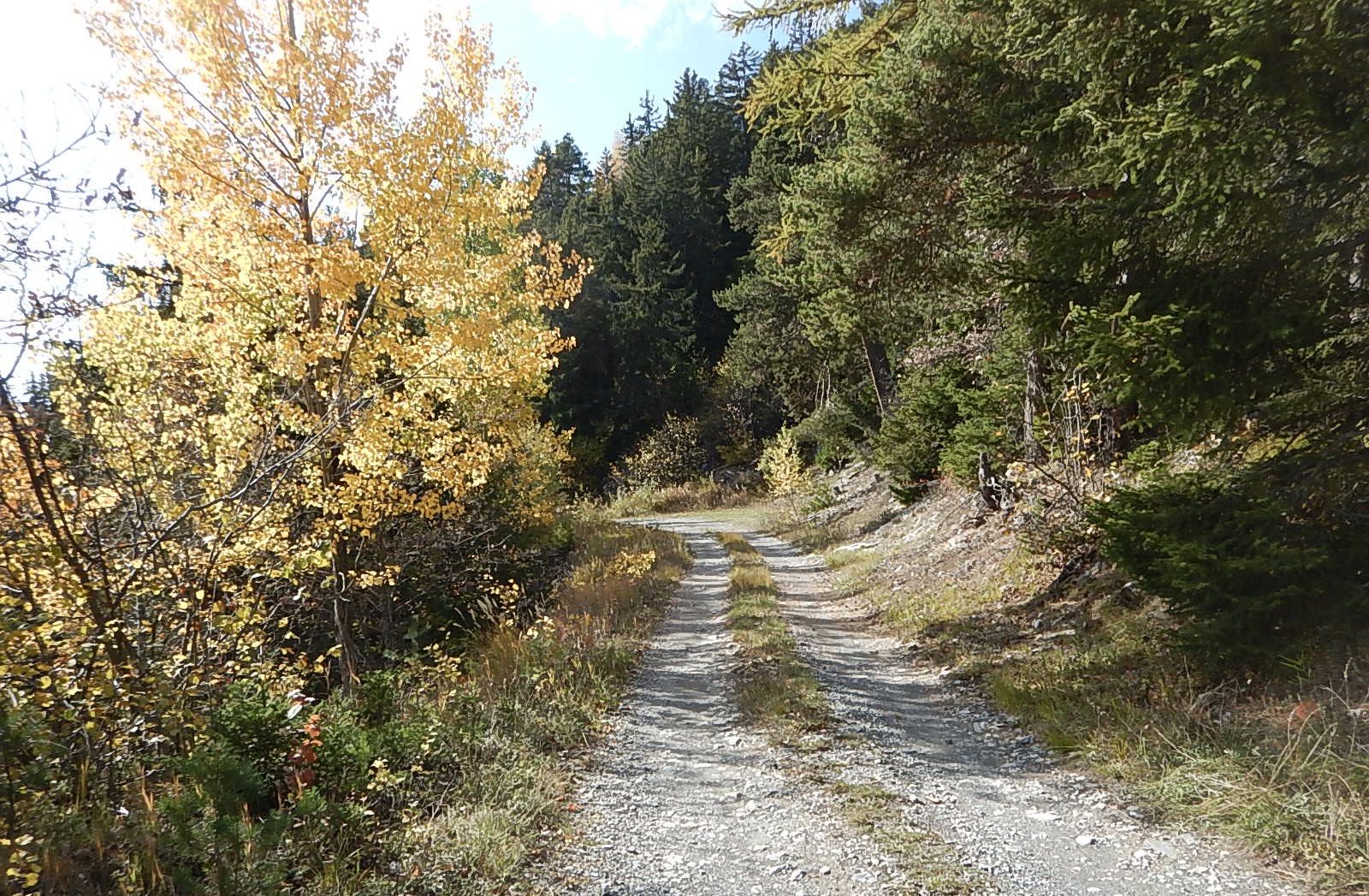
This itinerary in the region of the Mayens de Conthey features a rather demanding ascent and relatively easy descent, and consists mainly of forest roads and some singletrack sections. The route is fairly short but leads through a wonderfully varied landscape, between vineyards and forest.
- Directions
-
Choose your starting point depending on fitness level and how far you would like to ride: for the full tour, begin in Erde, otherwise start and finish in Aven for a shorter ride, omitting the lowest section. Follow the mountain road that climbs up to the hamlet of Code before descending along forest roads and some singletracks sections. This route is also suitable for electric bikes; the descents, partly off the beaten track, do not present special difficulties.
- Highest point
- 1,431 m
- Endpoint
-
Erde
- Height profile
-
 © outdooractive.com
 - Equipment
-
We recommend: a bike in excellent working order, a helmet, gloves and a bell, clothing suitable for the weather (always carry a waterproof), food and drink.
- Safety instructions
-
Use marked bike trails and routes only, making sure you observe all signposting. Kindly close gates after passing through. Please be considerate to walkers, as well as to plants and animals. As a rule, walkers have priority. When planning, take into account participants’ fitness level and ability. All riding is at one’s own risk.
- Tips
-
Don’t hesitate to combine this tour with others in the region.
- Additional information
- Directions
-
Motorway A9 until exit 25 Conthey, then follow in the direction of Erde.
- Public transportation
-
Train to Sion, then postal bus from Sion station to Erde.
Train to Châteauneuf then postal bus from Châteauneuf to Erde.
- Parking
-
Follow the local parking directions.
- Author
-
The tour Tour de Code is used by outdooractive.com provided.


General info
-
Thyon les Collons
182
-
Coteaux du Soleil
50
-
Vétroz
7