
- Brief description
-
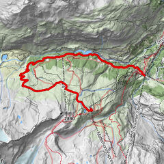
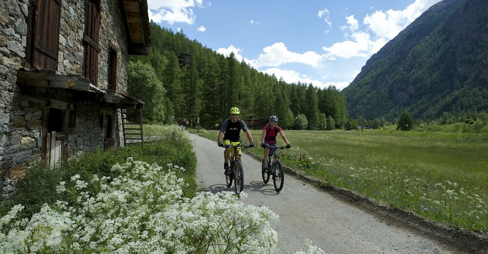
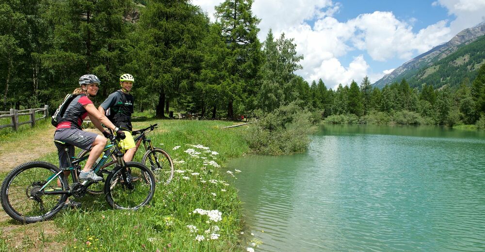
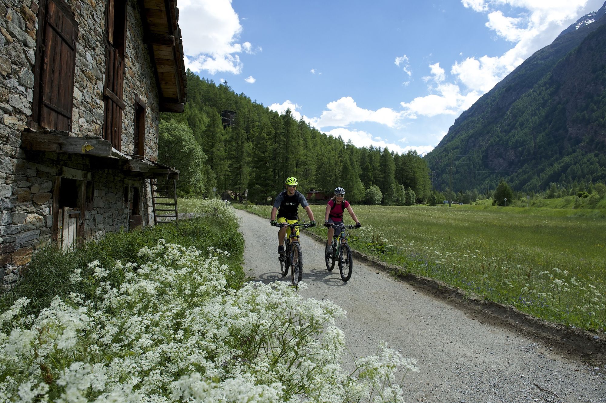
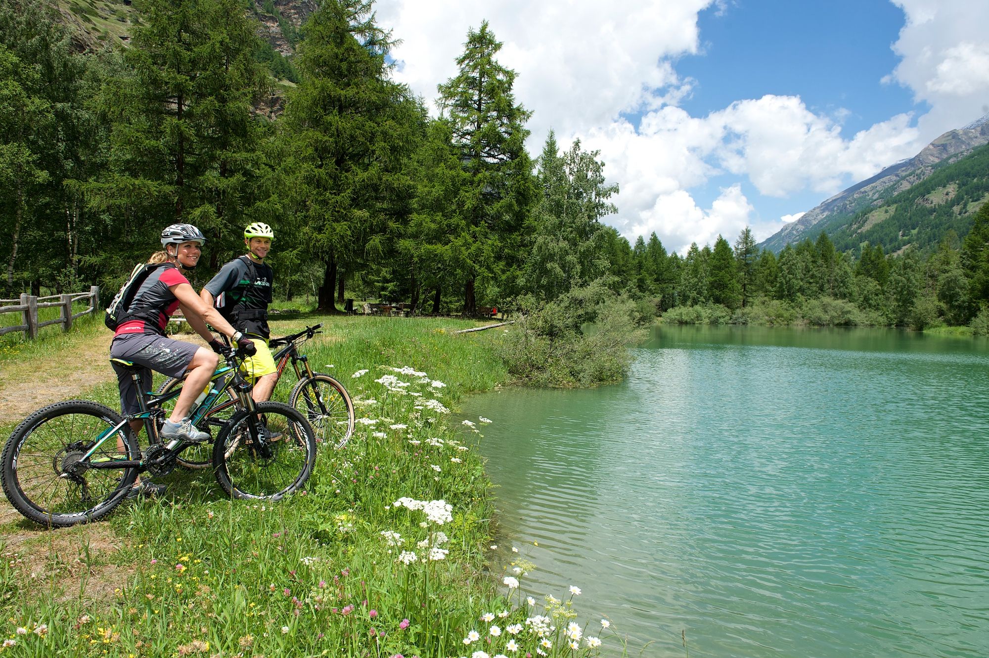
The Täsch-Randa circuit is perfect for the whole family. It leads along the valley floor through forests, along meadows and through typical Valais mountain villages.
- Difficulty
-
easy
- Rating
-
- Starting point
-
Täsch (1,450 m)
- Route
-
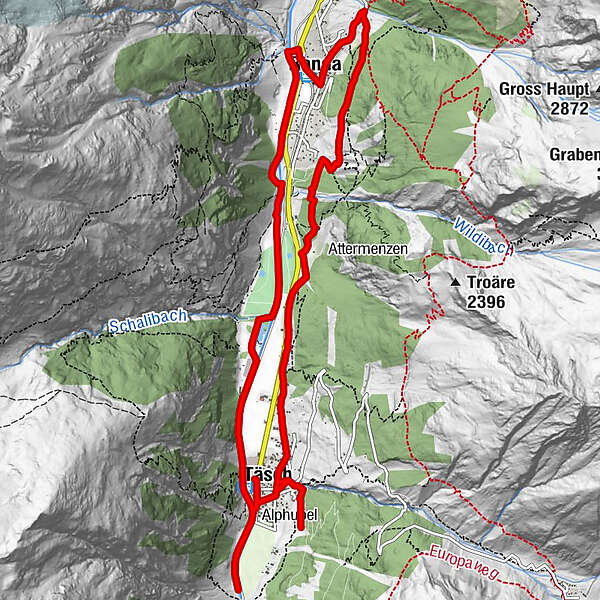
Täsch (1,449 m)0.0 kmRestaurant Walliserkanne0.1 kmTäscherhof0.1 kmTäsch (1,438 m)0.5 kmRanda4.9 kmRanda (1,406 m)5.0 kmTreff 4945.3 kmKirche St. Sebastian5.3 kmCamping8.5 kmTäsch (1,449 m)10.6 kmTäscherhof14.2 kmRestaurant Walliserkanne14.2 km
- Best season
-
JanFebMarAprMayJunJulAugSepOctNovDec
- Description
-
This leisurely ride leads along the Vispa river and, on the other side of the valley, past meadows and scattered mountain forests.
One of the highlights of this bike tour from Täsch to Randa is the view of the Randa landslide. A vast cone of fallen rock, with boulders as big as houses, bears witness to the cataclysm of 1991. A large chunk of the mountain descended in three slides, burying the railway, road and the Vispa river. Miraculously, no one was hurt. The bike trail leads past the spectacular sight.
Many shady spots and barbecue sites ideal for resting and picnicking Wealth of alpine flora Alternating sunny and shady stretches This route can also be ridden on an E-Bike - Directions
-
Täsch (station) - Schali - Randa - Mettelbrücke - Täsch (station)
Variant 1: At Holzji in Randa, the steep section can be bypassed on the easier wide road towards Randa village (signposted)Variant 2: Start and finish the trip in Zermatt, either riding along the Teerstrasse to Täsch or taking a shuttle train of the Matterhorn Gotthard Bahn.
- Highest point
- 1,571 m
- Endpoint
-
Täsch (1,450 m)
- Height profile
-
 © outdooractive.com
 - Equipment
-
We recommend:
Bike in excellent working order Helmet, gloves and (trail) bell Repair kit in case of any defects Clothing suitable for the weather (always carry a waterproof) Food and drink - Safety instructions
-
Always wear gloves and a helmet. Use marked bike trails and routes only, and observe all signposting. Please close gates after passing through. Please be considerate to walkers and to plants and animals. As a rule, walkers have priority. When planning, take into account participants’ fitness level and ability: some routes lead above 3,000 metres. All riding is at one’s own risk.
Tip: “Be searchable”. Equip yourself with an additional RECCO rescue reflector*. Whether summer or winter. Available in our Online-Shop or our information desk. *The additional reflector does not replace an avalanche beacon.
- Tips
-
Additional information and recommendations are available from the guest information centre near Täsch station.
- Additional information
- Directions
-
The drive from Visp to Täsch takes about 30–40 min. The road leads through the wild and beautiful Mattertal valley.
- Public transportation
-
The drive from Visp to Täsch takes about 30–40 min. The road leads through the wild and beautiful Mattertal valley. By train to Täsch: less than 3½ hours from Zürich airport or 4 hours from Geneva airport. Change at Visp onto the Matterhorn Gotthard Bahn (Matterhorn Gotthard Railway). From Visp, the railway leads through the Mattertal valley past idyllic small villages to Täsch.
- Parking
-
Täsch has car parks with both covered and open-air parking – e.g. at the Matterhorn Terminal or privately operated facilities.
- Author
-
The tour Täsch-Randa-Täsch Bike Tour (Nr. 31) is used by outdooractive.com provided.


General info
-
Oberwallis
211
-
Mattertal
62
-
Täsch
37