
- Brief description
-
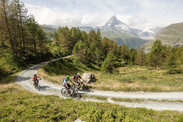
The ride up to Täschalp and deep into the valley begins with an ascent of the slopes above Täsch, mostly following small mountain roads. The climb is technically straightforward and boosts fitness.
- Difficulty
-
difficult
- Rating
-
- Starting point
-
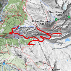
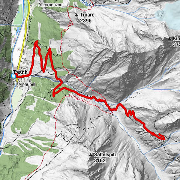
Täsch (1,450 m)
- Route
-
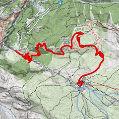
Restaurant Walliserkanne0.1 kmTäsch (1,449 m)0.2 kmEggenstadel4.4 kmTäschalp Restaurant & Lodge6.9 kmOttafe (2,205 m)7.1 kmTäschhütte (2,701 m)10.0 km
- Best season
-
JanFebMarAprMayJunJulAugSepOctNovDec
- Description
-
The Matterhorn Gotthard Bahn shuttle takes you to Täsch. Alternatively, you can ride the trail (route 20) to Täsch. From Täsch train station, the route heads through the village and soon starts to climb up the paved road. The majority of the road up to Täschalp winds through the forest. On hot summer days, the sections in the shade are very welcome.
The Täschalp taxi is a motorised way to help overcome the initial elevation gain to Täschalp. A reservation with the Täsch information office on +41 27 966 81 10 is essential.
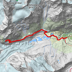
On Täschalp, there are some small chalets and a chapel. The view of the Weisshorn on the opposite side of the valley is incredible. It's well worth stopping for a rest.
The trail continues up to the Täschhütte and is very steep in places. On the way up, another highlight of the route is the stunning view down onto the plain around the Mellichbach river.
This route can also be ridden on an E-BikeSuggestion: If you don't want to bike the last steep section from Täschalp to the Täschalp hut, you can head from Täschalp through the valley (towards Pfulwe). The trail runs parallel to the Mellichbach river, climbing gently into the valley for a little over 3 km. Being in the valley surrounded by the incredible mountains makes you feel very small! If the trail becomes too steep to ride up, then simply turn around.
- Directions
-
Täsch - Täschalp (Ottavan) - Täschhütte
Variant 1: Start and finish the trip in Zermatt, either riding along the Teerstrasse to Täsch or taking a shuttle train of the Matterhorn Gotthard Bahn.Suggestion: Täschalp to Mellichsand (approx. 3 km)
- Highest point
- 2,701 m
- Endpoint
-
Täsch Hut (2,701 m)
- Height profile
-
 © outdooractive.com
 - Equipment
-
We recommend:
Bike in excellent working order Helmet, gloves and (trail) bell Repair kit in case of any defects Clothing suitable for the weather (always carry a waterproof) Food and drink - Safety instructions
-
Always wear gloves and a helmet. Use marked bike trails and routes only, and observe all signposting. Please close gates after passing through. Please be considerate to walkers and to plants and animals. As a rule, walkers have priority. When planning, take into account participants’ fitness level and ability: some routes lead above 3,000 metres. All riding is at one’s own risk.
Tip: “Be searchable”. Equip yourself with an additional RECCO rescue reflector*. Whether summer or winter. Available in our Online-Shop or our information desk. *The additional reflector does not replace an avalanche beacon.
- Tips
-
At Täschalp there is a cheese dairy where cheese and Ziger (soft cheese) can be bought from.
- Additional information
- Directions
-
The drive from Visp to Täsch takes about 30–40 min. The road leads through the wild and beautiful Mattertal valley.
- Public transportation
-
The drive from Visp to Täsch takes about 30–40 min. The road leads through the wild and beautiful Mattertal valley. By train to Täsch: less than 3½ hours from Zürich airport or 4 hours from Geneva airport. Change at Visp onto the Matterhorn Gotthard Bahn (Matterhorn Gotthard Railway). From Visp, the railway leads through the Mattertal valley past idyllic small villages to Täsch.
- Parking
-
Täsch has car parks with both covered and open-air parking – e.g. at the Matterhorn Terminal or privately operated facilities.


- Author
-
The tour Täsch-Täsch Hut Bike Tour (Nr. 25) is used by outdooractive.com provided.


General info
-
Oberwallis
211
-
Mattertal
62
-
Täsch
37