
- Brief description
-
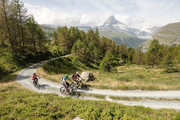
This route from Grächen to Mattsand is a classic enduro descent with plenty of trails and a spectacular view of the mountains surrounding the Mattertal Valley.
- Difficulty
-
medium
- Rating
-
- Starting point
-
Grächen
- Route
-
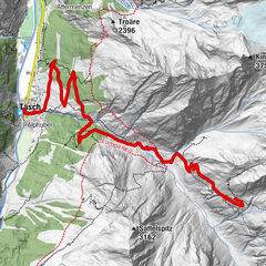
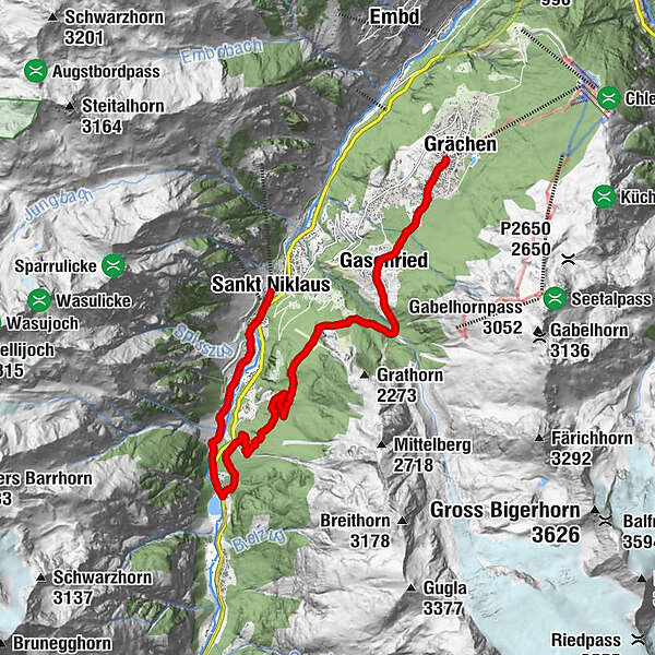
GrächenKirche Grächen0.1 kmErbji1.8 kmChäschermatte2.0 kmGasenried2.2 kmRiederstübli2.5 kmBalmu7.0 kmMamma Mia10.3 kmSchwiedernen11.8 kmStahlen12.3 kmRestaurant Monte Rosa13.6 kmSankt Niklaus13.7 km
- Best season
-
JanFebMarAprMayJunJulAugSepOctNovDec
- Description
-
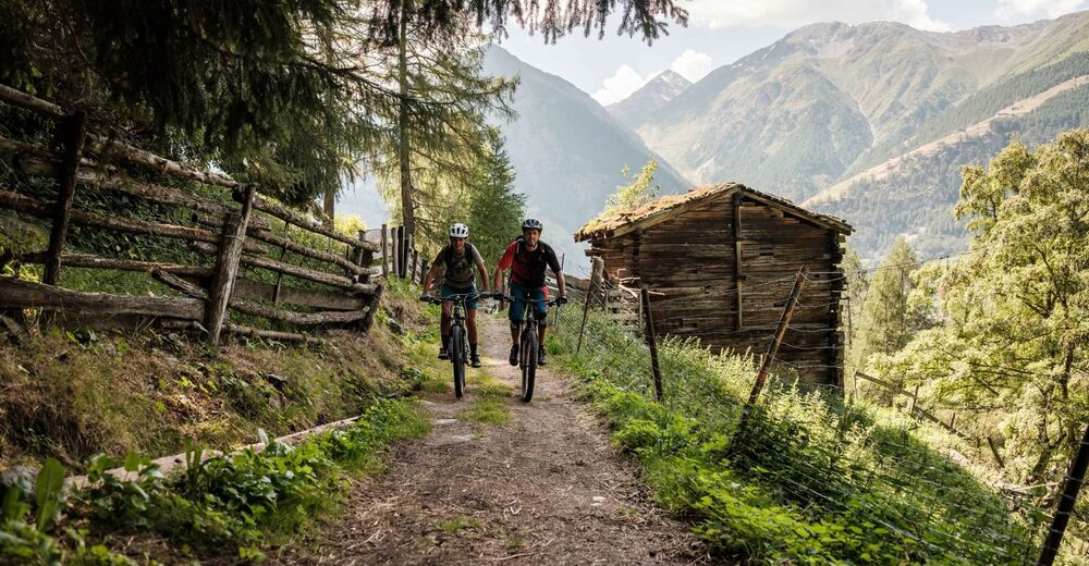
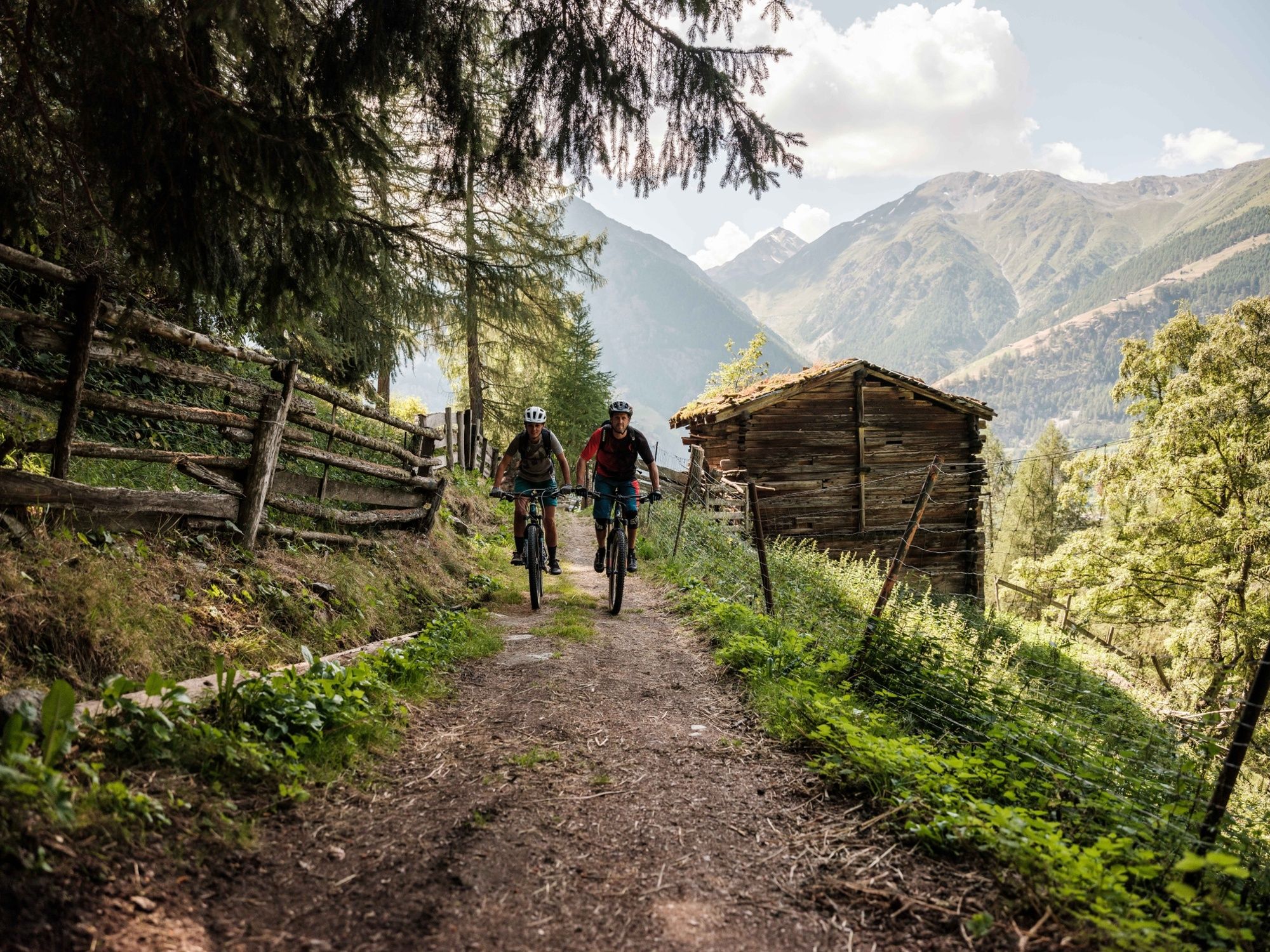
The first section of the route begins at the heart of the idyllic mountain village of Grächen, before moving on to Schalbettu via Gasenried, climbing gently over gravel paths and passing through an enchanting stretch of forest. After Schalbettu, the route crosses the Riedbach river and continues on the gravel path for a few hundred metres before leading onto a wonderful trail that hugs the mountainside for its first two kilometres and continues into the Mattertal Valley. If that doesn’t leave you short of breath, the high-Alpine panorama with views of iconic mountains such as the Weisshorn and the Zinalrothorn should do the trick. Simply breathtaking. Once you reach the Balmu region, there are downhill sections and trails to enjoy. The top-quality single trail to Mattsand is varied and full of surprises, promising unlimited fun for bikers. From Mattsand, you can return to St. Niklaus or join the Visp–Zermatt connecting trail (No. 150).
- Directions
-
The route is signposted in one direction only: Grächen -> Gasenried -> Mattsand
- Highest point
- 1,678 m
- Endpoint
-
St.Niklaus
- Height profile
-
 © outdooractive.com
 - Equipment
-
We recommend: a bike in excellent working order, a helmet, gloves and a bell, clothing suitable for the weather (always carry a waterproof), food and drink.
- Safety instructions
-
Use marked bike trails and routes only, making sure you observe all signposting. Kindly close gates after passing through. Please be considerate to walkers, as well as to plants and animals. As a rule, walkers have priority. When planning, take into account participants’ fitness level and ability. All riding is at one’s own risk.
- Tips
-
Head to St. Niklaus to visit the world’s only Museum of Mountain Guiding. It is housed in the Meierturm, the Mattertal Valley’s oldest surviving building.
- Additional information
- Directions
-
Ideally go to St. Niklaus.
- Public transportation
-
Regular rail connections from across Switzerland to St. Niklaus. Continue by postal bus to Grächen. Remember to reserve your space for bike transport on bus.
- Parking
-
Parking spaces available in the car parks and on the car park roofs at St. Niklaus, Herbriggen and Ried.
- Author
-
The tour Mattsand Enduro is used by outdooractive.com provided.


Surfaces
General info
-
Oberwallis
211
-
Unterbäch
106
-
Grächen - St. Niklaus
16