
- Brief description
-
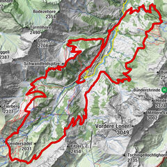
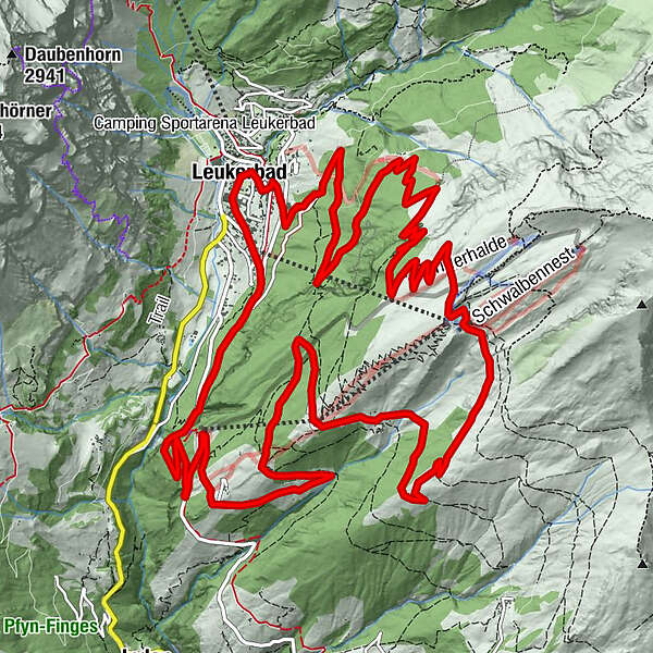
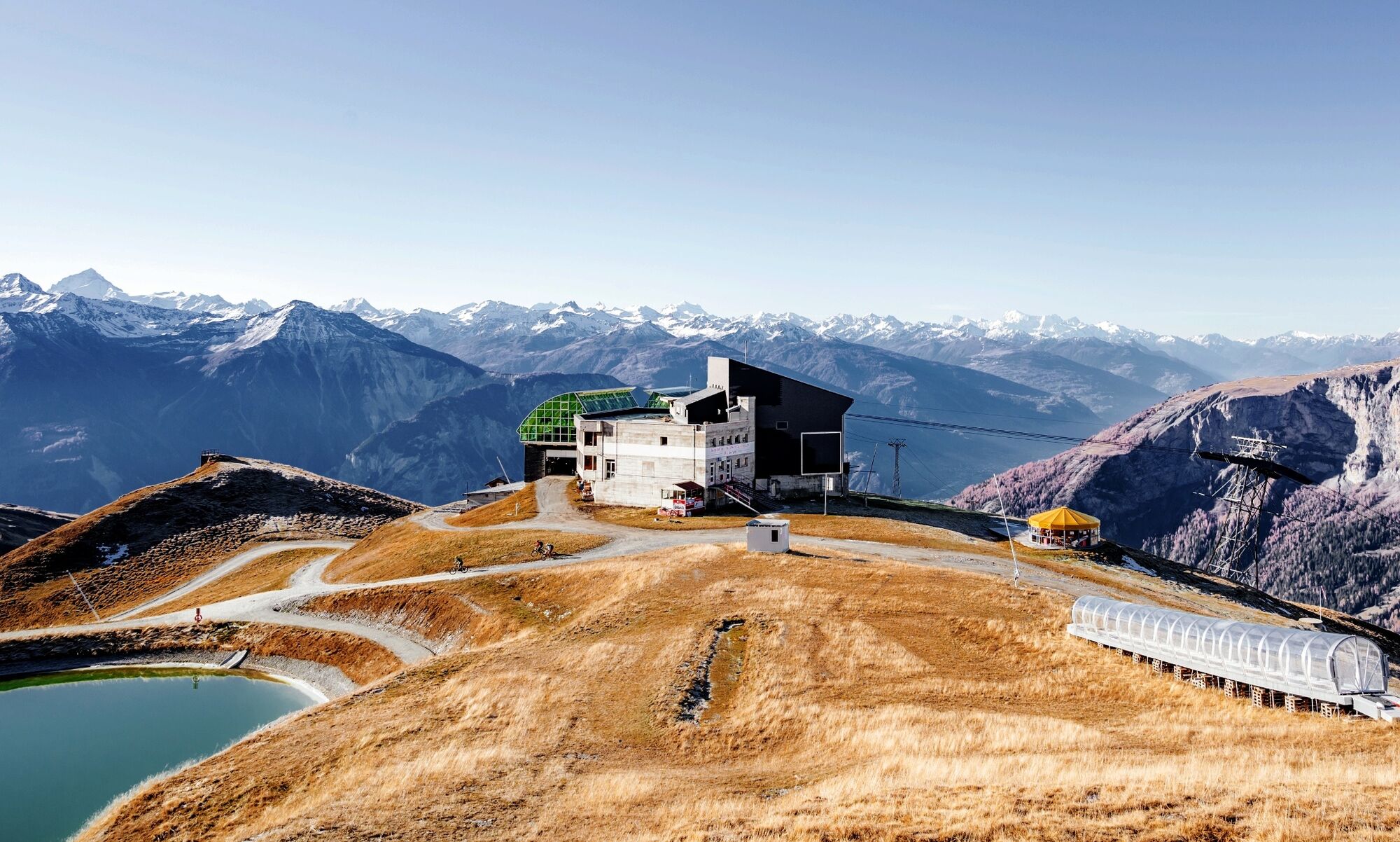
Conquer the Torrent region and the Rinderhütte mountain station (2350 m) - the starting point of numerous other biking routes - under your own muscle power.
- Difficulty
-
medium
- Rating
-
- Starting point
-
Leukerbad
- Route
-
Loèche-lès-Bains (1,402 m)0.0 kmHotel Restaurant Flaschen4.1 kmFlaschen4.2 kmAlpengruss8.6 kmBriand8.7 kmTorrentalp (1,928 m)8.9 kmLoèche-lès-Bains (1,402 m)22.0 km
- Best season
-
JanFebMarAprMayJunJulAugSepOctNovDec
- Description
-
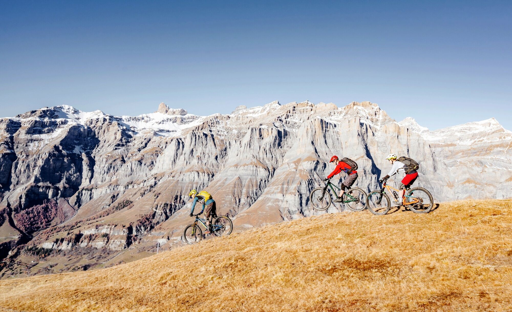
What the cable car can do, you can do yourself? Then let's do it! On this technically easy loop, the focus is for once on the metres in altitude and a phenomenal view. But this must first be earned over an ascent of 1000 metres in altitude. Once you arrive at the Rinderhütte mountain station, you also have the option of joining another bike tours. Otherwise, let it whiz as planned along a scenic mountain and forest road down to the village of Leukerbad.
- Directions
-
The route starts at the town hall and leads past the valley station of the Leukerbad cable car. A short nature trail takes you to the main road in the direction of Albinen and from here you pedal upwards through the tunnel (next to the scales of albinen) and branch off to the left to the Flaschen valley station. Via the narrow, asphalted side road with a steady incline, you wind your way up to the idyllic "Torrentalp". Via the panoramic path you finally reach the Rinderhütte mountain station.
The descent leads along a natural mountain road and later along a forest path down into the valley. Via "Folljeret" and the restaurant Weidstübli you rush back to the village of Leukerbad. The descent is steeper and somewhat rougher than the ascent, but is not really a technical challenge.
Make sure you have good brakes and that there are also scooters and hikers on this route. Mutual consideration and tolerance are important.
- Highest point
- 2,310 m
- Endpoint
-
Leukerbad
- Height profile
-
 © outdooractive.com
 - Equipment
-
We recommend: bike in excellent working order, helmet, gloves and bell, clothing suitable for the weather (always carry a waterproof), food and drink.
- Safety instructions
-
Use marked bike trails and routes only, and observe all signposting. Please close gates after passing through. Please be considerate to walkers and to plants and animals. As a rule, walkers have priority. When planning, take into account participants’ fitness level and ability. All riding is at one’s own risk.
- Tips
-
Those who want it even tougher can also tackle the loop in the opposite direction. The Flowtrail or Torrentrail Short is recommended for the descent. In this case, be aware of the oncoming traffic of monster scooters and scooters on the way up.
- Additional information
-
The tourist office in Leukerbad will be happy to provide information material and can give detailed information about the route.
- Directions
-
From Basel and Zurich: A1 motorway to Bern; A6 to Spiez; direction Kandersteg; car transport Kandersteg - Goppenstein; direction Gampel; Leuk - Leukerbad.
From Geneva: Motorway A1 to Lausanne; direction Sion/Sierre; Leuk - Leukerbad
From Milan: Motorway A8/A26 direction Simplon; car transport from Iselle - Brig; direction Leuk - Leukerbad
- Public transportation
- Parking
-
Various parking options in the village of Leukerbad. Follow the local parking guidance system.
Car parks in Leukerbad: Sportarena parking, Rathaus parking, Torrent parking, Leukerbad Therme parking, Alpentherme parking.
- Author
-
The tour Torrent Loop is used by outdooractive.com provided.


General info
-
Oberwallis
211
-
Leuk/Leukerbad
123
-
Leukerbad
60