

- Brief description
-
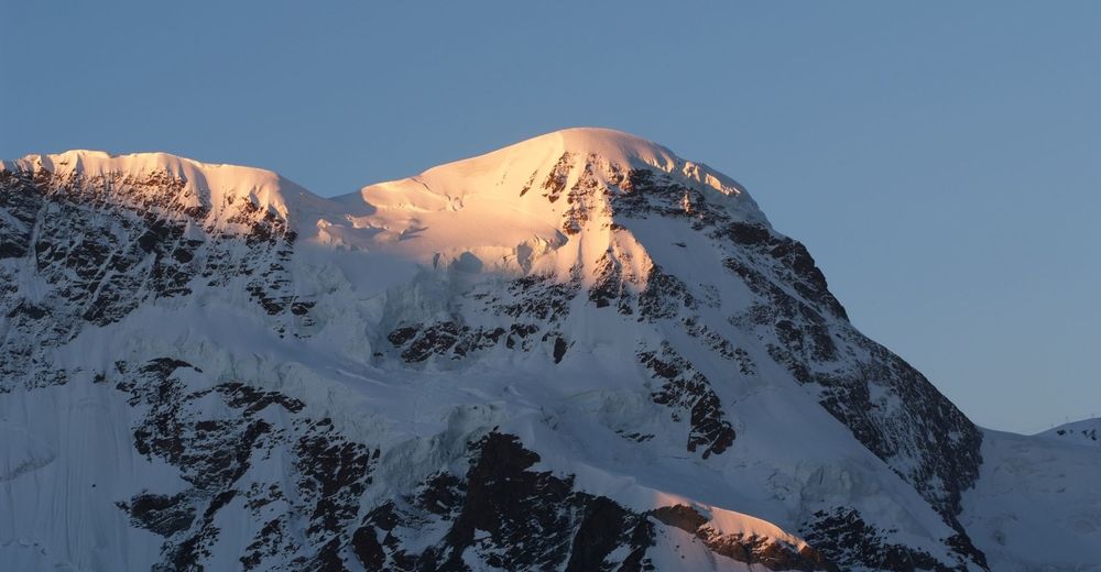
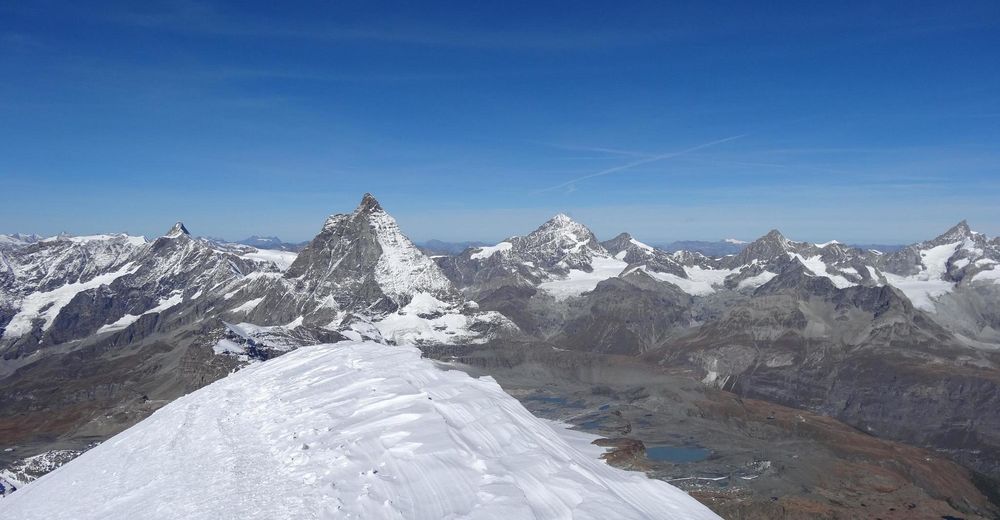
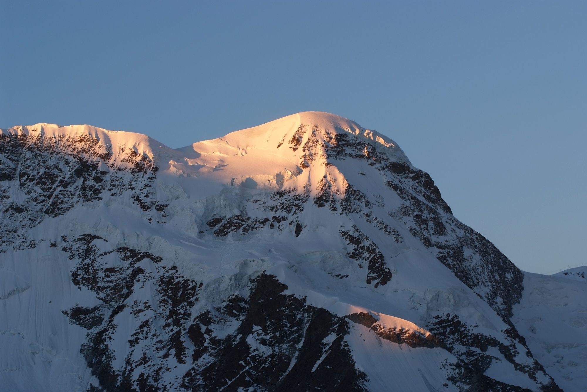
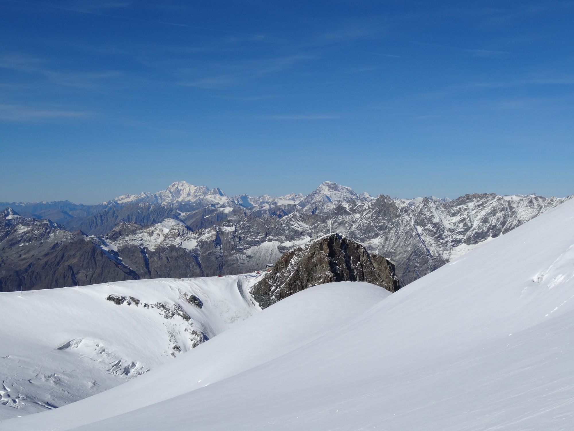
The Breithorn (4,164 m), with its many summits, is a strong, glaciered mountain crest. The normal climb is considered as one of the easiest routes for climbing a four-thousand metre mountain.
- Difficulty
-
medium
- Rating
-
- Starting point
-
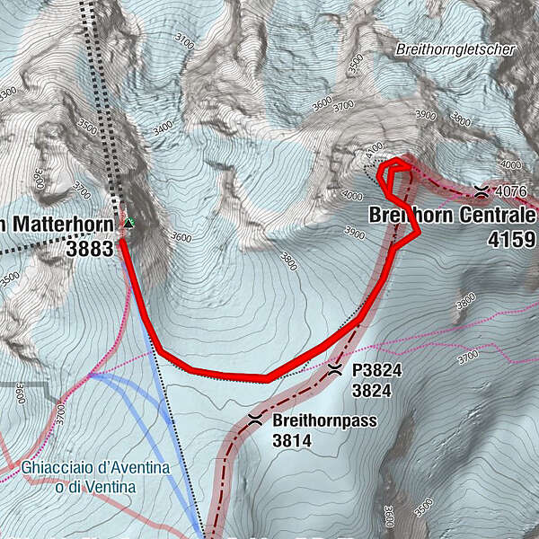
Klein Matterhorn (3,883 m)
- Route
-
P3824 (3,824 m)1.2 kmPiccolo Cervino (3,883 m)5.3 km
- Best season
-
JanFebMarAprMayJunJulAugSepOctNovDec
- Description
-
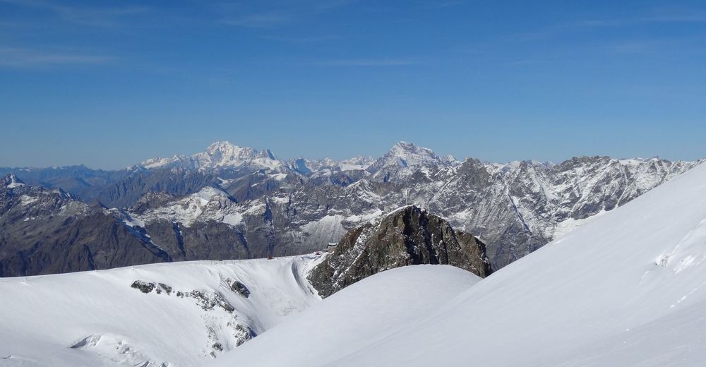
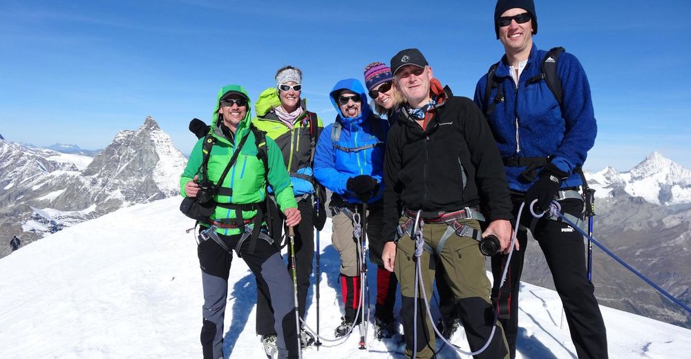
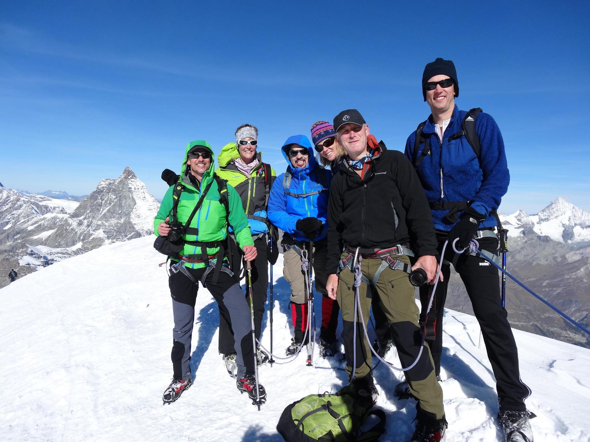
This tour is a perfect way to get a sense of high Alpine air for the first time but only for surefooted and experienced mountain hikers accompanied by a mountain guide. The tour includes climbing a glaciated four thousand-metre peak, and this is not to be underestimated. In the early morning, one takes the aerial tramway to Matterhorn glacier paradise at 3,883 m. The climb to the top and the descent afterwards lasts about three hours depending on the conditions. Even though the climb is not dizzying, the tour does offer a high Alpine mountain experience where one can live out the feeling of having one’s head already in outer space.
Snow tour on the glacier The overall difficulty of the tour is given as “L” (easy) A mountain guide is recommended Warning: glacier crevasses - Directions
-
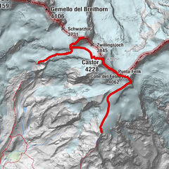
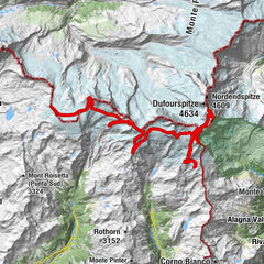
Station Matterhorn glacier paradise (Klein Matterhorn) - traversing of the glacier- ascent to the peak Breithorn - descent and again traversing of the glacier - station Matterhorn glacier paradise (Klein Matterhorn)
We recommend for this tour to book eventually a mountain guide who knows well the place. - Highest point
- 4,143 m
- Endpoint
-
Breithorn (4,164 m)
- Height profile
-
 © outdooractive.com
 - Equipment
-
We recommend:
Climbing boots suitable for use with crampons Climbing harness Crampons 1 ski pole Warm weatherproof clothing Warm full-fingered gloves and hat Sunglasses and sunscreen Thermos flask (approx. 1 litre capacity) Snacks (high energy foods such as chocolate, dried fruit, dextrose etc.) BackpackImportant! Requirement: good physical condition
- Safety instructions
-
Plan every mountain tour carefully and adapt to participants’ fitness level as well as the weather and season. Weather conditions can change quickly in the mountains. Appropriate clothing is therefore essential, along with adequate supplies of food and water. In uncertain weather, turn back in good time. Inform others of planned route, and whenever possible avoid going alone. Do not leave the marked routes; do not venture onto glaciers without a mountain guide. It is forbidden to walk on the ski pistes. Please be considerate to other walkers and to plants and animals. Take note of the warning signs drawing attention to the constant danger in river beds and along watercourses below dams and reservoirs.
Tip: “Be searchable”. Equip yourself with an additional RECCO rescue reflector*. Whether summer or winter. Available in our Online-Shop or our information desk.
*The additional reflector does not replace an avalanche beacon. - Tips
-
We recommend a guided tour with a mountain guide who knows well the place. Further information and mountain guide agency: www.zermatters.ch
Crampons, climbing harnesses and helmets can be rented in different sport shops in the village. - Directions
-
Zermatt is car-free. Private vehicles are permitted only as far as Täsch (5 km before Zermatt). The Täsch–Zermatt road is closed to the public.
Onward travel to Zermatt is either by private taxi or shuttle train. Trains depart every 20 minutes; the journey takes about 12 minutes, and ends at the Bahnhofplatz in Zermatt. - Public transportation
-
By train to the Matterhorn village: 3½ hours from Zürich airport or 4 hours from Geneva airport. Change at Visp onto the Matterhorn Gotthard Bahn (Matterhorn Gotthard Railway). From Visp, the railway leads through the Mattertal valley past idyllic small villages to Zermatt.
Zermatt is also the start and finish point for the world-famous Glacier Express panoramic train journey (Zermatt to St. Moritz or Davos). - Parking
-
Täsch has car parks with both covered and open-air parking – e.g. at the Matterhorn Terminal or privately operated facilities.
Onward travel: see “Getting there”.


- Author
-
The tour Breithorn Ascent is used by outdooractive.com provided.


General info
-
Unterwallis
23
-
Mattertal
25
-
Zermatt
19


, Nordwand und Zmuttgrat (rechts).")