© Anton_S

© Anton_S

© Anton_S

© Anton_S
Tour data
29.22km
1,178
- 1,778m
1,316hm
1,274hm
07:16h

- Brief description
-
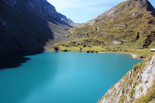
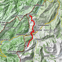
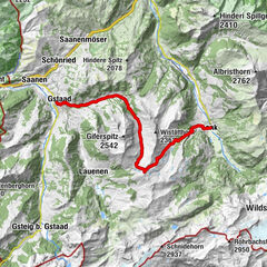
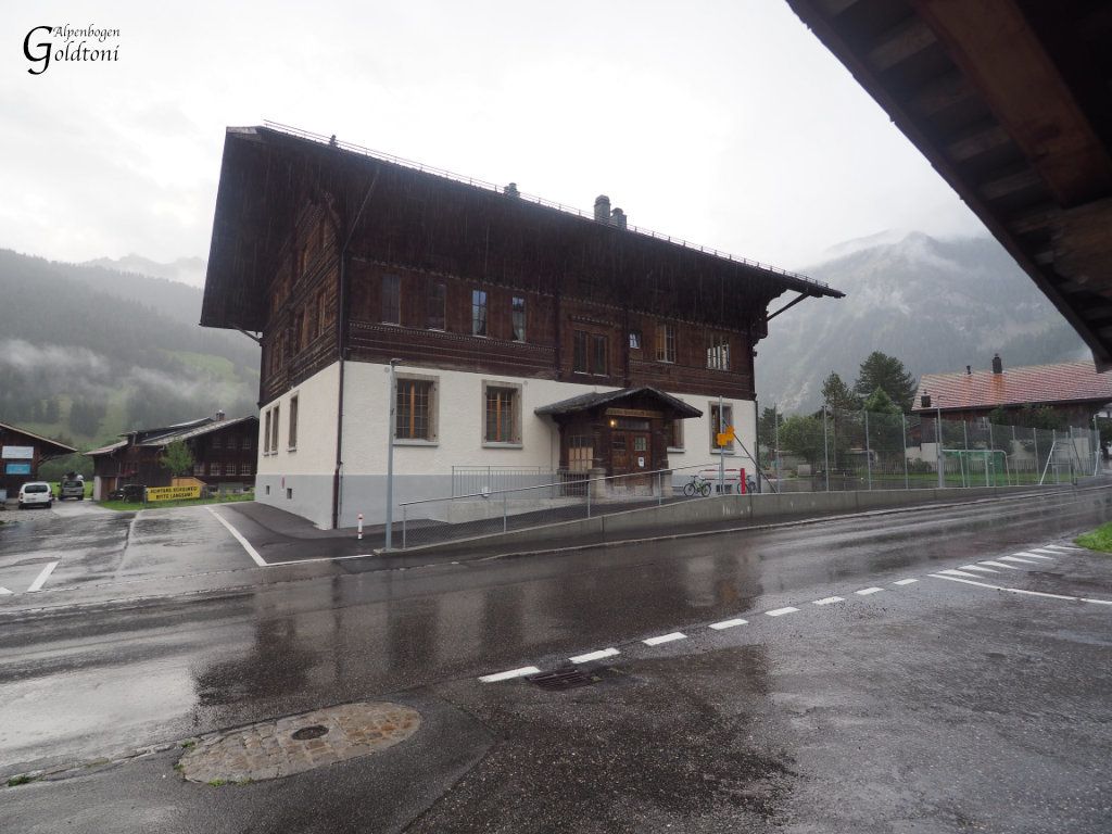
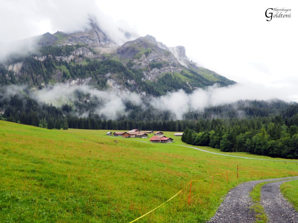
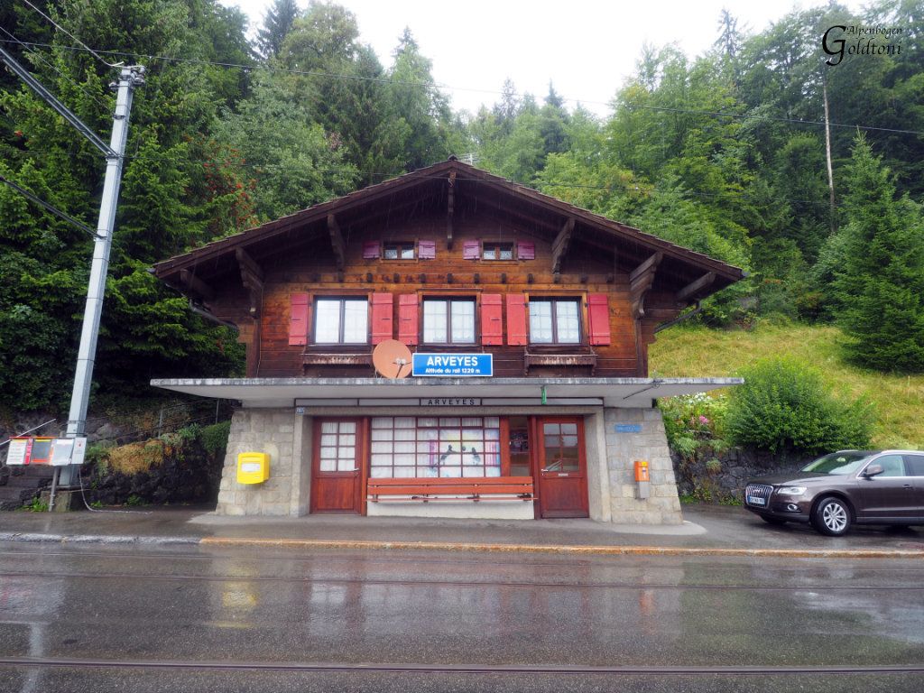
Gsteig(1187)-Allmi(1237)-Reuschalp(1318)-Reusch(1343)-Col du Pillon(1546)-Cascade du Dar(1460)-La Palanche(1257)-Les Diablerets(1177)-Col de la Croix(1778)-Arveyes(1240)
- Difficulty
-
easy
- Rating
-
- Route
-
Sanetsch0.1 kmGsteig b. Gstaad (1,184 m)0.2 kmBären0.3 kmPfrüendli0.6 kmHeiti1.0 kmHeiti1.1 kmRestaurant du Col du Pillon8.6 kmLa Palanche (1,257 m)13.0 kmTréchadèze17.1 kmCol de la Croix (1,776 m)20.4 kmCol de la Croix (1,732 m)21.0 kmLa Rasse25.9 kmArveyes29.2 km
- Best season
-
JanFebMarAprMayJunJulAugSepOctNovDec
- Highest point
- Col de la Croix (1,778 m)
- Source
- Toni Sommer
GPS Downloads

Trail conditions
Asphalt
(25%)
Gravel
(25%)
Meadow
(25%)
Forest
(25%)
Rock
Exposed
Other tours in the regions
-
Alpes Vaudoises
993
-
Aigle - Leysin - Les Mosses
543
-
Les Diablerets
149