- Brief description
-
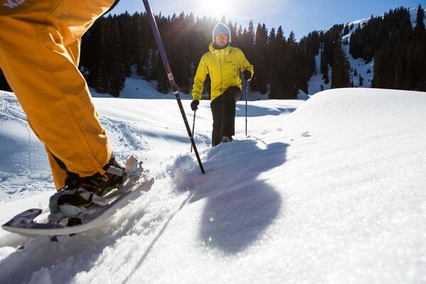
A quiet winter hike far away from the hustle and bustle of the snow-covered Zug Valley.
- Difficulty
-
medium
- Rating
-
- Starting point
-
Bus stop "Mautstelle" Zug
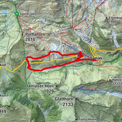
- Route
-
Gasthaus Älpele0.0 kmTannläger2.2 kmKlösterle9.2 kmZug10.2 kmSebastianskirche10.3 km
- Best season
-
AugSepOctNovDecJanFebMarAprMayJunJul
- Description
-
From Älpele Inn the winter hiking trail starts to the Tannlägeralpe. Here, almost at the end of the valley, the path describes a loop and leads you out of the valley again. After you have made a few metres on the path you have already taken, the path branches off to the right at the level of the old hunting lodge. The path leads slightly uphill through the forest to the Zuger saw. Here you cross the Lech over a bridge and return to the winter hiking trail which now leads you back to the picturesque village of Zug.
- Directions
-
From Älpele Inn the winter hiking trail starts to the Tannlägeralpe. Here, almost at the end of the valley, the path describes a loop and leads you out of the valley again. After you have made a few metres on the path you have already taken, the path branches off to the right at the level of the old hunting lodge. The path leads slightly uphill through the forest to the Zuger saw. Here you cross the Lech over a bridge and return to the winter hiking trail which now leads you back to the picturesque village of Zug.
- Highest point
- 1,671 m
- Endpoint
-
Bus stop "Mautstelle" Zug
- Height profile
-

- Equipment
-
Good winter shoes, warm clothes, cap, scarf, gloves
- Safety instructions
-
EMERGENCY CALL:
140 Alpine Emergencies Austria-wide
144 Alpine Emergencies Vorarlberg
112 Euo emergency call (works with any mobile phone/network)
www.vorarlberg.travel/sicherheitstipps
- Additional information
- Directions
-
From Germany: Take the A 96 to Bregenz from there on the A14 to Bludenz, continue on the S16 to the Lech Zürs am Arlberg exit. Follow the B197 to Alpe Rauz, turn left here onto the B198. Through the Flexengalerie and over the Flexenpass you reach Lech Zürs am Arlberg.
From Switzerland: Via the A13 and the Feldkirch, Hohenems or Lustenau border crossing onto the A14 as far as Bludenz. Continue on the S16 to the Lech Zürs am Arlberg exit. Follow the B197 to Alpe Rauz, turn left here onto the B198. Through the Flexengalerie and over the Flexenpass you reach Lech Zürs am Arlberg.
From Austria: Take the Inntal motorway A12 and then the S16 to the St. Anton am Arlberg exit (Arlbergpass). Follow the B197 first through St. Anton, then through St. Christoph and over the Arlberg Pass to Alpe Rauz. Turn right here onto the B198. Through the Flexengalerie and over the Flexenpass you reach Lech Zürs am Arlberg.
- Public transportation
-
Take the train to Langen am Arlberg or St. Anton am Arlberg station. From there, buses (no. 91 +92) run at regular intervals to Lech Zürs am Arlberg
- Parking
-
You can park your car either directly with your host or in the underground car park Anger. The underground car park is located directly in the town centre opposite the Raiffeisenbank Lech.
-

-
AuthorThe tour Älpele - Spullerwald - Tannlägeralpe - Zug is used by outdooractive.com provided.