From Steffisalp-Express via Bürstegg to Körbersee to Schröcken/Nesslegg


- Brief description
-
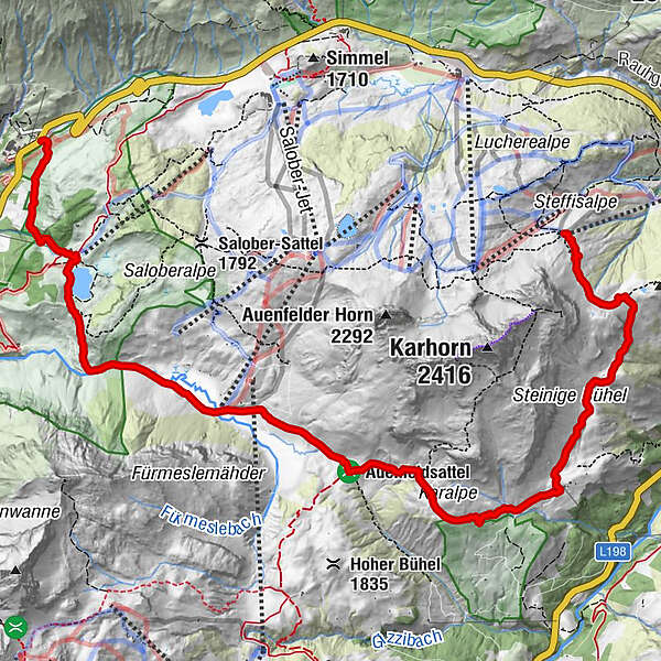
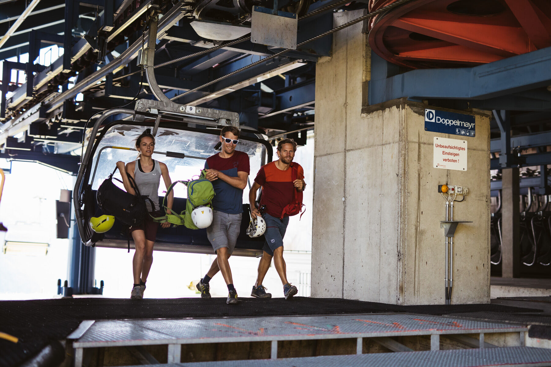
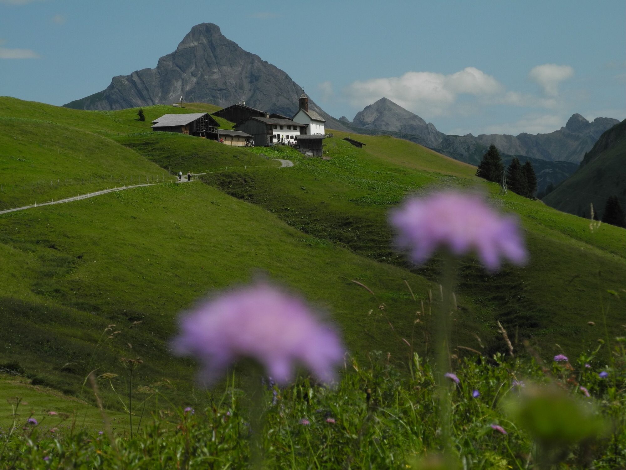
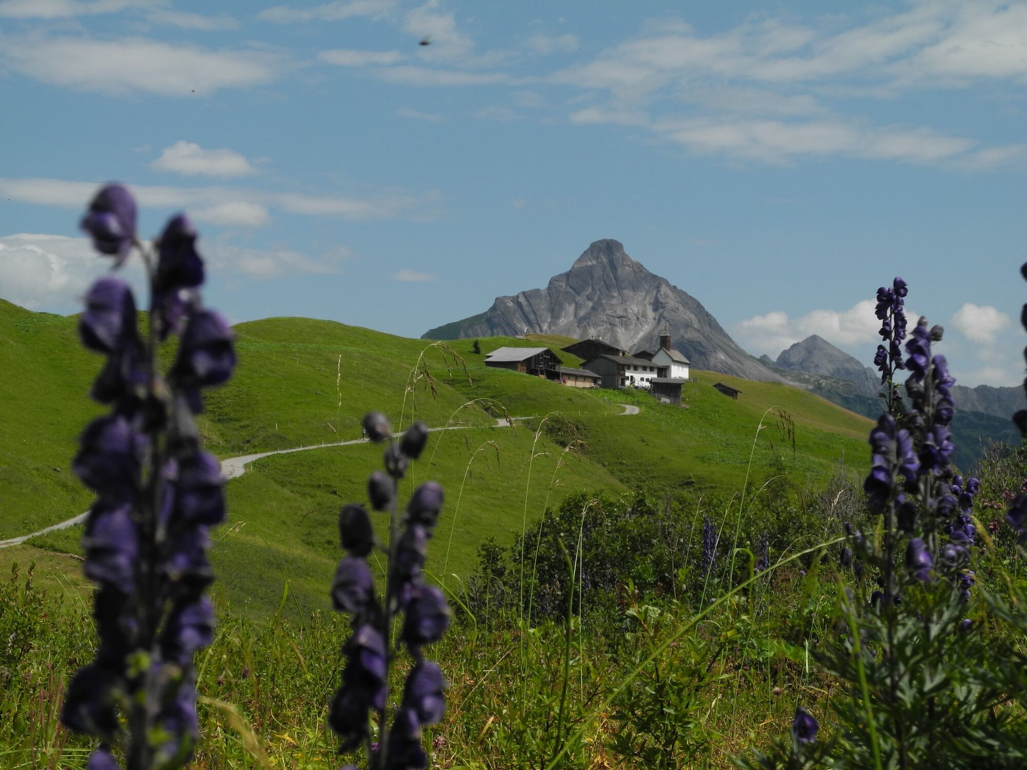
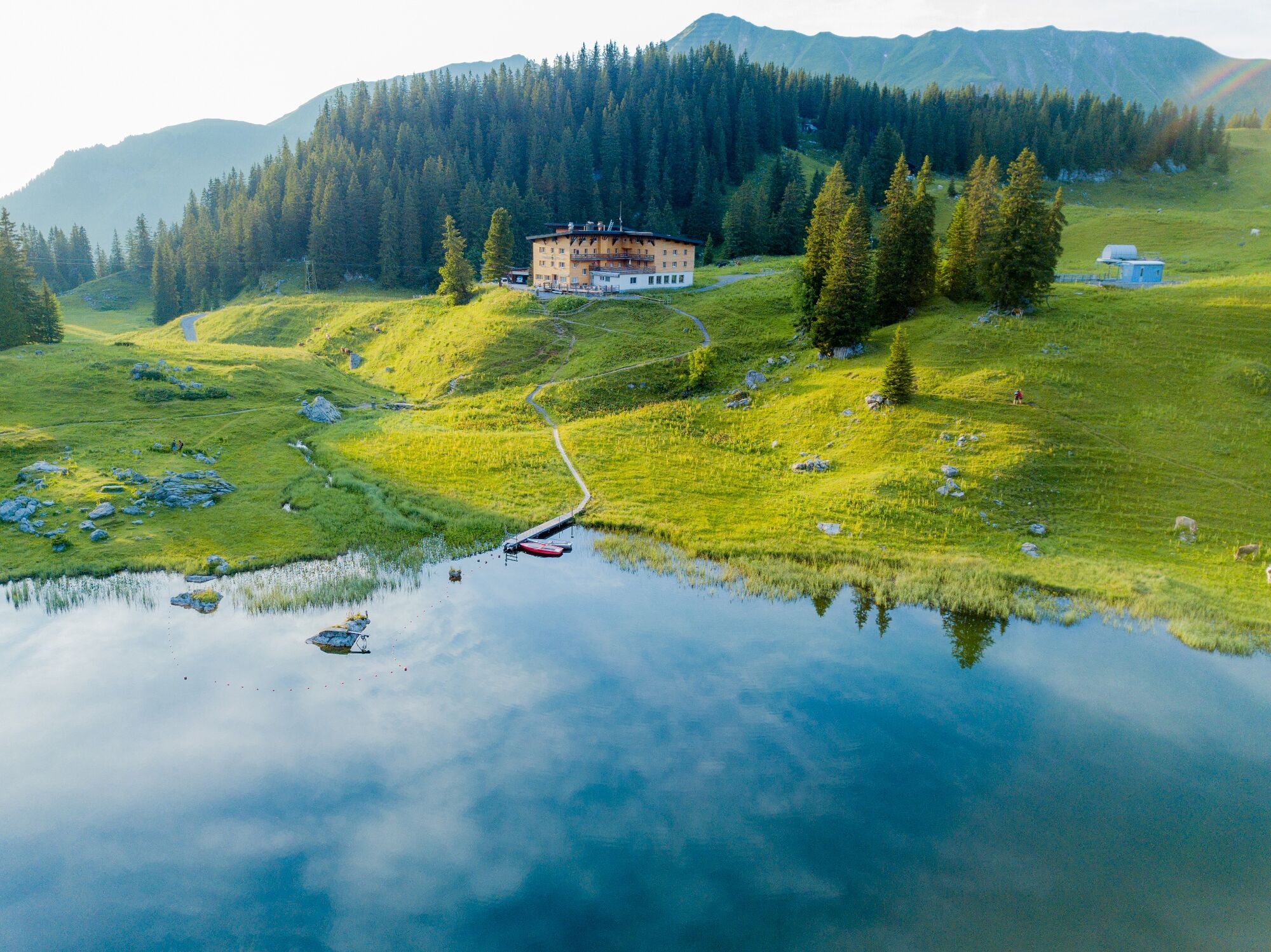
Relax again on the driveway with the Steffisalp-Express before you start. Now you have already left most of the vertical meters behind you and can start marching at your pace towards Wannenkopf. Here you can enjoy the view to Warth and take a deep breath before heading towards Bürstegg. Bürstegg, the formerly highest Walser settlement in Vorarlberg, is a particularly worthwhile hiking destination. The small Walser settlement greets from afar, but it seems as if one had left behind not only a good hour, but a whole century on a promising path. Now the trail runs upwards over the Karalpe to the Auenfeldsattel, up to the lush floodplain meadows, where you will surely meet grazing cows. Passing the Auenfeldalpe a narrow path leads to the Körbersee. The pleasant silence at the Lake Körbersee will enchant you. Passing Lake Körbersee, a nice path leads you down towards Nesslegg, to the destination of your hike.
- Difficulty
-
easy
- Rating
-
- Starting point
-
Steffisalp-Express
- Route
-
Steffisalp-Express0.0 kmGspa1.2 kmBürstegg2.8 kmJausenstation Bürstegg2.8 kmKarbühel (1,840 m)4.0 kmKarbühel4.6 kmUntere Auenfeldalpe5.7 kmMaterialseilbahn Körbersee8.4 kmNesslegg9.6 km
- Best season
-
JanFebMarAprMayJunJulAugSepOctNovDec
- Description
-
Touring.
Steffisalp-Express - Wannenkopf - Bürstegg - Karalpe - Auenfeldsattel - Auenfeld - Körbersee - Nesslegg
- Directions
-
Touring.
Steffisalp-Express - Wannenkopf - Bürstegg - Karalpe - Auenfeldsattel - Auenfeld - Körbersee - Nesslegg
- Highest point
- 1,943 m
- Endpoint
-
Schröcken-Nesslegg
- Height profile
-

- Equipment
-
This should never be missing on the mountain.
Backpack, First-Aid Set incl. Bladder plaster, telephone with emergency number, cash, drinking bottle, pocket knife, provisions, sun protection in good weather.
- Safety instructions
-
Emergency numbers.
140 - Alpine emergencies throughout Austria
144 - Alpine emergencies in Vorarlberg
112 - Euro emergency call
- Additional information
- Arrival
- Public transportation
- Parking

- Author
-
The tour From Steffisalp-Express via Bürstegg to Körbersee to Schröcken/Nesslegg is used by outdooractive.com provided.