
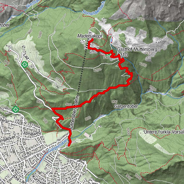
Tour data
3.64km
686
- 1,378m
690hm
4hm
01:30h
- Brief description
-
Der direkte Weg von der Talstation Muttersbergbahn zur Bergstation.
- Difficulty
-
easy
- Rating
-
- Starting point
-
Talstation Muttersbergbahn
- Route
-
BludenzMuttersbergbahn Talstation0.0 kmOberes Bild2.0 kmMuttersberg3.0 kmMadeisakopf (1,402 m)3.6 kmAlpengasthof Muttersberg3.6 km
- Best season
-
JanFebMarAprMayJunJulAugSepOctNovDec
- Highest point
- 1,378 m
- Endpoint
-
Bergstation Muttersbergbahn
- Rest/Retreat
-
Berggasthof bei Muttersbergbahn
GPS Downloads


Trail conditions
Asphalt
Gravel
Meadow
Forest
Rock
Exposed
Other tours in the regions
-
St. Gallen - Bodensee
2066
-
Alpenstadt Bludenz
1848
-
Muttersberg - Bludenz
499


