Bridge building river Leiblach: Hiking along the border river - Waterway no.31 in the Western Allgaeu


")
- Brief description
-
Three tours of the waterways of the Western Allgaeu (29,30 and 31) invite you to a cross-border discovery journey to the valley of the Leiblach. According to the motto 'building bridges'. The valley's lifeline is the river Leiblach, a near-natural river of the low mountain range, which leads to Lake Constance between Lindau and Hörbranz. The river's lower course marks the boarder between Germany and Austria. Enchanted ravine creeks, shady canyon forests, gushing waterfalls and much more views are waiting for the hikers. Tour no. 30 is a demanding day trip for hikers with outstanding endurance. It promises roaring waterfalls and generous views.
- Difficulty
-
difficult
- Rating
-
- Starting point
-
Community office Hohenweiler/alternatively Sigmarszell-Kirchdorf, forest experience path Moeggers or Cascades of Scheidegg
- Route
-
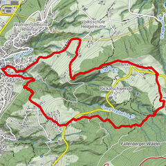
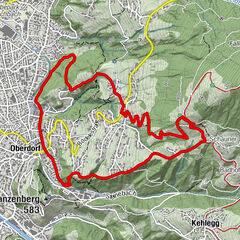
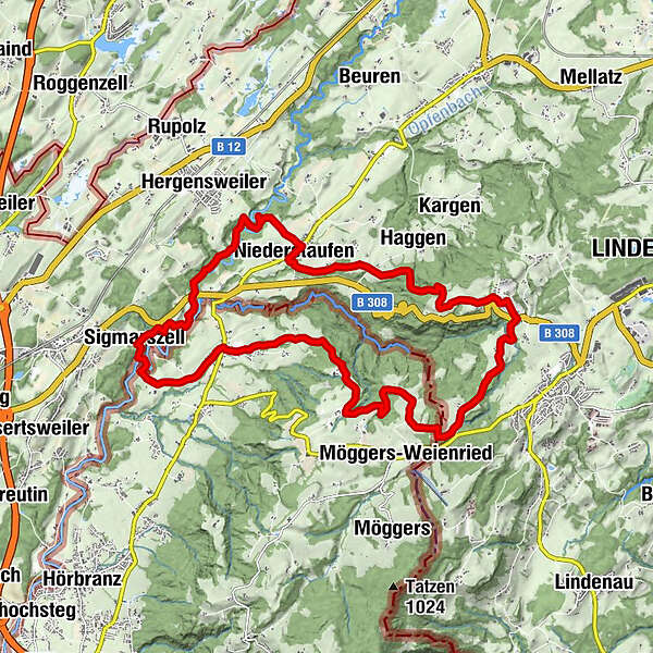
HohenweilerXaveriuskapelle0.4 kmSchönstein3.1 kmQuelltuff3.5 kmBuchans5.0 kmHasenreuter Wasserfälle6.5 kmAizenreute6.7 kmHauberfall7.3 kmRickenbach7.9 kmKleiner Wasserfall8.5 kmZweiter großer Wasserfall8.5 kmErster großer Wasserfall8.6 kmFeriendorf Saarland9.3 kmLötz9.6 kmSt. Wendelinskapelle10.0 kmKinberg10.3 kmHaggen11.5 kmAdelberg12.2 kmGeislehen13.2 kmSt. Peter und Paul13.7 kmNiederstaufen13.8 kmKnochenmühle15.0 kmDornach18.3 kmSigmarszell19.0 kmSt. Gallus19.0 kmEgons Buschenschank20.0 kmRied20.0 kmSt. Georg21.2 kmHohenweiler21.3 km
- Best season
-
JanFebMarAprMayJunJulAugSepOctNovDec
- Description
-
Starting at the community office Hohenweiler the trail leads us first to the village Gehren. We move to the village Schoenstein from there - partly crossing meadows, partly crossing shady forests - but always uphill. On a section of the forest experience path Moeggers we hike through the wild and romantic canyon forest in the ravine "Saegetobel". The pedagogical adventure path provides many interesting informations concerning life in and with the forest.
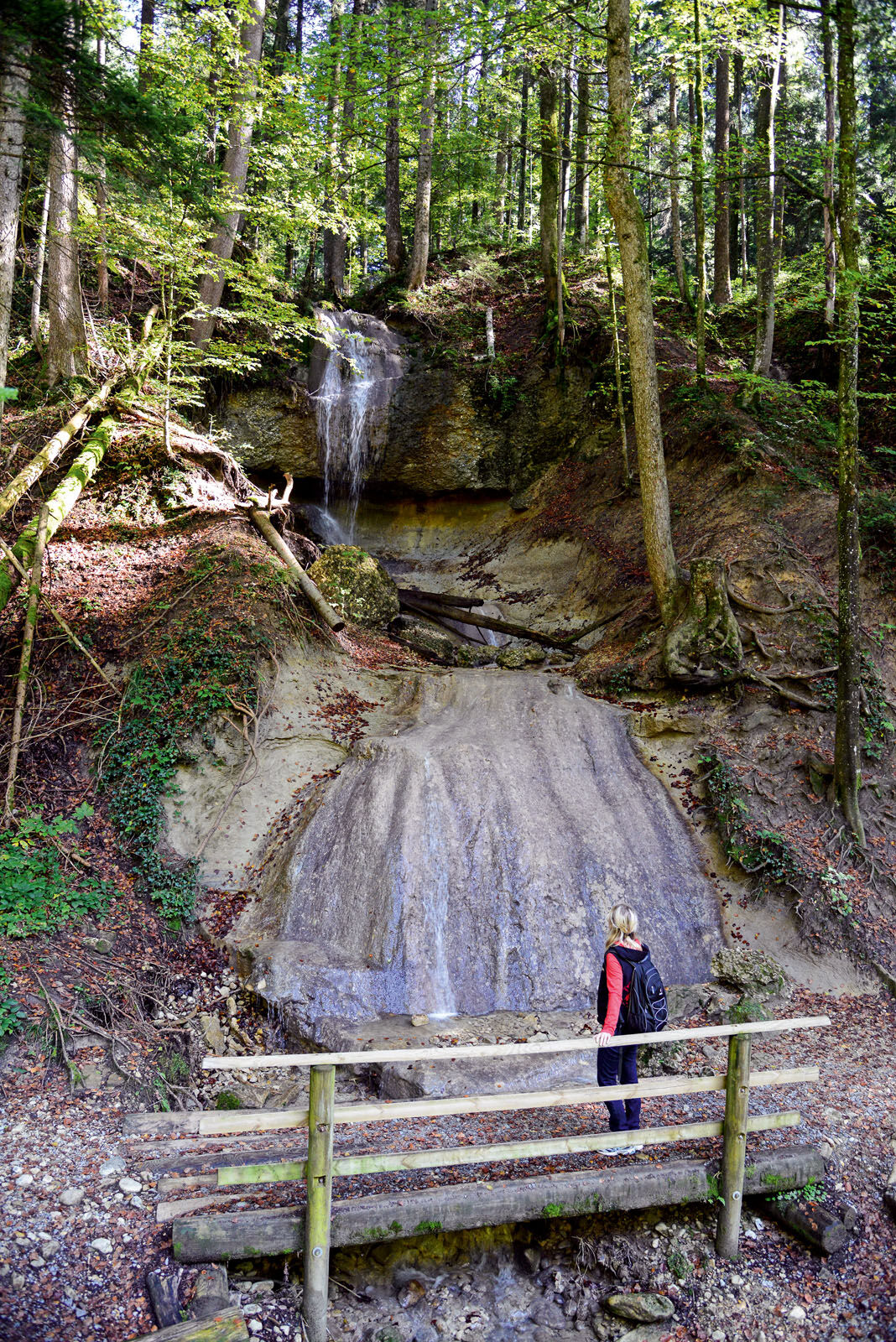
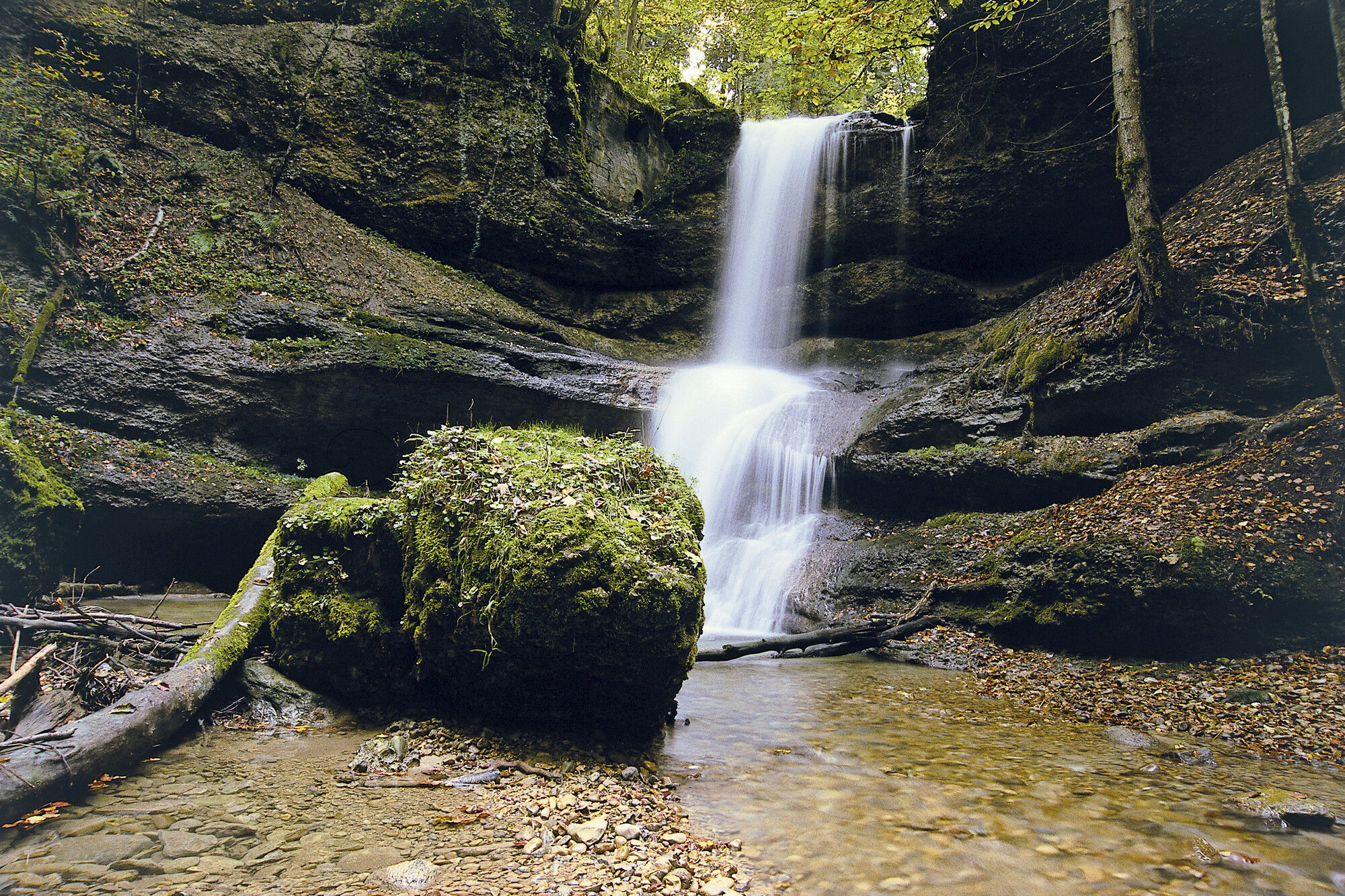
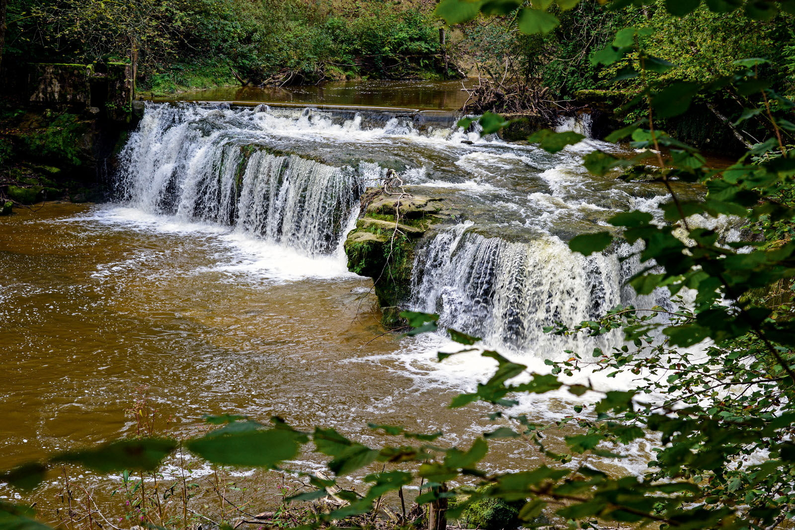
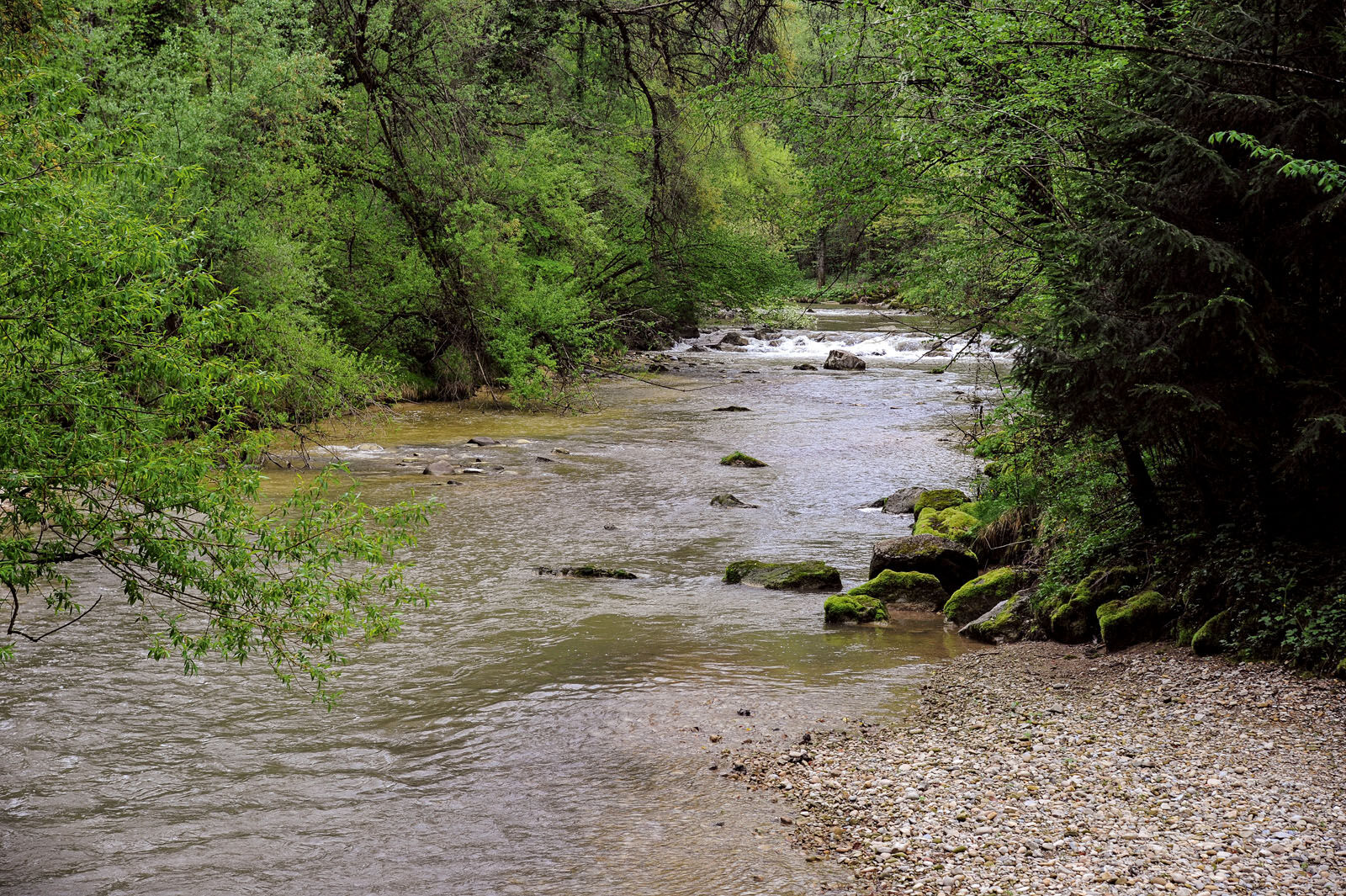
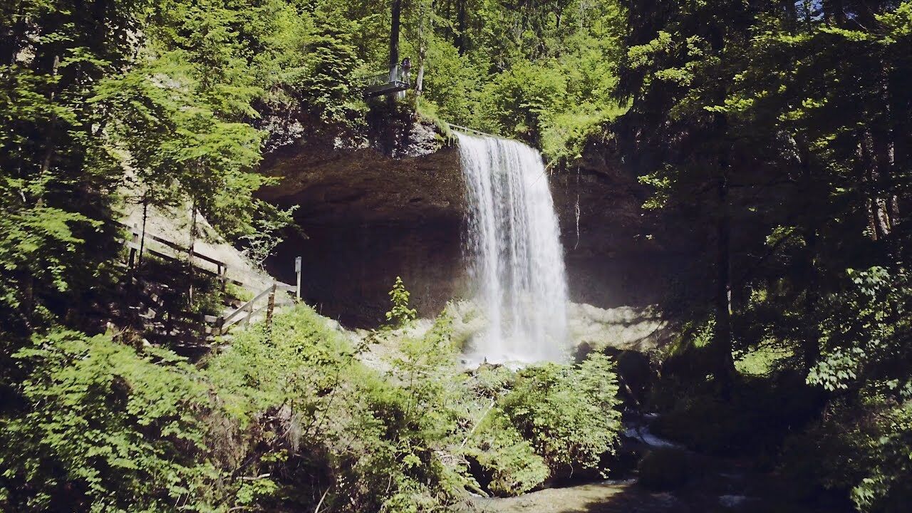
Leaving the canyon forest, we enter the open meadows near the village Buchans. Here, the view opens northwards to the other side of the canyon "Rohrachschlucht" where we can already see one of the next stages of our tour, the chapel of St. Wendelin. From Buchans in Austria, the hiking trail leads us crossborder to the village Aizenreute in Germany. From there, we just have to hike few minutes to the village Rickenbach to the cascades of Scheidegg. Theses cascades are among the 100 most beautiful geotopes in Bavaria.
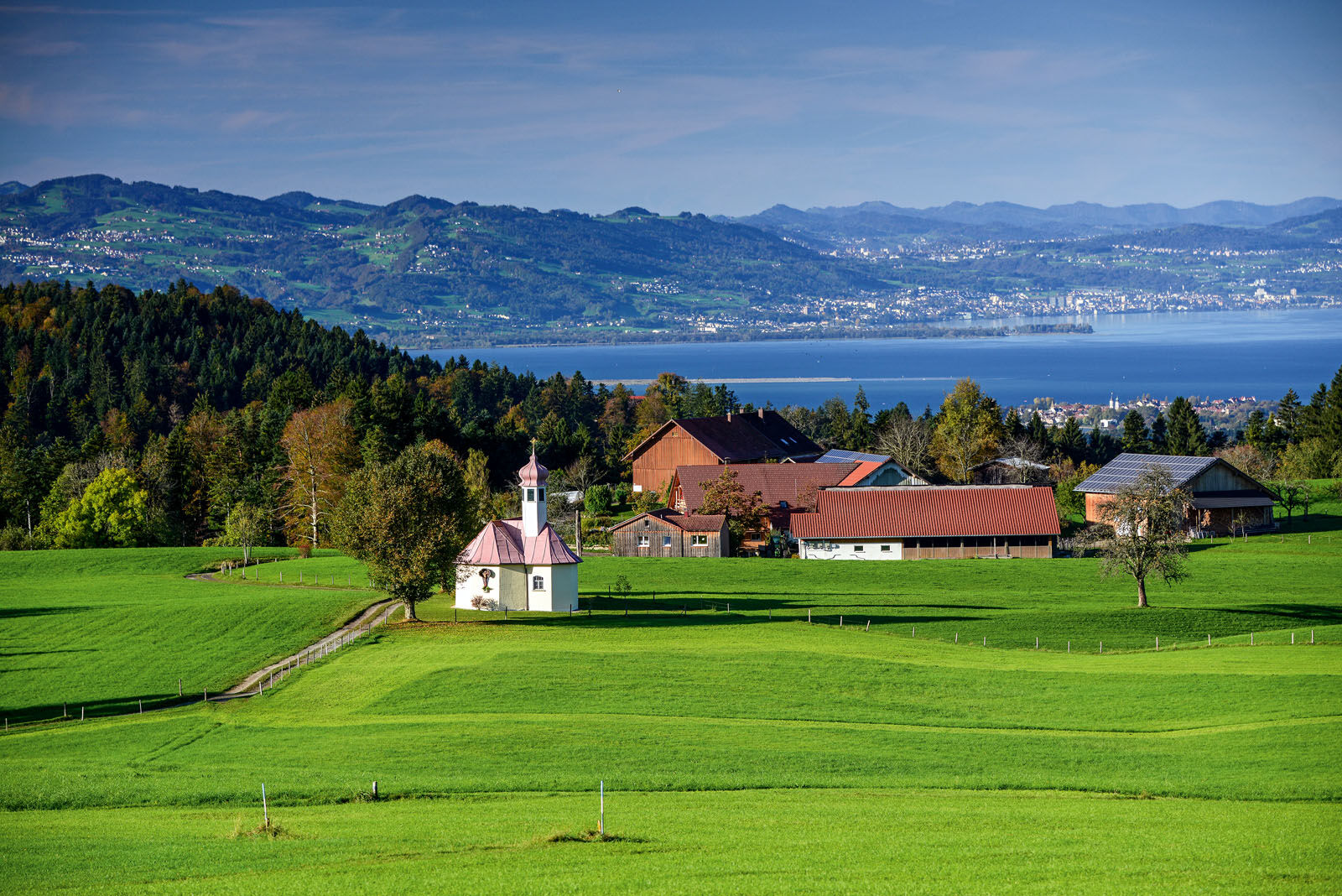
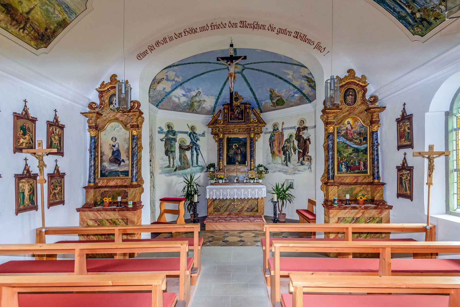
Subsequently, we come to the chapel of St.Wendelin, passing Ostkinberg. There we have a wonderful view of Lake Constance and the Swiss mountains before a section of the Camino de Santiago takes us to the village Niederstaufen. From Niederstaufen we hike down to the river Leiblach. Walking a few metres upstream is recommended there. The little side trip leads us to a terrain rim. At the rim, the river rushes several metres into the depth.
After that, we cross the Leiblach on a narrow footbridge that was renewed in 2000. Behind a river bend a hidden resting place invites you to linger. Via the village Dornach we reach Sigmarszell and then, on a short and steep ascent, we get back to the Leiblach and the footbridge Zellersteg. Crossing the river, we again crossed the boarder from Germany to Austria. After some walking minutes we have reached the starting point of the tour.
- Directions
-
The sdemanding daytrip mostly runs on forest and hiking trails. However, there are some short sections that are asphalted. In the sections of ravines it is absolutely necessary to wear sturdy shoes!
- Highest point
- 809 m
- Endpoint
-
Community office Hohenweiler/alternatively Sigmarszell-Kirchdorf, forest experience path Moeggers or Cascades of Scheidegg
- Height profile
-

- Tips
-
You can find inns in Scheidegg-Gretenmühle, Scheidegg-Ostkinberg, Niederstaufen and Hohenweiler-Ried. A few metres away from the trail, there are additional resting points in Hohenweiler-Fesslers, Möggers-Rucksteig, Möggers-Höflings, Möggers-Ried, Scheidegg, Hergensweiler and in Sigmarszell-Schlachters.
- Additional information

- Author
-
The tour Bridge building river Leiblach: Hiking along the border river - Waterway no.31 in the Western Allgaeu is used by outdooractive.com provided.


General info
-
Bodensee - Deutschland
1106
-
Westallgäu
1263
-
Hohenweiler
268