The scenic trail - from Lake Wiegensee to Verbellaalpe and through Ganifer Valley to Partenen


- Brief description
-
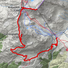
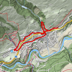
Summit station Tafamunt cable car- Lake Wiegensee - Verbellaalpe - Ganifer Valley - Partenen
- Difficulty
-
medium
- Rating
-
- Starting point
-
Valley station Tafamunt cable car, Partenen
- Route
-
InnertafamuntAlpstöbli Tafamunt0.0 kmPfarrkirche Partenen12.2 kmPartenen (1,051 m)12.4 km
- Best season
-
JanFebMarAprMayJunJulAugSepOctNovDec
- Description
-
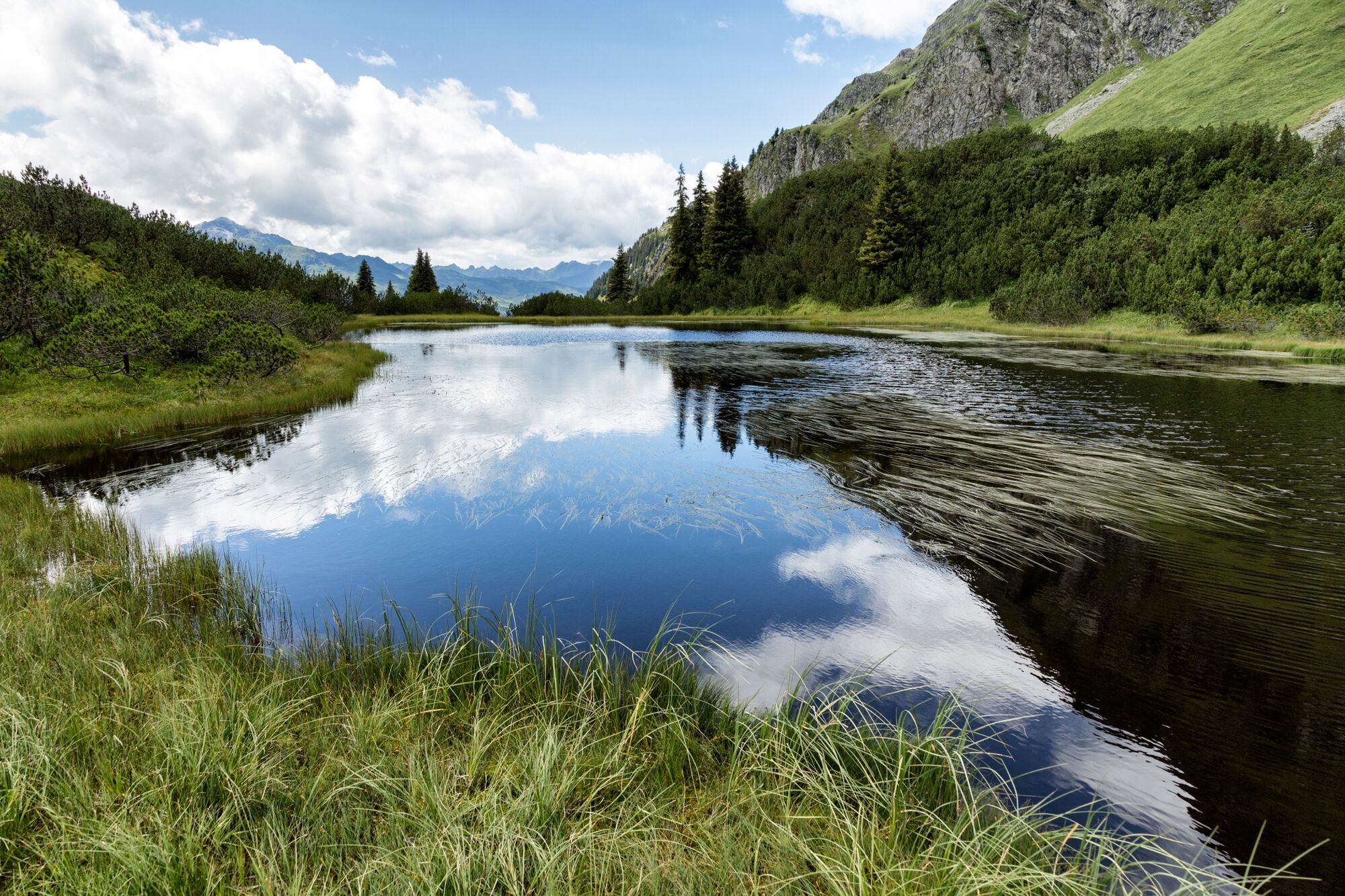
The Lake Wiegensee lies in a protected moorland landscape and is a product of the postglacial period. The view of the Silvretta mountains on the other side of the lake is overwhelming. The Kops reservoir with its curved dam wall is a successful combination of nature and technology.
- Directions
-
The moderate hike starts at the summit station of the Tafamunt cable car. The first ascent is taken by the cable car. The first stop is directly at the summit station, the Tafamunt Stöbli. From there you can continue uphill on your own, first through the forest. After leaving the forest, the view of the Silvretta peaks and the Silvretta High Alpine Road is thrilling. In order to enjoy the panorama better, observation benches invite you to do so. With a little luck you can observe chamois on the slopes below the Versalspitze, which you can see from the path. Soon afterwards you will reach the enchanting Lake Wiegensee, which is wonderfully embedded in the high moor landscape. Through the beautiful high moor landscape, the hiking trail gradually leads in a northerly direction into the wide landscape of the Verwall. Above the Verbella Valley, it gently rises and falls to the Verbellaalpe (open only from the end of June to the beginning of September). You start the descent a little after the Verbellaalpe and hike downhill like a serpentine through the Ganifer Valley. You will reach the Inner and Ausserganifer. Continue straight ahead uphill via Frons back to Partenen.
- Highest point
- 1,937 m
- Endpoint
-
Valley station Tafamunt cable car, Partenen
- Height profile
-

- Equipment
-
good, high boots with a good profile, sufficient food and drinks, hiking sticks recommended
- Safety instructions
- Additional information
- Directions
-
Coming from Bludenz take the motorway exit Bludenz/Montafon and follow the L188 to Montafon.
- Public transportation
-
Just leave your car.
The Montafonerbahn shuttle buses run throughout the Montafon. The main lines depart hourly from Schruns station.
From Schruns station you can take bus 85 to Partenen. The exit point is: "Bergbahnen". Return also with the bus line 85 to Schruns station.
Arrival by train
The Montafonerbahn runs every hour from Bludenz station (sometimes every half hour). There are also direct connections from Lindau (D) and Bregenz.
- Parking
-
Parking at the Tafamunt cable car valley station


-

-
AuthorThe tour The scenic trail - from Lake Wiegensee to Verbellaalpe and through Ganifer Valley to Partenen is used by outdooractive.com provided.


General info
-
Montafon
1380
-
Gaschurn - Partenen
355