
- Brief description
-
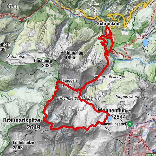
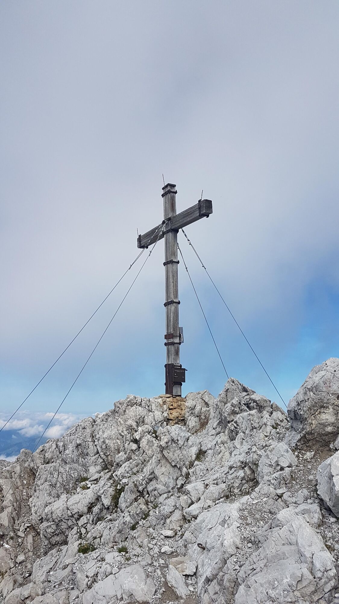
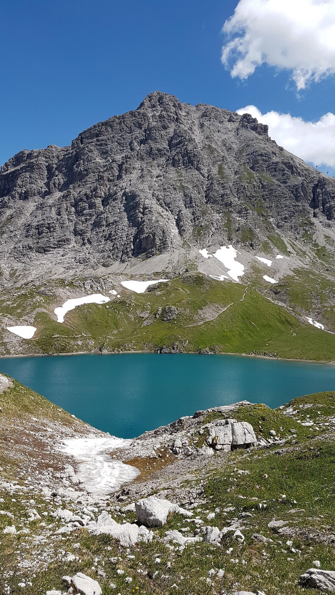
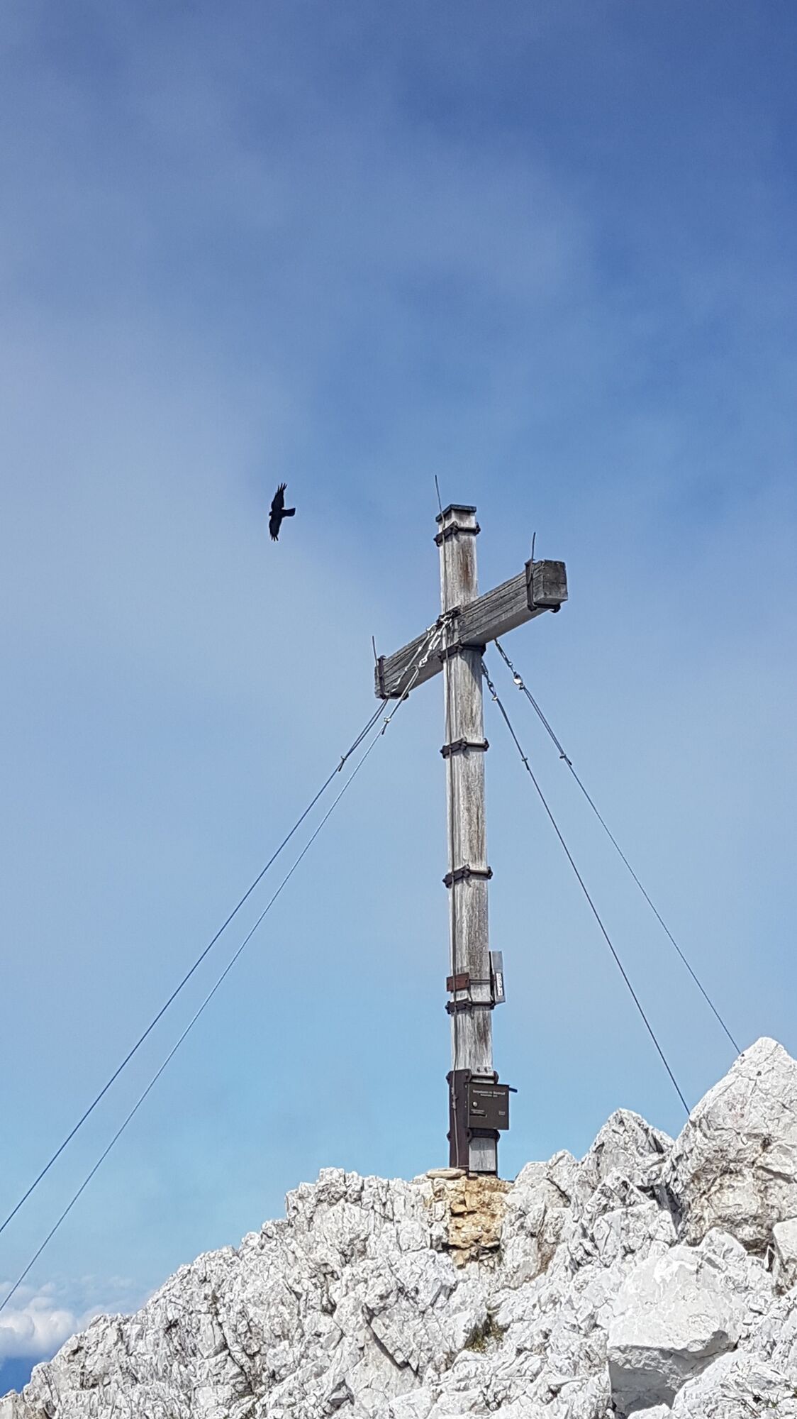
Let’s go! On the highest mountain in the Bregenzerwald – the Braunarlspitze. The challenging and long mountain tour starts in Schröcken-Heimboden. At the beginning, the goods trail leads right from the Hotel Mohnenfluh to the Fellealpe. Passing the cultivated alpine pasture, the path becomes narrower and narrower. When crossing some small mountain streams you can cool your arms a little. At the fork in the path after approx. 1,5 h walk, follow the sign for Fürggele. In front of the rock entrance, you can see the Hochberg directly in front of you and enjoy the beautiful view at an altitude of 2.145 m. The hiking poles should now be stowed in the backpack, from now on you need both hands free to move up on the partly rope-secured rock. After some exposed places, the last piece leads over loose slate rock. It’s done! At the summit cross you can watch blisslully the spectacle of the clouds in the wind. The descent takes place on the south side to the Butzensee. Already from a distance you can see the blue mountain lake with the massive Mohnenfluh summit in the background – a sight that remains in your memory! Via the Jägersteig the path leads back to the Fellealpe and back to the starting point.
- Difficulty
-
difficult
- Rating
-
- Starting point
-
Schröcken village square
- Route
-
Schröcken (1,269 m)Materialseilbahn Körbersee0.0 kmFürggele (2,145 m)4.9 kmBraunarlspitze (2,649 m)6.9 kmMaterialseilbahn Körbersee15.8 kmSchröcken (1,269 m)16.0 km
- Best season
-
JanFebMarAprMayJunJulAugSepOctNovDec
- Description
-
Touring.
Schröcken - Hotel Mohnenfluh - Fellealpe - Fürggele - Braunarlspitze - Butzensee - Jägersteig - Fellealpe - Schröcken
- Directions
-
Touring.
Schröcken - Hotel Mohnenfluh - Fellealpe - Fürggele - Braunarlspitze - Butzensee - Jägersteig - Fellealpe - Schröcken
- Highest point
- 2,633 m
- Endpoint
-
Schröcken village square
- Height profile
-

- Equipment
-
This should never be missing on the mountain.
Backpack, First-Aid Set incl. Bladder plaster, telephone with emergency number, cash, drinking bottle, pocket knife, provisions, sun protection in good weather.
- Safety instructions
-
Emergency numbers.
140 - Alpine emergencies throughout Austria
144 - Alpine emergencies in Vorarlberg
112 - Euro emergency call
- Additional information
- Directions
- Public transportation
- Parking
-

-
AuthorThe tour Braunarlspitze (2.649 m) is used by outdooractive.com provided.