
Tour data
6.8km
470
- 927m
22hm
418hm
03:00h
- Brief description
-
Waldlehrpfad
- Difficulty
-
medium
- Rating
-
- Starting point
-
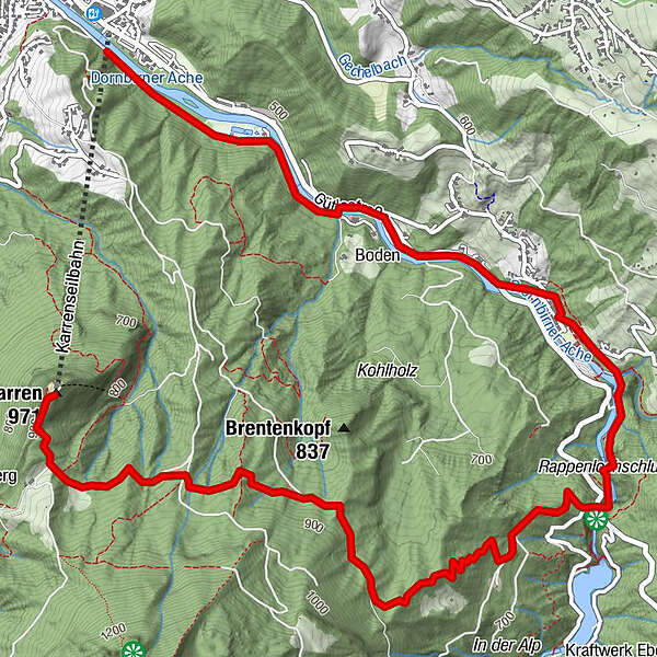
Bergstation Karren
- Route
-
Panoramarestaurant KarrenIn der Alp2.9 kmRappenlochstadl4.1 kmGasthof Gütle4.3 kmGütle4.5 kmDornbirn (437 m)6.8 km
- Best season
-
JanFebMarAprMayJunJulAugSepOctNovDec
- Highest point
- 927 m
GPS Downloads


Trail conditions
Asphalt
Gravel
Meadow
Forest
Rock
Exposed
Other tours in the regions
-
St. Gallen - Bodensee
2067
-
Bodensee - Vorarlberg
1317
-
Dornbirn
450


