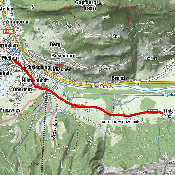
Rundweg Engevorsäß

Logo Rundweg Engevorsäß
Tour data
2.52km
685 - 703m
Distance
15hm
Ascent
01:30h
 
Duration
Brief description

Rundwanderweg

Rating
Technique
Fitness
Landscape
Experience
Route
Mellau
Übermellen
Pfarrkirche Mellau
0.0 km
Platz
0.0 km
Moos
0.1 km
Naze's Hus
0.2 km
Tempel
0.2 km
Achsiedlung
0.3 km
Hinterbündt
0.5 km
Tanna
1.2 km
Enge
2.4 km

Highest point
703 m

Overall rating

5

0

%

4

0

%

3

0

%

2

0

%

1

0

%

Error
An error has occurred. Please try again.
Thank you for your review

Rating has been deleted

GPS Downloads
  • GPX GPS Exchange Format (XML)
  • KML Google Earth, Google Maps
QR Download Codes for Mobile Phones

Trail conditions

Asphalt
Gravel
Meadow
Forest
Rock
Exposed
Other tours in the regions

Popular tours in the area

Damüls | Sünserspitze with Sünsersee

medium Hiking
8.12km | 405hm | 03:10h

Hoher Freschen

difficult Hiking
16.13km | 1005hm | 07:00h

Rote Wand 2704m

difficult Hiking
13.9km | 1181hm | 06:00h

Üble Schlucht / Laterns

medium Hiking
6.3km | 322hm | 02:30h