

© Tourismus & Stadtmarketing Hohenems GmbH - Stiplovsek Dietmar

© Bodensee-Vorarlberg Tourismus GmbH - Stiplovsek Dietmar

- Brief description
-
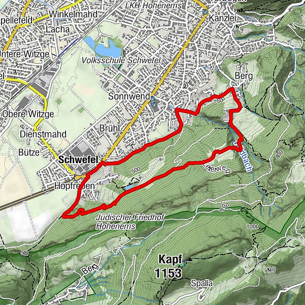
Jüdischer Friedhof - Weiher - Schwefelberg - Boden - Schütz - Vogelherd - Büntili - Schützenweg - Gottfried-Keller-Straße - Römerstraße
- Difficulty
-
easy
- Rating
-
- Route
-
HopfrebenBodner1.7 kmHohenems (432 m)2.6 kmBerg2.7 kmSchwefel (420 m)4.3 kmHopfreben4.4 km
- Best season
-
JanFebMarAprMayJunJulAugSepOctNovDec
- Highest point
- 615 m
- Endpoint
-
Jüdischer Friedhof, Römerstraße
- Height profile
-

- Author
-
The tour Rundwanderung: Schwefelberg Hohenems is used by outdooractive.com provided.
GPS Downloads


General info
Refreshment stop
Other tours in the regions
-
St. Gallen - Bodensee
2065
-
St. Galler Rheintal
1332
-
Hohenems
345


