


- Brief description
-
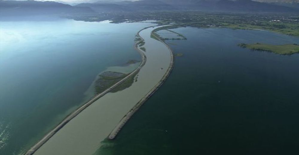
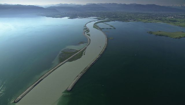
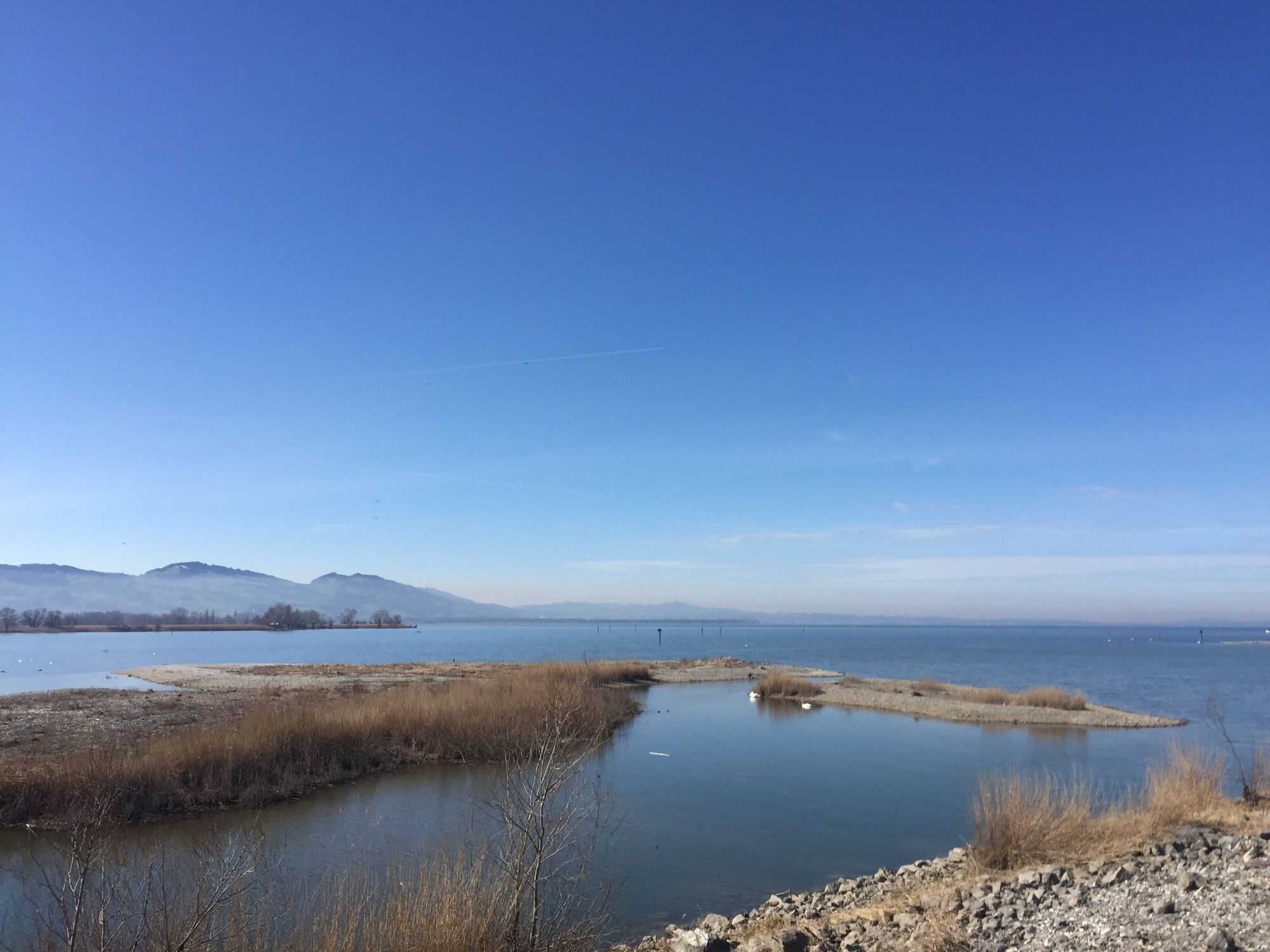
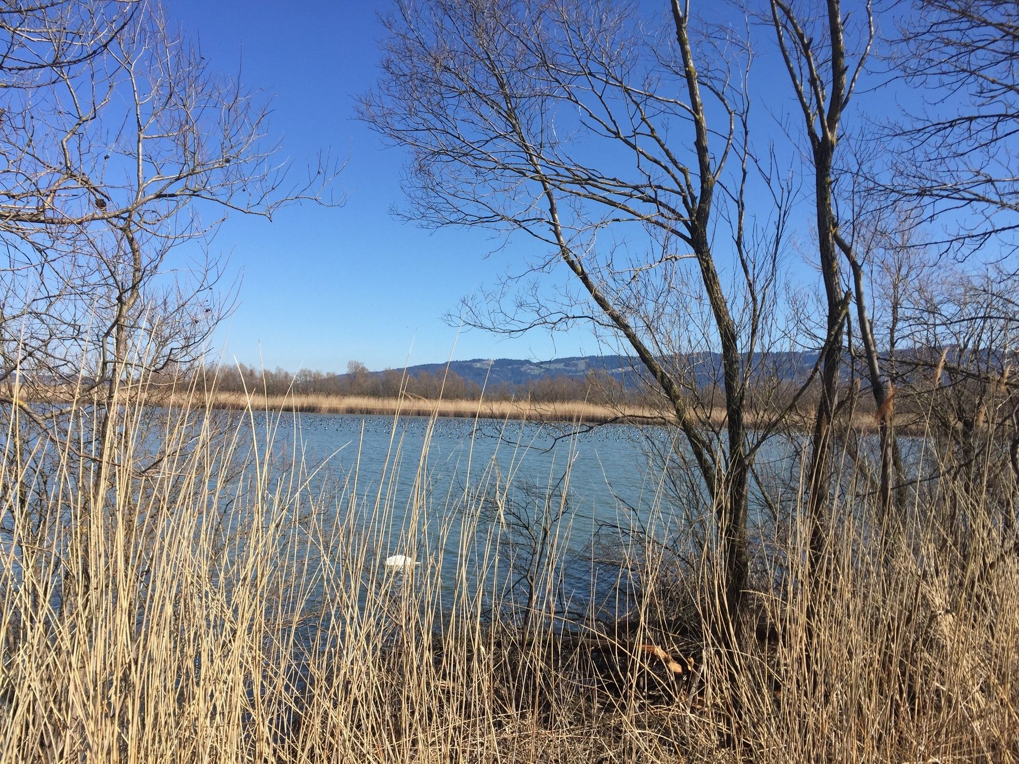
Da im Rheindelta das ganze Bodenseeufer unter Naturschutz steht, blieb hier vielen Vogelarten ein wertvoller Lebensraum erhalten. Wie sehr die Lagune und die Buchten nahe der Rheinmündung auch von Zugvögeln als Rastgebiet genutzt werden, sieht man besonders zwischen Spätsommer und Frühling.
- Difficulty
-
easy
- Rating
-
- Starting point
-
Fußach, In der Schanz
- Best season
-
JanFebMarAprMayJunJulAugSepOctNovDec
- Description
-
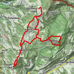
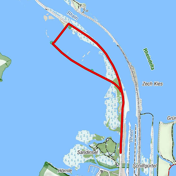
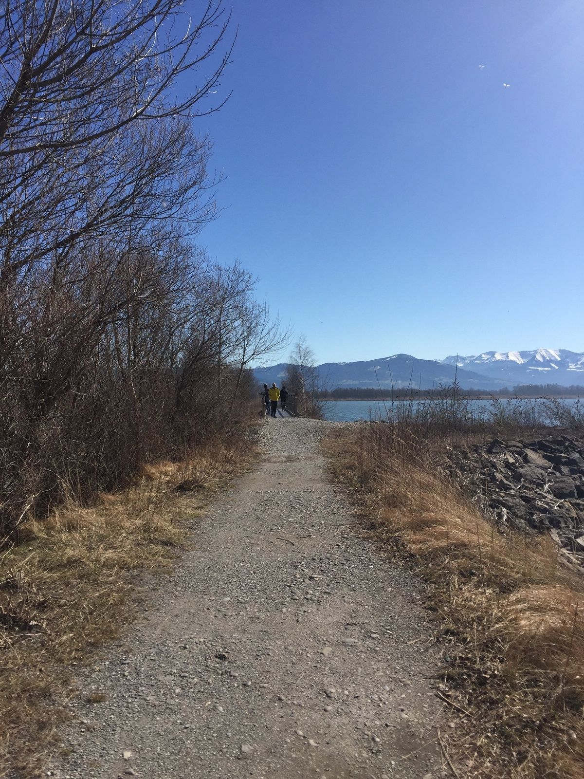
Fußach, In der Schanz Lagoon - In der Schanz The entire Lake Constance shore in the Rhine delta is a conservation area so it has become an important protected habitat for many species of bird. It is particularly between late summer and spring that the extent becomes apparent to which the lagoon and the bays near the mouth of the Rhine are used as resting grounds by migrating birds.
- Directions
-
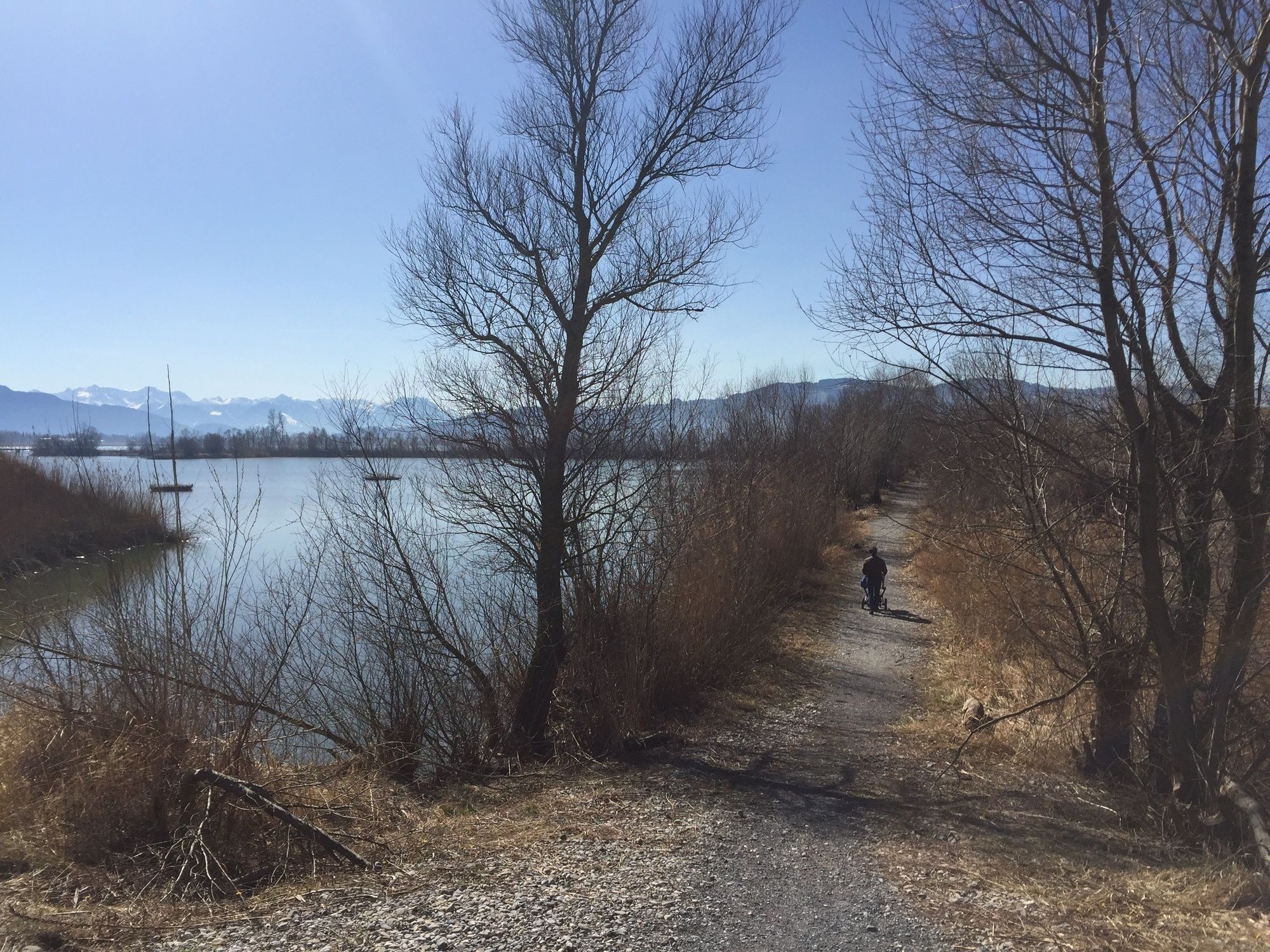
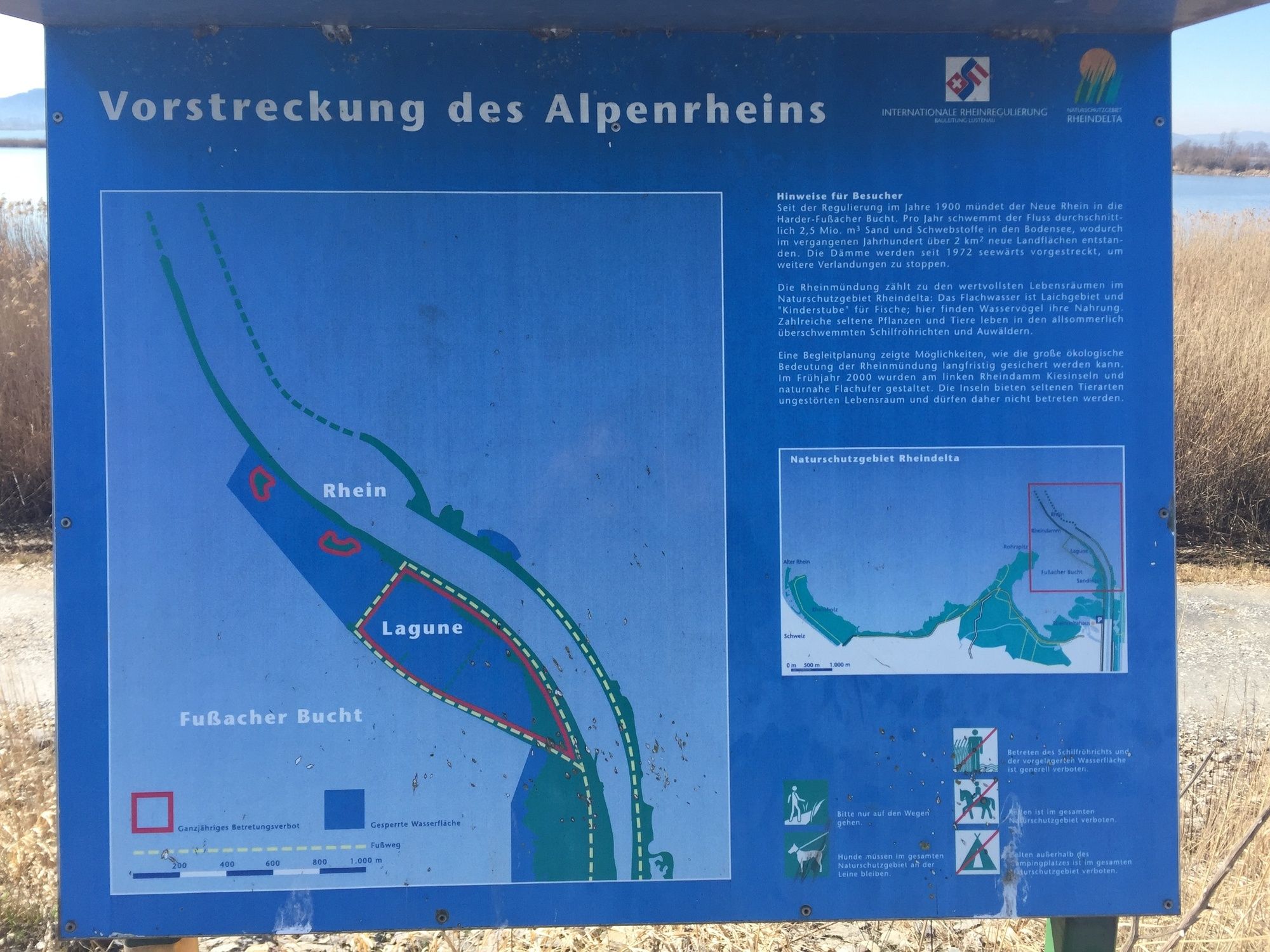
At the Fußach Rheindamm (Rhine Dam), visitors can walk from the Wanderparkplatz (car park for walkers) along the roadway at the base of the embankment towards the lagoon. After the bend in the projecting estuary, it’s another 20-minute walk along the top of the embankment that presents beautiful views across the Obersee (Upper Lake Constance) and to the island town of Lindau. The route then follows the footpath that branches off to the left and continues along the west side of the lagoon – along the shore of the Fußacher Bucht (Fußach Bay) – before returning to the starting point.
- Highest point
- 399 m
- Endpoint
-
Fußach, In der Schanz
- Height profile
-

- Tips
-
The RheinSchauen Museum in Lustenau provides an excellent overview of how the Rhine is being regulated. Information: Verein Rheinschauen T +43 (0)5577/20539, www.rheinschauen.at
- Public transportation
-
www.vmobil.at
- Parking
-
Wanderparkplatz (parking lot for walkers) just before vehicle access is prohibited.
- Author
-
The tour Lagoon circular walk at the mouth of the Rhine is used by outdooractive.com provided.


General info
-
St. Gallen - Bodensee
2067
-
Bodensee - Vorarlberg
1317
-
Fußach
264