


- Brief description
-
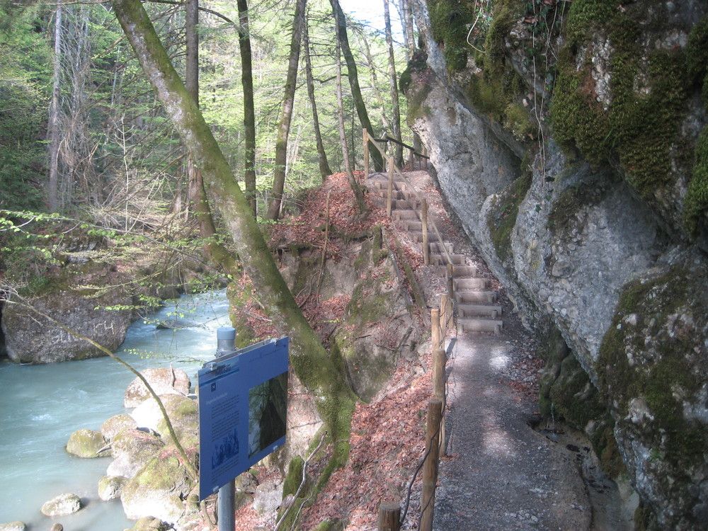
Am Fuße des Hochhäderichs entstand am Ende der Eiszeit ein See. Die Bolgenach bahnte sich ihren Weg durch den Felsen, der die "Staumauer" des Sees bildete. So entstand die Kommaschlucht. 15 Meter über dem Wasser überspannt seit fast 300 Jahren die Kommabrücke, die älteste gedeckte Holzbrücke des Landes, Ach und Schlucht.
At the end of the Ice Age, a lake emerged at the foot of the Hochhäderich. The Bolgenach carved its path out of the cliffs which formed the "dam wall" of the lake. And so the Komma gorge arose. For almost 300 years, the Komma bridge has been crossing the river and the gorge at a height of 15 m: this bridge is the oldest covered bridge in the province.
- Rating
-
- Starting point
-
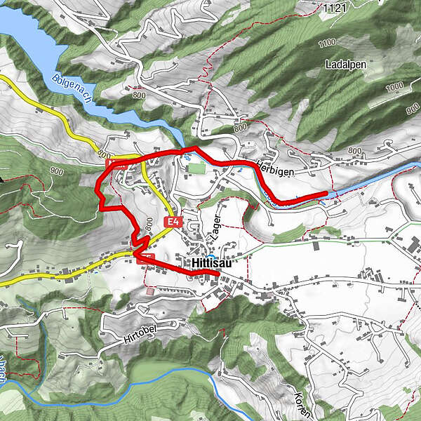
Hittisau - Ortsmitte
Starting point: Hittisau - centre of town
- Route
-
Gasthof Hirschen0.0 kmHittisau0.0 kmPfarrkirche Heilige Drei Könige0.1 kmGasthof Krone0.1 kmKänzele1.4 kmFatimakapelle1.7 km
- Best season
-
JanFebMarAprMayJunJulAugSepOctNovDec
- Description
-
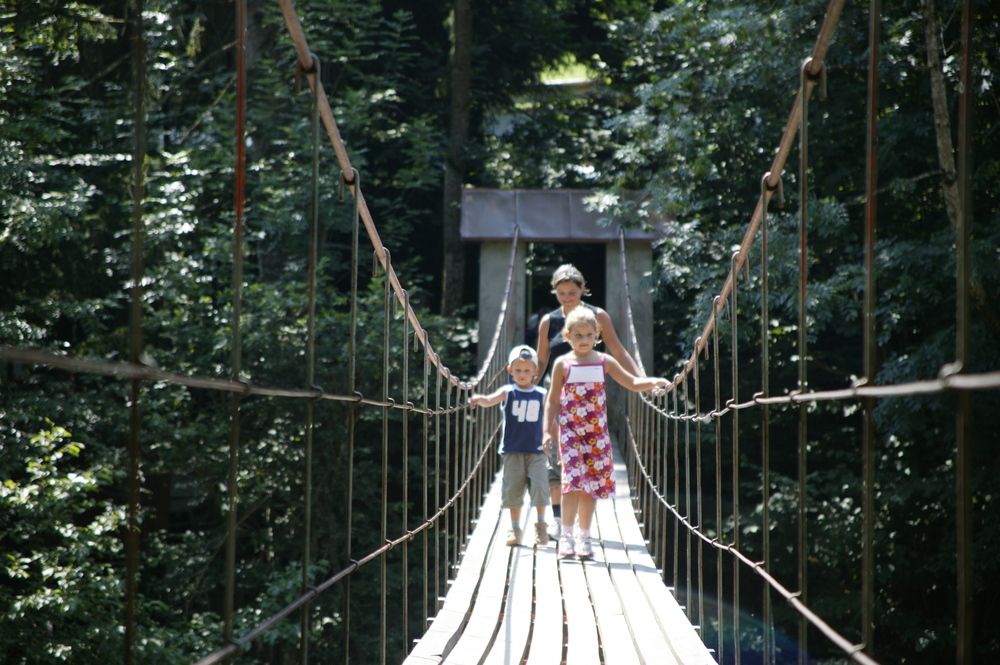
Along the Bolgenach, the water ramble takes you across a suspension bridge, past the wild yet romantic Engenloch gorge. This circular track starts with a march to a magnificent view (Känzele). You will pass the chapel of Fatima and then walk along the Bolgenach, upstream to the Engenloch gorge with interesting rock formations. After passing the gorge, a route will lead you back to the centre of Hittisau.
Itinerary:
Hittisau - centre of town (790 m) - Känzele View (Häleisen, 820 m) - Kommabrücke (760 m) - Engenlochschlucht - Hittisau - Highest point
- 838 m
- Rest/Retreat
-
Gasthöfe und Restaurants in Hittisau
Chances to stop off for a drink or for food: Inns in Hittisau
- Ticket material
-
Bregenzerwald I


Trail conditions
-
Allgäu
2365
-
Bregenzerwald
2295
-
Hittisau
704


