


- Brief description
-
A popular hike with views across the Rhine Valley, Lake Constance and the Swiss mountains, including a stop at the Panoramarestaurant Karren.
- Difficulty
-
medium
- Rating
-
- Starting point
-
Karren Valley Station
- Route
-
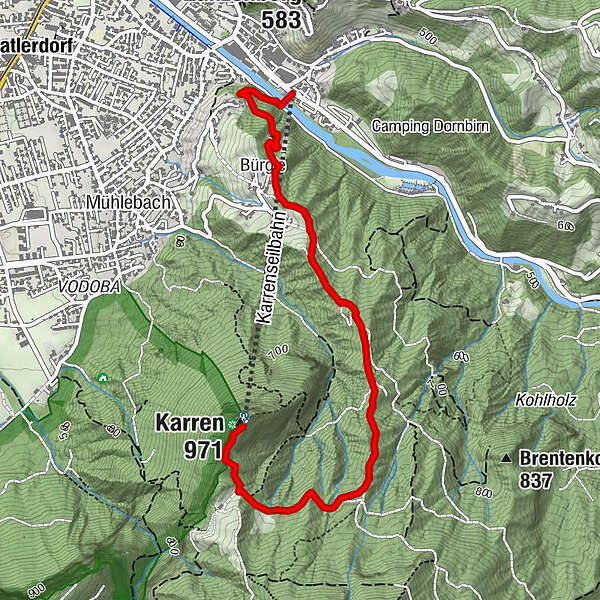
Karrenseilbahn Talstation0.0 kmDornbirn (437 m)0.2 kmBürgle (852 m)0.8 kmKarren (971 m)3.4 kmPanoramarestaurant Karren3.4 km
- Best season
-
JanFebMarAprMayJunJulAugSepOctNovDec
- Description
-
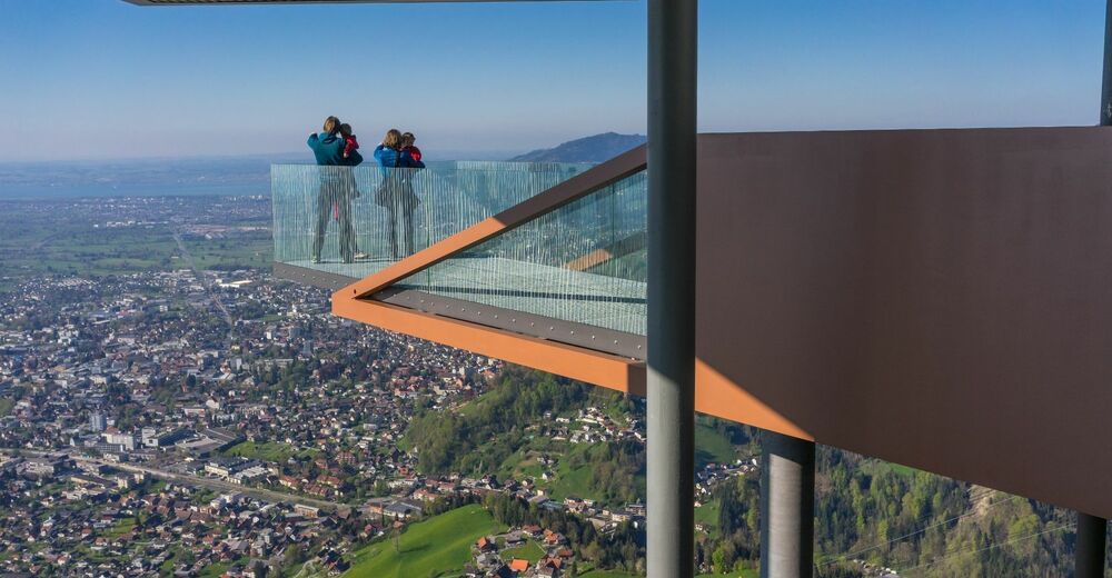
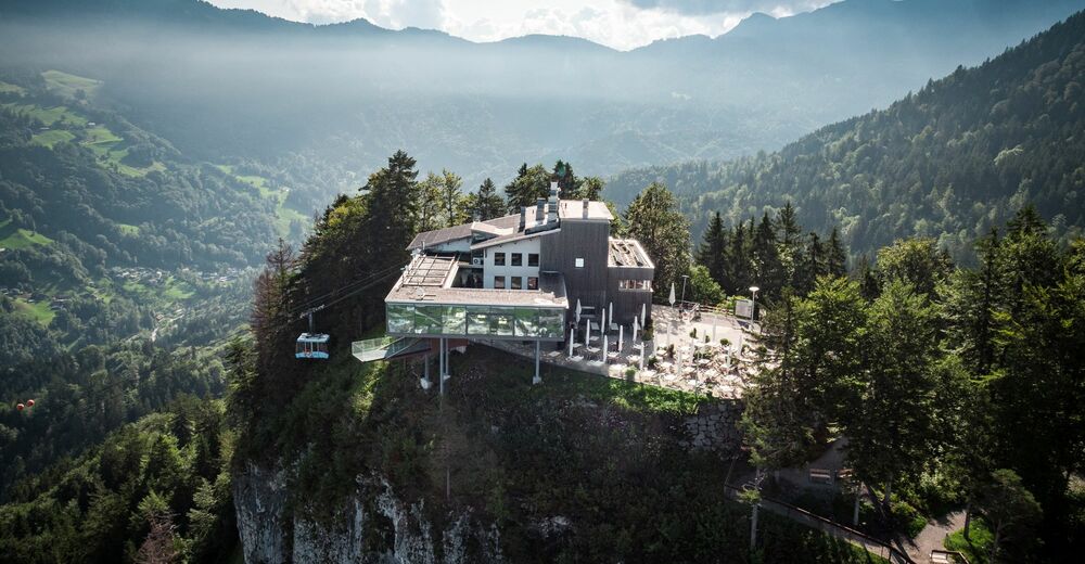
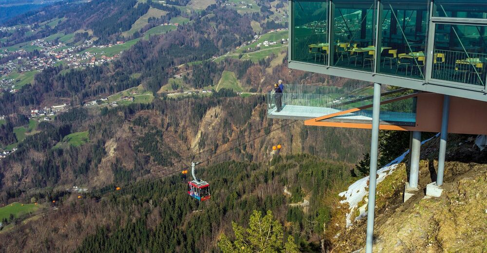
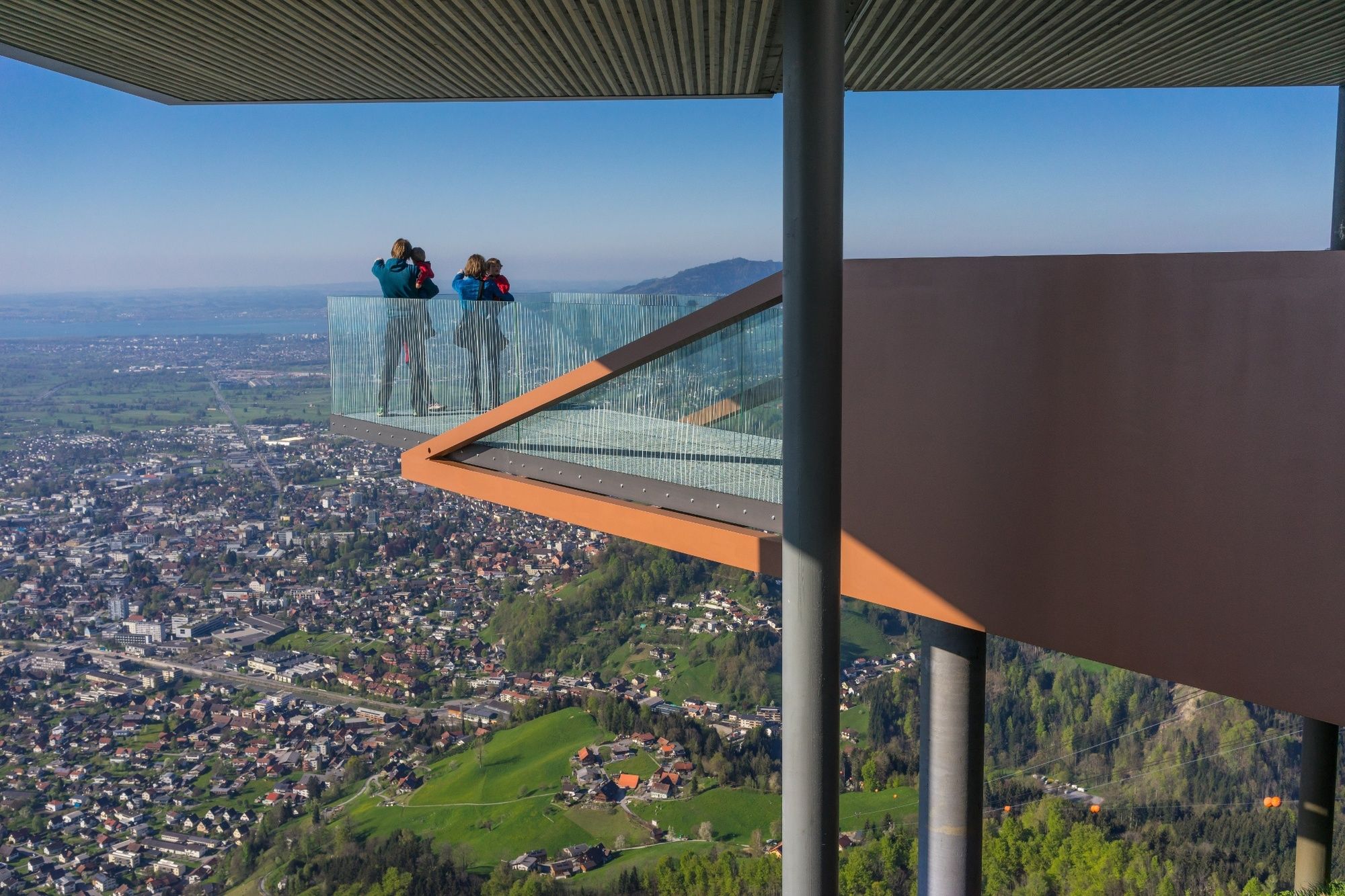
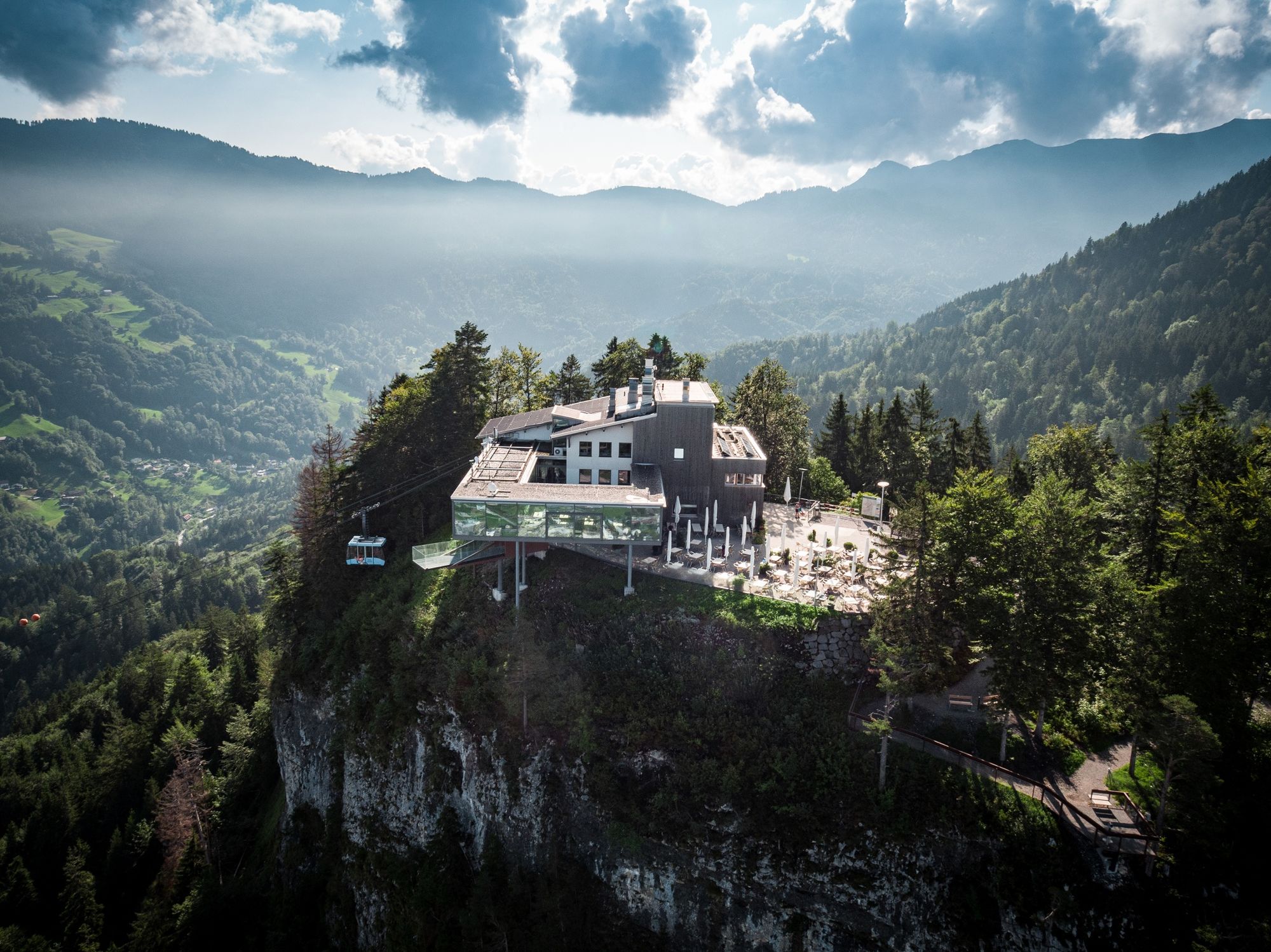
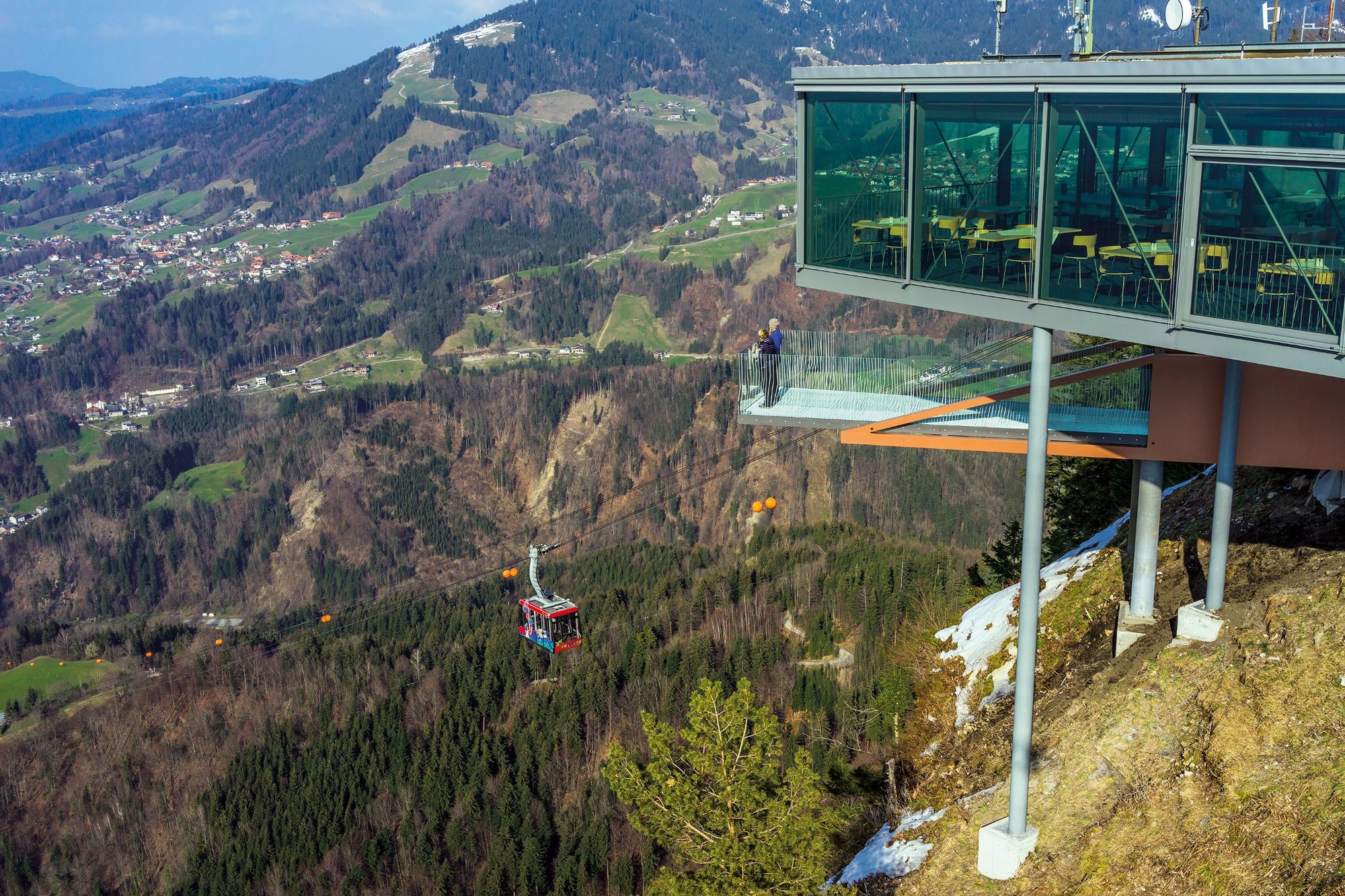
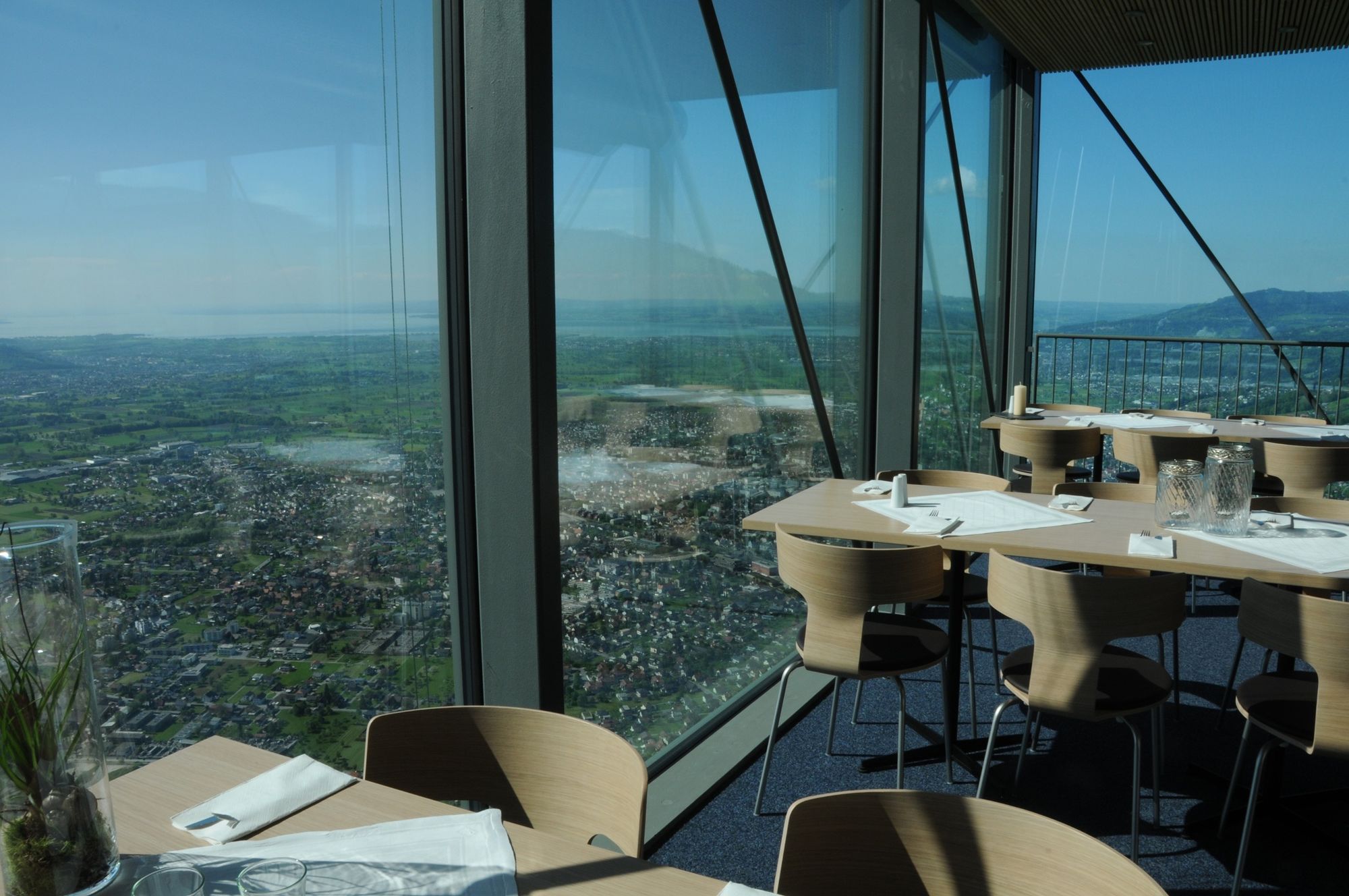
The hike up Dornbirn’s local mountain (976 m) starts at the cable car’s valley station. Hikers on their way up may choose between taking a steeper route or the family trail. The way up takes hikers through the forest and is therefore ideal on hot summer days because of the shade that the trees offer. The Karrenkante at the top provides panoramic views far beyond the borders of Vorarlberg. The Panoramarestaurant Karren is located at the Karrenseilbahn’s mountain station. The restaurant serves regional dishes and refreshing drinks. It’s also possible to combine the hike with a cable car ride, for example, to return to the valley.
- Directions
-
The well-signposted hike starts directly behind the cable car’s valley station (464 m). It takes hikers across the Dornbirner Ache from where there is an immediate right turn up the steep Oberbürgle Forstweg (Forest Path). Then it takes hikers over the Bürgle to the wayside shrine Bildstöckle (710 m). This is where hikers may choose between the shorter but steeper route straight ahead or turn left to use the family trail. The trails join again further up and continue across Kühberg up to the mountain station (976 m). Hikers may return the same way or take the cable car down to the valley. The cable car runs every 15 minutes until 11.00 p.m., even until midnight on Fridays and Saturdays.
- Highest point
- 962 m
- Endpoint
-
Karren Mountain Station
- Height profile
-

- Equipment
-
Firm footwear recommended
- Safety instructions
-
112 Emergency Call
- Tips
-
Viewing platform with selfie point at the Karrenseilbahn’s mountain station.
- Directions
-
Travelling from the north from the direction of Munich or from the south from the direction of Innsbruck on the A14 Rheintal-Autobahn, take the Dornbirn Süd (Exit 18) and then leave the roundabout and head towards Dornbirn-Zentrum (Dornbirn Centre) on the L204 Lustenauer Strasse, straight across the crossing with the L190 B-road, follow the signs and after approx. one kilometre you’ll arrive at the cable car’s valley station.
- Public transportation
- Parking
-
Charged car parking directly at the cable car’s valley station
-

-
AuthorThe tour Panorama hike Dornbirn Karren is used by outdooractive.com provided.


General info
-
St. Gallen - Bodensee
2066
-
Bodensee - Vorarlberg
1316
-
Dornbirn
447


