
Tour data
13.26km
1,329
- 2,393m
886hm
1,307hm
05:10h
- Brief description
-
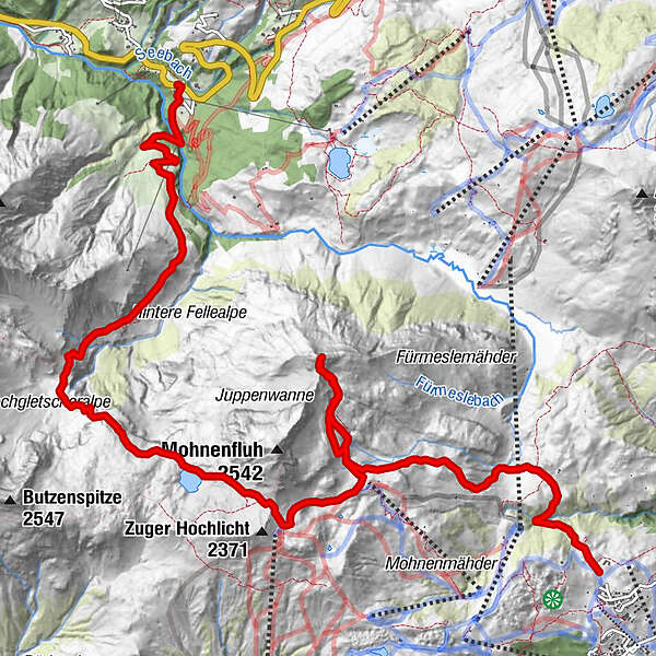
Von Oberlech hinauf auf die Juppenspitze und Abstieg nach Schröcken über den Mohnenfluhsattel/ Jägersteig
- Difficulty
-
medium
- Rating
-
- Starting point
-
Lech- Oberlech, 1700m
- Route
-
Juppenspitze (2,412 m)4.4 kmSchröcken (1,269 m)13.2 kmTannberg13.2 km
- Best season
-
JanFebMarAprMayJunJulAugSepOctNovDec
- Highest point
- 2,393 m
- Endpoint
-
Schröcken, 1269m
- Rest/Retreat
-
Es ist nur die untere Fellealpe bewirtschaftet. Bei Variante 2 zusätzlich noch die Kriegeralpe.
- Ticket material
-
z.B. Kompass Wanderkarte Nr. 33 Arlberg, Verwallgruppe
- Source
- schneeberglift
GPS Downloads


Trail conditions
Asphalt
Gravel
Meadow
Forest
Rock
Exposed
Other tours in the regions


