

© Warth-Schröcken Tourismus - Ratko Medienagentur

© Bregenzerwald Tourismus - Johannes Fink

© Warth-Schröcken Tourismus - Ratko Medienagentur
© Warth-Schröcken Tourismus - Ratko Medienagentur

© Warth-Schröcken Tourismus - Günter Drexel

- Brief description
-
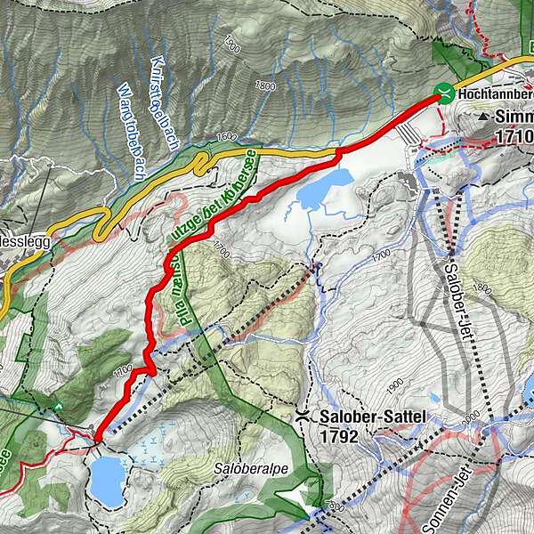
Hochtannbergpass (1,675 m) - Kalbelesee - Körbersee (1,670 m) - Batzenalpe - Schröcken centre of town (1,250 m)
- Difficulty
-
easy
- Rating
-
- Starting point
-
Schröcken Hochtannbergpass
- Best season
-
JanFebMarAprMayJunJulAugSepOctNovDec
- Description
-
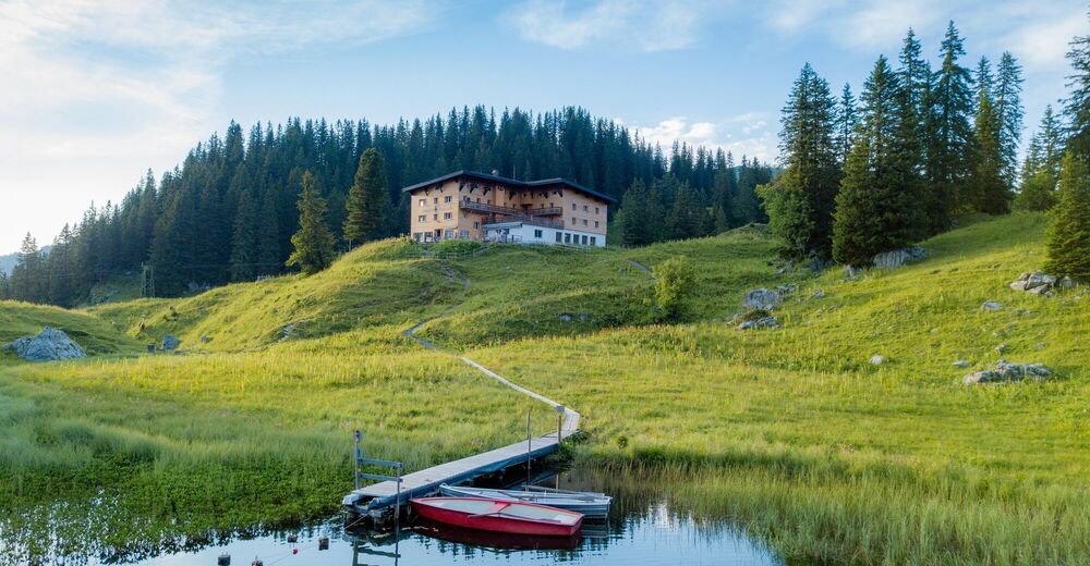
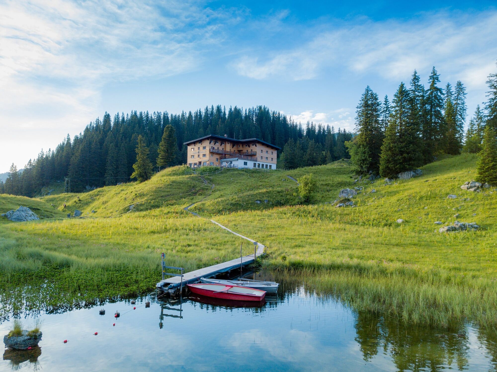
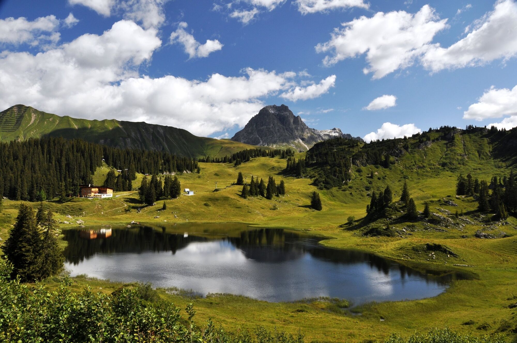
The two lakes on the Hochtannberg mountain are your guide on this ramble. The Batzenalpe is a licensed alpine pasture. Here, in the alp museum, you discover what life in earlier times was like. From the Hochtannberg pass, an extended, wide path takes you to the Körbersee, which lies at approximately the same altitude as the Hochtannberg pass. From there, a wide agricultural path takes you downwards across the Batzenalpe to Schröcken.
- Highest point
- 1,741 m
- Endpoint
-
Schröcken centre of town
- Height profile
-

- Tips
-
Chances to stop off for a drink/food:
Hotel Körbersee, Batzenalpe (during the alp season from mid/late June to mid September), inns in SchröckenRest & Play:
Short trip in a rowing boat on the Körbersee, brooks, Batzenalpe - Additional information
-
Opening times Alpmuseum:
T +43 5519 2670 - Directions
-
From Germany:
Motorway Lindau, Pfänder Tunnel, Exit Dornbirn Nord - Bregenzerwald - Egg - Au - Schröcken
Motorway Kempten - Immenstadt - Oberstaufen - border cross Springen-Aach - Lingenau - Egg - Au - Schröcken
From Switzerland:
Motorway St. Gallen - St. Margrethen/Au - Lustenau - Dornbirn - Bregenzerwald - Egg - Au - Schröcken. - Public transportation
- Parking
-
Hochtannbergpass


- Author
-
The tour Warth-Schröcken | from lake to lake is used by outdooractive.com provided.
GPS Downloads


General info
Refreshment stop
A lot of view
Other tours in the regions


