- Brief description
-
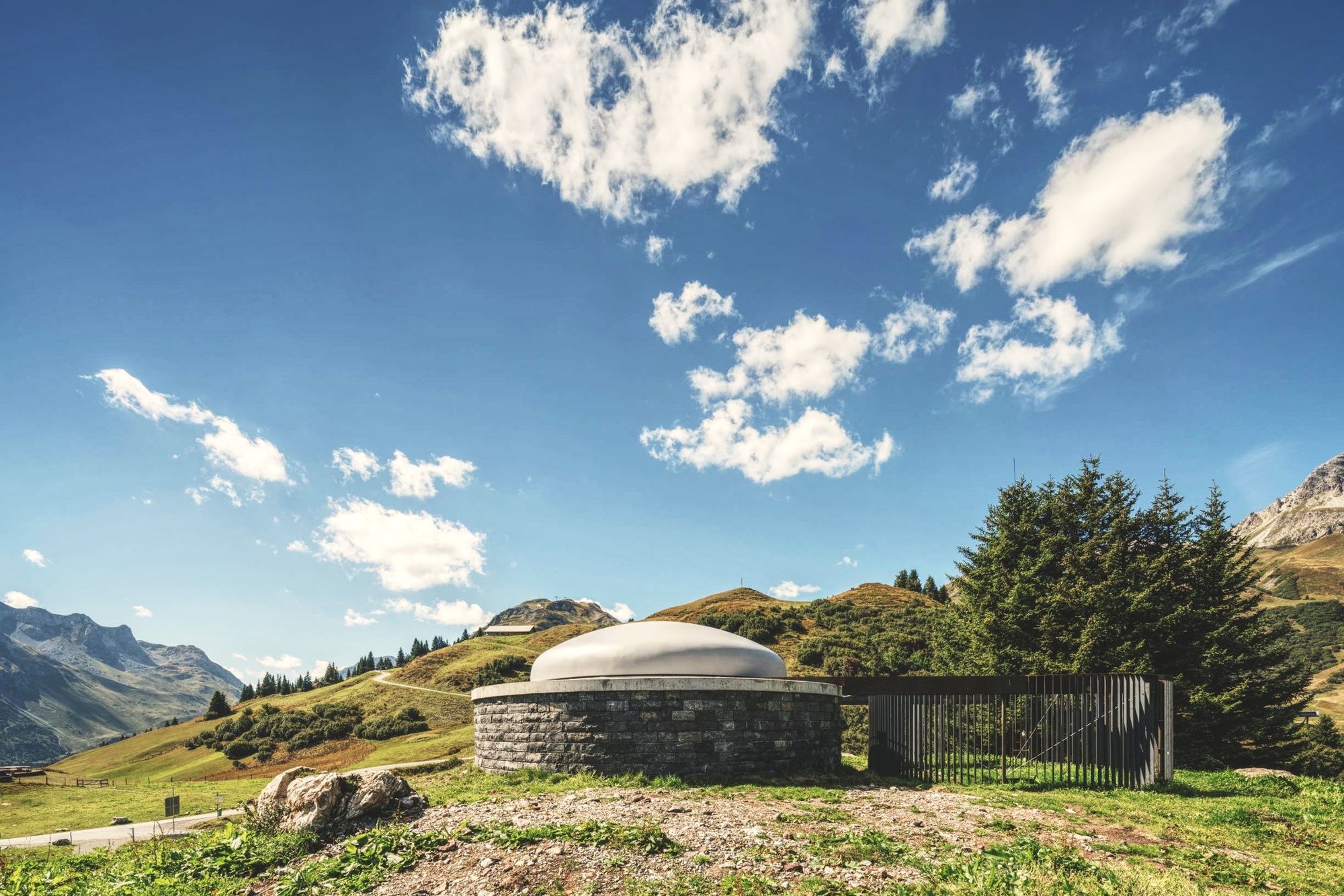
Skyspace Lech by artist James Turrell has been one of Vorarlberg's cultural highlights since it opened in summer 2018. And the visit can be combined with a hike.
- Difficulty
-
medium
- Rating
-
- Route
-
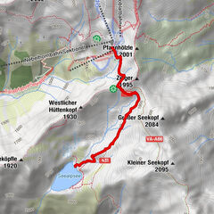
Bergbahn Lech - Oberlech0.0 kmOberlech0.2 kmÜbungslift Oberlech0.5 kmKarbühel3.8 kmKarbühel (1,840 m)4.5 kmEgge5.7 kmBodenalpe6.8 kmLech (1,444 m)10.8 kmNeue Kirche Lech10.8 kmBergbahn Lech - Oberlech10.9 km
- Best season
-
JanFebMarAprMayJunJulAugSepOctNovDec
- Description
-
Skyspace Lech was officially opened in the summer of 2018 and has been open to visitors ever since. With the Skyspace by James Turrel, the dimensions of space, light and time are lifted and newly combined. The intense feeling of space in the midst of the dreamlike mountain world mixes with the equally intense colours of the sky to create an overall experience that opens up to the visitor. Especially if you have some time, you should not miss the visit of the Skyspace. Ideally, one combines the visit of the Skyspace Lech with a hike, for example the hike listed here from Oberlech to the Bodenalpe.
- Directions
-
From the mountain station of the Lech-Oberlech mountain railway we take the hiking trail in the direction of Kriegeralpe and Auenfeld. About 30 minutes we go up to the Skyspace Lech, which we will visit at the beginning of our hike. After the visit we follow the signs to the right in the direction of Karhorn, Auenfel and Bodenalpe. Again and again the view goes back to Skyspace Lech, which was built at Tannberg. The Auenfeld is one of the most beautiful plateaus in Vorarlberg and connects the regions Lech Zürs and Warth-Schröcken. The trail descends slightly until we follow the signs in the direction of Bürstegg / Bodenalpe. A detour to Bürstegg would take about 15 minutes (easy), or you can walk straight down to Bodenalpe. Here you can stop for a bite to eat and end the day before returning to Lech via the hiking trail or by local bus.
- Highest point
- 1,795 m
- Endpoint
-
Gasthaus Bodenalpe
- Height profile
-

- Equipment
-
Good footwear (ankle high, profile sole), rain protection, Lech Card and bus timetable.
- Safety instructions
-
EMERGENCY CALL:
140 Alpine Emergencies Austria-wide
144 Alpine emergencies Vorarlberg
112 Euro emergency call (works with any mobile phone/network)
www.vorarlberg.travel/sicherheitstipps
- Tips
-
Take your time and explore Skyspace Lech intensively. The space and the art projection opens up with peace and serenity.
- Additional information
- Directions
-
From Germany: Take the A96 motorway to Bregenz from there on the A14 motorway to Bludenz, continue on the S16 to the Lech Zürs am Arlberg exit. Follow the B197 up to Alpe Rauz, turn left here onto the B198 through Flexengalerie and over the Flexenpass to Lech Zürs am Arlberg.
From Switzerland: Via the A13 motorway and the Feldkirch, Hohenems or Lustenau border crossing on the A14 motorway to Bludenz. Continue on the S16 until exit Lech Zürs am Arlberg. Follow the B197 up to Alpe Rauz, turn left here onto the B198 through Flexengalerie and over the Flexenpass to Lech Zürs am Arlberg.
From Austria: Via the Inntalautobahn A12 and then via the S16 to the exit St. Anton am Arlberg (Arlberg Pass). Follow the B197 first through St. Anton, then through St. Christoph and over the Arlbergpass to Alpe Rauz. Turn right here onto the B198, drive through Flexengalerie and over the Flexenpass to Lech Zürs am Arlberg.
- Public transportation
-
By train to Langen am Arlberg station or St. Anton am Arlberg. From there, buses (No. 750+760) run regularly to Lech Zürs am Arlberg.
- Parking
-
You can either park your vehicle directly at your host or park it in the underground garage in Anger. The underground car park is located directly in the centre of town opposite Raiffeisenbank Lech.
-

-
AuthorThe tour Hike to Skyspace Lech & via Auenfeld to Bodenalpe is used by outdooractive.com provided.