

© Alpenregion Bludenz Tourismus GmbH - Sarah Walch

© Vorarlberg Tourismus GmbH
- Brief description
-
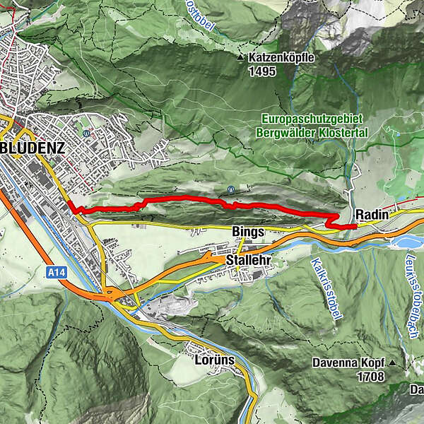
Varied meadow and forest paths lead on this tour via Gasünd, to St. Leonhard and on to Radin.
- Difficulty
-
easy
- Rating
-
- Starting point
-
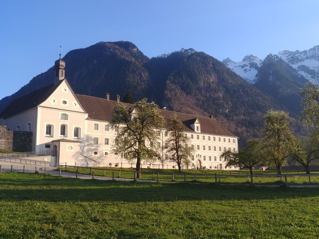
St. Peter's Monastery, Bludenz
- Route
-
BludenzBings2.4 kmSt. Leonhard3.7 kmRadin4.0 km
- Best season
-
JanFebMarAprMayJunJulAugSepOctNovDec
- Description
-
This tour starts at the monastery of St. Peter in Bludenz. From there take the hiking trail up to Gasünd, descend at the turnoff to St. Leonhard and hike the last stretch down to Radin. Return to the starting point by bus.
- Directions
-
St. Peter's Monastery - Gasünd - St. Leonhard - Radin - back by bus to the starting point
- Highest point
- 799 m
- Endpoint
-
Radin, Bludenz-Außerbraz
- Height profile
-

- Equipment
-
Ankle-high mountain boots with profiled sole, sun and rain protection, snacks, filled water bottle and first aid equipment. Mobile phone in case of emergency.
- Safety instructions
- Tips
-
Enjoy the peace and quiet and the wonderful views along the way.
- Directions
- Public transportation
- Parking
-
Parking spaces at St. Peter's Monastery, Bludenz
- Author
-
The tour Via Gasünd to Radin | Bludenz is used by outdooractive.com provided.
GPS Downloads


General info
A lot of view
Other tours in the regions
-
St. Gallen - Bodensee
2065
-
Alpenstadt Bludenz
1847
-
Stallehr
563


