
- Brief description
-
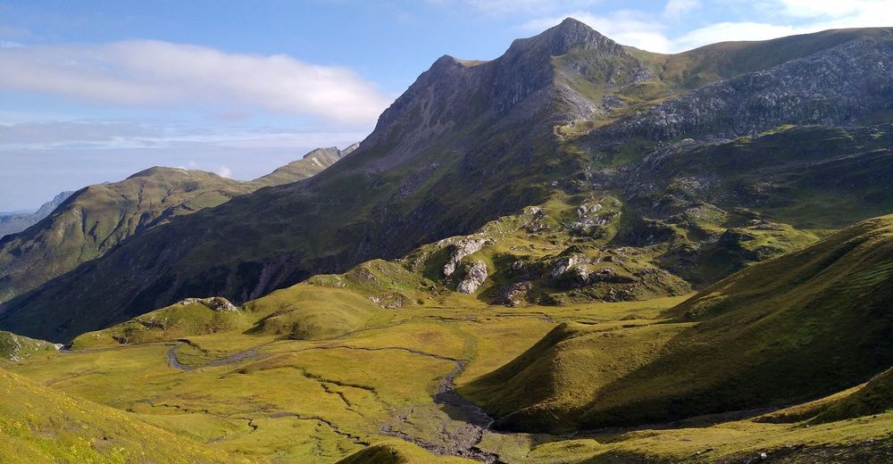
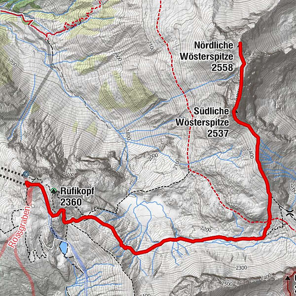
From the panorama restaurant at the Rüfikopf, the route leads through the Ochsengümple to the Bockbachsattel and then to the Northern Wösterspitze.
- Difficulty
-
medium
- Rating
-
- Starting point
-
Rüfikopf mountain station
- Route
-
Panoramarestaurant Rüfikopf0.0 km
- Best season
-
JanFebMarAprMayJunJulAugSepOctNovDec
- Description
-
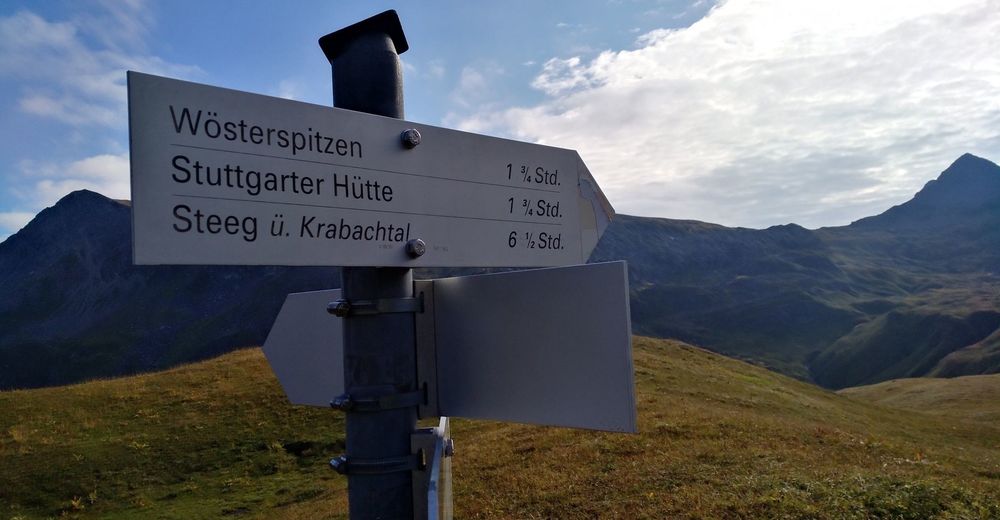
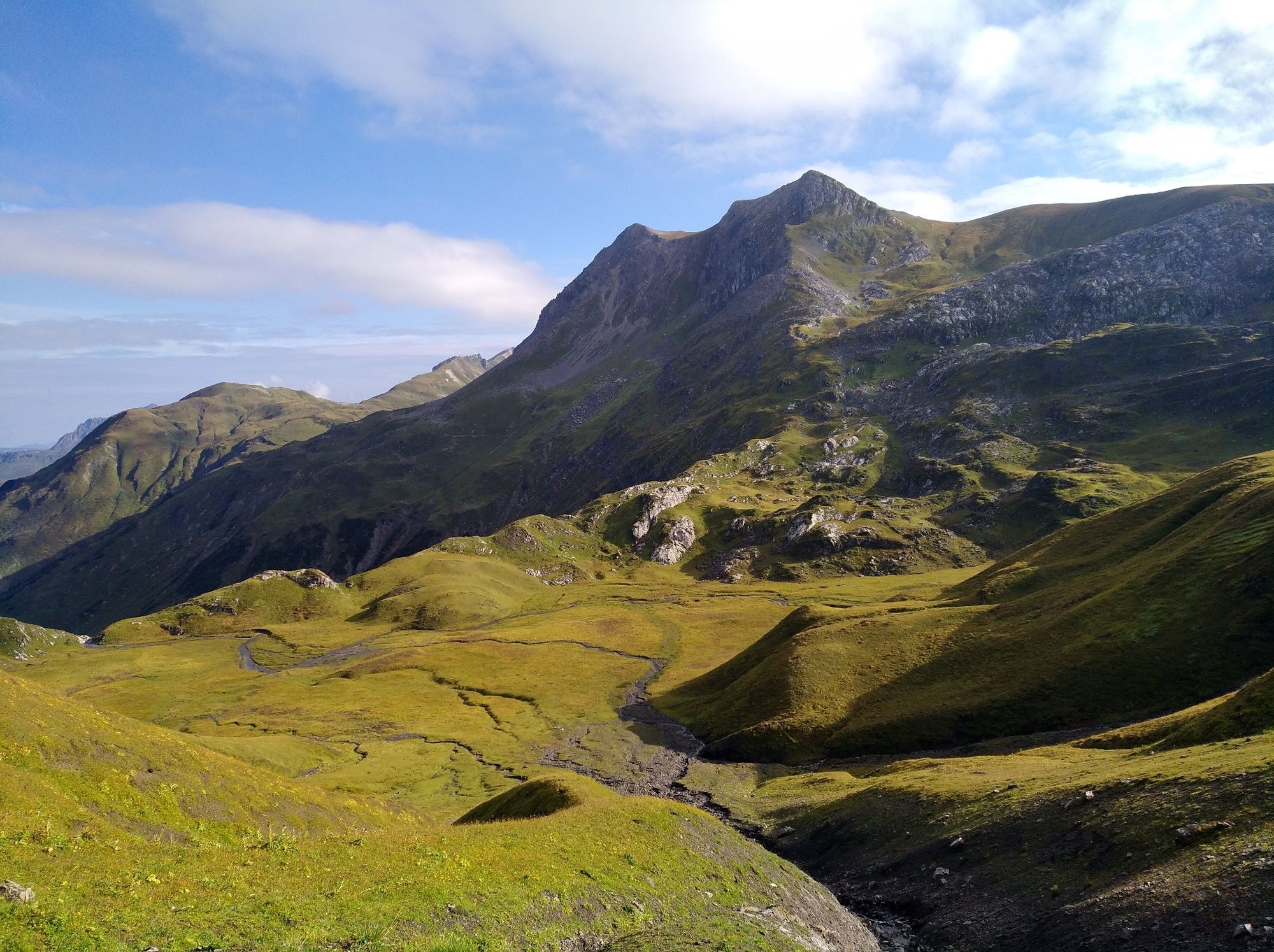
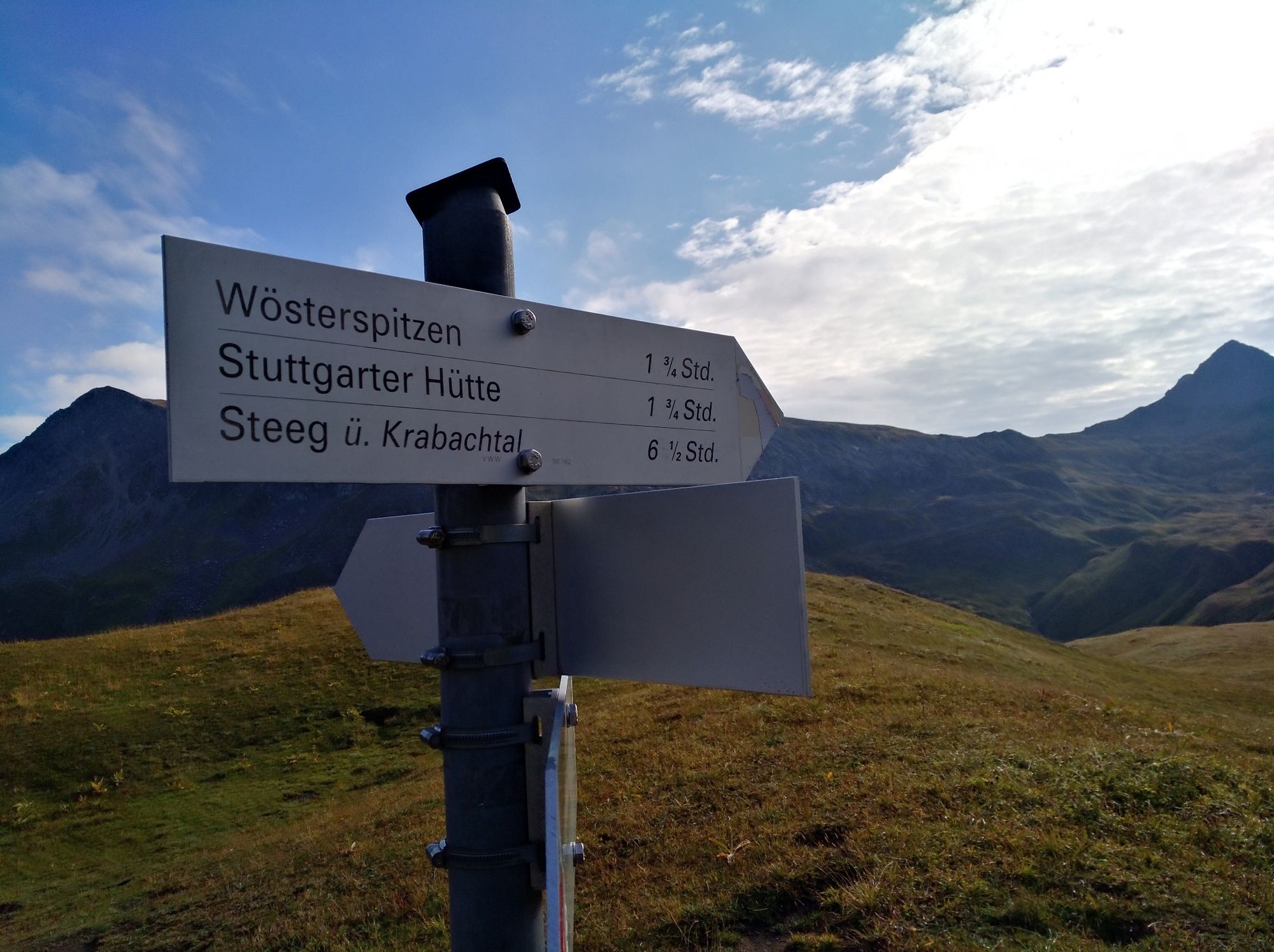
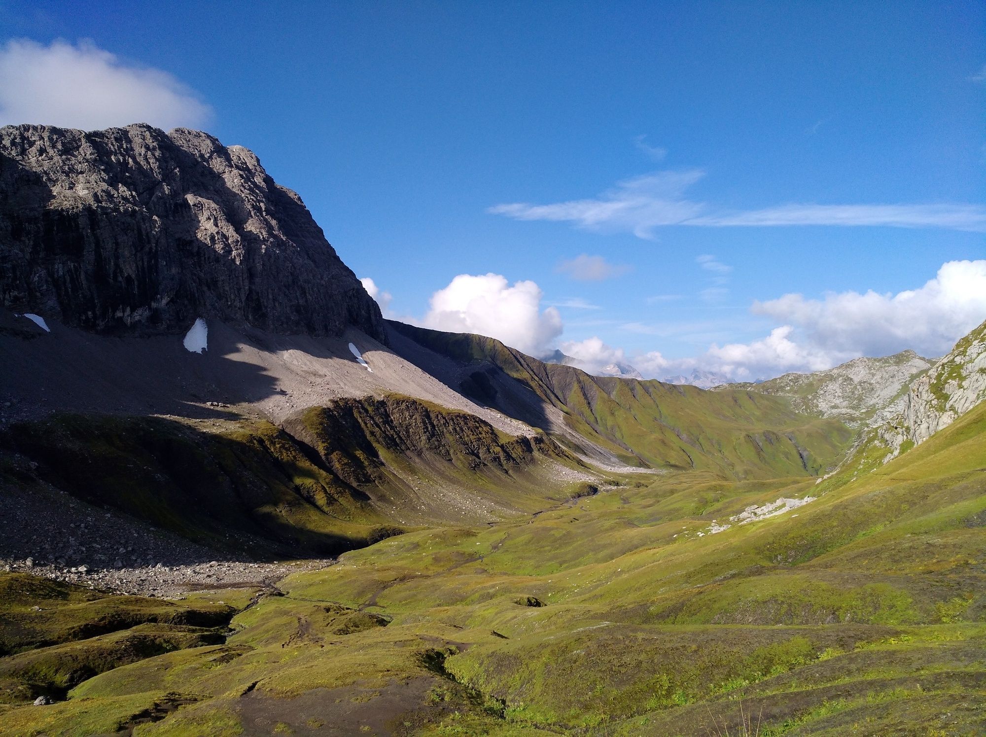
From Rüfiplatz you take the mountain railway up to Rüfikopf. At the mountain station follow the signposted path to the Monzabonjoch and on through the Ochsengümple to a ridge. From here it goes along the ridge to the summit.
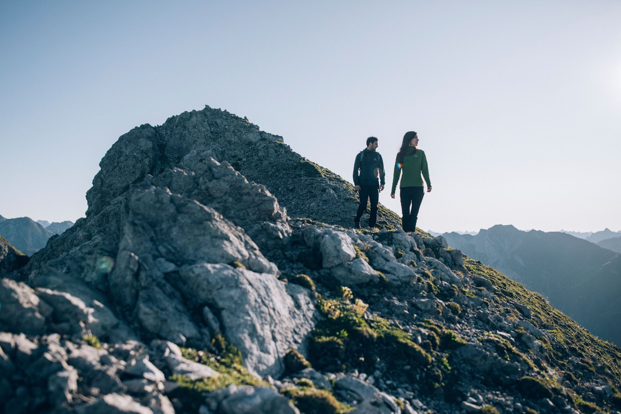
For this hike, sure-footedness and a head for heights are recommended.
If it is wet, the hike is not recommended, as it can become slippery and dangerous on the stone slabs, the scree and on the meadow ridge.
In winter, the Rüfikopf is an Eldorado for winter sports enthusiasts. Whether skier, snowboarder or winter walker or for a culinary stop, the Rüfikopf is the hub for sports enthusiasts. - Directions
-
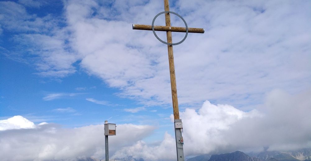
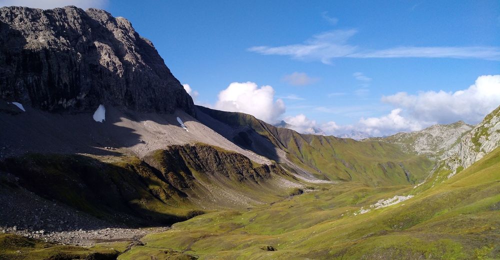
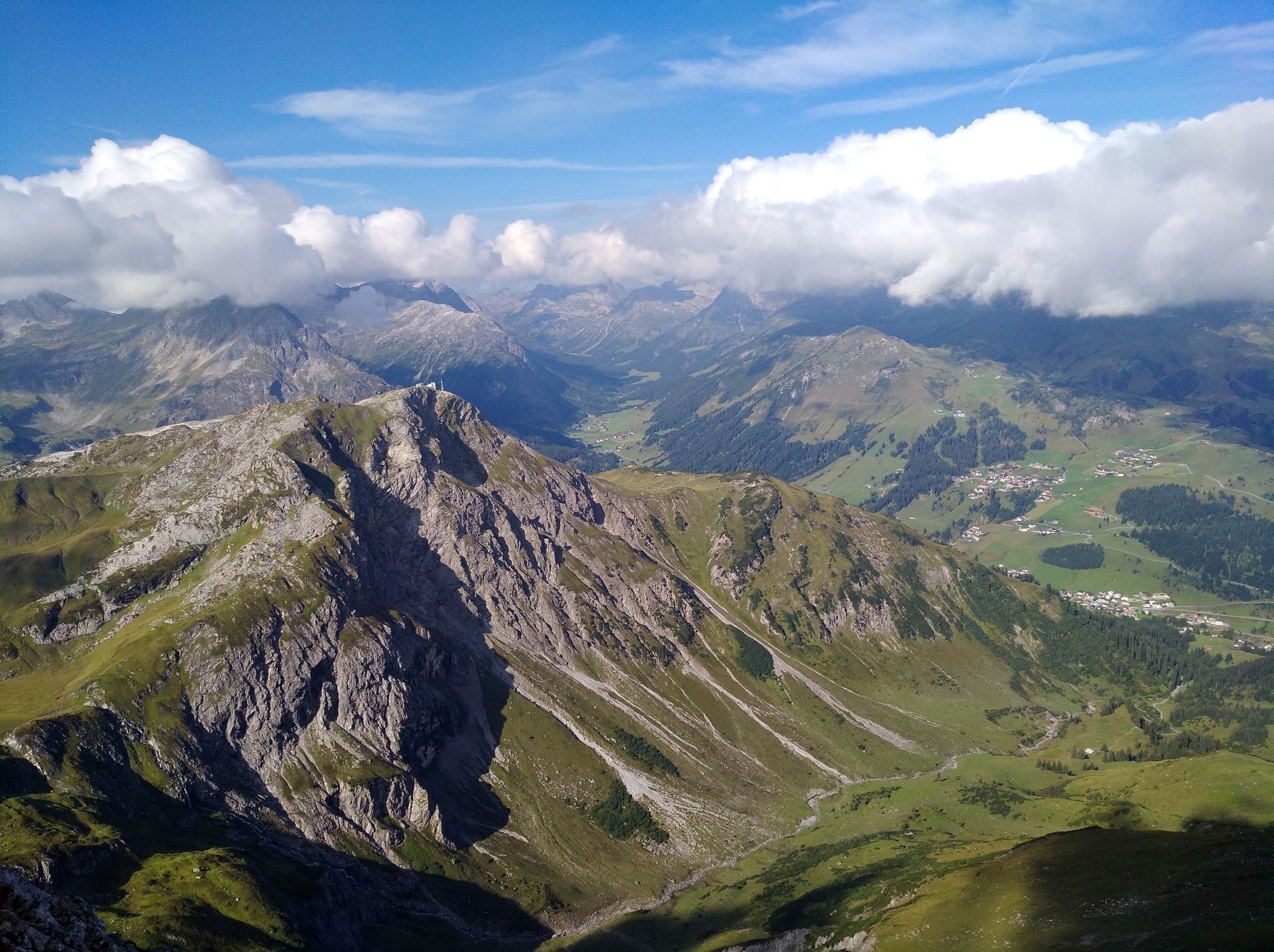
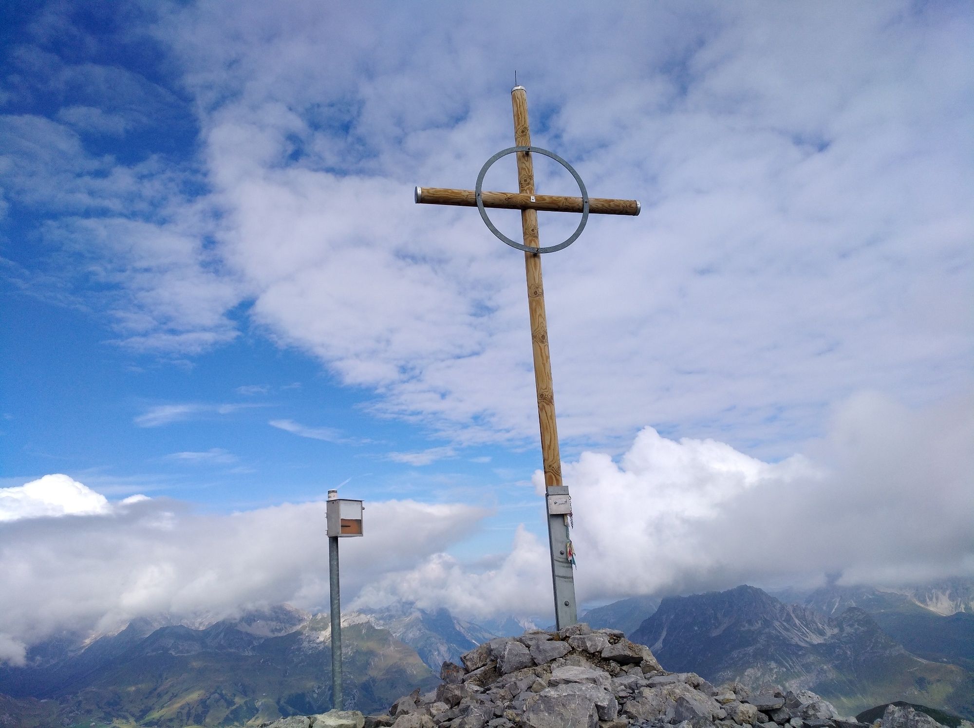
From the mountain station at Rüfikopf, a wide hiking trail leads east to the Monzabonjoch. Downhill you go through a depression and the Ochsengümple. Along the Stuttgarter Hüttenweg you reach a ridge via a slight ascent, from where the path branches off to the left towards Wösterspitzen. Some of the way leads north along the grassy ridge towards the summit. The path changes after about 300 metres. The ascent to the southern Wösterspitze requires sure-footedness and a head for heights. At the saddle it goes over a ridge to the middle and finally to the Nörldichen Wösterspitze. The path along the Grad, leads over rocky slabs and is rocky. In wet conditions it can become uncomfortable. From the Mittlerer Wösterspitze, the route briefly descends to the east and then climbs again up a ridge to the Nördlicher Wösterspitze. The view is breathtaking, on clear days you can even see as far as Lake Constance.
Descent is the same way as ascent.
Alternatively, the descent from the ridge can also be made via the Wöstersattel to Stubenbach. - Highest point
- 2,536 m
- Endpoint
-
Rüfikopf mountain station
- Height profile
-

- Equipment
-
Good footwear (ankle-high, profiled sole), rain cover, Lech Card and bus timetable.
- Safety instructions
-
EMERGENCY CALL:
140 Alpine emergenicies Austria-wide
144 Alpine emergencies Vorarlberg
112 Euo emergency call (works with any mobile phone/network)
www.vorarlberg.travel/sicherheitstipps
- Tips
-
For all visitors to Rüfikopf, the panorama restaurant is an absolute insider tip to indulge in culinary delights.
- Additional information
- Directions
-
From Germany: Take the A 96 to Bregenz from there on the A14 to Bludenz, continue on the S16 to the Lech Zürs am Arlberg exit. Follow the B197 to Alpe Rauz, turn left here onto the B198. Through the Flexengalerie and over the Flexenpass you reach Lech Zürs am Arlberg.
From Switzerland: Via the A13 and the Feldkirch, Hohenems or Lustenau border crossing onto the A14 as far as Bludenz. Continue on the S16 until the exit Lech Zürs am Arlberg. Follow the B197 to Alpe Rauz, turn left here onto the B198. Through the Flexengalerie and over the Flexenpass you reach Lech Zürs am Arlberg.
From Austria: Take the Inntal motorway A12 and then the S16 to the St. Anton am Arlberg exit (Arlbergpass). Follow the B197 first through St. Anton, then through St. Christoph and over the Arlberg Pass to Alpe Rauz. Turn right here onto the B198. Through the Flexengalerie and over the Flexenpass you reach Lech Zürs am Arlberg.
- Public transportation
-
Take the train to Langen am Arlberg or St. Anton am Arlberg station. From there, buses (no. 750+760) run at regular intervals to Lech Zürs am Arlberg.
- Parking
-
You can park your car either directly with your host or in the underground car park Anger. The underground car park is located directly in the town centre opposite the Raiffeisenbank Lech.
-

-
AuthorThe tour From Rüfikopf to Wösterspitze is used by outdooractive.com provided.