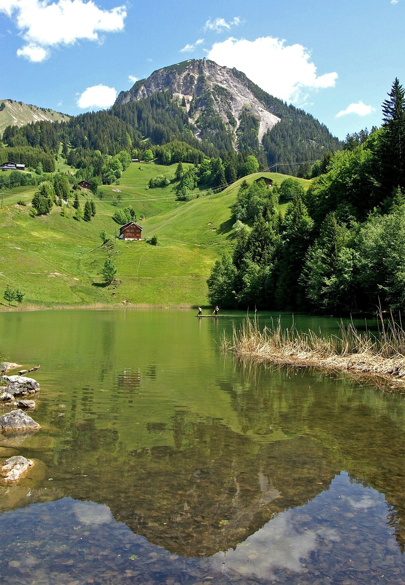
Faschina | Blasenka

Logo Faschina | Blasenka
Tour data
11.2km
1,443 - 1,997m
Distance
622hm
631hm
Ascent
04:45h
 
Duration
Brief description

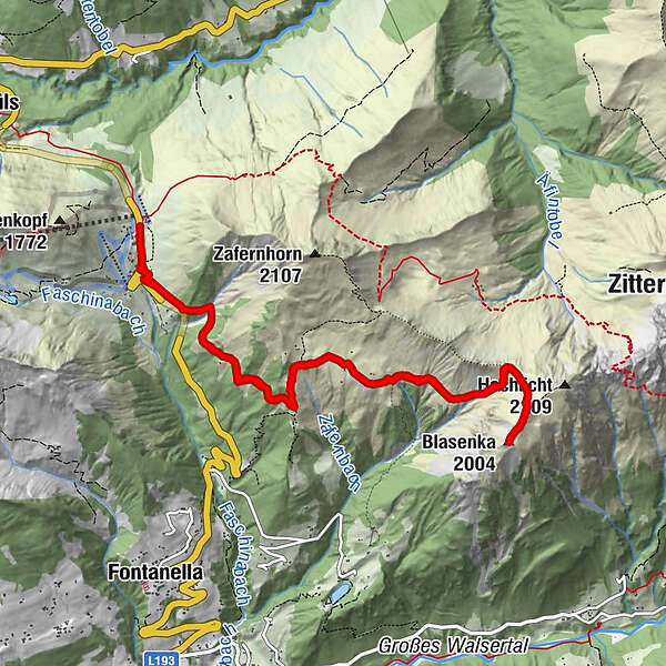
Faschinajoch (1.486 m) - Untere Zafernmaisäß - Bären Alpe (1.683 m) - Blasenka (2.010 m) - Bären Alpe (1.683 m) - Untere Zafernmaisäß - Faschinajoch

Difficulty
medium
Rating
Technique
Fitness
Landscape
Experience
Route
Faschina
0.0 km
Zafernmaisäß
3.3 km
Bärenalpe
3.6 km
Blasenka (2,004 m)
5.6 km
Zafernmaisäß
7.8 km
Faschina
11.1 km

Best season
Jan
Feb
Mar
Apr
May
Jun
Jul
Aug
Sep
Oct
Nov
Dec
Highest point
1,997 m
Endpoint

Faschinajoch

Height profile

Author
The tour Faschina | Blasenka is used by outdooractive.com provided.

Overall rating

5

0

%

4

0

%

3

0

%

2

0

%

1

0

%

Error
An error has occurred. Please try again.
Thank you for your review

Rating has been deleted

GPS Downloads
  • GPX GPS Exchange Format (XML)
  • KML Google Earth, Google Maps
QR Download Codes for Mobile Phones

General info

Refreshment stop
A lot of view
Other tours in the regions

Popular tours in the area

Damüls | Auf das Portlahorn

medium Hiking
9.62km | 533hm | 04:05h

Faschina | Rund um's Zafernhorn

medium Hiking
10.09km | 634hm | 04:15h

Damüls | Sünserspitze with Sünsersee

medium Hiking
8.12km | 405hm | 03:10h

Hoher Freschen

difficult Hiking
16.13km | 1005hm | 07:00h